Part 57: Slough of Despond Side Trail to Nels Maher Side Trail
Date: 24 August 2020
Start: Slough of Despond Side Trail, Colpoy’s Range Road, Georgian Bluffs
End: Nels Maher Side Trail, Kemble Rock Road, Georgian Bluffs
Distance Covered: 12.4 km
Total Distance Covered: 715.3 km
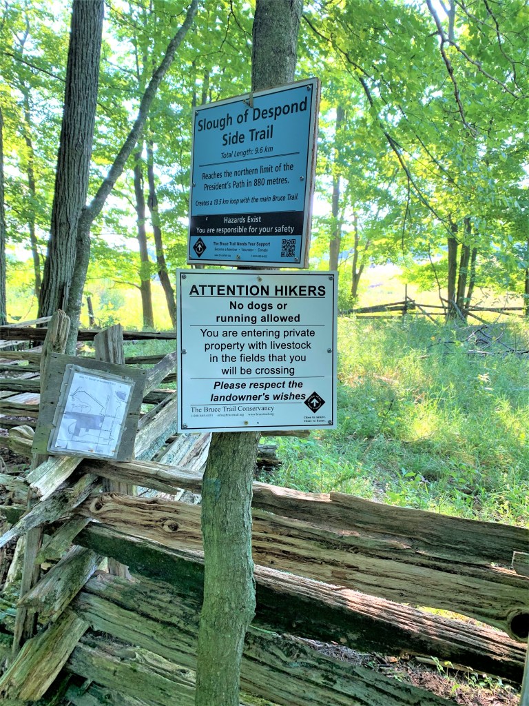
704. It’s very warm and muggy on the second morning of our third overnighter in Owen Sound. We hike from west to east to save the shady, forested section through Kemble Mountain for the hotter part of the day. Fortunately, we decided to approach the parking place on Colpoy’s Range Road from the west. For we soon discover that the eastern section of that gravel road, which the Trail itself follows, is impassable by conventional motor vehicles as it’s partly flooded, even after this dry spell. But before we start, we get into a conversation with a local farmer astride his ATV. He seems to want to get into an argument with us, until he discovers that we are two serious hikers, not the layabouts and riff-raff who are always blocking his gate with their vehicles. And finally we set off … from the sign marking the start of the Slough of Despond Side Trail!
705. The Slough of Despond! It’s a wetland that was left when this area was cut off about 11,000 years ago from glacial Lake Algonquin by a baymouth beach ridge. Lake Algonquin, by the way, was the gigantic ancestor of today’s three biggest Great Lakes: Superior, Michigan, and Huron. Deriving from the meltwater of the even more gigantic Laurentide Ice Sheet, Lake Algonquin was about 950 km long and lasted for about 3,000 years, eventually drying up around the edges and leaving … our three Great Lakes.
Back to the Slough of Despond. “Slough,” which rhymes with “cow” in the UK but with “clue” in North America, means a marsh or bog. “Despond” is an old word meaning “despondency,” “dejection,” or “despair.” The original Slough of Despond appears in John Bunyan’s The Pilgrim’s Progress (1678). This allegorical narrative, written when Bunyan, a Puritan, was in prison for preaching nonconformity, concerns a road trip in which everything is a symbol of something else. Christian (an average man) must make the arduous journey from the City of Destruction (life on earth) to the Celestial City (heaven). On the way he encounters places suggesting stages on his spiritual journey — Hill Difficulty, Vanity Fair, Doubting Castle — and characters who help or hinder him on the road — Pliable, Worldly Wiseman, Evangelist. Early on, Christian, weighed down with sins of the flesh, falls into the Slough of Despond: “This miry Slough is such a place as cannot be mended; it is the descent whither the scum and filth that attends conviction for sin doth continually run, and therefore is it called the Slough of Despond.” Christian is eventually pulled out of the Slough by a character with the rather unimaginative name of Help.
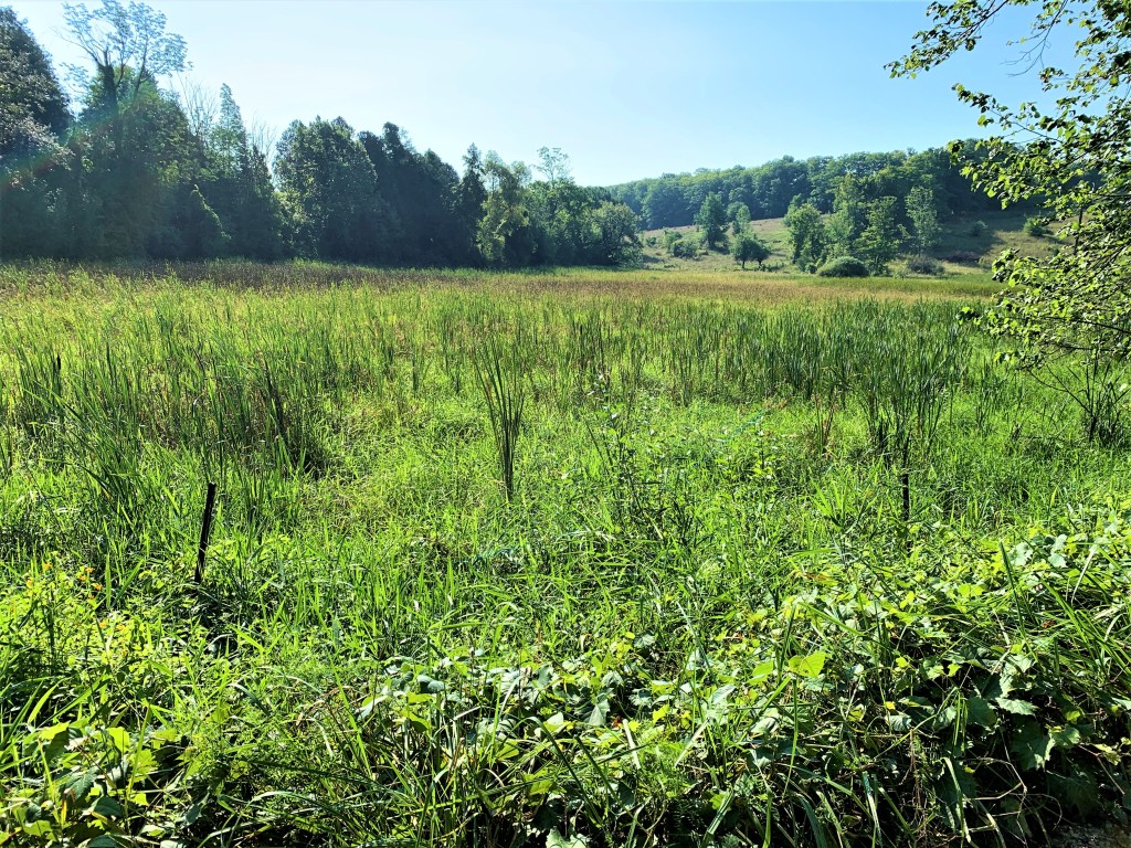
It would be interesting to visit this literal Slough if only to see whether we carry our sins lightly, but as the Main Trail bypasses it, we merely observe it from a distance.
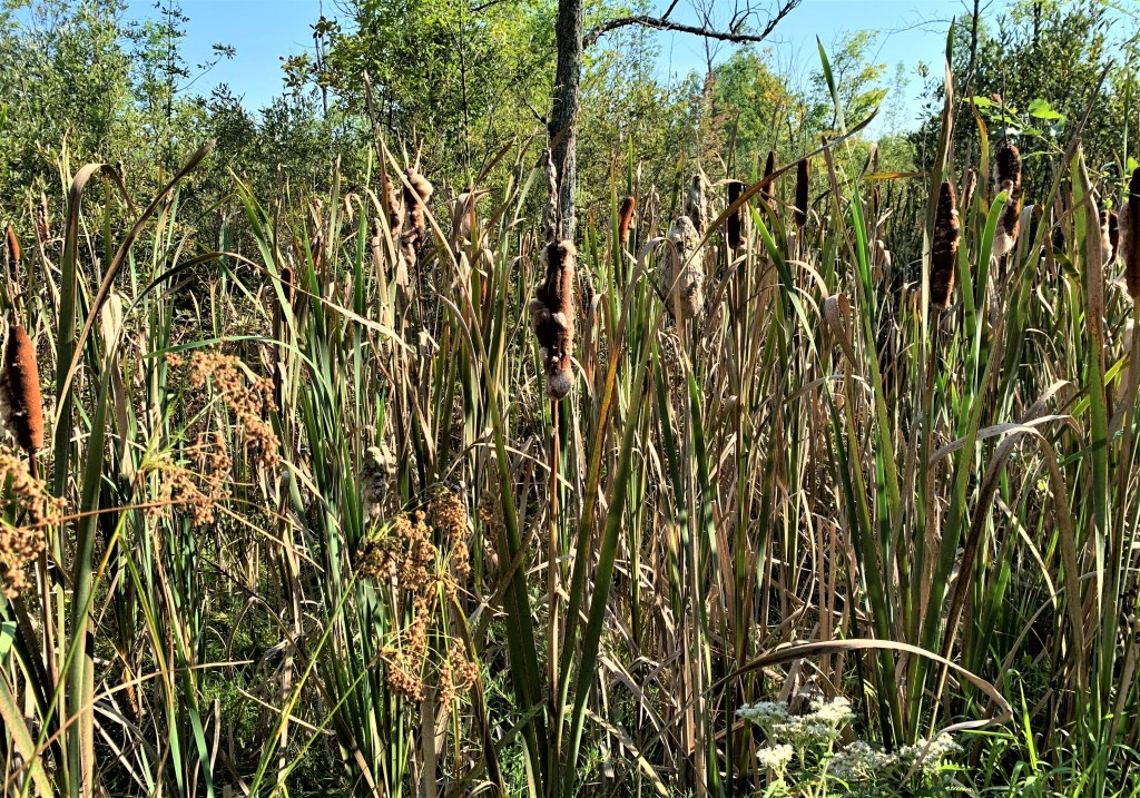
706. Cattails (Typha) grow prolifically in the marshy areas round the Slough. These tough, aggressive plants, known as bulrushes in the Old World, have edible shoots and rhizomes that can be processed into flour. The seeds are eaten by livestock, the stems have been used to build boats and make yarn, the fluff is a good insulator, the leaves can be used to make paper, and the whole plant is a source of ethanol.
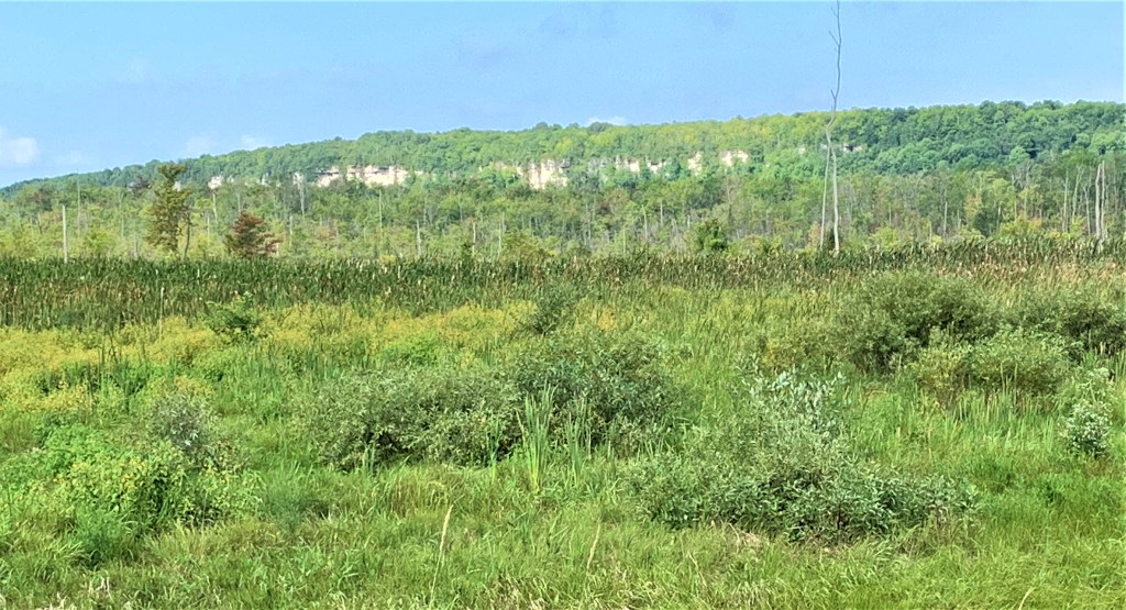
707. The view from Cole’s Sideroad west over the Slough to Esther’s Bluff, a 236 m high cliff that’s part of the Niagara Escarpment.
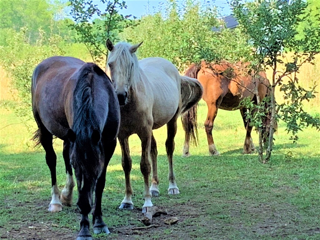
708. These beauties come to the fence to see us and visit the water trough. Up close, we can see that, sadly, they are absolutely plagued by flies.
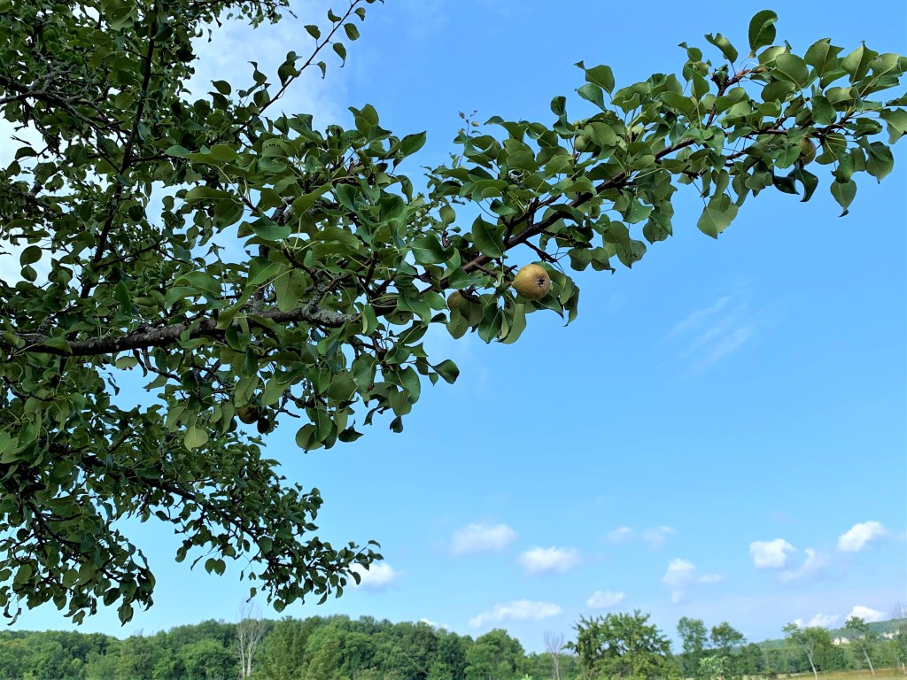
709. As we cross the fields eastward towards Kemble Mountain, instead of the ubiquitous apple trees we pass by a solitary pear tree. Five main kinds of pears are grown in Ontario, with the Bartlett variety (known as the Williams in Europe) the overwhelming favourite. Pears don’t usually ripen on the tree, but are picked when firm and then allowed to ripen in storage. We noticed this tree only because of the pears rotting on the ground beneath it.
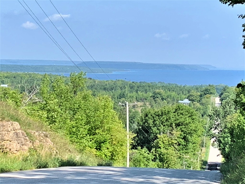
710. The view to the north from the point where the Trail, following Big Bay Sideroad, reaches the top of the Escarpment. The strip of water at right of centre is Big Bay, leading left into Colpoy’s Bay. White Cloud and Hay Islands lie beyond, and, just visible at right in the far distance, is the point of Cape Croker, projecting eastward from the southern Bruce Peninsula into Georgian Bay. That’s the general direction in which we’re headed.

711. After we cross Kemble Rock Road, the Trail runs along this wide dolostone outcrop on top of the Escarpment. Dolostone, a term frowned upon by some geologists, refers to limestone which has been hardened from being exposed to magnesium-rich groundwater.
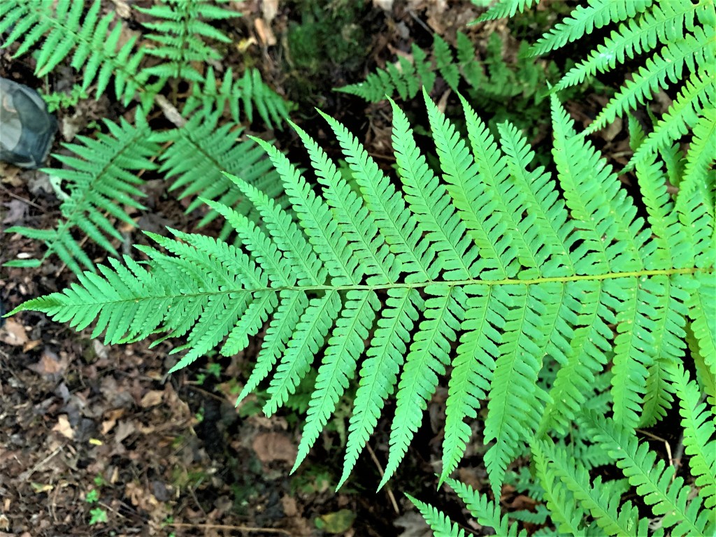

712A & B. Let’s see if we can identify these common ferns from hints given by pteridophiles. A is probably cinnamon fern (Osmundastrum cinnamomeum): the leaflets are twice divided and it has the long, classic fern profile. B is almost certainly spinulose wood fern (Dryopteris carthusiana): the leaflets are thrice divided, and the two innermost leaflets closest to the stem are longer than the ones beside them.
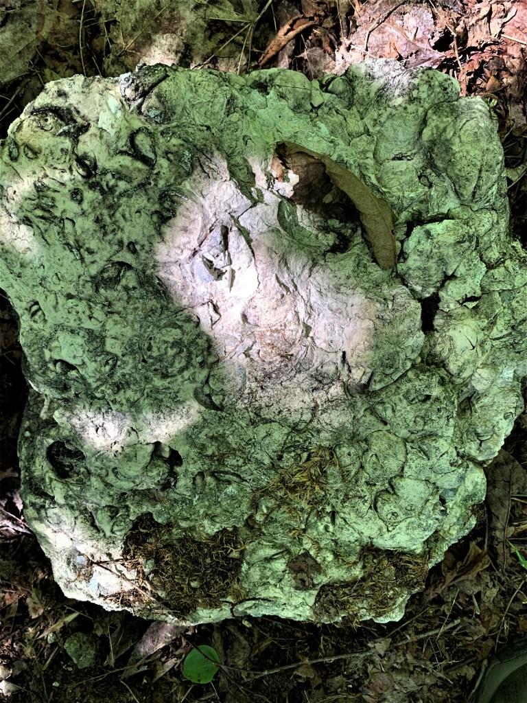
713. A chunk of Amabel dolostone, formed from sediment in a warm, shallow sea, and containing fossils of marine creatures. Such vast expanses of geological time are difficult to conceptualise, but the middle Silurian period 420 million years ago makes the last Ice Age, the one that, melting, formed the Great Lakes (see 705 above), seem like yesterday. When this rock was being formed, earth was an alien planet: “a mountain range higher than the Himalayas dominated [North America] which in turn straddled the equator, and our very planet was spinning faster, giving us 21-hour days”: Beth Gilhespy, “Escarpment Geology” in Bruce Trail Magazine (Spring 2015).

714. The heart-shaped leaves of Canadian wild ginger (Asarum canadense) form a dense forest ground cover on the top of the Escarpment in Kemble Mountain. The rhizome of this plant has a gingery taste but it’s not related to root ginger. Though it has been consumed as a traditional medicine for various ailments, wild ginger is now thought to cause kidney damage or worse, as it contains aristolochic acid, a carcinogen.
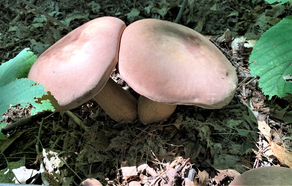
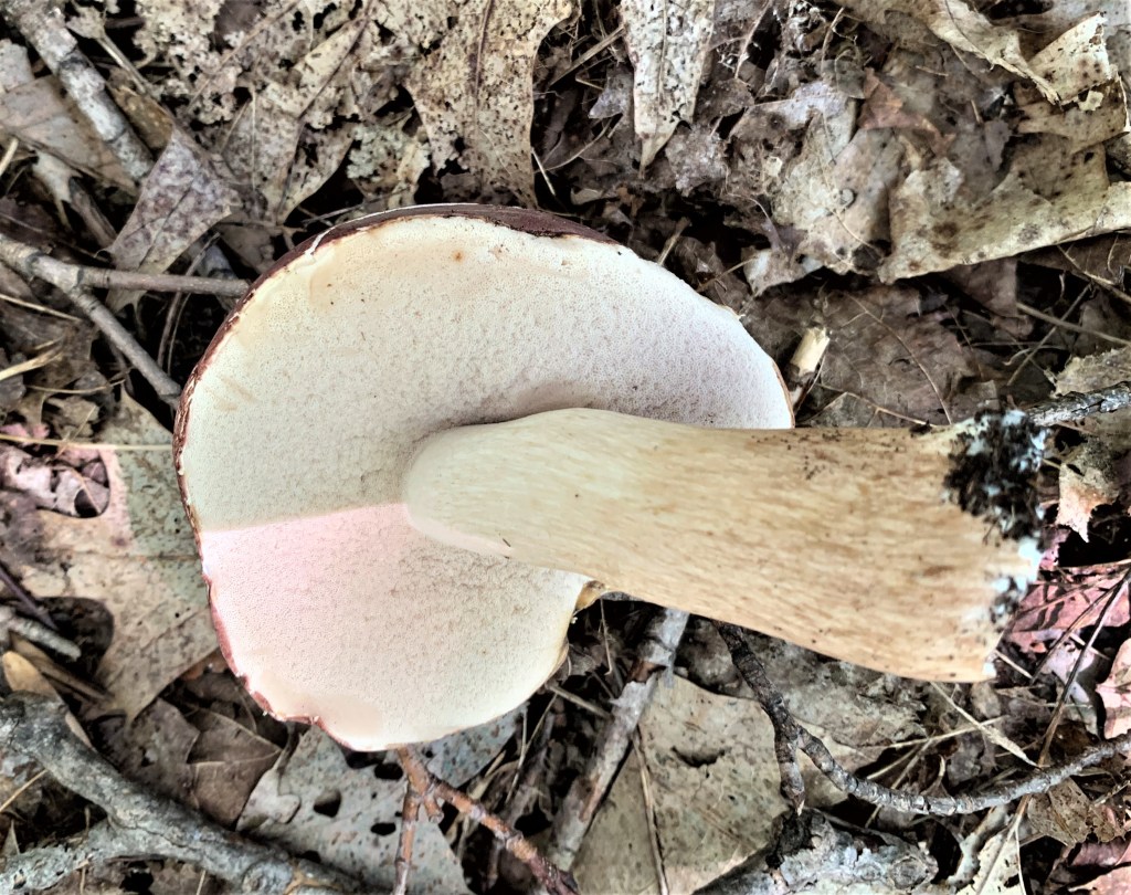
715A & B. A kissing couple of bolete mushrooms, identified by the pores rather than gills under the cap. These are probably king boletes (Boletus edulis), a.k.a. ceps or porcini mushrooms, and thus good eating, though that’s not for me to say.
Go to Part 58: Slough of Despond Side Trail to George Street
