
290. Kitchener, the middle one of the K-W-C tri-cities, is also the largest of the three. In fact, its population is roughly equal to that of Waterloo and Cambridge combined. It has its origins in Ebytown, a small village founded in 1807 and named for the dynamic Mennonite minister and civic leader Benjamin Eby, an immigrant from Pennsylvania. Eby promoted industry and preached pacific nonresistance in the settlement, located near what is now the centre of Kitchener. Subsequently the centre of German-speaking settlement in Upper Canada, Ebytown was renamed “Berlin” in 1833 after the Prussian capital. After WWI broke out, anything German was viewed unfavourably, to say the least, by most Canadians, so there was great pressure to rename Berlin. The citizens held a plebiscite in 1916, and “Kitchener,” for the British military hero who had just drowned, was subsequently, if unenthusiastically, chosen as the city’s new name.
The first two settlers, both Mennonites from Pennsylvania, in the area had started farms in 1800 on either side of the Grand River near what is now the suburb of Doon. But the city developed farther to the northwest, centered on the former Ebytown. So the Grand does not flow through Kitchener; rather, the river forms the eastern boundary of the city, while the east bank in northern Kitchener is mostly in the township of Woolwich. That bank is only urbanized near road bridges, of which there are surprisingly few. The Kitchener bank, meanwhile, is being rapidly developed with new housing surveys.
Kitchener is one of the top five fastest-growing large cities in Canada (see above). Still, the city seems committed to preserve a ribbon of land, if sometimes very narrow, for the Walter Bean Grand River Trail (WBGRT). We’ll continue to follow this Trail, in different seasons, in this episode.
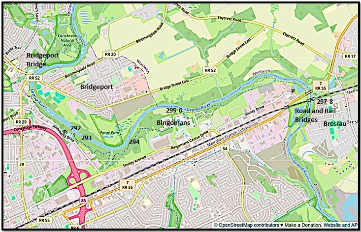
Map 24 (follows Map 22 above). This map covers the stretch of the Grand in northeast Kitchener between Carisbrook Natural Area and Otterbein Road. Numbers on Maps 24 and 25 correspond to the numbered entries below them. Recommended parking places for the Walter Bean Grand River Trail (the blue dotted line) are marked with a P.


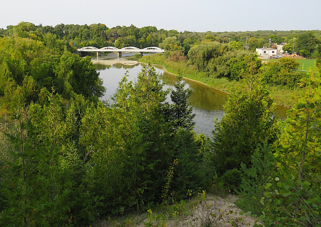
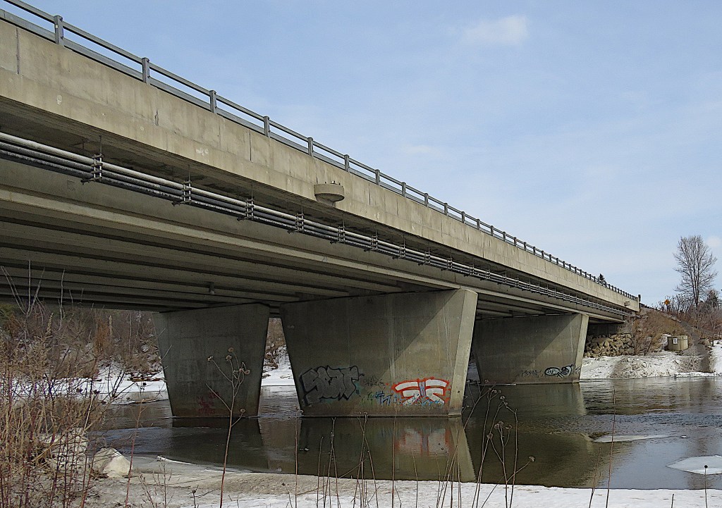
291. (Top) The Bridgeport Bridge (1934) is a five-span reinforced concrete bowstring arch bridge 126 metres long. Here it’s seen from the east bank, where it spans the short Bridgeport Trail in the foreground. There is no direct riverside access to the bridge from the WBGRT.
(Middle) The walkway along the bridge’s south side, segregated from traffic.
(Bottom) The elegant form of the bridge viewed at a distance from a high point on the WBGRT downstream.
This bridge was constructed to a design pioneered by Charles Mattaini (b. 1874), who had immigrated from Italy to Fergus in 1892 at the age of 19. Mattaini was familiar with concrete, as it had been used since Roman times in his homeland, though he had never designed a bridge before coming to Canada. His firm would build 70 of these bowstring or “rainbow” bridges, primarily in Wellington and Waterloo counties. As a way of thanking Canada for welcoming him, he never patented his striking and highly successful design. Mattaini died in 1947 and is buried in Elora.
After WWI, bowstring bridges proved capable of supporting the rapid increase in motorized vehicles. The construction of the Bridgeport Bridge was a public works project during the Great Depression. It was so well built that it survived major floods in 1948, 1954 (Hurricane Hazel), and 1974. Today, however, many bowstring bridges can’t handle the weight and volume of modern traffic and are facing demolition and replacement. That includes the longest and best-known one, the nine-arch span on Argyle Street in Caledonia (more details soon). The Bridgeport Bridge, however, was extensively restored in 2009, suggesting its heritage value has been recognized.
There’s been a river crossing – a ford – on this spot for centuries, as the Grand here is sometimes shallow enough to wade across. There’s been a bridge here since 1847, the current one being the fourth iteration. Thanks to it, the former village of Bridgeport developed on both sides of the Grand. The part of the village on the east bank, formerly known as New Glasgow, was annexed by the city of Kitchener in 1972.

292. On the Economical Insurance Trailway section of the WBGRT downstream from Bridgeport. P off Riverbend Drive.
(Top) That pier is a relic of an ambitious plan in the early twentieth century to build a network of electric railways across Perth, Oxford, Waterloo and Wellington counties, powered by cheap hydro from Niagara Falls. Here in July 1910 concrete piers were built to support a 400-foot-long bridge that would carry an electric railway from Berlin (Kitchener) to Bloomingdale. But the project foundered less than a year later. Then WWI halted all rail expansion plans. When peace returned, a big increase in fossil-fuel-driven vehicular traffic gradually doomed electric railway development. Sadly, such relatively clean electrically powered transit schemes were too far ahead of their time.
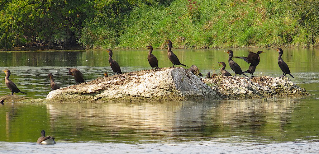
(Bottom) The remains of a midriver pier has been colonized by cormorants.


293. “I fish therefore I am.” A great blue heron (Ardea herodias) poses meditatively on the other side of the river south of Bridgeport. Great blue herons are actually greyish in colour, the sexes are similar in appearance, and they have a wide range in eastern North America. The ones found here by the Grand are likely to be migratory, wintering as far away as northern South America. However, they are very hardy birds, and if rivers like the Grand remain unfrozen thanks to global warming so that herons can continue to fish, a few may start to overwinter. They dine primarily on fish, but also on frogs, toads, salamanders, water snakes, turtles, small mammals, birds, and aquatic insects, all of which they swallow whole. They breed in heronries, i.e., groups of nests built out of sticks in trees close to water. They have few predators thanks to their formidable size and dagger-like bill, though eagles may manage to carry off juveniles.

294. A 2 km section of the WBGRT from Riverbend Drive to Bingemans Centre Drive is closed for most of 2025 due to a washed-out culvert. Because of its proximity to the Grand and of the large number of tributary creeks that it crosses, the Walter Bean Trail is frequently subject to closure because of flooding and washed-out bridges. Most of the Grand River Natural Area north of Bridgeport was inaccessible when I visited in 2024 because of a damaged bridge over a creek. See here for current details on closures.

295. Bingemans Grand Experiences is a large private camping resort, conference centre, wedding venue, catering, and entertainment facility occupying a long stretch of the west (here south) bank in the Victoria North section of Kitchener. Their website states that “Bingemans and the City of Kitchener have arranged for the Walter Bean Trail to go through the property, as such trail users are advised to please stay on the marked trial, and not veer into areas not considered the trail.” Bingemans map here.
I’m here in late winter, when there’s very little going on. The waterpark above opens in June and runs through Labour Day.

296. Mallards in flight over the Grand, early March, near Bingemans
297. The Victoria Street North (Ontario Highway 7) bridge. P at J.A. Pollock Family Trailway off Shirley Drive.


298. The rail bridge over to Breslau just downstream from the Victoria Street bridge. This was built in 1856 for the Grand Trunk Railway, then rebuilt as a steel deck girder bridge in 1905. It’s now used by GO trains on the Kitchener line and by VIA Rail passenger trains.
Someone has risked life and limb to inscribe “ECCLESIASTES 3.14” on the bridge.* This verse reads in the King James version, “I know that, whatsoever God doeth, it shall be for ever: nothing can be put to it, nor any thing taken from it: and God doeth it, that men should fear before him.” It’s not the best-known verse from Ecclesiastes, one of the most quotable of Old Testament books. Pete Seeger wrote a song that includes eight earlier verses of Ecclesiastes 3 almost verbatim, and the Byrds had a big hit with it as the antiwar anthem “Turn! Turn! Turn!” in 1965. But it’s not clear why chapter 3 verse 14 is referenced on the bridge.
Here’s a thought: the number 3.14 is associated with π, the Greek letter pi that represents the mathematical constant used to calculate the area of a circle. So there is an annual Pi-Day, the 14th day of the 3rd month, celebrated in some rarefied mathematical circles by the consumption of (circular, obviously) pies and pizzas. So if the implied message on the bridge is, “God intends us to eat pies, rather than make war,” I’m good with that.
*This is not the only enigmatic inscription associated with this bridge. The other side once bore the rather paradoxical legend “TWAS NOW.” This was appropriated as the name of a Kitchener self-styled “hyper-local pico-brewery.” Check them out here.

Map 25. From Natchez Woods to Doon. The Grand here keeps its distance – 8 km or so – from the centre of Kitchener.

299. The Grand looking upstream in early March from the M.R. Good Family Trailway section of the WBGRT. P at Otterbein Rd. The river is flowing freely, but its banks are still under a foot of snow.

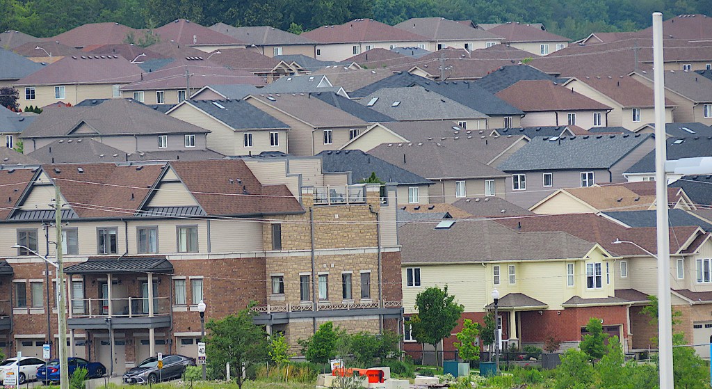
300. New houses crown the ridge near Natchez Woods. They’re in the suburb of Kitchener known as Grand River South.

301. Fall: the WBGRT occupies a narrow strip between the river (down a steep bank just off to the left) and the backyards of new houses in the Grand River South subdivision.

302. Beware low-flying aircraft! Only 500 metres or so separate us here from the west end of the Region of Waterloo International Airport’s main runway on the east side of the Grand.
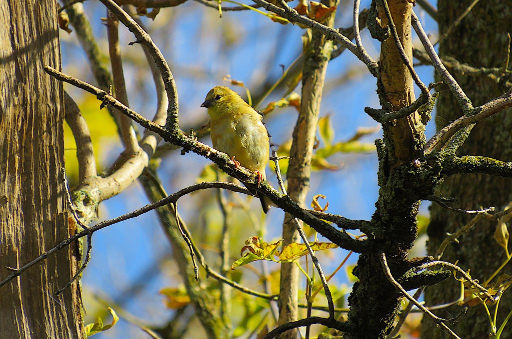
303. A juvenile goldfinch blends in with fall foliage on the WBGRT as we approach Fairway Road Bridge.

304. Fairway Road Bridge, Fall. P near south end of Woolner Trail.
305. The surface of the Grand projects moving ripple patterns onto the underside of the Fairway Road Bridge

306. Summer: Fairway Road Bridge, from the east bank. From this point south as far as the Freeport Bridge, the east bank is in Cambridge.
This bridge opened in December 2012 and was the first new Grand River crossing since 1963. It’s 247 metres long, only 95 m of which spans the river.
307. Two contrasting views from the Fairway Road Bridge.
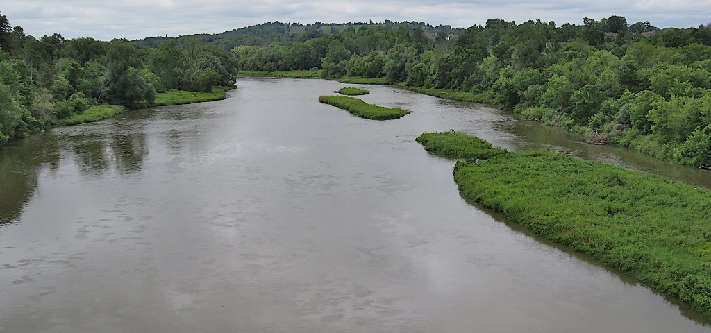
(Top) The Grand downstream.
(Bottom) Newly-built Kitchener suburbia on the west bank. The bridge has made this area much more accessible by road from Cambridge and the airport.

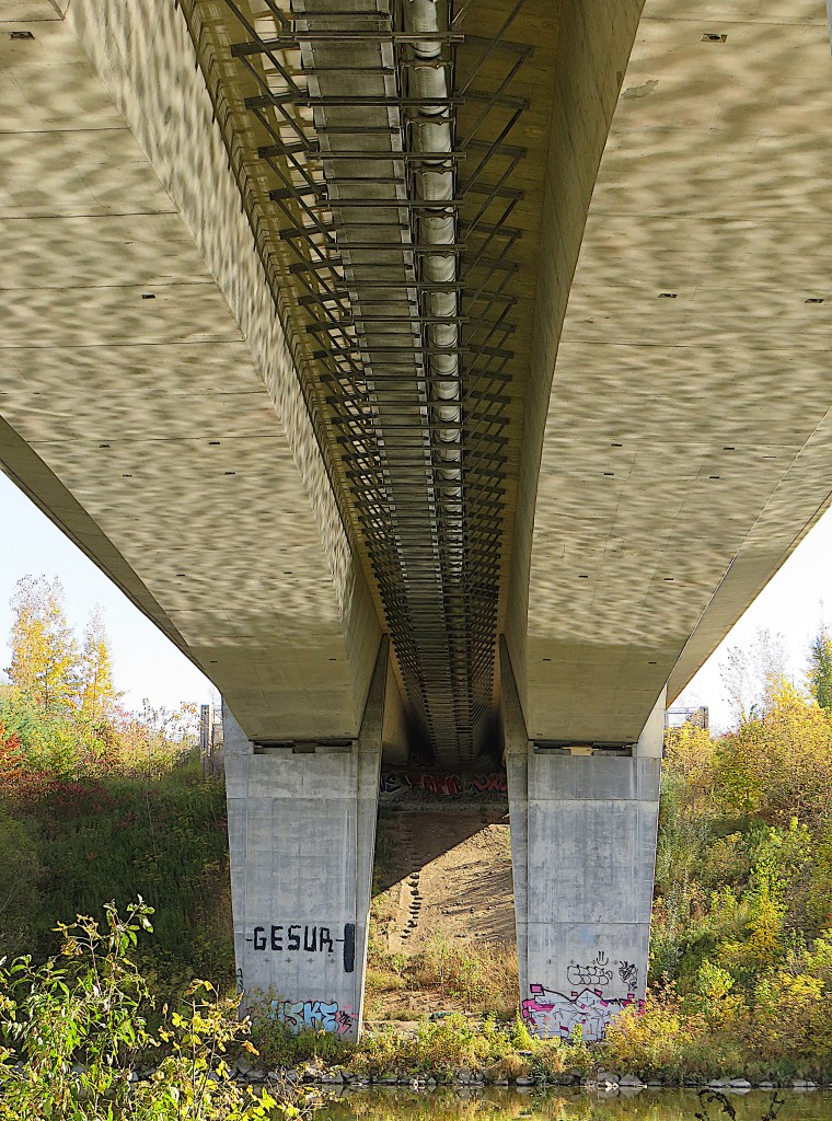
308. This rail bridge, parallel to and just upstream from the Freeport Bridge, was originally built in 1903 for the Preston and Berlin Street Railway, a 13 km interurban electric line connecting Preston (now part of Cambridge) with Berlin (Kitchener). The line opened to passenger traffic in 1904. Four years later it was merged into a new entity, the Berlin, Waterloo, Wellesley and Lake Huron Railway (BWWLHR), then leased to Canadian Pacific (CP) for 99 years. This line was later rebranded as the Grand River Railway (GRR) in 1914. In the 1950s CP Rail began to abandon passenger service as increased use of motor vehicles on paved roads seemed to obviate the need for rail-based public transit.
There’s a complex history of “radial” i.e., electric interurban railways in the Tri-City area. So it’s interesting to note that since 2019 they have made a comeback in the shape of the ION LRT, a new street-running electric light rail/tram system that currently connects Kitchener with Waterloo (though not yet Cambridge). This was a progressive move that few other Canadian cities have yet been able to initiate. ION has been successful in terms of both ridership and encouraging development in the central area of K-W. Click here to read my 2019 report on the then just-opened ION LRT.


309. (Top) The Freeport Bridge from the north bank. P at Schneider Park off King Street East just north of the bridge.
(Bottom) The deck of the bridge. There’s a segregated pedestrian walkway like the one at #291 above. Just as well: the WBGRT crosses the Grand on this bridge, after which it follows the east bank for some distance.
Like the Bridgeport Bridge, the Freeport Bridge on King Street East is at a shallow spot where a ford used to be. The first (toll) bridge (1820) here was wooden, and collapsed after being struck by ice floes in 1865. A second wooden bridge, with no toll (hence “Freeport”) collapsed under a heavy load of flour, and was replaced in 1880 by the first steel bridge in Waterloo County, built by the Hamilton Bridge Company. The current Freeport Bridge that replaced it in 1926 is a seven-span reinforced concrete bowstring arch bridge 160 metres long built at a cost of about $85,000, thus it’s an earlier avatar of the bridge at #291 above. Considered the most important heritage bridge in the Waterloo Region, the Freeport Bridge was restored at a cost of $3,500,000 in 2003. Further rehabilitation is planned for 2025, and meanwhile heavy vehicles have been banned from it.
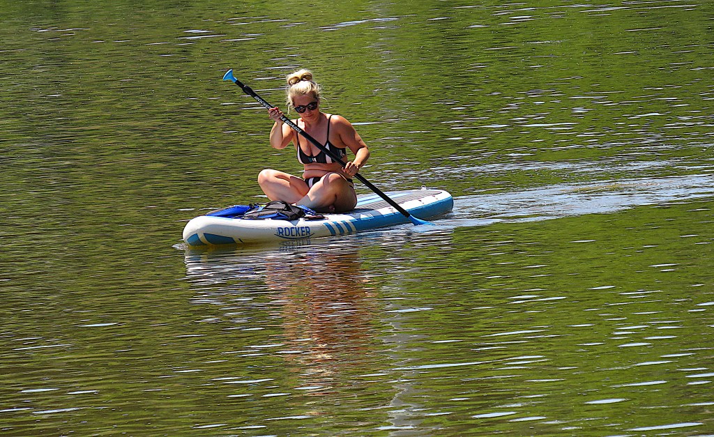

310. Kayaking off Schneider Park, west of the Freeport Bridge.
