This stretch of the upper Grand flows mainly, but not exclusively, through private land. So in this episode you’ll find details of three short hikes along or near the riverbank.
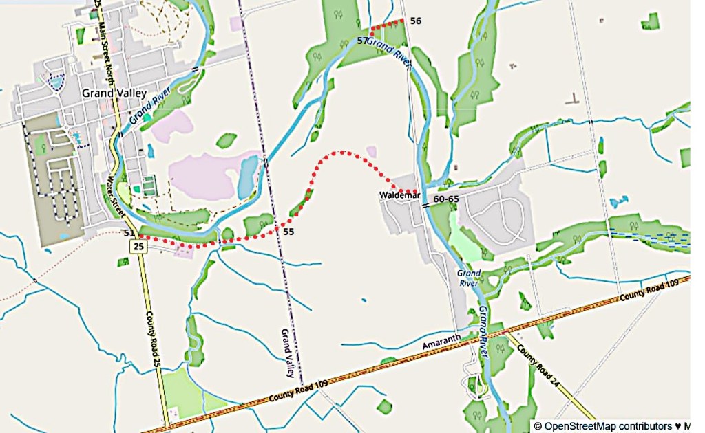
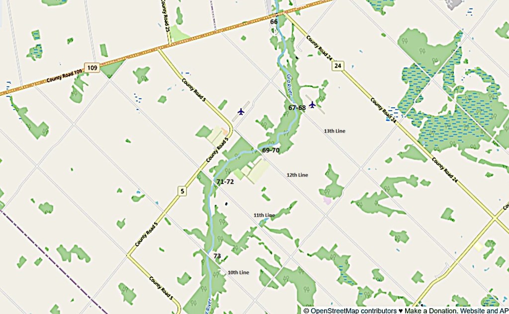
Map 7. The Grand River between Grand Valley and Waldemar.
The section of the Upper Canada Trailway (see #51 below) marked with red dots is 2.8 km one way. There is limited roadside parking at both ends.
The entrance to the McDowell Tract (#56 below) is on 10th Line 2 km north of Waldemar. It’s about 500 metres to the river from the Tract entrance, where there is limited roadside parking.
There are bridges over the Grand on the Amaranth-East Luther Townline (currently under reconstruction), on 10th Line, and in Waldemar.
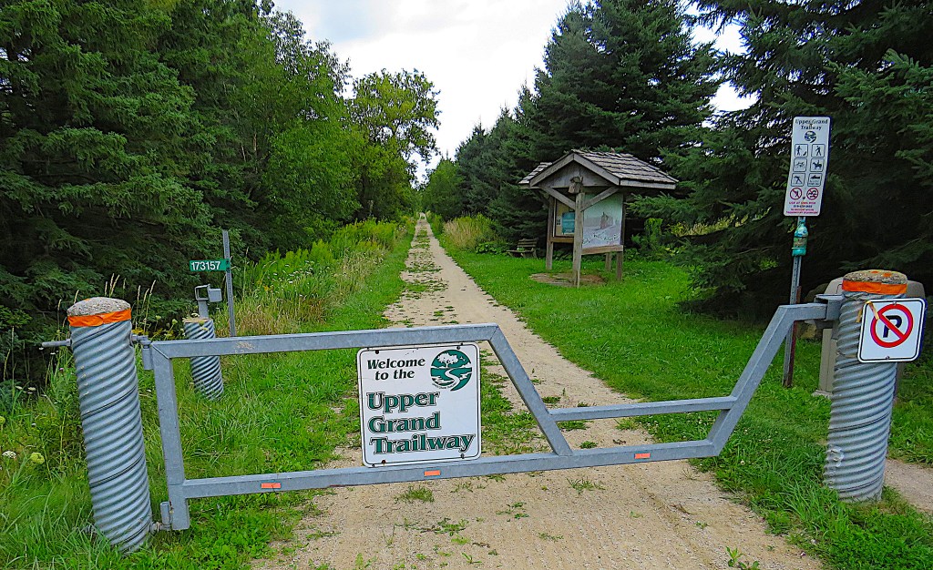
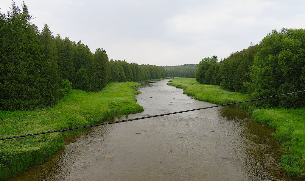
51. This is the entrance to the Upper Grand Trailway on County Rd 25 south of Grand Valley, looking east.
The Trailway runs about 22 km from Arthur to Waldemar. The short easternmost section from here to Waldemar is closest to the river. It’s an easy and pleasant stroll, but you won’t see much of the Grand in summer because of dense foliage.
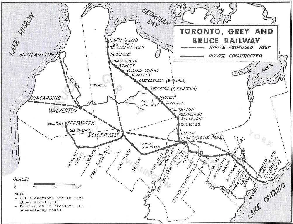
52. This Trailway is on the former Teeswater Branch of the Toronto, Grey and Bruce (TG&B) Railway that connected Grand Valley, Waldemar, and Amaranth to Orangeville, then continued on to Toronto. (We have previously crossed the rail trail on the former Owen Sound Branch of the TG&B near Dundalk: see #7 above).
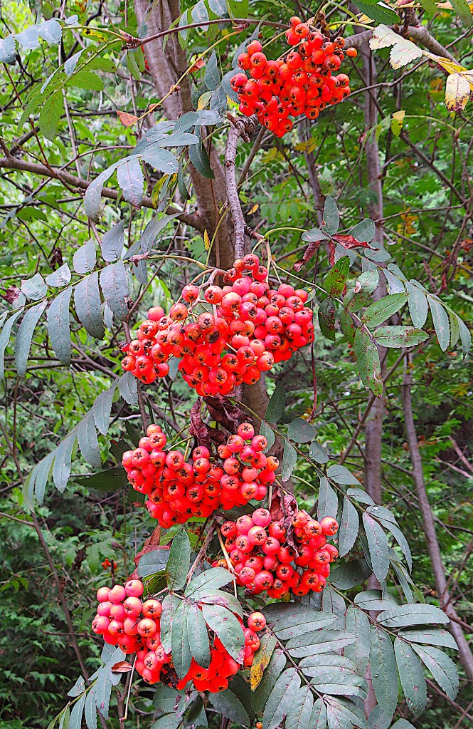
53. By the Trailway, mid-August, a fine crop of rowan berries. Sorbus aucuparia, the rowan or mountain ash, is a northern European tree that has adapted well to temperate North America. Its berries, which are full of sugar, are very popular with songbirds, especially waxwings. Berries left on the tree long enough will ferment, and cold weather will concentrate their alcohol content. Then birds who binge on them become drunk and can be seen falling out of trees, staggering around on the ground, or flying headfirst into windows.
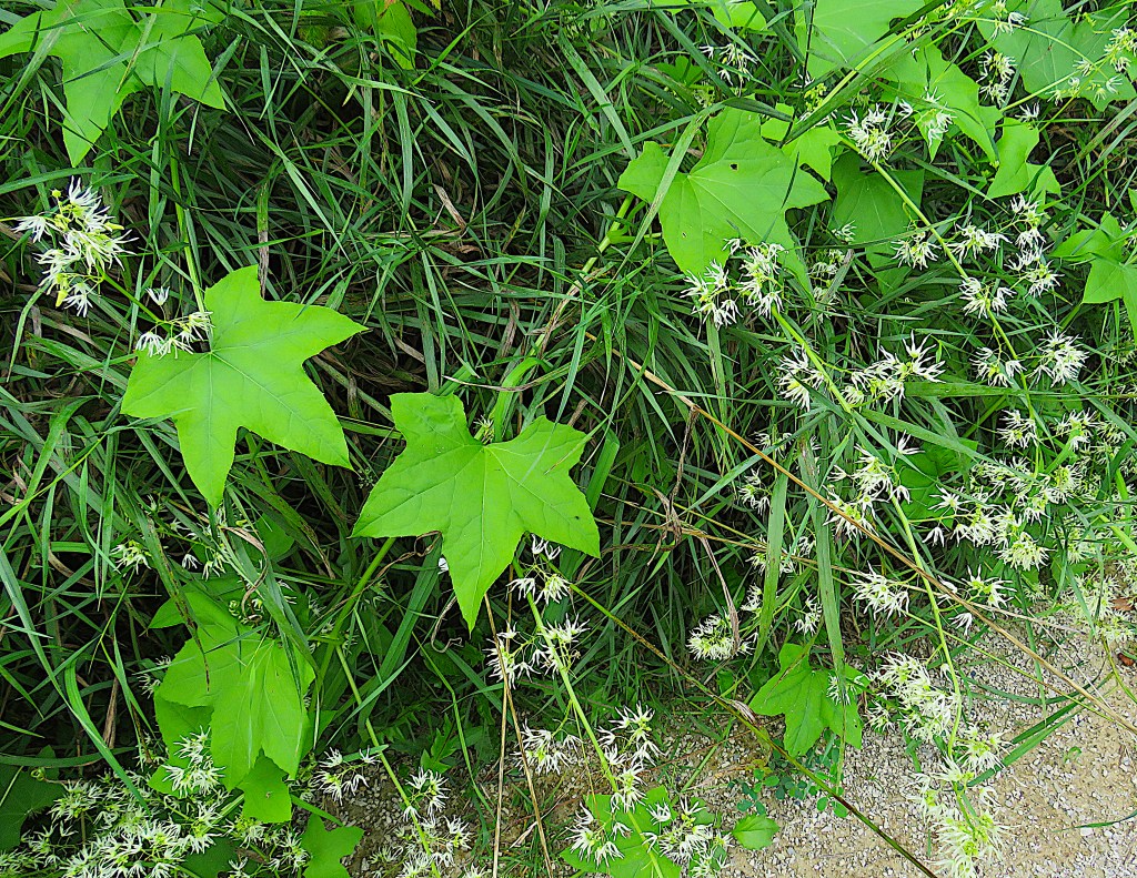
54. Also by the Trailway: wild cucumber (Echinocystis), a North American native. This is a widely distributed vine, related to the domestic cucumber. Its fruit, inedible by humans, is a capsule that looks like a small prickly watermelon.
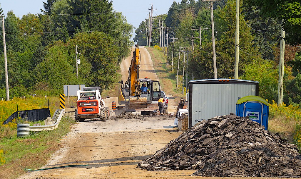
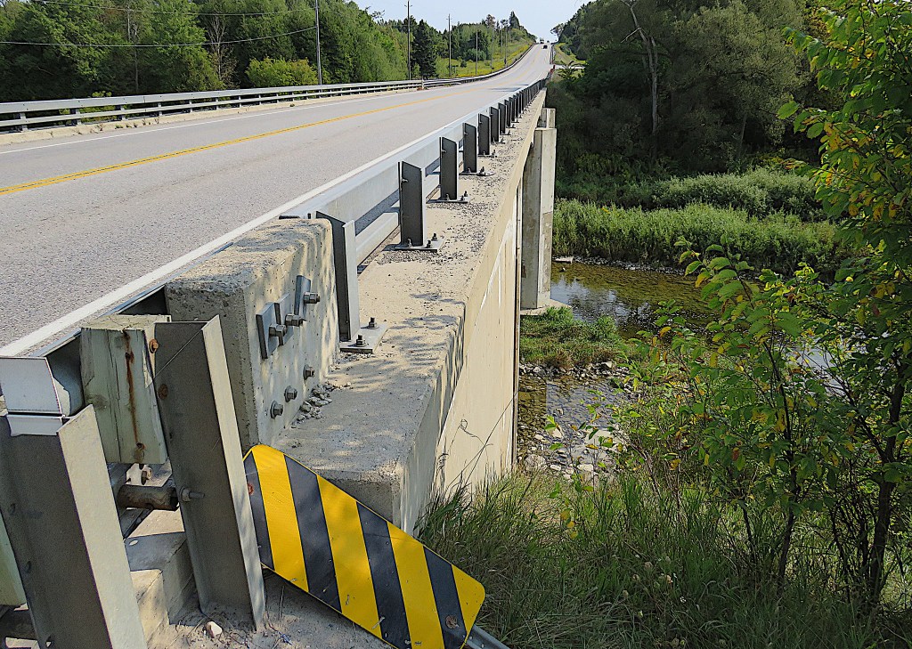
55. The bridge over the Grand on the Amaranth-East Luther Townline east of Grand Valley is currently inaccessible. It’s in the process of being resurfaced, after which the Townline, currently a gravel road, will be paved.
56. The McDowell Tract is a forest managed by the Grand River Conservation Authority at the apex of a large oxbow in the Grand. The entrance to the Tract on 10th Line is overgrown in late summer, but there is a trail hiding under all that vegetation …
57. … and if you follow it, you’ll find yourself on the north bank of a very peaceful stretch of river, with only some geese for company.
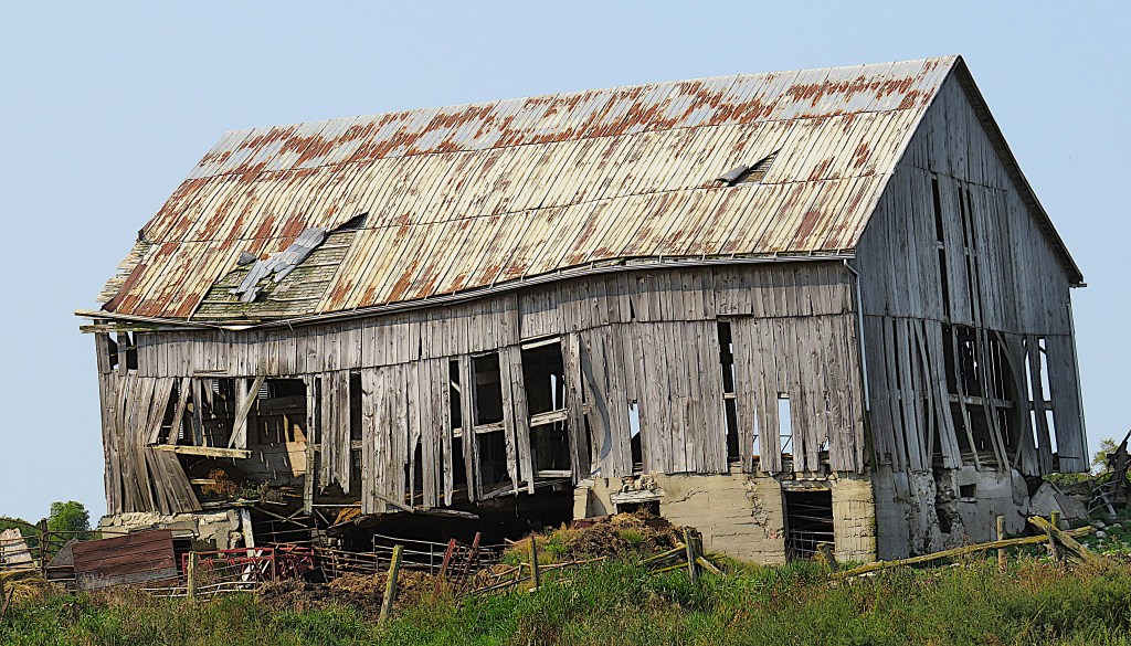
58. A photogenically decrepit barn on 10th Line about 1 km north of Waldemar.
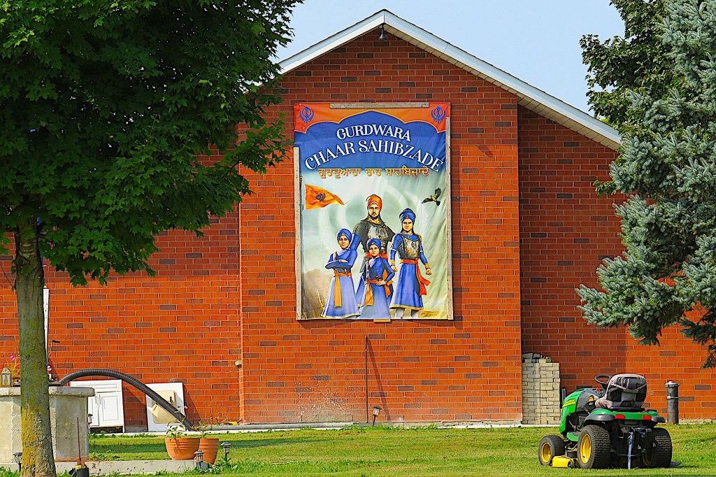
59. An exotic surprise by the Grand on 10th Line just north of Waldemar: a Gurdwara (Sikh Temple) named for the historical events depicted in the popular Punjabi animated film Chaar Sahibzaade (2014). The image on the wall facing the river is a version of the film poster.
60. Our next stop is the riverside hamlet of Waldemar.
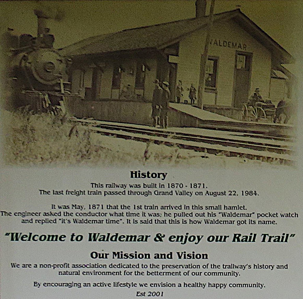
An information board at the eastern terminus of the Upper Grand Trailway explains how “it is said” the hamlet got its name. (“Waldemar” was a popular brand of pocket watch put out by the New York Standard Watch Company in the mid-19th century.) It’s a charming anecdote, though almost certainly untrue as the timing is off: the place was already named Waldemar when its post office was established in January 1870.
In the days when the TG&B had a station here (see #52 above and #63 below), Waldemar was a thriving community. See J.D. Ross’s Waldemar: Recollections of Times Past.
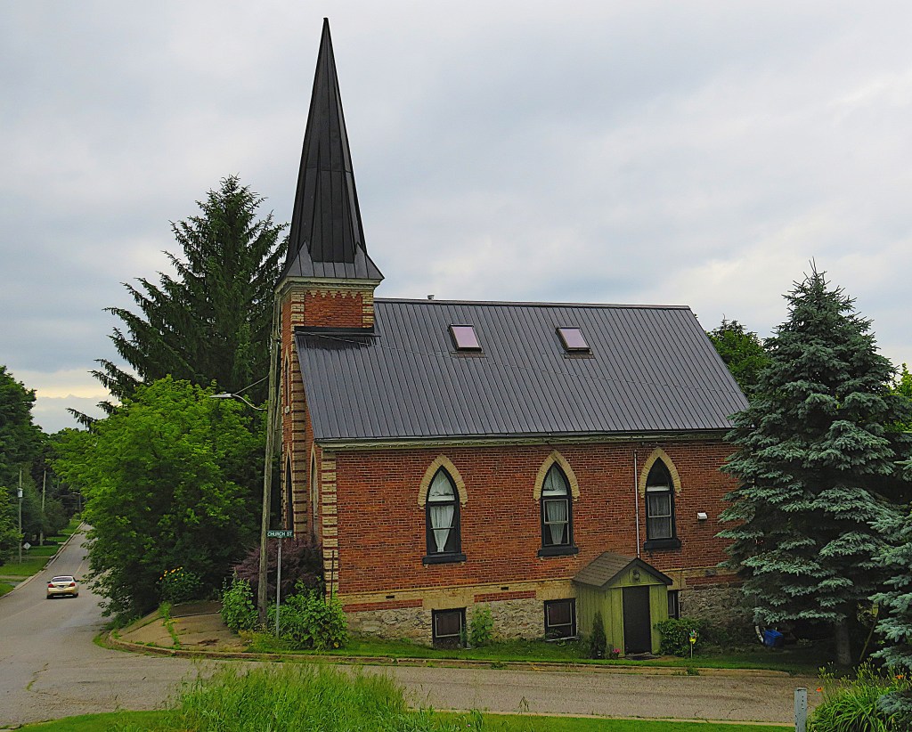
61. Waldemar’s Presbyterian church was built in 1887, then closed and sold in 1995. The interior has been beautifully adapted as a living space and there’s a deck at the back with views over the Grand (when the leaves are off the trees).
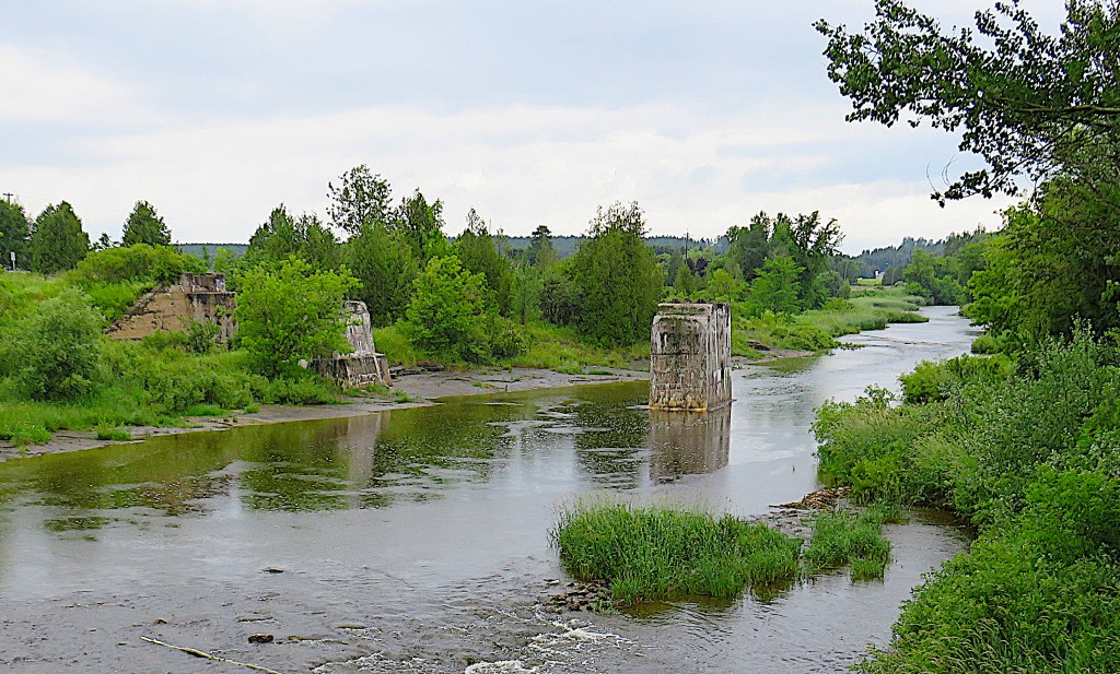
62. The remaining abutment and pier of the TG&B Railway bridge where it crossed the Grand, just north of the current Waldemar road bridge.
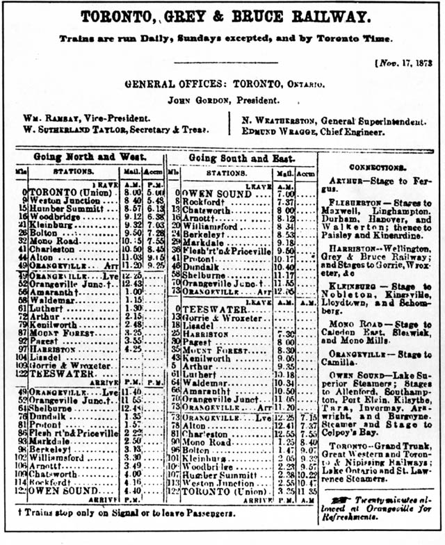
63. A 1873 Timetable of the TG&B Railway.
In that year Dundalk, Grand Valley (then called “Luther”), and Waldemar were all connected to Toronto by a train that ran six days a week. You’d leave Waldemar at 10:34 am and arrive at Toronto’s Union Station about 5 hours later, with a 20-minute break at Orangeville “for Refreshments.” As it’s about 100 km to Toronto, the train’s average speed was a little better than 20 km/h.
But progress isn’t just about going faster. Can you guess Google Map’s answer when you ask it for directions to Toronto today by public transit from anywhere in Grand Valley, Melancthon, Amaranth, or East Garafraxa Townships? (Clue: it starts, “Sorry, …”).
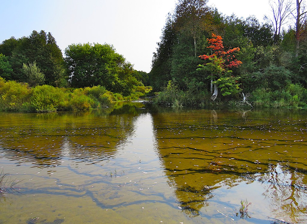
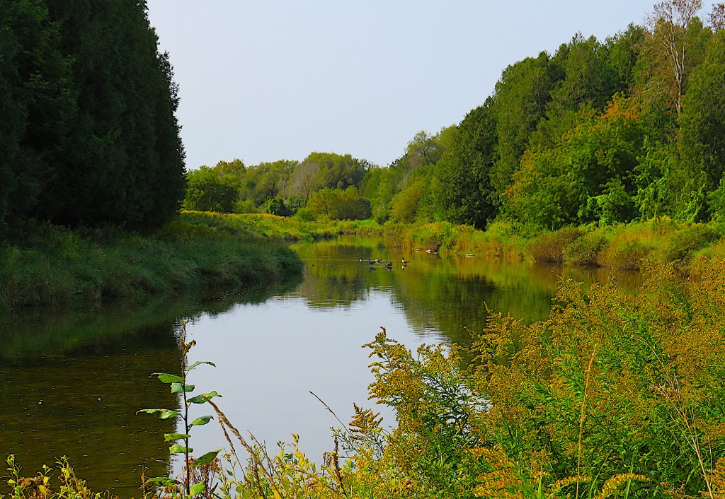
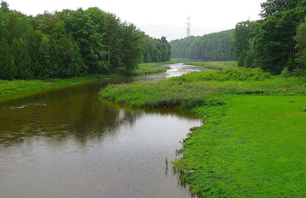
64. The river just north of the Waldemar Bridge flows across layered bedrock. A tributary creek, Willow Brook, joins the Grand at centre.
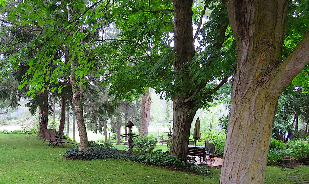
65. An atmospheric riverside garden in Waldemar.
Map 8. The Grand River in East Garafraxa.
South of Dufferin County Road 109, the Grand enters East Garafraxa Township. The origin of Garafraxa is an intriguing mystery. Ace Ontario onomastician Alan Rayburn notes, “Some believe it may be from an Aboriginal language and have the meaning ‘panther country.’ Others look to an Irish family or estate, such as ‘Garrafranes,’ or to the Irish garry fraech, meaning ‘rough heath’” (103).* Other sources repeat the “panther country” theory, but none of them indicates which Aboriginal language it comes from, or provides any evidence that this area was once infested with panthers.
The Gaelic etymology is only a little less unlikely than the Aboriginal. Garadh/Gharadh (pronounced “Garry”) can be a hydronym, i.e., a river name, as in Glengarry in Scotland, and East Garafraxa is centered on the Grand River. Fraxa, however, isn’t close to anything in Gaelic … though it does mean “happy” in Somali!
In East Garafraxa, the Grand has now definitely become a river and runs through a beautiful wooded valley. Unfortunately, almost all of this valley is in private hands, so you can only view the Grand from bridges.
*Actually, the Irish Gaelic for “rough heath” Is fraoch garbh, which doesn’t sound much like Garafraxa at all.
66. The next bridge, carrying busy County Road 109 over the Grand, is not recommended for a stop. Parking is awkward, huge trucks whizz by to and from Orangeville, the view is not worth the risk, and access to the river below is precipitous.
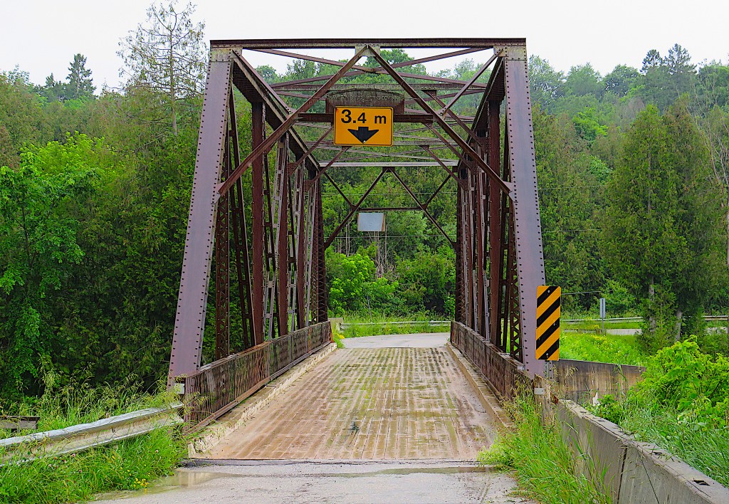
67. The next crossing downstream, on 13th Line, is definitely worth a stop, and not just for the river view. It’s a 37-metre-long steel six-panel rivet-connected Pratt through-truss bridge with a wooden (!) deck. That is, it’s a bridge made of a web of steel members arranged in structural triangles on both sides and overhead that carries a road that goes through the arrangement, as designed by US father-and-son engineers Caleb and Thomas Pratt. Pratt trusses were manufactured in relatively low cost, easily movable pieces, and could be assembled on site by semi-skilled workers. They were superior in strength to earlier road and rail bridges with modest spans. Hundreds of these bridges were built in North America from 1842, but not many remain. This one was built in 1913 by the Hamilton Bridge Works Company of Hamilton, Ontario and is the oldest bridge of its kind in the Grand watershed …
68. … and the view of the river from it is very pleasant.

69. The 12th Line crossing is equally interesting. The MacPherson Bridge is a 52-metre-long concrete rainbow through-arch, built ca. 1921 and fully restored in 2019. It’s the only skewed, off-set twin concrete bowstring arch bridge over the Grand, and rates highly as a heritage structure.
70. Great river view, too!

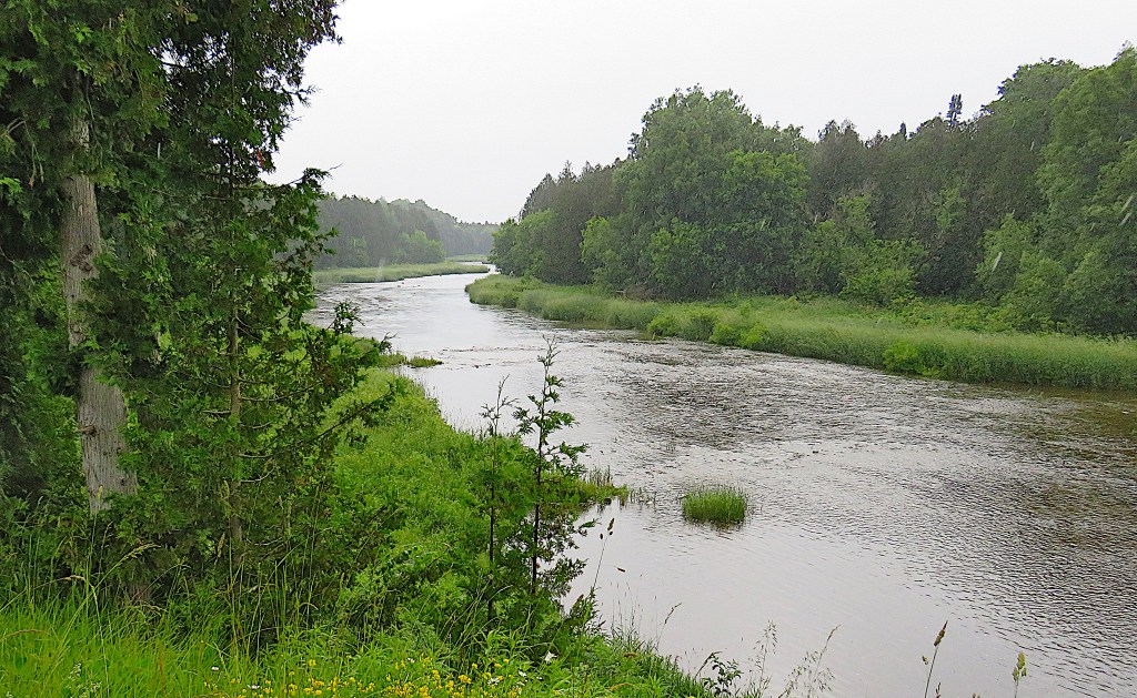
71. There’s nothing very special about the bridge on 11th Line, but the upstream view of the river is delightful even on a damp, miserable day.
“A river is water is its loveliest form; rivers have life and sound and movement and infinity of variation, rivers are veins of the earth through which the lifeblood returns to the heart.” So wrote Roderick L. Haig-Brown (1908-76), Canadian writer, fly fisher, and conservationist, in the chapter “To Know a River” in his book A River Never Sleeps (1946). Haig-Brown’s home water was the Campbell River in BC, but his sentiments apply equally to the Grand.
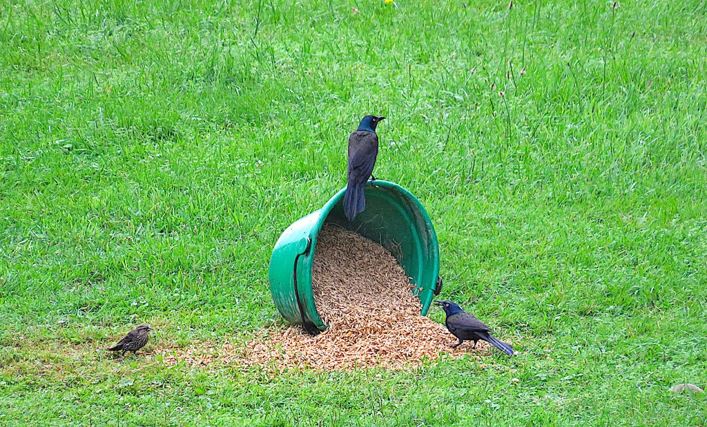
72. Downstream from the 11th Line bridge, there’s a lawn on which a bucket of grain has been artfully spilled as a slightly unconventional bird feeder. One grackle is stuffing itself while the other guards the bucket from interlopers. A sparrow waits patiently for the pair of bullies to clear off.
73. Nothing special about the 10th Line bridge either. But as golden sunlight begins to fade, the river takes on the quality of a different precious metal.
“Slowly, silently, now the moon
Walks the night in her silver shoon …
And moveless fish in the water gleam,
By silver reeds in a silver stream.”
— from “Silver” by Walter de la Mare (1873-1956).
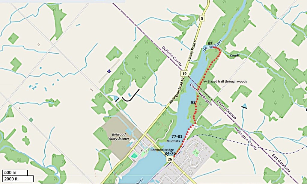
Map 9. The Grand north of Belwood.
Two km north of the Belwood Bridge, the Grand starts to widen considerably, though it remains shallow. Downstream from the bridge, it forms Lake Belwood, a body of water created artificially by the Shand Dam at the Lake’s south end.
Starting at the southeastern end of the Bridge – as long as the water level is low – you can explore the eastern shoreline of the river. My route is marked by red dots. Go carefully along the mudflats, using rocks as stepping stones when the mud is deep, and the chances are you’ll spot a variety of wading birds, ducks, and gulls.
If you seek greater solitude, continue on the irregularly blazed path through the woods as far as the tributary creek marked on the map. You’ll have to return the same way, and you’ll undoubtedly lose the trail from time to time. But don’t panic: the river is always close at hand on one side, and on the other you’ll come up against fences marking off the back of private properties on Sideroad 10.
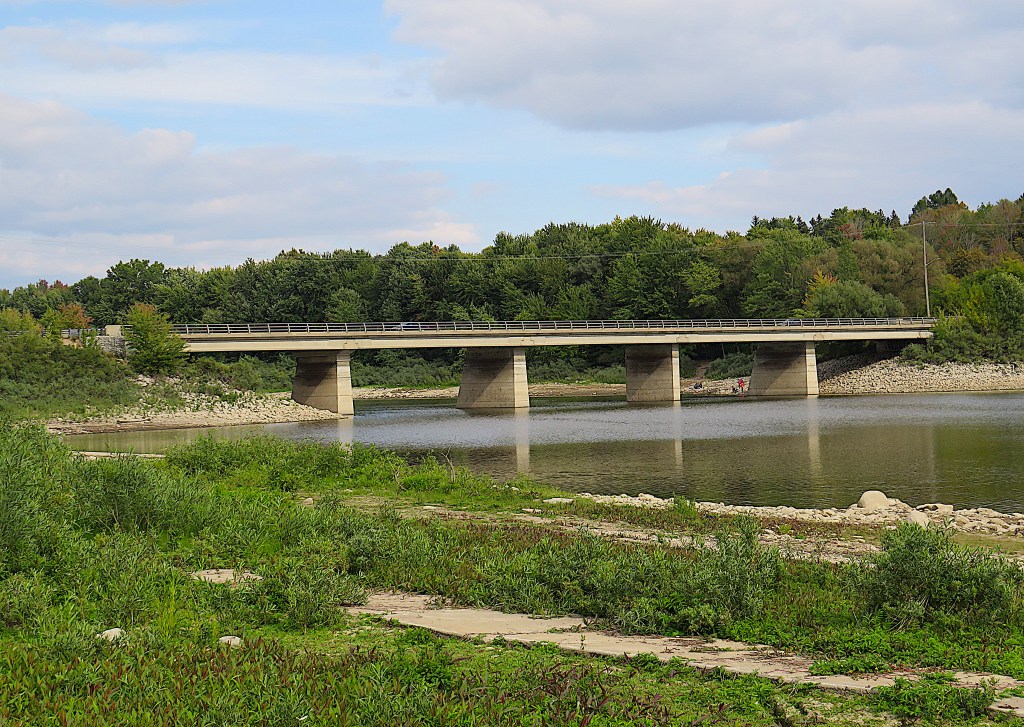
74. This is the sleek County Road 26/North Broadway Street Bridge (2008) at Belwood. It’s the only road bridge across the Lake. The next vehicular bridge across the Grand to the south is on 2nd Line more than 10 km from here.
We’ve left East Garafraxa and are now in Centre Wellington, a township created in 1999. With a population of over 30,000 including the towns of Fergus and Elora (of which, much more later), it’s more populous than the townships we have visited so far, but it’s still very much a rural area.
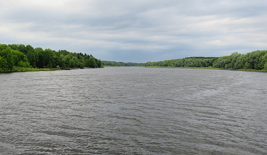
75. From Belwood Bridge looking upriver. There’s a cottage road on the west bank with properties coming right down to the shoreline. But the east bank at right has not been colonized, possibly because it’s more subject to flooding.
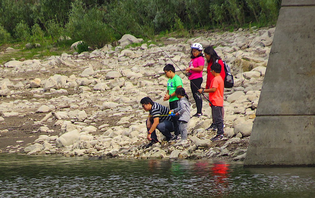
76. Let’s descend to the riverbank behind the southernmost pier of the Belwood Bridge, near where this family is fishing.
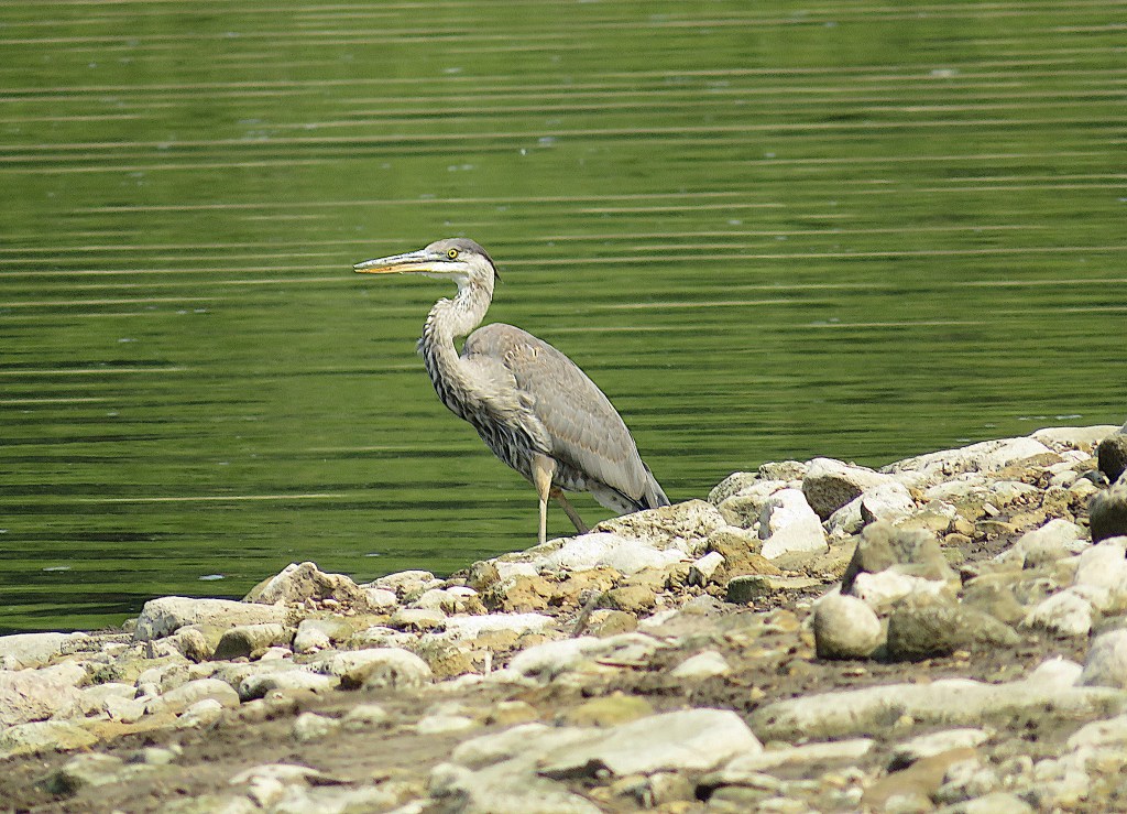
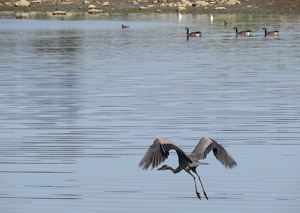
77. For such big birds, great blue herons scare easily. With six-foot wingspan and bent neck, their flight is slow and steady, long legs periodically trailing in the water.
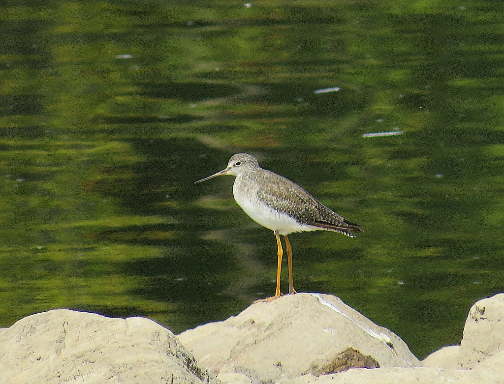
78. No need to ask how the yellowlegs got its name.
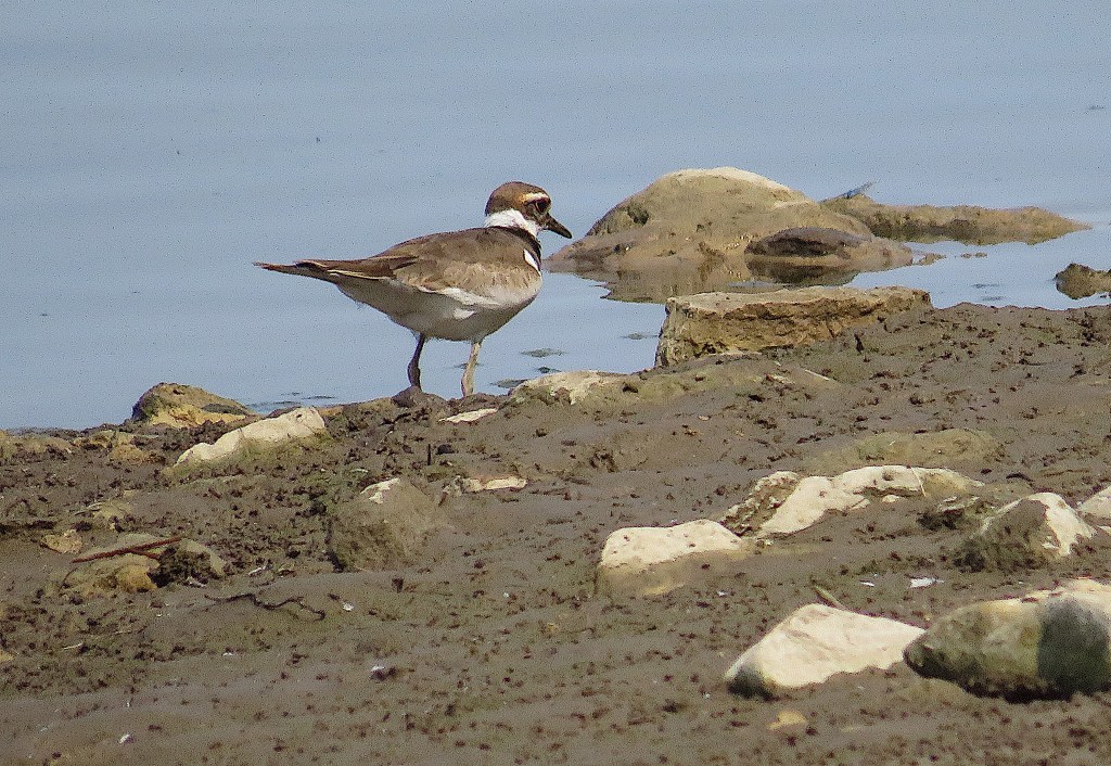
79. A killdeer has important business to conduct on the mud at the water’s edge.
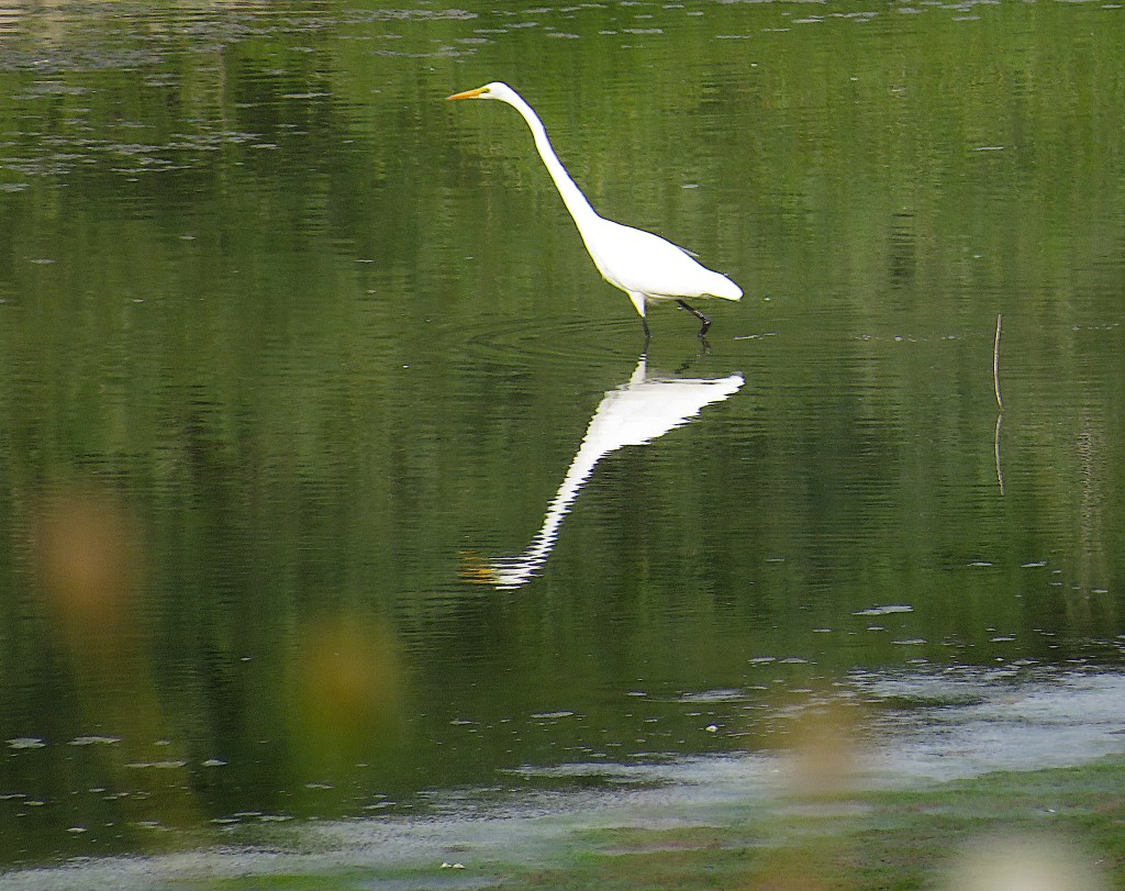
80. A great egret poses narcissistically in the shallows.
81. A solitary immature blue-winged teal seems to be awaiting further instructions.
82. After about 1 km, the shoreline meets the start of a trail through the woods. The Grand is just visible at left. The white blazes marking the trail are sometimes poorly defined or missing. Can you spot the one in the image above? This unnamed trail to nowhere in particular is a bit of an adventure and you won’t meet too many people on it … that is, probably no one at all.
83. There’s a side trail along a small creek down to the Grand. This is the view upstream.
Now you have to retrace your steps back to Belwood Bridge. It’s about 5 km in total there and back, and you can rejoin Sideroad 10 for the last 1 km on your return if you don’t feel like mudhopping along the shoreline.
