In Memoriam Peter Bowman
1. This hike follows the shore of Lake Ontario from west to east through the central part of Toronto, Canada’s biggest city. It’s approximately 23 km long, not including side trips. (There are innumerable possibilities for side trips.) It is an easy hike, in that the trail is generally well paved, flat, and segregated from traffic. A reasonably fit hiker can do the whole trail in a single day at almost any time of the year. If you prefer to do the trail in two legs, then the CN Tower is roughly the halfway point. There are of course plenty of places to stop for rest and refuelling.
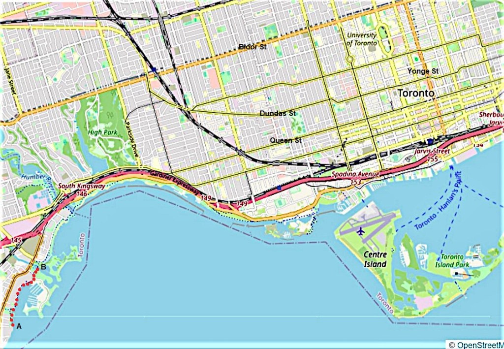
I’ve broken up the trail into short sections as there is a great deal to see at almost every point. The first section, from A to B in the bottom left corner of the map above and marked with red spots, is about 1.5 km long. Zooming in …
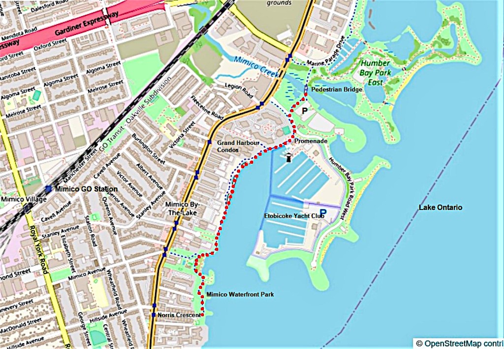
2. … you start at the eastern end of Norris Crescent in the area of the city called Mimico, and finish at the pedestrian bridge over Mimico Creek.
As this is Toronto, where neither driving nor parking is easy, I suggest you use public transit to access the trail. GO Trains on the Lakeshore West line stop at Mimico, from where it’s about a 1.5 km walk to Norris Crescent. To avoid this lengthy and not terribly pleasant introductory walk, take a Toronto Transit Commission (TTC) bus or streetcar along Lake Shore Boulevard West. On the map above, that’s the yellow road marked with dark blue streetcar stops that runs parallel to the lakeshore. There are transit stops from both directions very close to Norris Crescent. Walk eastward along Norris Crescent for about 200 metres. Norris Crescent ends at a small park on the Lakeshore and that’s where the Waterfront Trail begins. As the trail goes in only one direction (north), you can’t go wrong!
If you do come by car, you can park on Norris Crescent itself if you’re lucky enough to find a space. Parking is much easier at the large (black) P in Humber Park West that you access from Lake Shore Boulevard West. From that P you can hike this section north to south and back again, or take the TTC one way, thus making a loop.

3. If you see this sign, you’re starting at the right place. Parkette, incidentally, is a Canadianism for a small urban public park, often containing a children’s play area.

4. This is the view of the downtown Toronto skyline from Norris Parkette. It’s about 11.5 km on foot to the CN Tower from here, or about 8.8 km as the crow flies. The CN Tower, 553 meters tall and visible for miles in every direction, makes the Toronto skyline immediately recognisable, gives it a clear focus, and helps you establish your bearings from almost anywhere in the GTA (Greater Toronto Area). It is, in the truest sense of the word, an iconic structure.

5. Much closer at hand, there’s another skyline: the condominium towers, most of which have been built recently, clustered around Mimico Creek. They offer their residents on the east side a view of the lake … at least until a newer highrise blocks their view. This inlet of Lake Ontario is known as Superior Creek, and that boat approaching …

6. … is a police launch. MU04 is about 10 metres long and is used for search and rescue operations. It weighs five tons and has twin Volvo diesel engines. Toronto Police’s Marine Fleet patrols more than 1,190 square km of Lake Ontario. That’s because the boundary of the City of Toronto extends to the border with the USA in the middle of Lake Ontario.

7. Though the trail, passing through a series of linear parks, is segregated from road traffic, hikers still need to be vigilant. Vehicles on the trail powered by muscle or by electric motors approach you rapidly and silently from behind. A small minority of their operators (not including the dog walker above) take a sadistic pleasure in whizzing past you as fast and as close as they can without warning. Keep to the right of the trail and periodically glance over your shoulder.

8. There are only a few watercraft on the open lake on this fine spring day. A merchant vessel in the distant haze heads west towards Hamilton Harbour or the Welland Canal. And then there’s this sailboat coming in to a local marina.
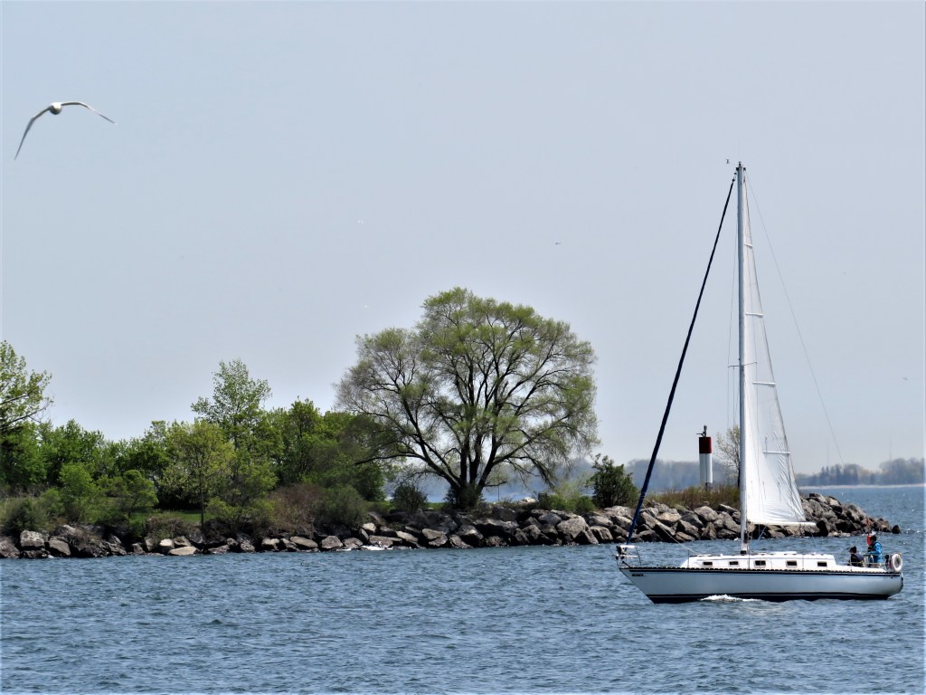
9. Here the sailboat passes the light at Etobicoke Point, the southern tip of Humber Bay Park West. Incidentally, Etobicoke (the “k” is silent) is the name of a former municipality amalgamated into (i.e., absorbed by) the city of Toronto in 1998. It now designates the large district (pop. 370,000) where we are at the moment: the western edge of Toronto from here on the lakeshore to the city’s northern boundary at Steeles Avenue. The word Etobicoke apparently derives from Mississaugan wadoopikaang, meaning “place where the black alders grow.”

10. The sailboat docks near the Humber Bay Park Lighthouse in the marina of the Mimico Cruising Club. This lighthouse, a heritage structure constructed in 1906, was once located on the Toronto Islands east of here. No longer needed there, it was moved here in 1981 chiefly for cosmetic purposes.
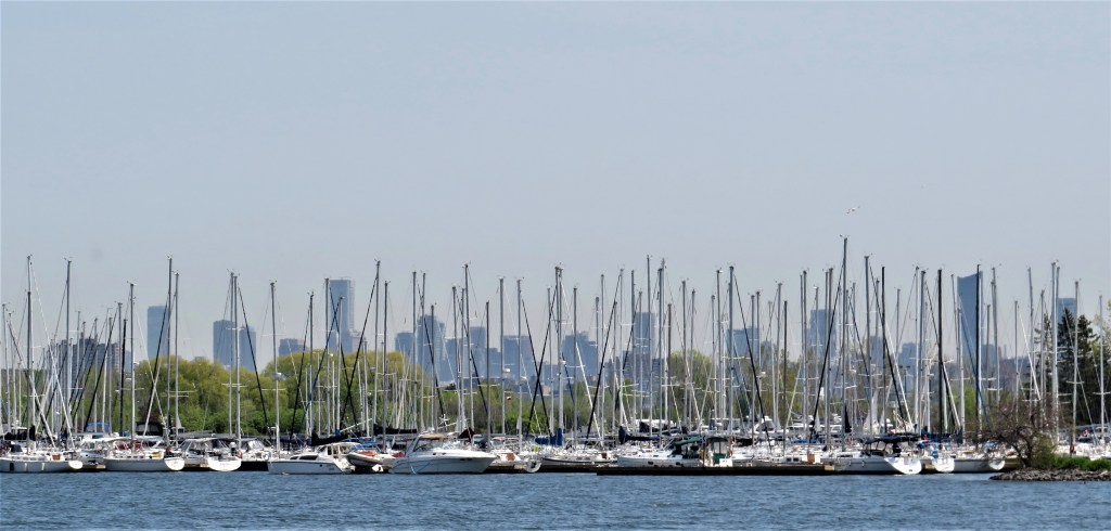
11. Three forests: of masts in the foreground, of trees in the middle ground, of highrises in the background.

12. Here the Waterfront Trail is a paved path shared by walkers, cyclists, et al. …

13. … but just a little farther along the trail splits into two: the paved path for bikes and other vehicles keeps to the shore, while this boardwalk across a small sub-inlet is reserved for pedestrians. We are entering Condo Land!

14. Grand Harbour Condominium (constructed 1989-92) is at 2285 Lake Shore Blvd West (on its eastern, lake side). At back are two towers connected by an arch, looming over townhouses in the foreground. The development was designed by Matsui Baer Vanstone, and the architectural style, if that’s the right phrase, is Neo-Eclectic/Postmodern. The Toronto Star described the development as “a hybrid of classical, neo-gothic, and Georgian … mixed together and applied – incongruously but felicitously – to 20th-century-sized structures.” In my view, incongruity trumps felicity, and may induce a severe migraine. And yes, those are chimneys with traditional pots on top of the towers. Are the penthouses really fitted out with coal- and wood-burning fireplaces?

15. The charming gazebo at Humber Bay, with pigeons on its roof. Mimico, the name for this lakeside district of Etobicoke, derives from the Mississaugan word omiimiicaa, meaning “place of wild pigeons.” For that First Nation, those wild birds were passenger pigeons, once the most numerous birds in North America, but entirely extinct by 1914 as a result of hunting and various other human interventions.
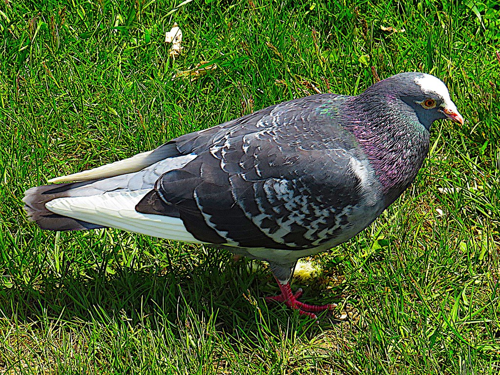
16. And though the passenger pigeon is long departed, Mimico is still frequented by its surviving relative Columba livia domestica, properly the rock dove, an immigrant from the Old World. This one stands expectantly by my feet as I rest on a bench. This is the oldest domesticated bird in the world, as attested by Mesopotamian cuneiforms and Egyptian hieroglyphics.

17. Now the trail widens into the Promenade at Humber Bay.
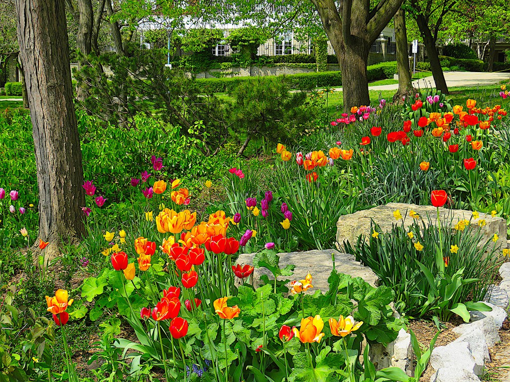
18. The small gardens above the Promenade are beautiful in spring.

19. Variegated tulips are in bloom …

20. … as is crabapple blossom.
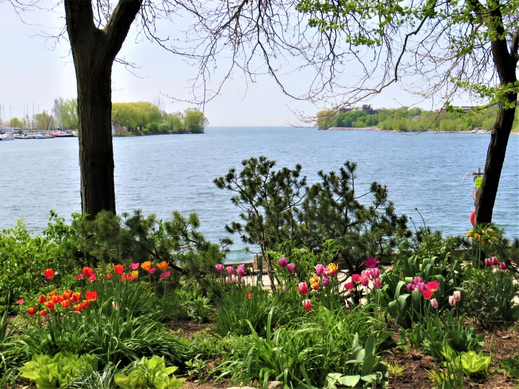
21. Superior Creek viewed from the gardens above the Promenade.

22. A painted turtle sits on a rock just off the edge of the Promenade. This one, while alert, doesn’t seem excessively alarmed by the proximity of so many people. Given the density of human population hereabouts, there’s a surprising amount of wildlife here at the Mimico lakefront, though it’s the kind that’s semi-domesticated, having accustomed itself to an urban environment.

23. A dog-walker in Humber Bay Park West. These days dog-walking is a service industry, whereas formerly it was a chance for owners and their pooches to get some exercise and spend some quality time together. The Toronto Humane Society notes: “dog walking is physically and mentally challenging” as it involves “exercising multiple dogs with varying personalities, behavioural quirks, and physical needs. This takes a certain type of individual. Great dog walkers are also organized, efficient, reliable, and hold a strong work ethic. This will help them plan their dog walking schedules and keep consistent communication with pet parents … They need to be masters of reading canine body language, have advanced dog handling skills, and know which dogs can be walked together.” And how much does such a service cost a “pet parent”? One representative organization charges $24.50 per group walk like the one above. Group walks, which last from 30 minutes up to an hour, are fine if your dog interacts well with others and you take the package of 12 or more walks per calendar month, for which you’d be paying at least $294. But expect to pay more per walk if you feel your dog only needs 11 or fewer walks in a month, and more still if your canine companion doesn’t play well with others and so needs individual attention.

24. Double-crested cormorants in Humber Bay Park West. This is a species native to the Great Lakes, but it almost became extinct here in the later 20th century. The cormorant population has recovered dramatically in the Toronto area, but now these water birds are the cause of friction between city and province. Since 2020, thanks to lobbying by hunters and fishers, Ontario has allowed cormorant hunting with shotguns from boats, based on the argument that culling these birds is a good thing in itself, as they eat a lot of fish. (Very few hunters in Ontario have ever shot cormorants with a view to eating them.) However, the City of Toronto forbids hunting of any kind within city limits, with a $5,000 fine for contravention. Cormorants have long been blamed for dwindling fish stocks, though there is good evidence that such declines are almost always caused by human overfishing. As David Suzuki puts it, “Humans must grow up, take responsibility and stop scapegoating other species for our mistakes.”

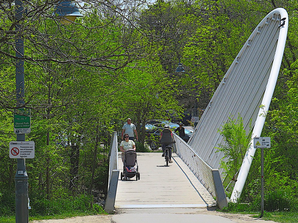
25. The Mimico Creek Pedestrian Bridge (1996-98) was designed by the celebrated Spanish architect and structural engineer Santiago Calatrava. It spans 44 meters and has a deck 2.5 meters wide. Weighing only 50 tons, it was prefabricated in four separate pieces and assembled on site.
26. Viewed from the trail, the bridge seems weirdly lopsided …
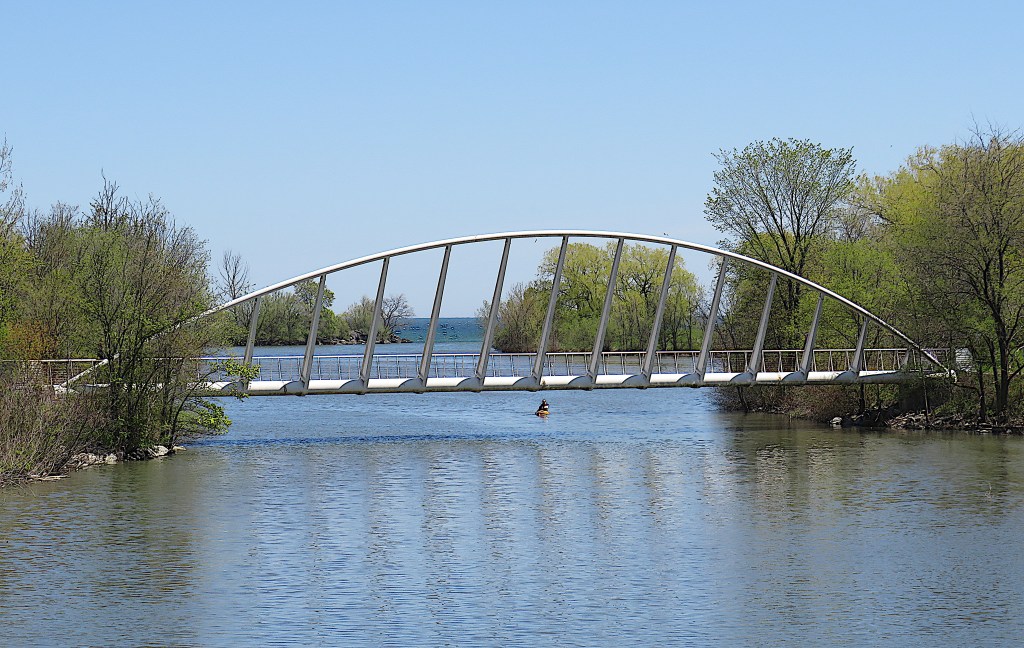
27. … but from the perspective of a canoe it is quite elegant.

28. Mimico Creek viewed from the footbridge, looking towards its mouth at Lake Ontario. The creek has its source in Brampton and is about 33 km long. Its estuary is now surrounded by two parks, Humber Bay Park West and East, constructed from landfill during the period 1970-90.
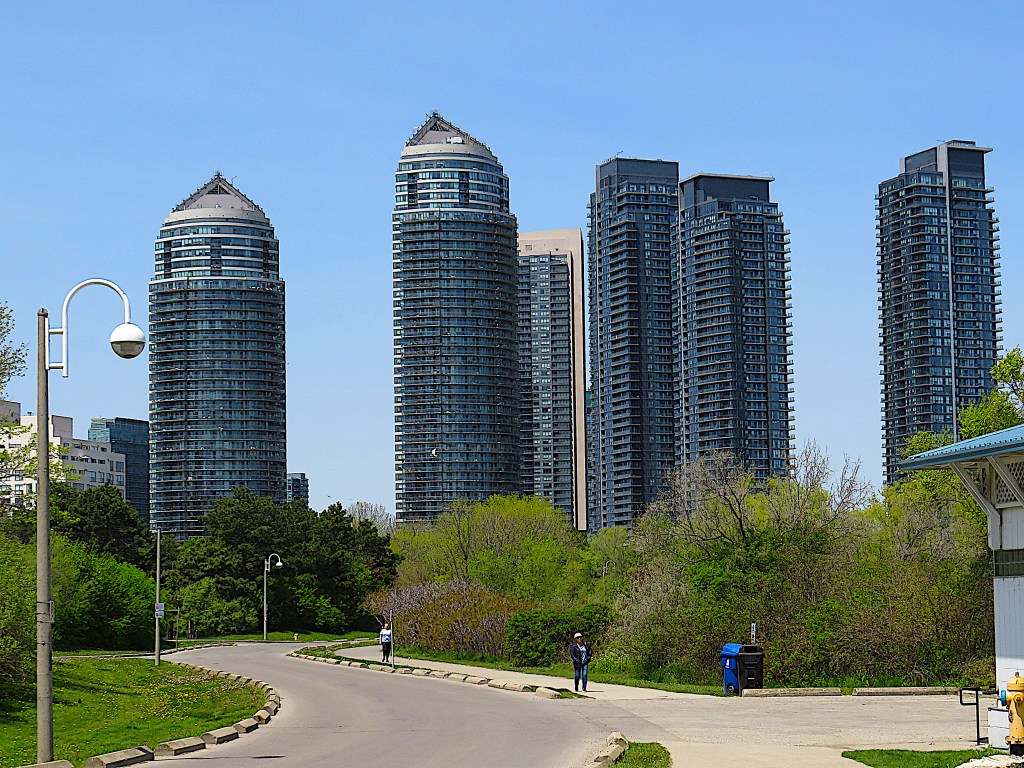
29. If you park your car in the big P at Humber Bay Park West, this is the view as you come out of the lot to meet the Waterfront Trail. All these condo towers (built 2012-18) stand on the west (city) side of Lake Shore Boulevard. From left to right: Beyond the Sea South II, 128.7 m; Beyond the Sea Star, 151.5 m; Westlake Encore, 146 m; Westlake Village I, 153.3 m; Westlake Village III, 150.3 m. Westlake Village II, 135.5 m; Mimico Creek threads its way between the Beyond the Sea and the Westlake towers.
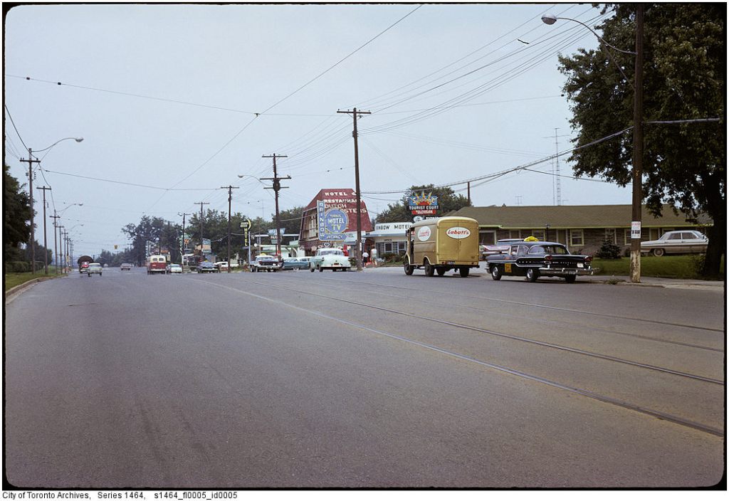
30. This is what Lake Shore Boulevard West near Mimico Creek looked like in about 1961. There was a motel strip that also featured drive-through restaurants, dance halls, and bars. Not a condo or highrise in sight! Image courtesy of the City of Toronto Archives series 1464 s1464_f10005_id0005: Etobicoke: A Modern Suburb.

31. Looking south down Lake Shore Boulevard West at Park Lawn Road today. You can make out the parapet of the Boulevard’s bridge over Mimico Creek near the bottom left corner of the image. The Waterfront Trail may be busy in good weather, but it’s a lot more relaxing than negotiating this canyon on foot.
