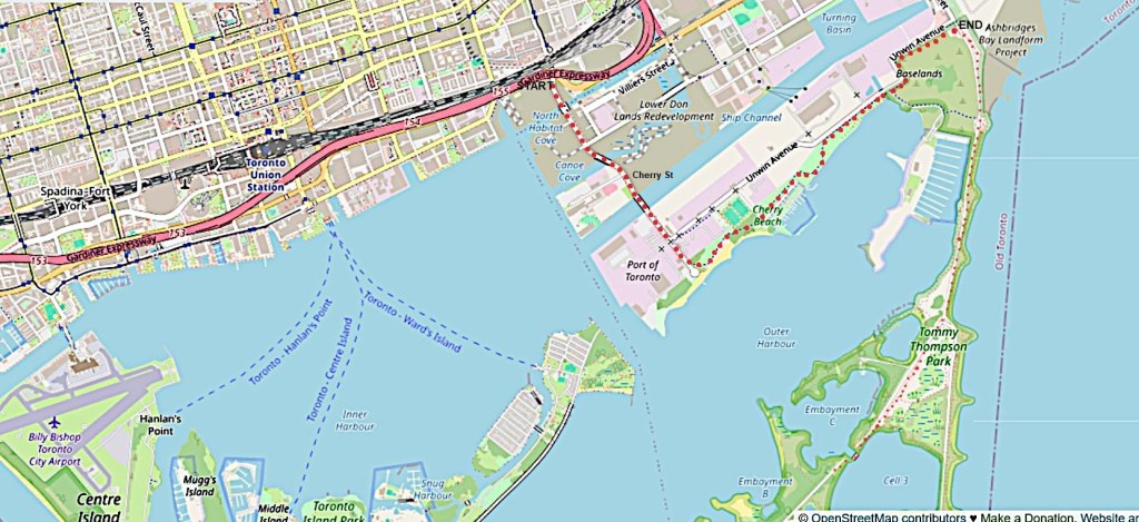
175. Today’s main hike, indicated by the larger red dots, is about 4.3 km from START beside the Gardiner Expressway near the Distillery District, then south down Cherry Street, and then east along the Martin Goodman Trail (MGT) as far as the entrance pavilion of Tommy Thompson Park near the south end of Leslie Street (END). You can get to the START of this hike by the 72 bus from Bay Street near Union Station.
I extended this hike by going south about 3.5 km into Tommy Thompson Park on the Leslie Street Spit, and then returning. This extension is marked by smaller red dots. The Spit extends about 5 km from the entrance pavilion to the Toronto Harbour Lighthouse. It’s up to you how far down the Spit you venture, but remember that you’ll have to walk double that distance as you must retrace your steps.
There is a large P near the entrance pavilion to Tommy Thompson Park at Unwin Avenue and Leslie Street. The nearest bus stop to END is about 550 m north at Leslie Street and Commissioners Street.

176. From Parliament Street at Lake Shore Boulevard the MGT runs briefly parallel to the southern edge of the elevated Gardiner Expressway. As you can see, this ain’t the most aesthetically pleasing section of the MGT. The Trail then turns right (south) down newly realigned Cherry Street.

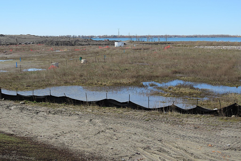
177. We have entered Toronto’s Port Lands, an area of 356 hectares that was formerly an industrial zone around a harbour and is currently at an early stage of massive reconstruction. As it is waterfront terrain close to downtown, it’s envisaged as a potentially appealing place to live, and aside from housing there’ll be parkland and roads in which pedestrians and cyclists will be prioritized.
All of this area south of Front Street was created by gradually infilling the lakeshore from the 1880s on. Before that it was a huge natural wetland, Ashbridge’s Bay Marsh. The current plan is to renaturalize as much of the area as possible. That will include protecting it from flooding by creating a second, more “natural” estuary for the Don River, which currently flows into the Lake via the Keating Channel. This will create Villiers Island, on which there is to be housing surrounded by parkland. The image above is how the future Port Lands were envisaged in 2011. Landscaping work is now under way, but whether the completed project will look anything like the above, only time will tell.

178. As we turn into Cherry Street, let’s look over our right shoulder toward downtown. At left is one of the relics of the Port Land’s past, the Victory Soya Mills Silos, built in 1944 and disused since 1991. The silos have a heritage designation, but that doesn’t mean that it’ll be easy to find a new function for them.
You’ll find that there are two connected questions continually raised by this leg of the hike. What structures redolent of this area’s industrial past are worth preserving? And if they are preserved, how might they be usefully repurposed?

179. The realigned north end of Cherry Street boasts a pair of smart new bridges over the Keating Channel. In the photo above, the nearer bridge carries two lanes of traffic, while the farther will eventually support a new streetcar line. The pedestrian and bike crossings in the foreground are fully segregated from motor traffic.
These red and white bridges (2020-22) are 57 metres long and cost $100 million. Once upon a time they would have been built locally, but not any more. Designed and engineered by Entuitive, Grimshaw and Schlaich Bergermann, fabricated by CIG in the Netherlands, and assembled by Cherubini Metal Works in Halifax, NS, they were then shipped to Toronto on barges.
At back to the left are the cement-holding silos of the Essroc Toronto Terminal, originally constructed for the Century Coal Co. in 1920. The Villiers Island Precinct Plan of 2017 refers to them as prominent landmarks, marking the Keating Channel entrance and terminating the view westward on Villiers Street. Meanwhile, Essroc is relocating its facility. Is there really a place for frankly ugly decommissioned silos in the brave new world of the Port Lands?

180. Toronto Harbour was once a busy port, but in recent years shipping has declined as the kind of industry that depends on it has moved elsewhere. I did spot one commercial vessel in the Inner Harbour as I crossed the new bridge. The Annie M. Dean is a tugboat built in 1980 and typically used for dredging projects, but here she’s being used to push a barge laden with construction materials. That’s Billy Bishop Airport at back.
181. This huge desolate area west of Cherry Street will include new housing and a recreation area called Promontory Park on the southwestern shore of the Keating Channel.
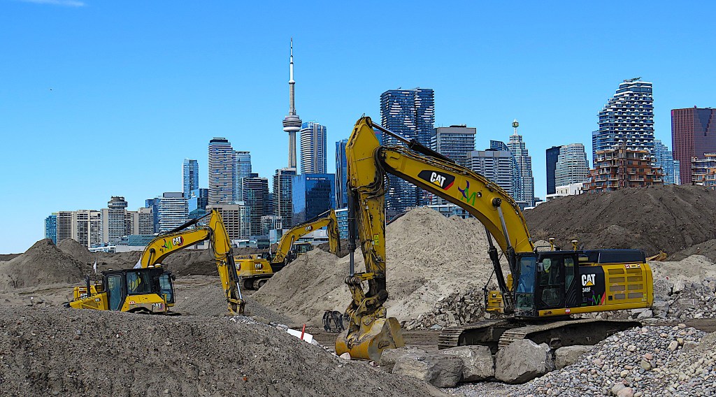
182. Earthmoving machines construct a temporary range of hills that threaten to obscure the towers of downtown.

183. Newly laid-out Cherry Street with its segregated bike and pedestrian lanes curves toward another new bridge, a yellow-and-white one over what will be the new naturalized estuary of the Don River.
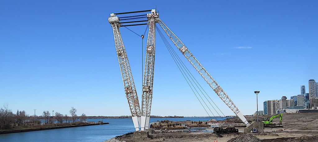
184. This huge atlas crane was placed on this site in 1961 to unload ships. A heritage structure, it will become a permanent “installation” on the north bank of what used to be the Polson Slip and is soon to be the second mouth of the Don River. One hopes that it will be periodically given a fresh coat of paint to keep rust at bay.

185. Lafarge is Canada’s largest provider of aggregates, cement, ready mix, precast concrete, asphalt and paving for road and civil construction. Their silos on Polson Street are still operational, one of the few remaining sites of traditional dockland industry in the area.

186. A new footbridge is in place over the reconfigured Don River east of Cherry Street, though it and the surrounding riverbanks weren’t yet open to the public when I passed.

187. A utopian future vision of the area covers the base of a viewing platform on Cherry Street.

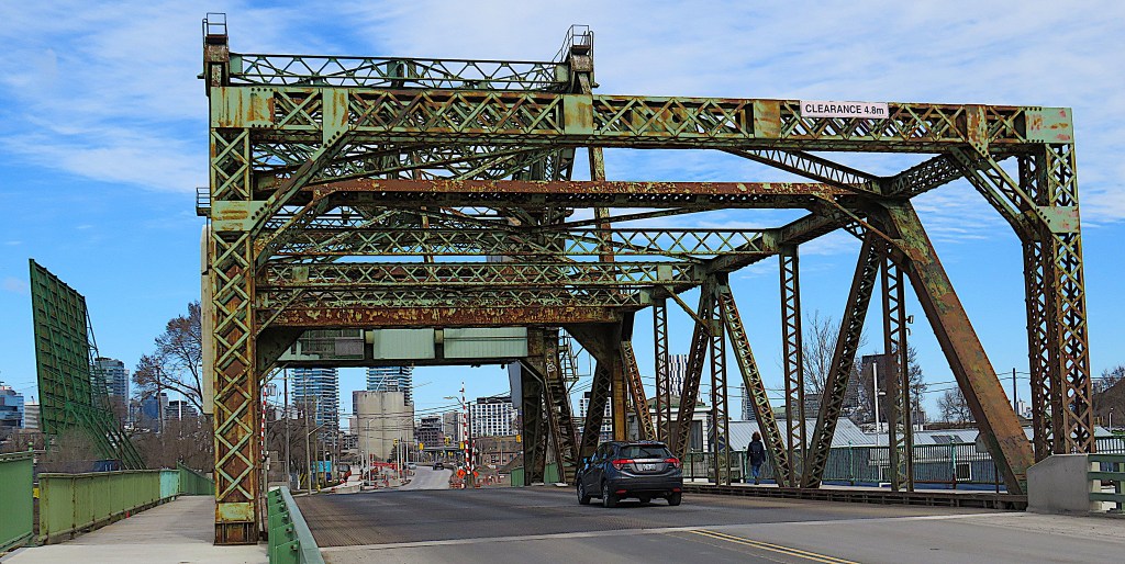
188. Opened in 1930, the Cherry Street Strauss Trunnion Bascule Bridge spans the Ship Channel. Two 750-ton concrete counterweights – the white masses on either side in the top picture – let it be raised almost vertically, allowing the passage of ships into the Channel and on to the Turning Basin at its end. This bascule bridge was based on a design by Joseph Baermann Strauss, the US chief engineer of the Golden Gate Bridge. It’s yet another a heritage structure, though at least it currently has a function. The northward view in the bottom picture shows that bridge’s metalwork needs some TLC.

189. At the Royal Canadian Yacht Club facility on Cherry Street south of the Ship Channel, youngsters aged 5 and up learn sailing skills in tiny boats called beginner prams.
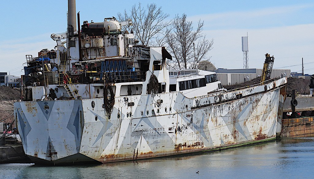
190. An abandoned vessel sits rotting on the north bank of the Ship Channel … offering a stark contrast to the utopian vision of the revitalized Port Lands!

191. On the Harbour side of the bascule bridge the River Gambler is moored. In spite of its name and its resemblance to a Mississippi sternwheeler, it’s not a casino, but a party boat, i.e., a rentable floating venue for weddings, corporate functions, themed cruises, etc.
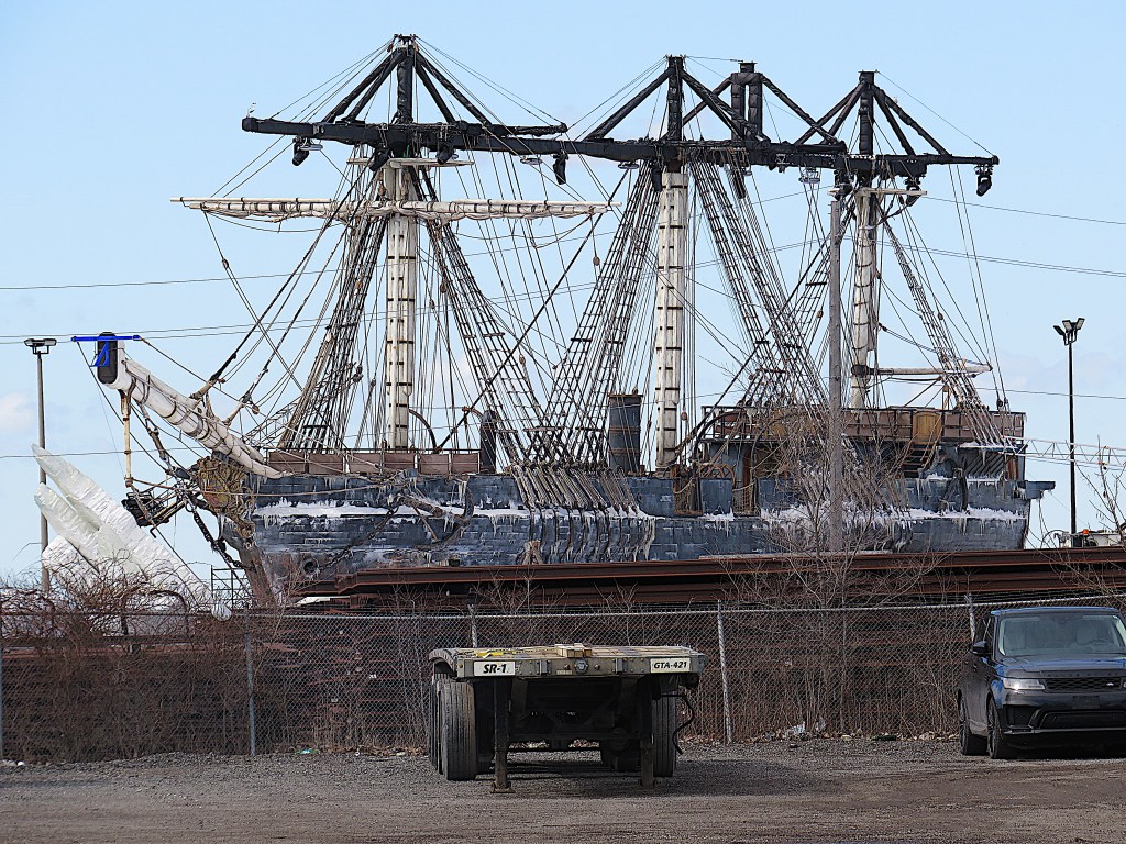
192. When I passed, this vessel loomed like a spectral Flying Dutchman over the dockland southwest of the Ship Channel. As there is a large film studio (Cinespace) there, and there are spotlights fixed to the ship’s yardarms, I guessed that this vessel was a movie set. And Google confirmed it: this was a ship built for Guillermo del Toro’s next film, a sequel to Frankenstein. The film is provisionally titled Prodigal Father, stars Oscar Isaac, Ralph Ineson, and Mia Goth, and is due to open in 2025.

193. At the end of Cherry Street is Cherry Beach. This area feels off the beaten track and sports this decaying lifeguard station. Though Cherry Beach was once a popular bathing destination, it was found that, thanks to years of industrial use nearby, there are accumulations of heavy metals in the area. Still, Waterfront Toronto describes it as “the cleanest beach in Toronto.” The land across the water at back is the end of the Leslie Street Spit.
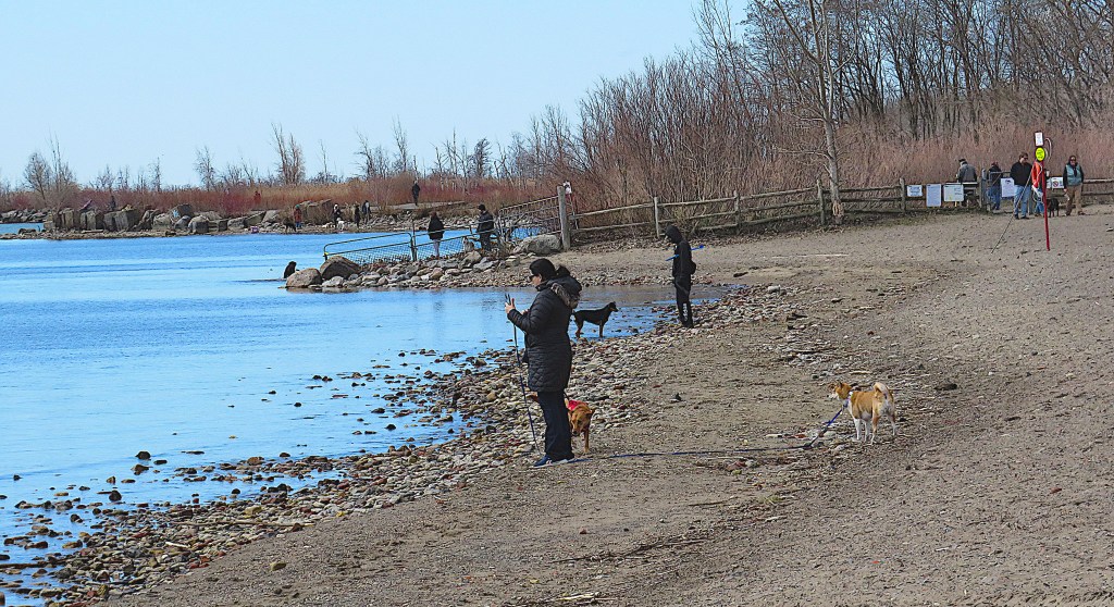
194. At this time of the year Cherry Beach is frequented chiefly by off-leash dog walkers.

195. Now the MGT turns east to follow the lakeshore. At the Cherry Beach Sports Fields between Unwin Avenue and the MGT, a game of Junior A Lacrosse is taking place between the Northmen from Orangeville and the Mountaineers from Mimico …

196. … while aircraft on their descent to Billy Bishop Airport drone not far overhead.
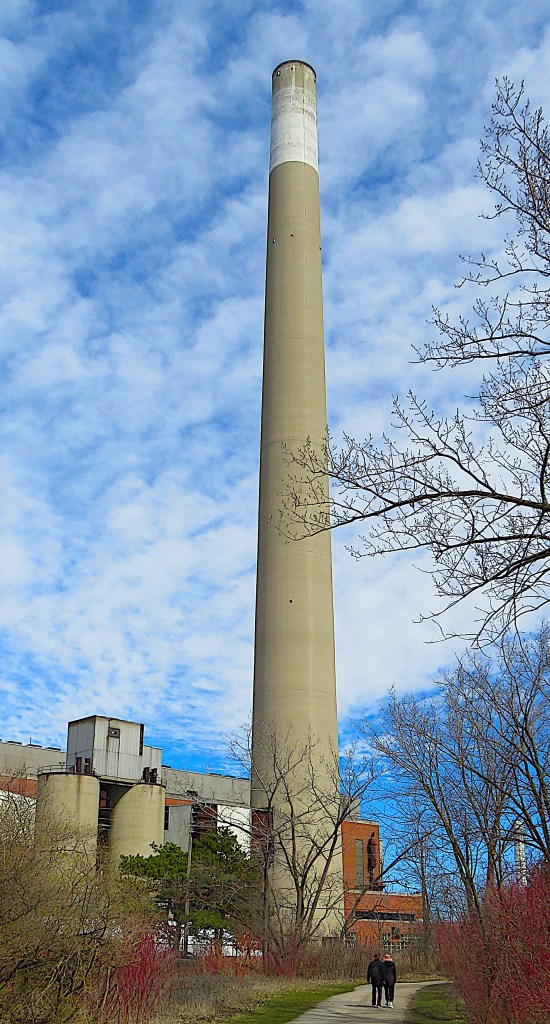
197. Soon the chimney of the decommissioned R.L. Hearn Generating Station looms over the MGT. This plant was built to generate electricity from coal, burning 400 tons of it per hour at its peak. The plant was converted to burn natural gas in 1971, when this huge chimmey, 215 metres tall, was constructed to replace several shorter ones. Its immense height was supposed to solve the problem of low hanging clouds of pollution in the area, but the whole plant was gradually phased out from 1983 on. Some of the events at Toronto’s Luminato Arts Festival in 2016 were held at the Hearn. But later plans to turn the enormous generating station into a movie studio never came to fruition, and it now sits empty.
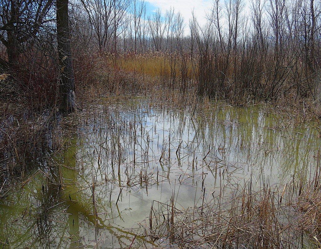
198. There’s a trace of the original Ashbridge’s Bay Marsh as the MGT makes a dogleg as it approaches the entrance to Tommy Thompson Park. (This area, the Baselands and Wet Woods, is currently incorrectly marked on Google Maps as “Villiers Island,” for which see #177 above.)


199. We’re now at the entrance to Tommy Thompson Park, occupying most of the manmade peninsula known as the Leslie Street Spit. Tommy Thompson (1913-85) was Toronto’s first Commissioner of Parks, and was responsible for the pleasant landscaping of the Toronto Islands.
The park has restricted hours because dumping of infill (chiefly construction debris) that helped create the Spit in the first place, still takes place during weekdays. Note that pets are not permitted in the park at any time, to preserve the peace of wildlife.
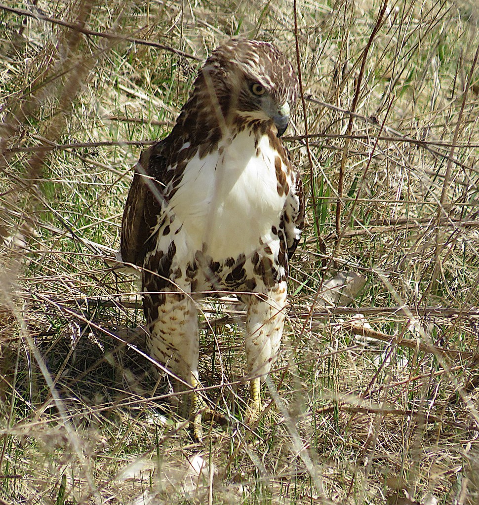
200. The park is known for its birdlife, and during my visit I was lucky to see several red-tailed hawks – unless it was a single one that followed me about. My first sighting was on the ground near the entrance, where the raptor was tearing at the corpse of its most recent victim.
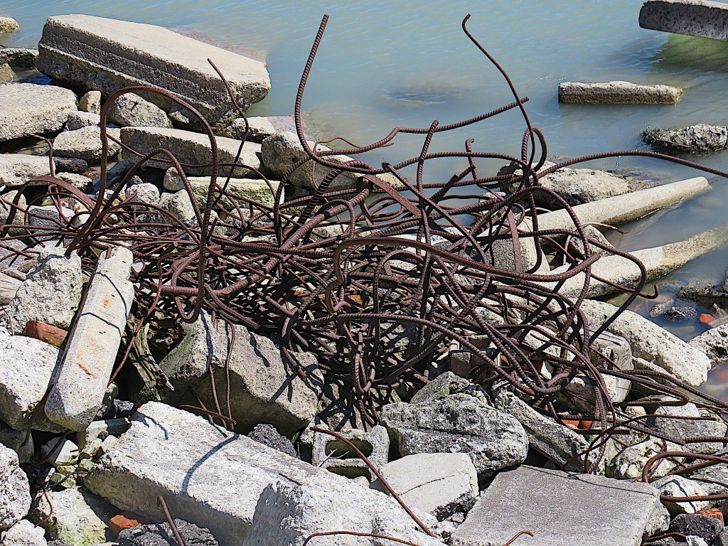
201. The “beaches” on the east side of Tommy Thompson Park are covered with lumps of old concrete and tangles of rusting rebar that send the strong message, “keep away.”
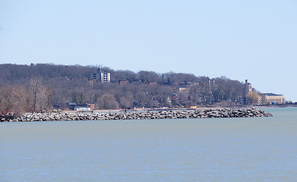
202. The view north from the eastern shore of the Spit. Those are the Toronto Beaches behind the breakwater. The Harris Water Treatment Plant on the extreme right is where my Waterfront Trail hike will terminate at the end of the next episode.

203. The floating pedestrian bridge at the heart of Tommy Thompson Park. It’s 3.1 km from the entrance pavilion to here, so be prepared for a hike of a least 6.2 km if you come this far.
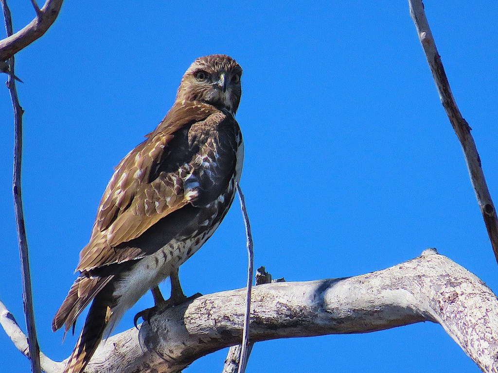
204. This stern-looking red tail was eyeing me from a tree by the floating bridge. Was it the same raptor I saw on the ground in #200 above?

205. The paved multi-use trail through the park is popular with cyclists and joggers …

206. … though it’s pleasant enough just to walk along when the intense colour of red-osier dogwood indicates that spring is well on its way …
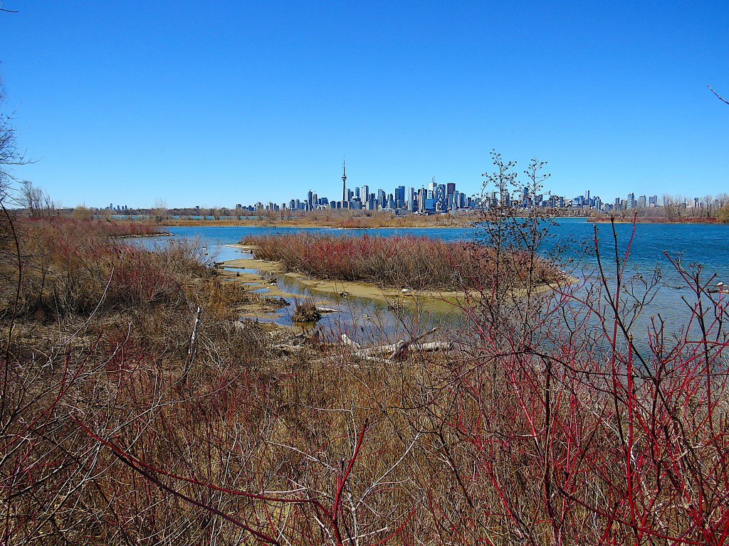
207. … and there are spectacular views of the downtown skyline, especially at this time of year before the leaves are out.

208. On the return hike, I took this rougher and much less busy unpaved parallel nature trail.
