
209. This hike goes from START at the entrance pavilion of Tommy Thompson Park (lower left on map above), north up Leslie Street, east along Lake Shore Boulevard East to Woodbine Beach Park and then along the boardwalk linking the four Eastern Beaches: Woodbine, Kew, Balmy, and Silver Birch. We end the main hike by going north up Nursewood Road to the streetcar loop on Queen Street East (END).
The hike, marked by the red dots on the map above, is 5.5 km long. You can extend it en route by exploring Ashbridges Bay Park and its peninsula, as I did. My extended route is indicated by the solid red line and adds about 1.7 km to the main hike.
If you arrive at the START of the Hike by car, park at the large P at the entrance to Tommy Thompson Park. At the END of the hike take a Queen 501 streetcar west towards downtown. Stops on the line are marked by small black dots on the map above. Though it’s only about 4.5 km from END to Queen East and Leslie, plus another 1 km back south along Leslie to your car, your return journey may take at least an hour (see #236 below).
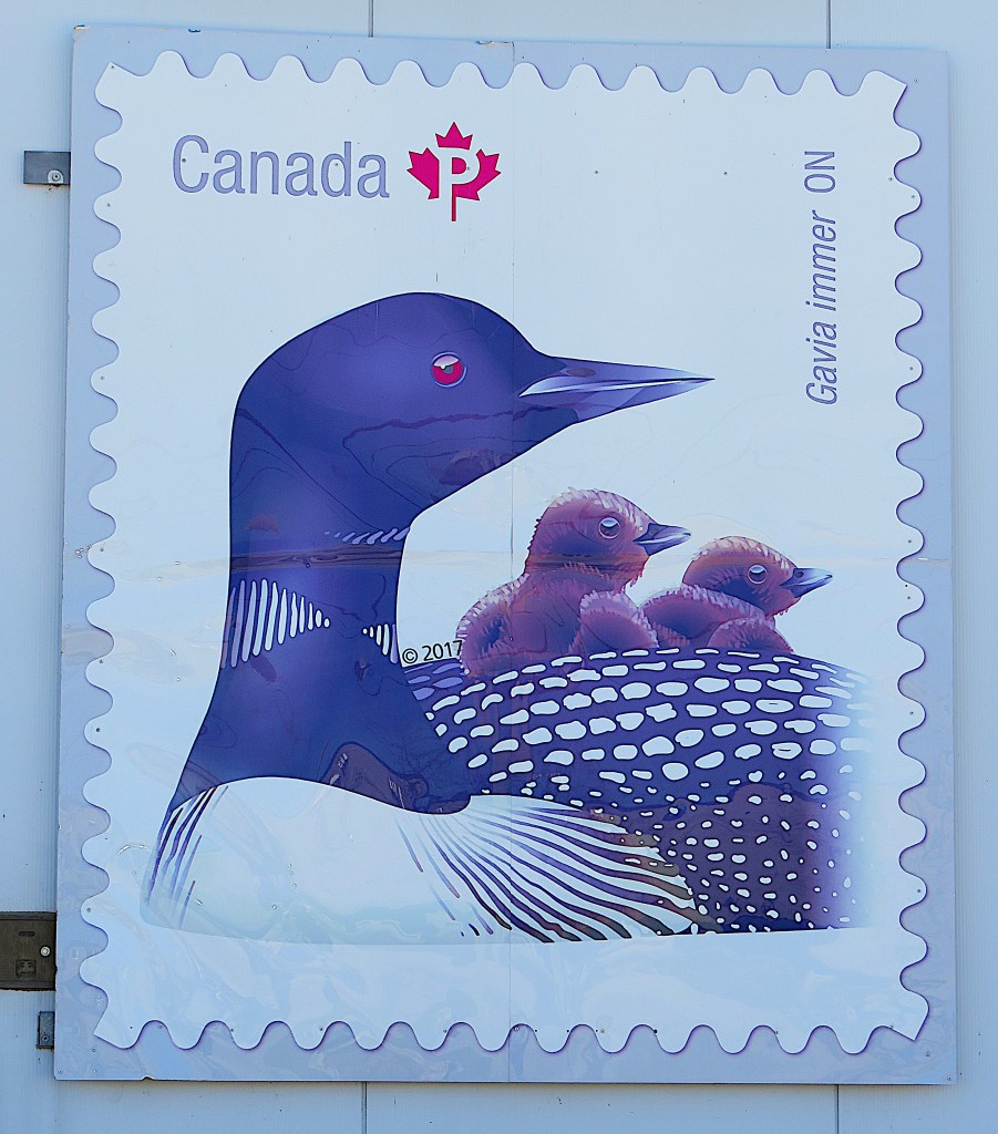
210. Leslie Street offers little of interest. If you’re walking, it’s better to take the sidewalk on the left side of the street going north, as most cyclists use the one on the right. En route you might admire the large reproductions of postage stamps on the side of the Canada Post Delivery Centre at 675 Commissioners Street. This one is of that Canadian icon, the common loon, with two chicks. Loon chicks often ride on their parents’ backs in their first two weeks of life.

211. The junction of Leslie Street with Lake Shore Boulevard East is marked by this, not to my mind the finest example of Toronto public sculpture. The artist was apparently inspired by the scrap metal on the Leslie Street Spit (see #201 above). Called Typha (the Latin name for cattails/bulrushes), this installation is 10 metres tall and made partly from reclaimed railroad rails. The effect is a menacing rusty tangle, to put it kindly.


212. The long, low, red-panelled wall on the east side of Leslie Street up to its junction with Lake Shore Boulevard East encloses the Leslie Barns. It’s a huge TTC streetcar maintenance facility (opened 2016) that can house half of the TTC’s 204 Flexity Outlook electric streetcars. These streetcars, manufactured by Bombardier, are 29 metres long and have a capacity of 130 people, 70 of which can be seated. They have a maximum speed of 70 km/h, which, I think it’s fair to say, they almost never come close to attaining (see #236 below).
At one point along the Boulevard you are encouraged to peek through a window into the Barns (top). What you see is a maze of overhead electrical wires and lots of out-of-commission streetcars (bottom).
If you hear loud explosions in this area, don’t be alarmed. Sound cannons are being fired to deter seagulls from nesting on the roof of the Leslie Barns service facility.
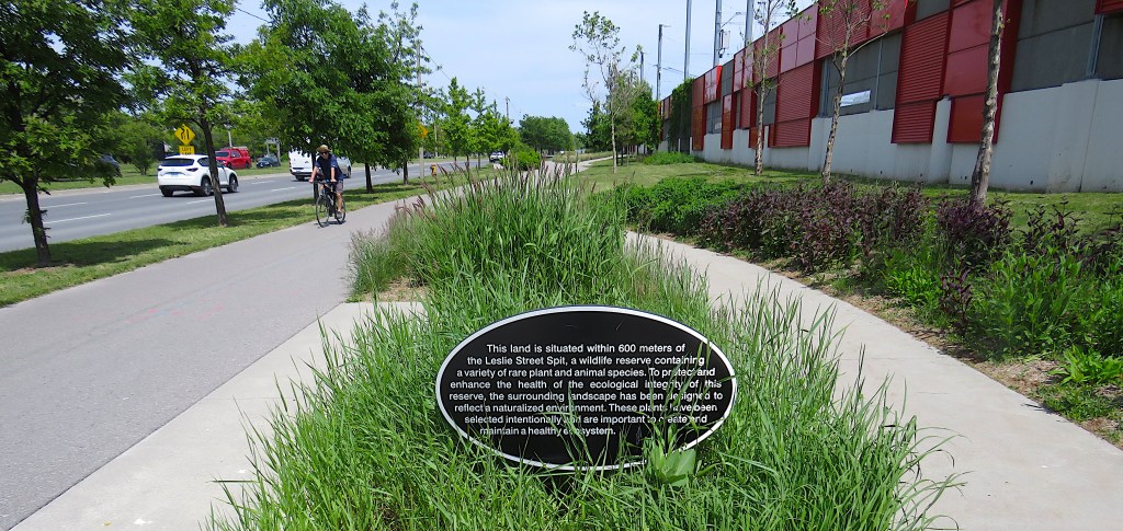
213. The view east along the MGT as it runs on the south side of Lake Shore Boulevard East. Some effort has been put into the landscaping here, so that what might otherwise be a bleak, heavily trafficked street is reasonably pleasant to negotiate …

214. … and if you’re passing in midsummer, see if you can spot the prickly seedcases on the Ohio Buckeye trees (Aesculus glabra, a.k.a. North American horse chestnut) lining the route.


215. On the right side of the Boulevard east of the Leslie Barns is a fence (top) announcing a major infrastructure project taking place in the vicinity. This is the DRCW (Don River and Central Waterfront) project, costing $3 billion and taking 20 years (2018-38) to fully implement. Its aim is to ensure that in future, no raw sewage enters the lower Don River and ends up in Toronto’s Inner Harbour and Lake Ontario.
The key to its success is what’s behind the fence: the Ashbridges Bay Water Treatment Plant (opened 1910) (middle) with its 185 metre chimney (unused since 1987). This plant treats the sewage of 1.4 million Toronto residents and is the focus of a number of major upgrades.
Much of Toronto’s current sewage system is antiquated. When there is heavy rain or rapid snowmelt, stormwater runoff mixed with sewage overwhelms the current water treatment system and pollutes the lower Don River and its outflow. The upgrades will ensure that all such water will be decontaminated before flowing into the Lake. A new 22 km long tunnel system will collect most of the water flowing from creeks and sewers on the east side of Toronto. A new Integrated Pumping Facility is currently under construction on the south side of Lake Shore Boulevard East (immediately behind that fence) to replace old pumps on the north side. An ultraviolet decontamination process will replace the current chemical (chlorine-based) one. A shaft descending 85 m from the current Water Treatment Plant will connect with a 3.5 km tunnel constructed under the lakebed, from which risers will allow treated water to enter the Lake (bottom).
The result should make the water off Toronto’s Eastern Beaches safer for swimming and boating. It should also make the former industrial Port Lands cleaner for the housing projects that that are planned there (see #177 above). One hopes that the completion of the two huge developments will be synchronized.
216. Ashbridges Bay viewed from the MGT. The Ashbridge name commemorates a family of Quakers from Pennsylvania who arrived in Upper Canada as Empire Loyalists in 1793. The family, headed by the widow Sarah Ashbridge (d.1801), was granted land on Lake Ontario east of the Don River and occupied it for more than 200 years, the longest such tenure in the history of Toronto. What remains of the Ashbridge estate today is an 1854 house at 1444 Queen Street East, now owned by the Ontario Heritage Trust.

217. It’s hard to conceive how much this lakefront area has changed over the years. This detail from an 1865 map shows Ashbridges Bay as a lagoon with the land to the west of it and south of the mouth of the Don River “under water”, i.e., a wetland. This marshy area, including much of the lagoon itself, was filled in from 1911 on to make the Port Lands when Toronto had aspirations to be a major port.
Tides and storms constantly reconfigured the shallow Toronto lakeshore in the 19th century, as can be inferred from the diagonally-oriented legend above between the Harbour and Lake Ontario: “channel 8 feet deep 300 feet wide formed in the last 5 years.” This refers to a gale in 1858 that created the so-called Eastern Gap, cutting what are now the Toronto Islands off from the mainland.
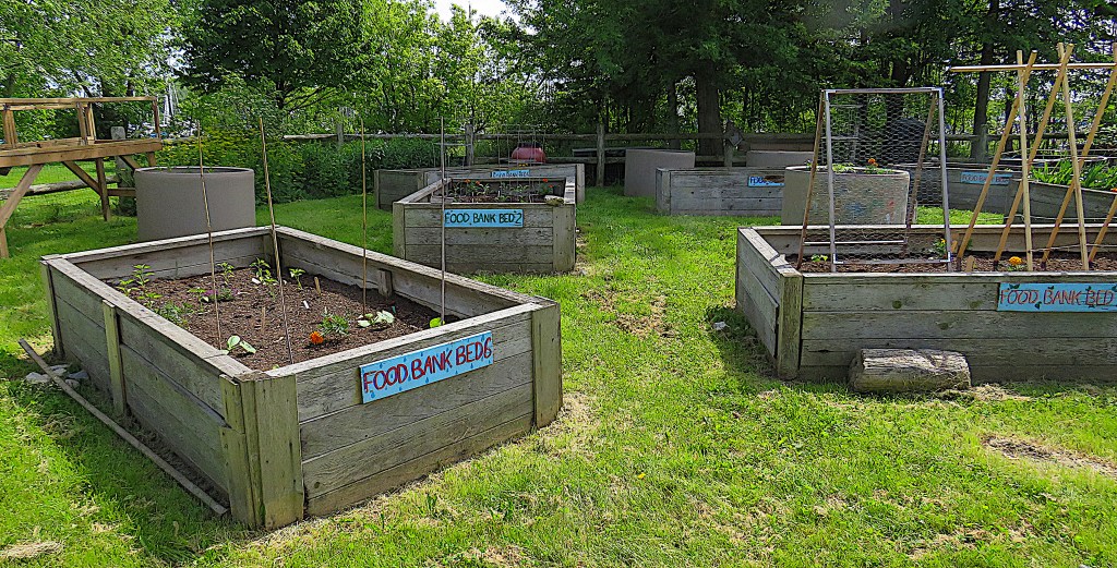
218. Toronto is currently one of the ten least affordable cities in the world, so food deprivation is an inevitable part of the social landscape. As we enter Woodbine Beach Park, there are beds for growing vegetables to be donated to food banks.

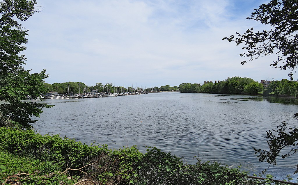
219. Much of the eastern shore of Ashbridges Bay is occupied by two marinas: the Toronto Hydroplane and Sailing Club, and the Ashbridges Bay Yacht Club.
220. Yacht Clubs recommend that sailboats returning to the marinas lower their sails and fire up their engines, as there can be a lot of offshore powerboat and jetski traffic that needs to be smartly negotiated. However, the Coatsworth Cut that leads from the Lake into Ashbridges Bay is quite peaceful at the moment.
221. The downtown skyline from Ashbridges Bay Park.

222. A rocky breakwater forms the southern tip of Ashbridges Bay Park. This peninsula is an artificial creation like the Leslie Street Spit and indeed like almost all of the current Toronto lakeshore that we’ve been following on this Waterfront Trail. Back in the day, the closest thoroughfare parallel to the lakeshore was Front Street, hence its name. These days there are at least 800 m between Front Street and the lakeshore, all the land between having been reclaimed from Lake Ontario.

223. A young angler wades along the edge of the shore at Ashbridges Bay Park.


224. Woodbine (top) is the busiest beach today. The facilities include beach volleyball and pickleball courts, change room, washroom, picnic site, bottle filling station, etc. If you want to stand out from the crowd, bring your own boat (bottom).
225. Beach volleyball offers an opportunity to get some good exercise while showing off your muscular chest, sleek posterior, and tattoos. There are dozens of courts in the area, but only a few are for public use.

226. Some colourful contemporary townhouse condos on Lake Shore East just before it turns north and becomes Woodbine Avenue.

227. The Leuty Lifeguard Station has been watching over Kew Beach since 1920 and has been credited with saving over 6,000 lives. It was first known as the Scarboro’ Beach Station and has been moved four times in its history, though evidently never very far. A group of local residents, for whom the simple clapboard structure is iconic, saved it from demolition in the 1990s and raised enough money to repair it. After floods in 2017 it was placed on a rocky platform so as better to weather storms off the Lake.


228. Though the Kew Beach boardwalk is crowded (top), the beach itself is far from it (middle). There’s too much of it, and too little to encourage people to plod to the distant shore.
More than a century ago, things looked very different. From 1907, the area between Leuty and Maclean Avenues right down to the water’s edge was an amusement park known as Scarboro’ Beach. In 1909 the first demonstration flights in Canada were held here, by US barnstormer Charles Foster Willard in his monoplane. In 1911 the facility was bought by the Toronto Railway Company (forerunner of today’s TTC) which was developing a streetcar line in the vicinity. By 1924, when the aerial photo (bottom) was taken, the funfair boasted an Illuminated Tower, a “Scenic Railway” (i.e., a roller-coaster), a Shoot-the-Chute flume ride, a Tunnel of Love, a House of Mirth, a Globe of Death, a midway with a snake show, etc., etc.
But when the newly formed TTC took over, it was not interested in running an amusement park and sold it to the Provident Investment Company. They shut it down on 12 September 1925, demolished it, and built duplexes on the site.

229. It’s a pity that there still isn’t a Coney Island-style amusement park here. Frankly, aside from eating, drinking, and people-watching, there isn’t a great deal to keep the vast majority of boardwalkers and their kids amused.
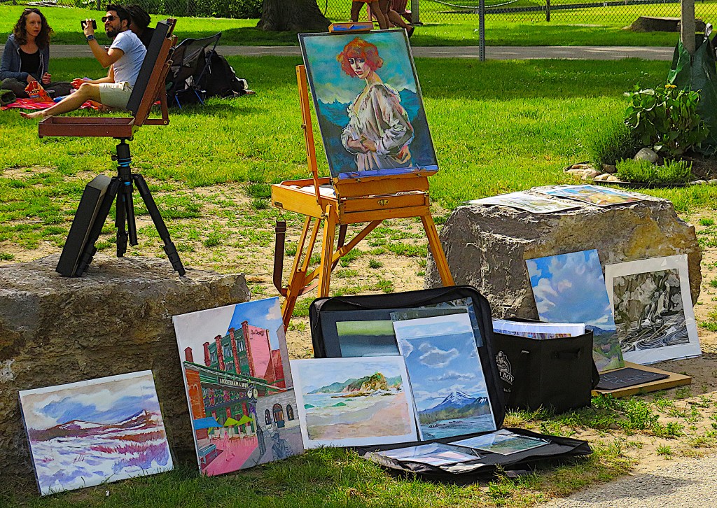
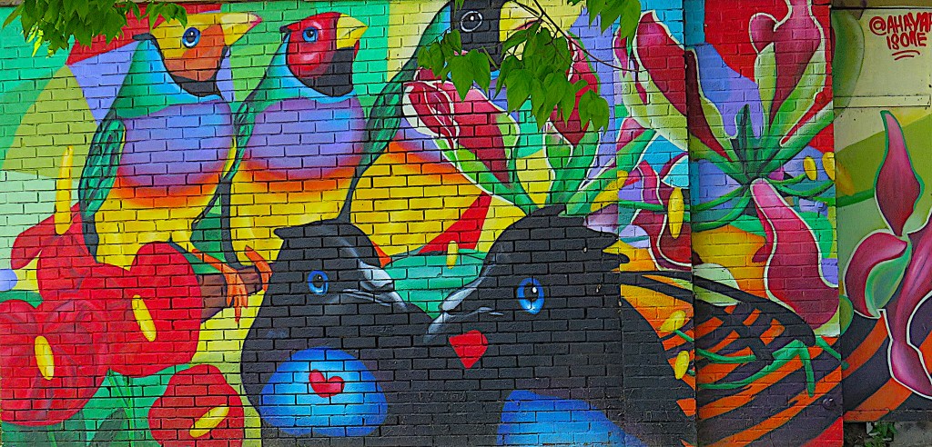
230. Art in the Beaches: “original” oils on display, and a decorated garage.
231. The Beaches Boardwalk is 3 km long. It begins in Ashbridges Bay Park and ends at Silver Birch Avenue. Beyond that, you have to trudge along a sandy trail to get to the Water Treatment Plant.
The first section of the boardwalk was built in 1907 along Woodbine Beach, but that was largely destroyed by storms in 1929. There was a new boardwalk along its current route from the early 1930s, part of which was destroyed by fire in 1942. It was reconstructed in the early 1950s, only to be severely damaged in a storm in 1973. Though there’s now the parallel paved MGT for bikes, roller-bladers, etc., the boardwalk gets plenty of hard usage, and requires constant repairs thanks to off-piste garbage trucks, inclement weather, and a periodically hostile Lake.
So, how many boards are there in the Beaches boardwalk? If the boards are 2” x 8” and the boardwalk is 3 km long, it’s made up of approximately 15,000 boards. (I stand to be corrected.)

232. The boardwalk (top) is busy on a summer Sunday. Compare its quiet counterpart (#82 above) in the Western Beaches. Why is there such a difference? The answer has to do with accessibility. There’s no Gardiner Expressway and Lakeview West GO train line separating the residential areas of the city from these Eastern Beaches. In fact some private houses in the Beaches (bottom) face right onto the boardwalk. And some of the local residents are … ambivalent about the presence of the hordes trooping past their front doors.
So, The Beach or The Beaches? There are good arguments for both. The Wikipedia article significantly entitled “The Beaches, Toronto” summarizes the often quite heated disputes about the correct name. Local residents are supposed to favour The Beach. Outsiders such as myself prefer The Beaches, as four different names are attributed to parts of what is technically one continuous beach. And, as there are beaches like Sunnyside to the west of downtown (see #78 above), these are specifically the Eastern Beaches.
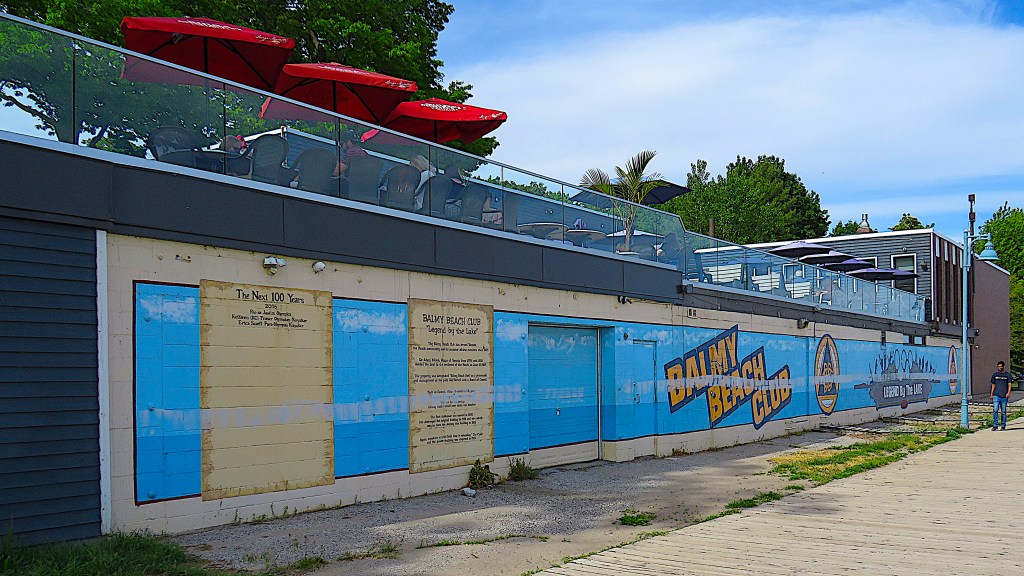

233. The Balmy Beach Club (top) at the foot of Beech [sic] Avenue calls itself the “Legend by the Lake,” though its frontage is far from the most attractive sight on the boardwalk. It’s a private members club that has occupied this site since 1905. Its original buildings were a lot more attractive than this one, but burned down twice. This clubhouse dates from 1965. Now it’s chiefly a sports and fitness club with a restaurant whose patio overlooks the hoi polloi on the boardwalk below. Sports include hockey, rugby, various kinds of paddling (bottom), beach volleyball, lawn bowling, and squash. There’s a $1,000 initation fee for first-time members and it’s $683 p.a. thereafter.
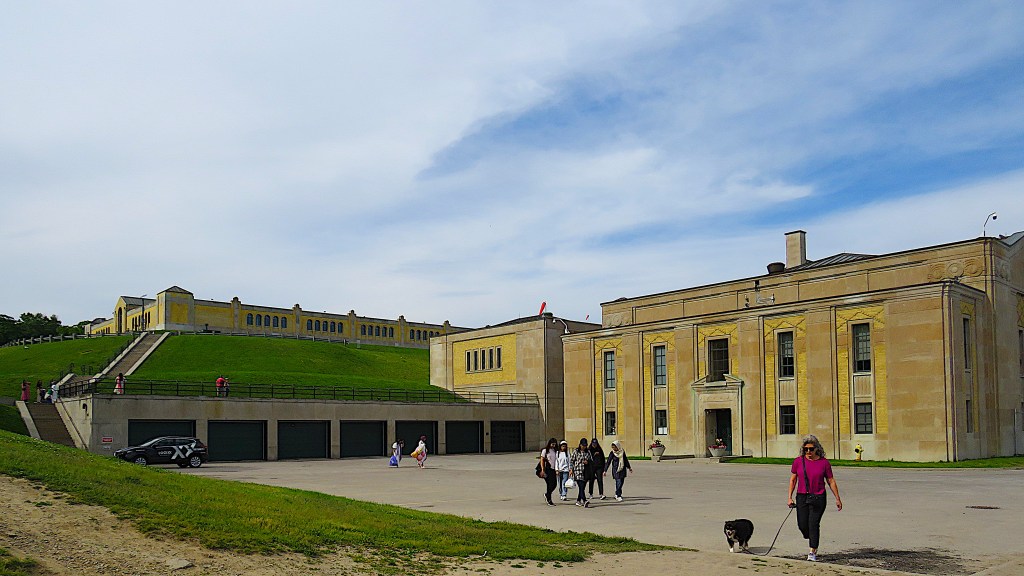
234. The R.C. Harris Water Treatment Plant, a.k.a. The Palace of Purification, was built in Art Deco style during the later 1930s and opened in 1941. It’s named for Rowland Caldwell Harris (1875-1945), a long-serving Toronto Public Works Commissioner. The plant provides about 30% of Toronto’s drinking water, or up to 950 million litres daily, which it extracts from Lake Ontario and chlorinates.
The Plant is popular as a movie setting, often doubling for a maximum security prison or an insane asylum. Its interior is closed to the public for security reasons these days, but you can clamber over the grounds and enjoy the views from its terraces.
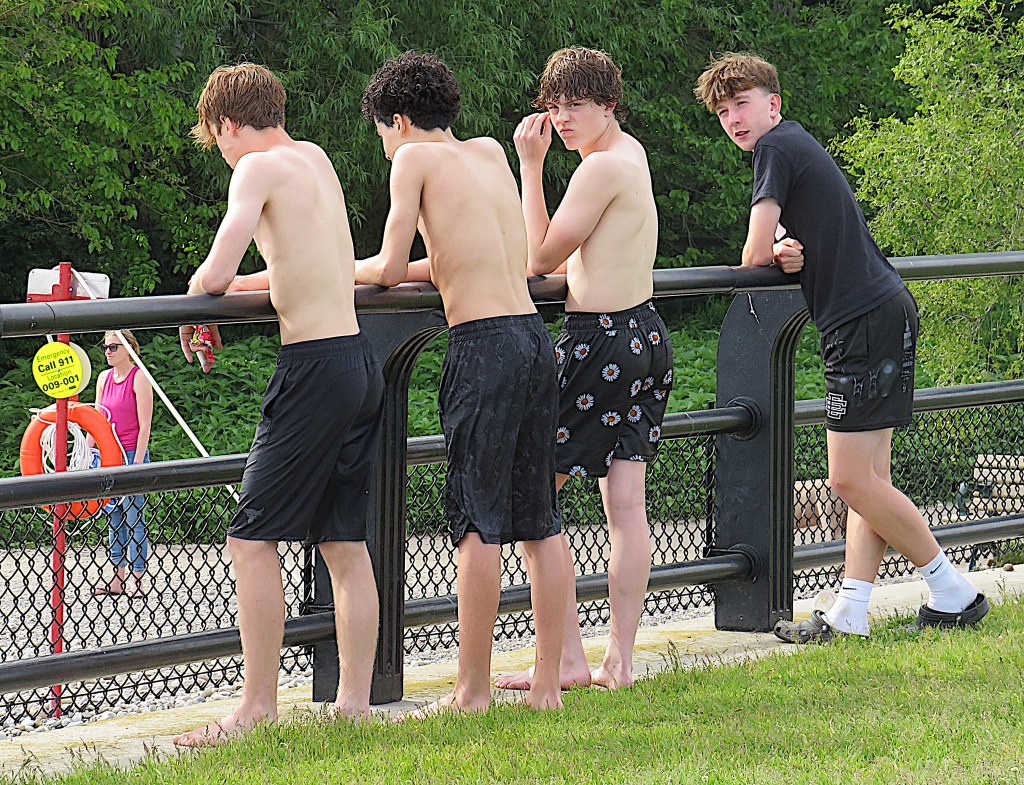

235. From one of these terraces, there’s a good view west over Silver Birch Beach. A group of young lads are doing what their forefathers have done for millennia: ogling girls below.


236. The Queen streetcar rests at its terminal loop (top), before its long grind westward along Queen East (bottom) towards downtown. The Queen streetcar can be very slow, as it must share the congested roadway with cars, buses, trucks, bikes, haphazardly parked courier vans, etc. I’d guess that a cyclist or even a distance runner of average fitness would win a 10 km race with a Queen streetcar from the loop on Queen Street East to Yonge Street downtown. Prove me wrong, TTC!
So, once on board, try to relax: it’ll take much longer than you ever imagined to get wherever it is you’re going.
And this concludes our hike along the Toronto Waterfront Trail.
