From Old Dundas Road to Dundas Valley Trail Centre
Date: 20 August 2021
Start Point: Old Dundas Road, Ancaster
End Point: Dundas Valley Trail Centre, Dundas
Distance Covered: 4.1 km*
Total Distance Covered: 47.0 km
*plus 400 metre side trip to Sherman Falls; plus 1.0 km side trip to Griffin House; plus 4.5 km optional return loop via Groundhog Hill and Artaban Road
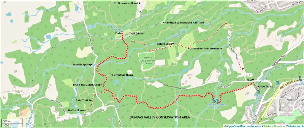
195. This hike, marked with the bigger red dots on the map above, takes us 4.1 km from our previous end point at Old Dundas Road, along the Bruce Trail (shared first with the Heritage Trail, then with the Main Loop) to the Trail Centre of the Dundas Valley Conservation Area (DVCA). Smaller red dots indicate two recommended side trips, both involving a short there-and-back: the first to another spectacular waterfall, Sherman Falls, at the start of the hike; and the second mid-hike to Griffin House, a site of historical interest. There’s an optional return loop too, also marked with smaller red dots.
The DVCA is an area of great natural beauty at all times of the year: this hike will sure to be one of the highlights of the HOLO loop. If you do the main hike, both sidetrips, and the return loop, you’ll walk 10.0 km.
If you have two cars, park one at the official DVCA parking lot on Artaban Road, and the other in the DVCA main parking lot, accessed from the entrance on Governors Road. If you have only one car, park it on Artaban Road and relax: the DVCA is a maze of more than 40 km of beautiful hiking trails, and you are spoiled for choice when it comes to the return to Artaban Road. Unless you are a card-carrying member of the Hamilton Conservation Authority, you will almost certainly have to pay $11 to park at DVCA lots, as there is a strict no-parking-at-the-roadside policy in the DVCA.
As indicated in the previous episode, travel by bus from downtown Hamilton to the start point will involve walking a fair extra distance from Wilson Street East to Old Dundas Road. At the end, you’ll have another extra walk of about 1.7 km to Governors Road at Pirie Drive, where you can pick up the #5E Delaware bus to downtown Hamilton.
Side Trip 1: Sherman Falls

196. Sherman Falls is a 17 metre curtain waterfall on Ancaster Creek, a stream that has a reasonably good flow at most times of the year. It’s about 200 metres from the P on Artaban Road to Lion’s Club Road, then another 200 metres there and back on one of the two trails to the Falls. Until recently there was a wooden bridge over the creek at the foot of the Falls, enabling you to return a different way to Lion’s Club Road. But this bridge has now been removed as unsafe, and for the moment there is no good way to cross Ancaster Creek as it runs through its ravine. If you take the western access trail, you can continue on the Bruce Trail when you return. Ignore the Bruce Trail arrow at the junction of Lion’s Club and Artaban Roads: this no longer indicates the main trail.
Sherman Falls is named for the family of Clifton W. Sherman (1872-1955), who owned the surrounding property for many years. He was the American-born founder of the Dominion Steel Castings Co. Ltd. in 1912, which the next year became Dominion Foundries and Steel Co. Its abbreviated nickname “Dofasco” became the official name of the company in 1980. After more takeovers, it is now part of Luxembourg-based ArcelorMittal (2006), one of the world’s largest steel companies. As ArcelorMittal Dofasco it is Hamilton’s biggest private sector employer and Canada’s largest steel producer.
An essential thing to remember about Sherman Falls is that it is on private land, hence the ugly concrete viewing platform overhead and the many No Trespassing signs. (The current owners are not members of the Sherman family.) At any time the landowner can choose to block public access to Sherman Falls and the section of Bruce Trail that leads from here to Canterbury Falls. So please take particular care to respect the signs and stay on the trail.
Hike #10 Begins

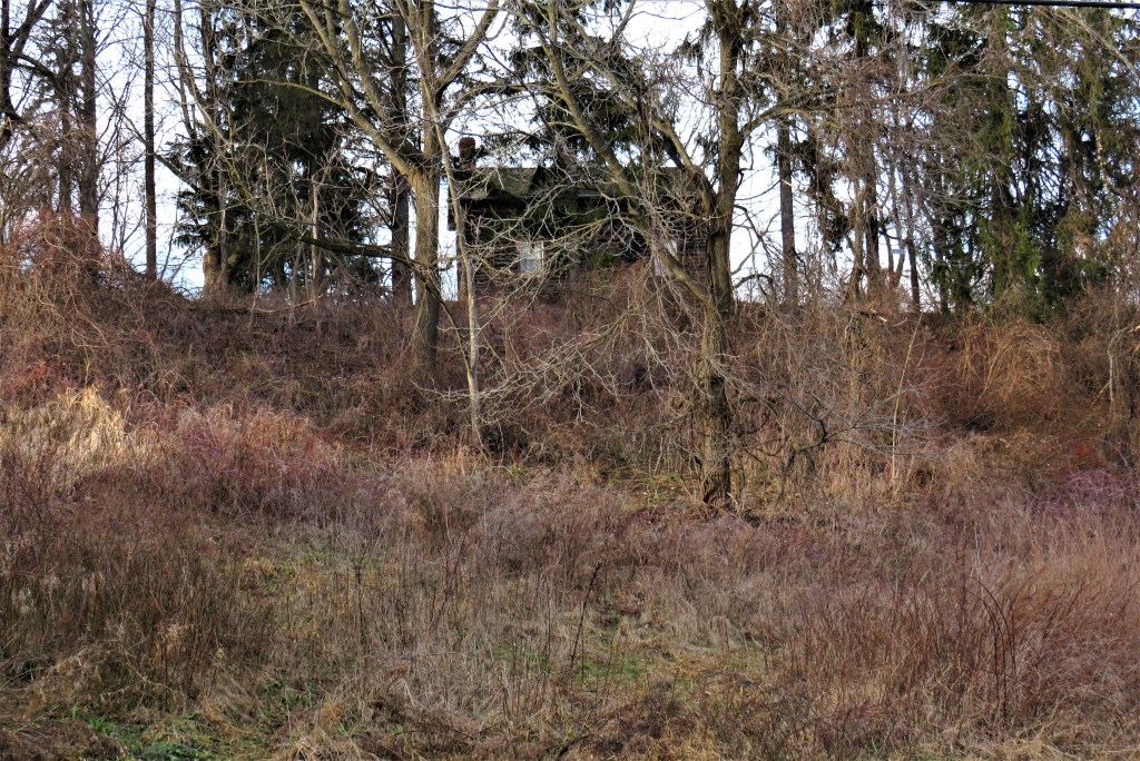
197. You’ll continue on a section of the main Bruce Trail that was closed for several years, necessitating a long detour via Artaban Road. But thanks to the landowner, it was reopened in October 2020. It climbs out of the Ancaster Creek ravine and past the landowner’s mansion, visible on the left. It then descends part way into another ravine, where there’s a smaller, two-phase waterfall that’s cute rather than awesome. It’s Canterbury Falls, a 9.5 metre terraced ribbon waterfall that may be difficult to see fully during the summer time because of the surrounding vegetation and because the Trail crosses the lip, rather than visits the foot, of the Falls. The stream is Canterbury Creek, a minor tributary of Sulphur Creek, and flows are reduced in warmer seasons. To get to the bridge above, you cross Little Canterbury Falls, which in summer may very well have dried up completely.
“ … the only prime
And real love-rhyme
That I know by heart
And that leaves no smart,
Is the purl of a little valley fall
About three spans wide and two spans tall
Over a table of solid rock
And into a scoop of the self-same block;
The purl of a runlet that never ceases
In stir of kingdoms, in wars, in peaces;
With a hollow, boiling voice it speaks
And has spoken since hills were turfless peaks.”
— Thomas Hardy, from “Under the Waterfall” (1914)
There’s a good argument for visiting this section of the HOLO loop in winter if the trail is clear of snow and ice. There will be fewer visitors, the waterfalls are likely to be much more active, and the dramatic landscape will not be shrouded in leaves. It’ll almost certainly be muddy, though.
“Canterbury” seems to derive from the fact that some of the local area is owned by the Anglican Church of Canada: Canterbury Cathedral is the mother church of the global Anglican communion. This church operates Canterbury Hills, a children’s summer camp on Lion’s Club Road.

198. The trail here runs above a talus slope whose rocks are covered with brilliant green moss.
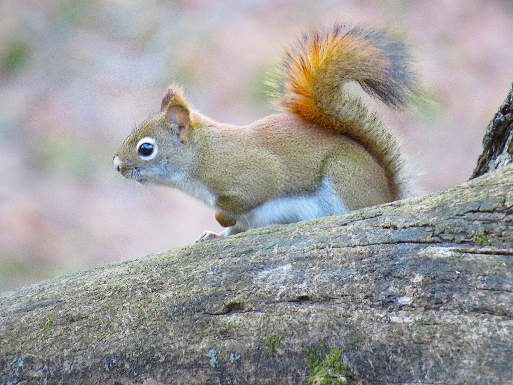
199. There are probably more squirrels than people in the Dundas Valley, but most are of the grey or black variety. Here, darting among the rocks, is the smaller, shyer American red squirrel (Tamiasciurus hudsonicus). Only half the size of a grey squirrel, it has a white eye ring, reddish fur on its tail, and (in summer) a blackish stripe along its side. The favourite food of red squirrels is spruce seeds, and they typically hoard spruce cones for winter consumption. But they can be quite omnivorous, with a diet including insects, baby birds, mice, birds’ eggs, berries, mushrooms, and fruit. Red squirrels are asocial (unlike their grey cousins) and highly territorial. But they are currently following the example of the greys by moving into urban areas where there is a surer supply of food in winter.

200. Giant rectangular slabs of dolomite, the hard limestone that caps the Escarpment, have fallen here by the wayside, having been undermined by the erosion of the softer rocks beneath.

201. The charm of the Dundas Valley encapsulated: geology and botany in an intimate embrace.
Side Trip 2: Griffin House
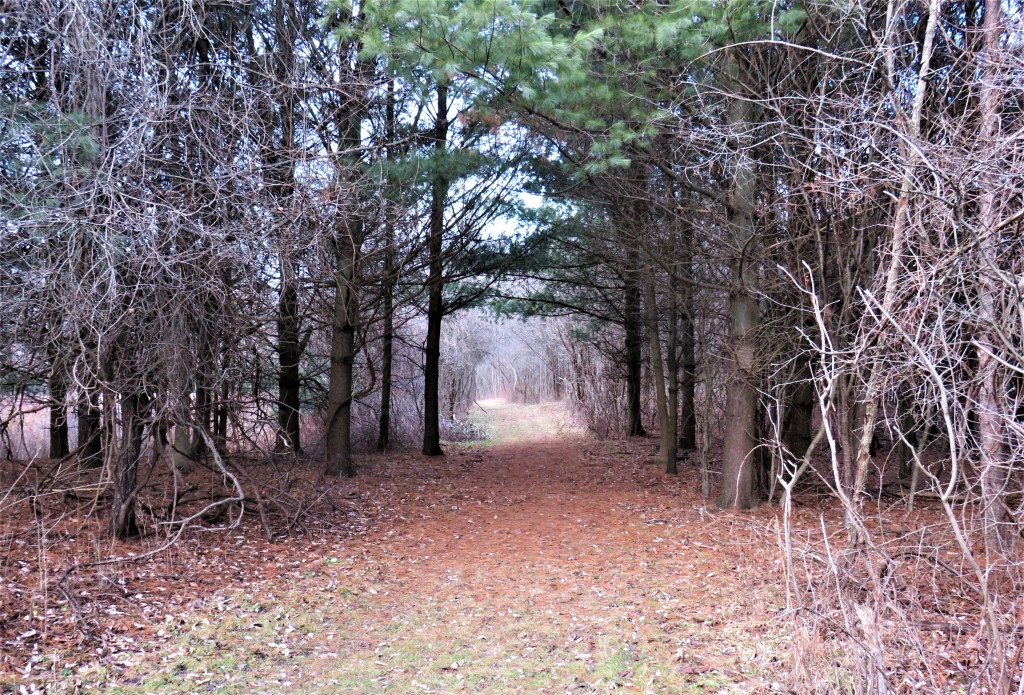
202. The Griffin House is a one-and-a-half-storey four-room clapboard house built in 1827 on a knoll overlooking the Dundas Valley. To get there, follow the signs from the Main Loop: take the Headwaters Trail, cross Sulphur Springs Road, then fork right on the short Griffin House Trail (top image).
It’s often supposed that African Americans born into slavery in the pre-Civil War US South were spirited into freedom in Canada by the so-called Underground Railroad. But the historical reality for individuals is likely to have been more nuanced than this. It should be remembered that slave-holding was not uncommon in the early history of Upper Canada, and slavery was not abolished in (most of) the British Empire until 1833. It was not until after the US Fugitive Slave Act of 1850 that large numbers of African Americans sought freedom in Canada via the Underground Railroad. That said, the Griffin House provides a window into the lives of some successful early Black settlers in Upper Canada.

The house and the surrounding 50 acres of land were purchased for £125 in 1834 by Enerals Griffin (ca. 1792-1878) and his wife Priscilla (1795-1850). They had been born in Virginia and had immigrated to Upper Canada via Ohio in 1829. Were they escaped slaves who found freedom here on the outskirts of Ancaster with the surreptitious help of abolitionists? Specific corroborative details are lacking, hardly surprising given the lengths that some slaveholders would go to recover their fugitive “property.” Still, the Griffins must have been a very visible minority: in 1851 there were only 27 people categorized as Black out of Ancaster’s population of 4,358.
Though there was legislation in Virginia banning the education of slaves (1819), Enerals Griffin was literate. He must have been already reasonably prosperous to have afforded this house. He certainly succeeded as a farmer in the Valley: in the census of 1851 he owned 45 acres of land, of which 15 were under crops, 14 under pasture, 15 were woodland, and there was a one acre orchard; he had two cows producing 150 lbs of butter; one calf; three horses; 15 sheep producing 40 lbs of wool; and 9 pigs.
However, the Griffins didn’t live in luxury. They had one son, James (b. 1833), whose Scottish wife Euphemia bore him eight children. So there were as many as eleven people living in this modest two-bedroom house during the 1870s.
The house remained in the Griffin family for 154 years until it was sold in 1988 to the Hamilton Conservation Authority. Since 2008 it has been a National Historic Site of Canada. It has been restored to its appearance in the mid-nineteenth century, and is now a museum devoted to the Black experience in Ontario. However, for reasons that are unclear, it is hardly ever open to the public. To view its interior, click here for a virtual tour.
Back on the Main Trail


courtesy of “The Hermitage” (undated brochure)
published by Hamilton Region Conservation Authority, p. 9.
203. The Hermitage was a stone mansion, one of the finest in the area. It was completed by Scottish stonemasons in 1855 according to the plans of George Gordon Browne Leith (1812-87), a wealthy Irish-born immigrant, who used it as a summer home. Alma Dick-Lauder (1854-1942), Leith’s eccentric youngest daughter, acquired the mansion in 1892 and filled it with domestic animals, including cows and horses. On 10 October 1934 the house was destroyed by fire, though part of the main walls remained standing. Alma was so devoted to the property that at first she lived in a tent among the ruins. Later a small wooden cabin was built for her and she lived there with her many animals till her death.
What was left of the Hermitage was eventually donated to the City of Hamilton and is now under the auspices of Hamilton Conservation Authority. The crumbling stone walls had been secured with “temporary” braces for over 60 years and were increasingly hazardous. A campaign raised $600,000, and in 2016 a team of expert stonemasons dismantled the ruins stone by stone, numbered, cleaned, and reassembled the stones over a concrete foundation with invisible steel reinforcements in the walls. The result is sculptural rather than ruinous, neoclassical rather than Gothic. The Hermitage is now a popular alfresco wedding venue: there’s a sign indicating that commercial photography is only allowed by permit.
The Hermitage is also the focus of a number of ghostly legends, even though these derive from an earlier house on this site. In the 1830s, a lowly coachman fell in love with the niece of the wealthy owner, was rejected, and hanged himself. As a suicide, he was reportedly buried at a nearby crossroads, and his ghost, mourning for his lost love, haunts the Hermitage on moonlit nights.
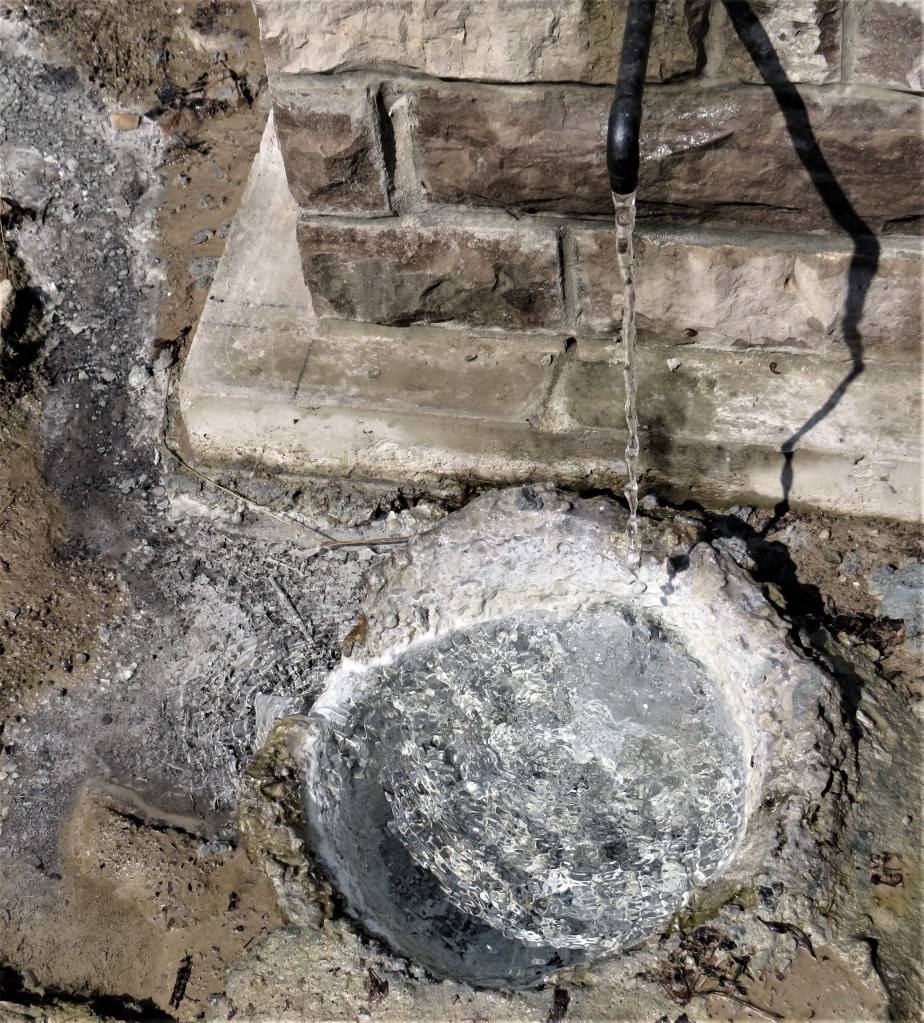
204. Where the Main Loop touches Sulphur Springs Road, you may smell rotten eggs in the air. The odour emanates from a small spring at the roadside, where a flowing tap leaves a white deposit as it drains away. George Browne Leith, owner of the Hermitage, donated this spring to Ancaster Township some time after 1850. From 1868-1900 there was a spa hotel near this spring, catering to visitors who believed that the sulphurous waters had healing powers. Indeed, the spring and another a little farther up the road are still popular with people who believe in the curative power of these waters. That’s in spite of a notice posted by the Hamilton Conservation Authority warning that the water contains high levels of arsenic (a carcinogenic poison) and sodium (to be avoided by people with heart problems). Note: bathing in sulphurous hot springs may be therapeutic, but drinking the waters … probably not so much.
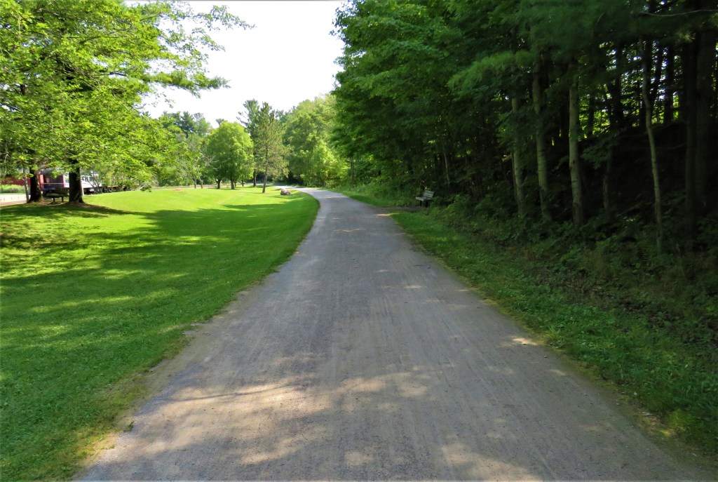
205. The Bruce Trail crosses the Hamilton to Brantford Rail Trail south of the Trail Centre. The spot pictured above is 5.7 km from the Hamilton end of the Rail Trail, and 26.3 km from the Brantford end. The Rail Trail is particularly popular with cyclists, as it climbs the Escarpment very gradually and has a well-drained, all-season surface. For more on this Rail Trail, please check out my six-part photo blog, starting at the Hamilton end.

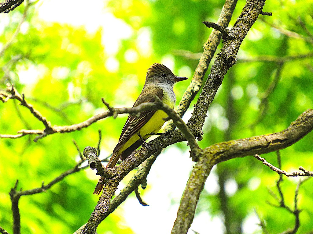
206. A few metres to the west along the Rail Trail stand several nesting boxes. There is a wooden bird-blind arrangement in place so you can watch what’s going on without disturbing the nesting birds. This great-crested flycatcher (Myiarchus crinitus) with its beautiful yellow belly was about to enter one of the boxes. This bird is a native of Central and South America. It lays its eggs and raises its young here in summer before flying home to warmer climes in the fall. Flycatchers are attracted to shiny things and will sometimes line their nests with snakeskin, metal foil, or even plastic wrap.
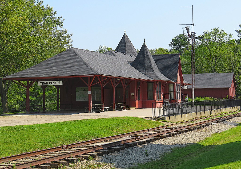
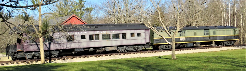
207. The Dundas Valley Trail Centre looks like a train station, and there are two antique carriages parked on rails outside. The purple “Manitoba” executive coach was built in 1929 for Canadian Pacific (CP) Railway. The green baggage car was built in Hamilton in 1931 and donated by Canadian National (CN) Railway. But there never was a station here: the building is a simulation built in 1977. However, there was a railroad track here along what is now the Hamilton to Brantford Rail Trail (#205 above). It was owned by the Toronto, Hamilton and Buffalo (TH&B) Railway (1892-1987). In spite of its name, TH&B never reached either Toronto or Buffalo, though its trains shared the track of its co-parent companies, CP and the New York Central Railroad.

The Trail Centre stands at one of the most important hiking/cycling hubs in southern Ontario. This is where the Bruce Trail (900 km) crosses the Hamilton-to-Brantford-and-on-to-Paris-and-Cambridge Rail Trail (77 km). In the immediate vicinity are accesses to several of the best DVCA trails, including the Main Loop, the McCormack Trail, the Spring Creek Trail, the Deer Run, and the Sawmill Trail. The “Sulphur Springs Station” building has a snack bar, washrooms, and a small natural history museum, though opening times are unpredictable off season and during the pandemic.
The Return Loop
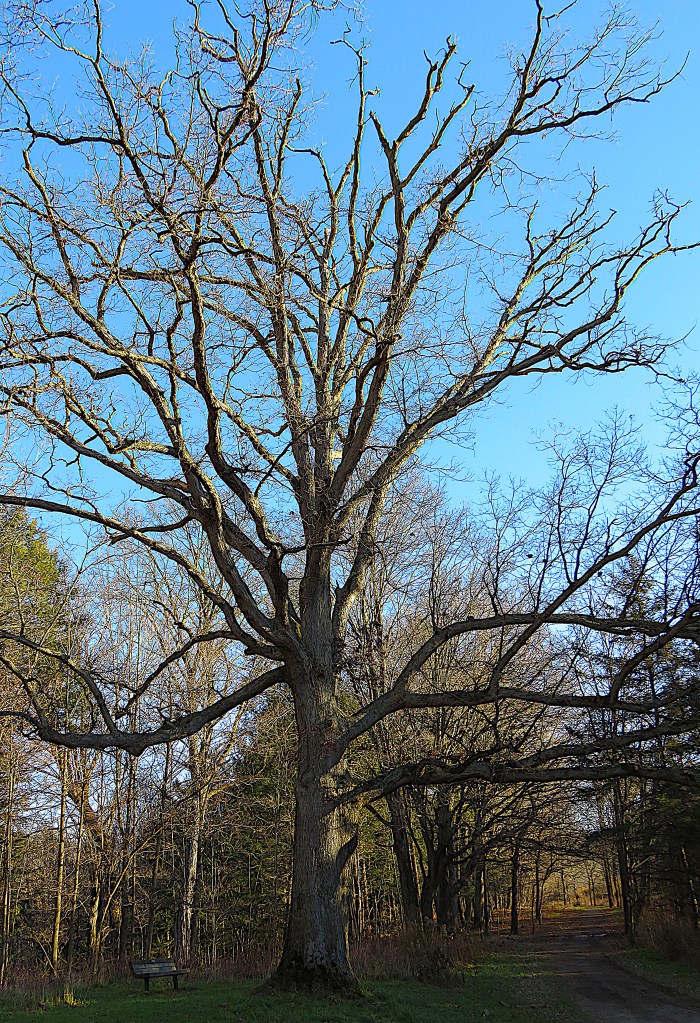
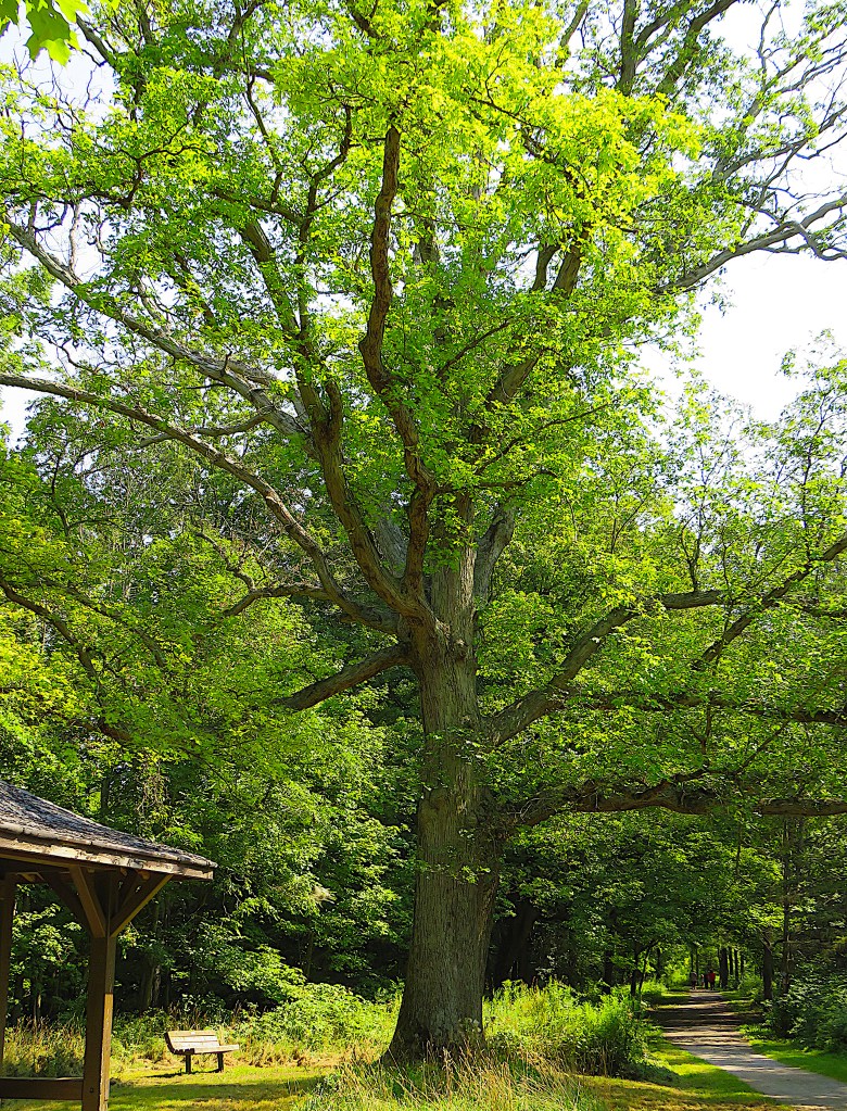
208. The forest in the Dundas Valley is chiefly lushly deciduous, meaning that the lay of the land is obscured by foliage during the summer months. On the return loop, retrace your steps to the Main Loop, turn left (east), descend into a ravine with a bridge across Sulphur Creek at the bottom, ascend the other side through a grove of hemlocks until you arrive at this fine white oak, about 150 years old. Now let’s fast forward into winter. Leave the Main Loop at this point and take the Monarch Trail to the right of the tree.

209. It’s mid-December, but the temperature is well above average. A picnic table under this little pavilion in the old Merrick apple orchard is a good place to relax for a while.

210. There has been some snow in the past couple of weeks, but it has all melted off, leaving the Monarch Trail damp and muddy.
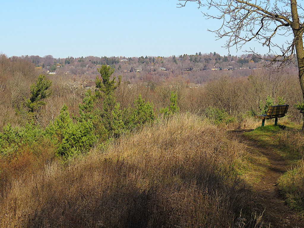
210. Turn right at the trail marker for Groundhog Hill and make the short climb to the top. There’s a view over the breadth of the Dundas Valley, with houses in Greensville lining the brow of the Escarpment opposite.
212. The latest official map of the DVCA is simplified, omitting several well-established but nameless trails that parallel the main trails. This view of the trail from the top of Groundhog Hill eastwards following the crest of a sinuous ridge is only possible in the leafless winter months. This trail eventually takes you down to Artaban Road.

213. A busy chirping overhead alerts you to a bird that hangs around all year: the misleadingly-named red-bellied woodpecker (Melanerpes carolinus). It’s the red head patch that’s the obvious identification mark, but as there already is a red-headed woodpecker, this one gets its name from the faint red patch (just visible) on its belly. A standard bird book published in 2000 calls this the “rarest of Ontario woodpeckers.” But the local climate has become considerably more accommodating since the turn of the millennium, and these birds are now quite common in the area. As the second part of their Latin name indicates, they prefer mature deciduous Carolinian forest, and that’s exactly what they find here in the Dundas Valley.

214. Near the Artaban Road P there’s a view east along a powerline corridor towards Hamilton. It’s about a 12 km drive from here to downtown, though the camera’s zoom lens makes it seem much closer.
Go to Part 11: Dundas Valley Trail Centre to Davidson Boulevard Side Trail
