From Filman Road to Old Dundas Road
Date: 19 August 2021
Start Point: Filman Road, Ancaster
End Point: Old Dundas Road, Ancaster
Distance Covered: 2.9 km*
Total Distance Covered: 42.9 km
*plus 400 metres to P on Artaban Road; plus 850 metres side trip to Tiffany Falls; plus 5.7 km return loop via Ancaster Village.
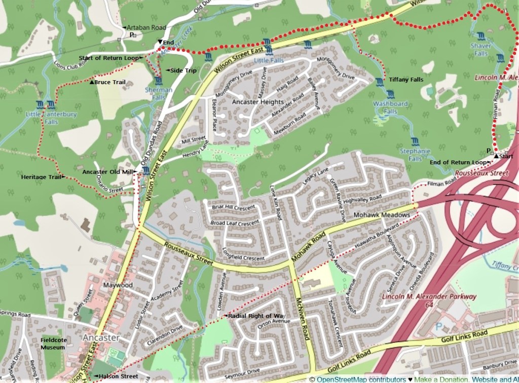
171. Today’s linear hike, represented by the larger red dots on the map above, is a short 2.9 km, though with some challenging up-and-down sections. You park your start car at the previous hike’s end point on Filman Road, and your end car at the P on Artaban Road (first right off Lion’s Club Road). Mid-hike, there’s an unmissable 850 metre side trip to Tiffany Falls, spectacular after rain or during spring runoff. At the end of the hike on Old Dundas Road you’ll walk an extra 400 metres to your end car. Close to the end car is another major waterfall, Sherman Falls, though you might want to leave this 800 metre side trip for the next hike. The end of this hike is in the Dundas Valley Conservation Area (DVCA), and parking here is restricted to official lots: you should not park by the side of the road anywhere in the DVCA. Unless you are a member of Hamilton Conservation Authority and display your membership card on your dash, you’ll probably have to pay to park in the DVCA.
By public transit, you’ll have to walk a few extra km on this hike. Take the #5C from downtown Hamilton to West Hamilton loop on Main Street West, and then walk up the north end of Filman Road to the main Bruce Trail. There is no bus stop close to the Old Dundas Road endpoint. Your best option may be to take the #5 Jones and King bus from Wilson Street East at Rousseaux Street to downtown Hamilton.
This hike also offers a return loop (the smaller red dots above) that takes you on a scenic trail past a small waterfall and then through historic Ancaster Village. If you opt for this, you’ll continue along the Bruce Trail until it meets the Heritage Trail at Canterbury Falls. Take the Heritage Trail east to its end at Old Dundas Road and then explore Old Ancaster Mill and its surroundings. Then take the sidewalk southbound along Old Dundas Road, cross at the lights, and go south along Wilson Street East, the main thoroughfare through Ancaster Village. Turn left at Halson Street and immediately left again along Ancaster’s “Radial Right of Way”, which is the extension of the Radial Trail along the former B&H track that we took on our previous hike. After Cayuga Avenue this Trail continues as a quiet suburban street, Hiawatha Boulevard, which you should take until its end. Turn left down a short alley, cross Mohawk Road at the lights, and carry on northward along Filman Road until you come to your vehicle. This return loop is about 5.7 km, making the whole loop hike 8.6 km long, or 9.5 km if a Tiffany Falls side trip is included.
Warning: from the map, it looks as if you can shorten the return loop by walking south up Old Dundas Road. Do not attempt this! There is no sidewalk or adequate shoulder along this busy, steep uphill road with a blind curve.
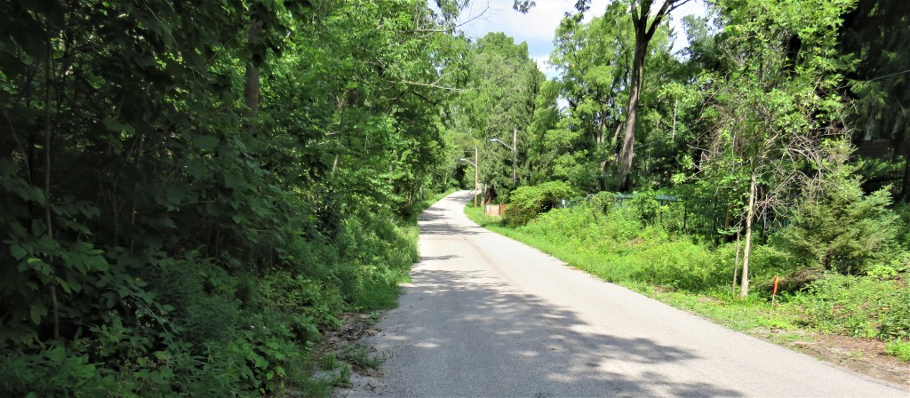
172. Filman Road is one of the oldest byways at the Head of the Lake. Established in 1789, it enabled local people to travel up and down the Escarpment between what are now Ancaster and Dundas. The road is named for Conrad Filman (1759-1851), an Empire Loyalist born in Pennsylvania who settled in the vicinity. Initially a squatter, in 1791 he received official land grants of 400 acres for himself, his wife Catherine Horning, and their two children. These days, the north and south end of Filman Road are paved, but the stretch between them that steeply descends the Escarpment is closed to vehicular traffic and has become part of the Bruce Trail system.
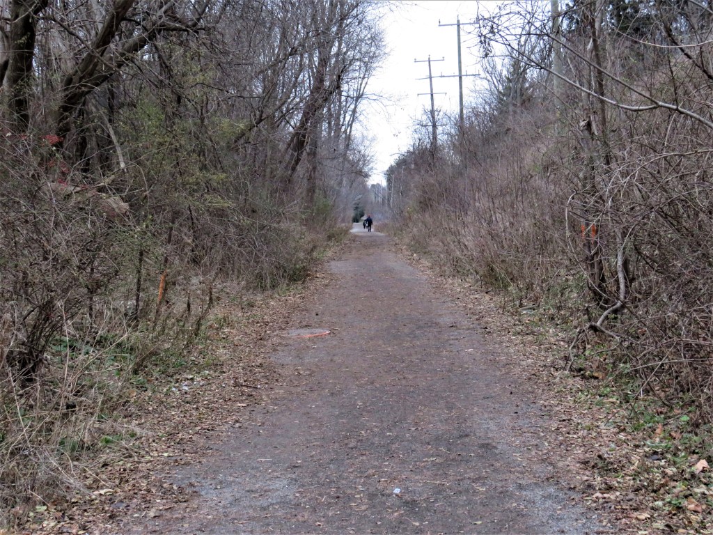
173. At this point on the the pedestrian-only midsection of Filman Road, the Bruce Trail diverges from the Filman Road Side Trail, which (as the blue blazes indicate) turns off to the right. If you need public transit, take the Side Trail down the Escarpment to the paved north end of Filman Road, and on to the point where Wilson Street East becomes Main Street West. There you’ll find bus stops for downtown Hamilton on the east side of the road, and for Ancaster on the west. But on this hike you follow the white blazes …
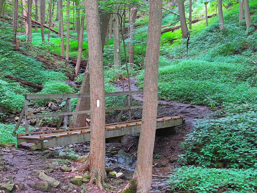
174. … which take you down into a ravine where a minor headwater of Ancaster Creek arises, across the bridge over the little creek, and then steeply up again.
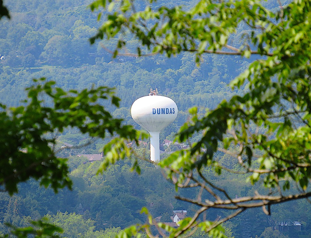
175. Through a gap in the trees, you may glimpse the Dundas water tower down in the Valley. This landmark is 37 metres tall and has a capacity of 2.8 million litres.
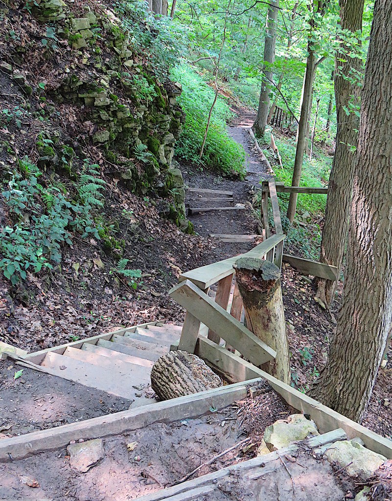
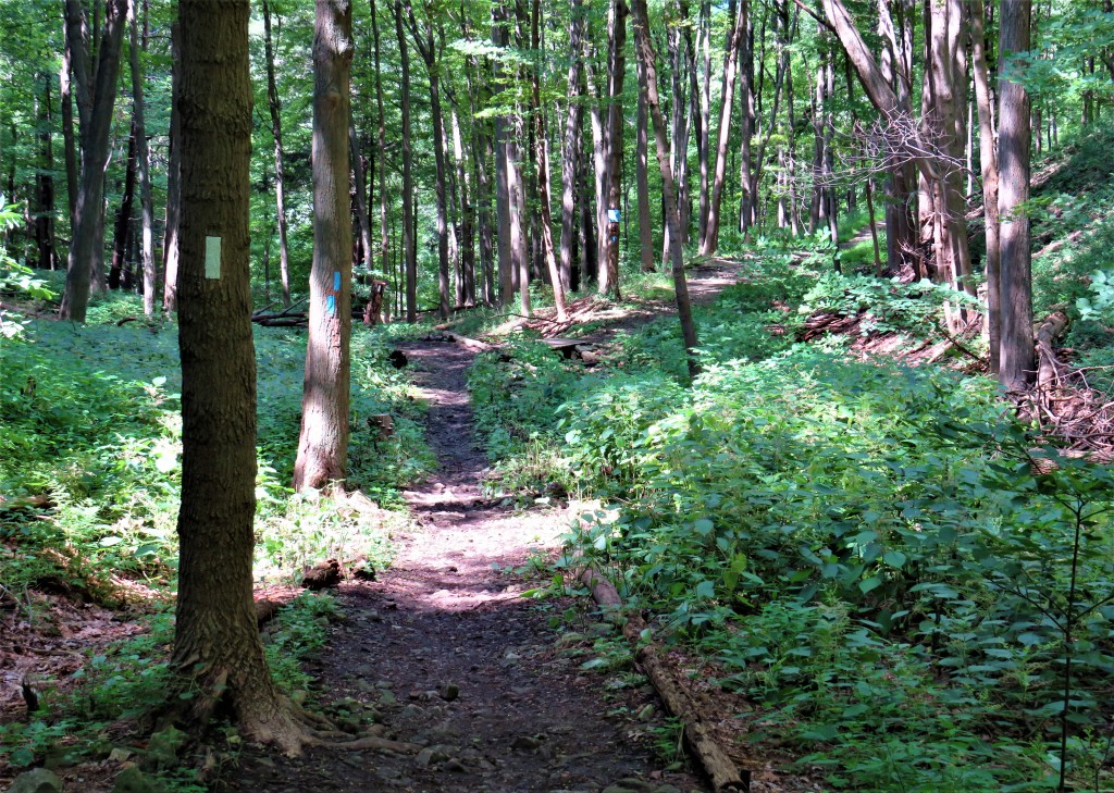
176. This part of the hike has steep sections both up and down. These are typical Bruce Trail rustic stairs, all of which have been constructed by volunteers. Watch your step, especially if the trail is slippery with mud.
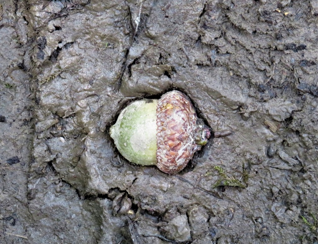
177. An acorn lies embedded in the mud of the Trail.
“Pleasant Sounds” (a prose poem written some time after 1845) by John Clare (1793-1864)
The rustling of leaves under the feet in woods and under hedges;
The crumpling of cat-ice and snow down wood-rides, narrow lanes, and every street causeway;
Rustling through a wood or rather rushing, while the wind halloos in the oak-toop like thunder;
The rustle of birds’ wings startled from their nests or flying unseen into the bushes;
The whizzing of larger birds overhead in a wood, such as crows, puddocks, buzzards;
The trample of robins and woodlarks on the brown leaves, and the patter of squirrels on the green moss;
The fall of an acorn on the ground, the pattering of nuts on the hazel branches as they fall from ripeness;
The flirt of the groundlark’s wing from the stubbles—how sweet such pictures on dewy mornings, when the dew flashes from its brown feathers.
Glossary: cat-ice = thin, milky ice in a shallow place from under which water has receded; oak-toop = (probably) the top of one or more oak trees; puddocks = red kites, or similar birds of prey.
178. Eventually the Bruce meets Wilson Street East. Here you have to cross busy Wilson, though visibility is fairly good in both directions.
Side Trip: Tiffany Falls
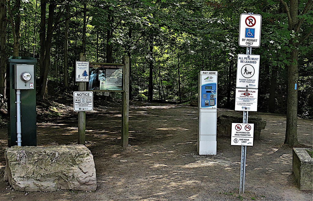
179. The Bruce Side Trail to Tiffany Falls is marked by blue blazes, and involves recrossing Wilson. This is just a selection of the signs that greet you in the parking lot. They tell you to pack in what you pack out, that ticks may be found in the area, that pets must be leashed, that there’s an emergency plan, that you can’t picnic or barbecue, that you have to pay $11 for parking but can’t stay for longer than an hour, that ice climbing is inherently dangerous, that this is a sensitive environmental area, that you shouldn’t use the trail in poor weather conditions, that you should be “an experienced hiker equipped with appropriate hiking boots” to use it at all (utter nonsense, you can probably do the 800 metres there-and-back in high heels if the trail is dry), that you must keep to the gravel path, etc., etc. Is this any way to welcome visitors to a beauty spot?
If it were an individual posting all these signs, we’d call it an extreme case of passive aggression. Why else post so many red flags if you have the power to avert the dangers you are warning against? But it’s the Hamilton Conservation Authority (HCA), and what this display shows is that they are too cheap to pay officers to monitor the behaviour of tourists. (They don’t mind taking your money, though: a regular annual HCA membership pass is $115.) So, ignore this admonitory barrage, don your six-inch stilettos, and take the five-minute stroll to the falls for your photo op …
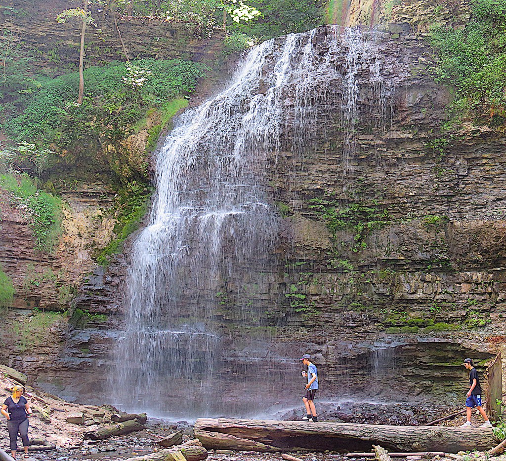
180. … and this is what you’ll find. Even on this day in late summer it’s pretty spectacular.
Tiffany Falls (22 metres) is on a minor tributary of Ancaster Creek. It’s named for the first physician in Ancaster, Dr. Oliver Tiffany (1763-1835) of Norton, Massachusetts, who graduated from Dartmouth College in 1786 and gained his medical qualifications in Philadelphia. He served Ancaster and district from 1796 until his death in 1835, and many members of local pioneering families were his patients. It’s said that 600 people attended his funeral, and he’s buried in St. John’s Anglican churchyard in Ancaster (see #193 below).
This deep forest ravine is reputedly frequented by otherwise rare birds such as the Louisiana waterthrush and the tufted titmouse.
Back on the Trail

181. We’re back on the main Bruce Trail running parallel to and just north of Wilson. Here there’s an impressive display of fairy inkcaps (Coprinellus disseminatus), the mushroom notorious for having 143 different sexes.
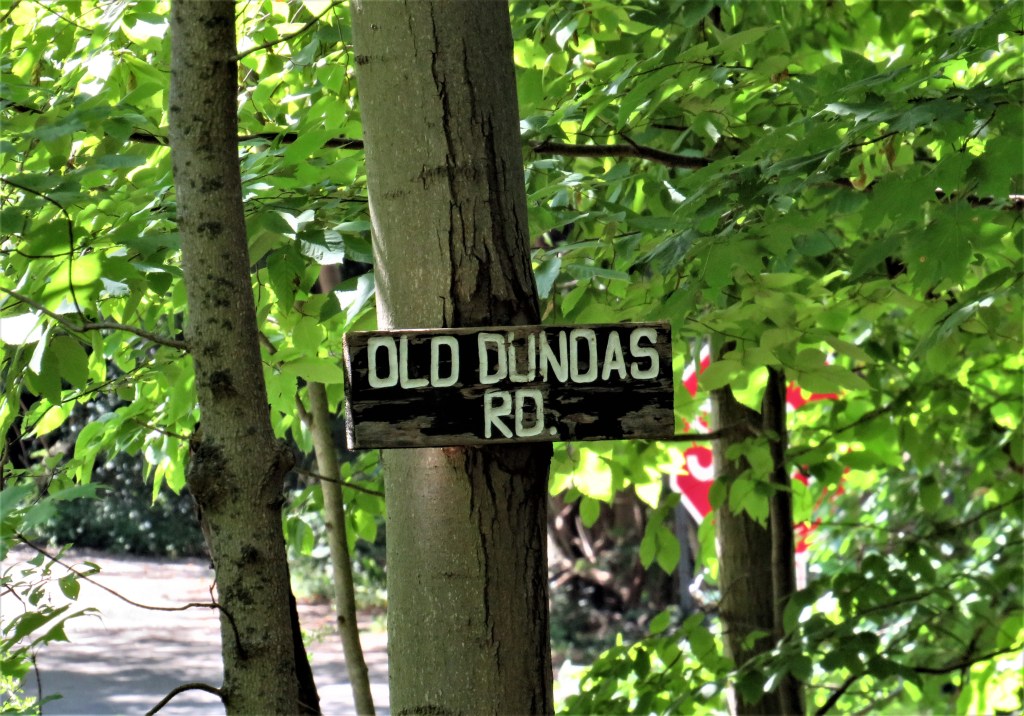
182. And this is your endpoint: Old Dundas Road. This narrow, roller-coaster of a road is the only direct route for cars between Ancaster and Dundas, the two oldest settlements in the area. One of the few paved roads through the DVCA, it changes its name to Old Ancaster Road when it meets the former boundary between the towns. It’s a beautiful road to drive in the fall, but it’s not safe to walk any stretch of it north of Montgomery Drive, as there is nothing to separate pedestrians from traffic.
if you opt for the return hike to Filman Road, continue following the white blazes of the main Bruce Trail …
Return Loop via Ancaster Village
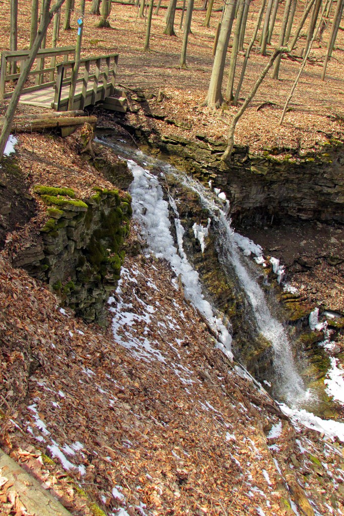
183. For some years the Bruce between Old Dundas Road and Canterbury Falls was closed at the behest of the landowner. But recently he relented and now it’s open again. Please be extra careful to respect the Trail wherever it goes through private property. Private landowners have no obligation to allow hikers through their property, and may withdraw their consent if they experience antisocial behaviour.
This is Canterbury Falls half frozen in winter.
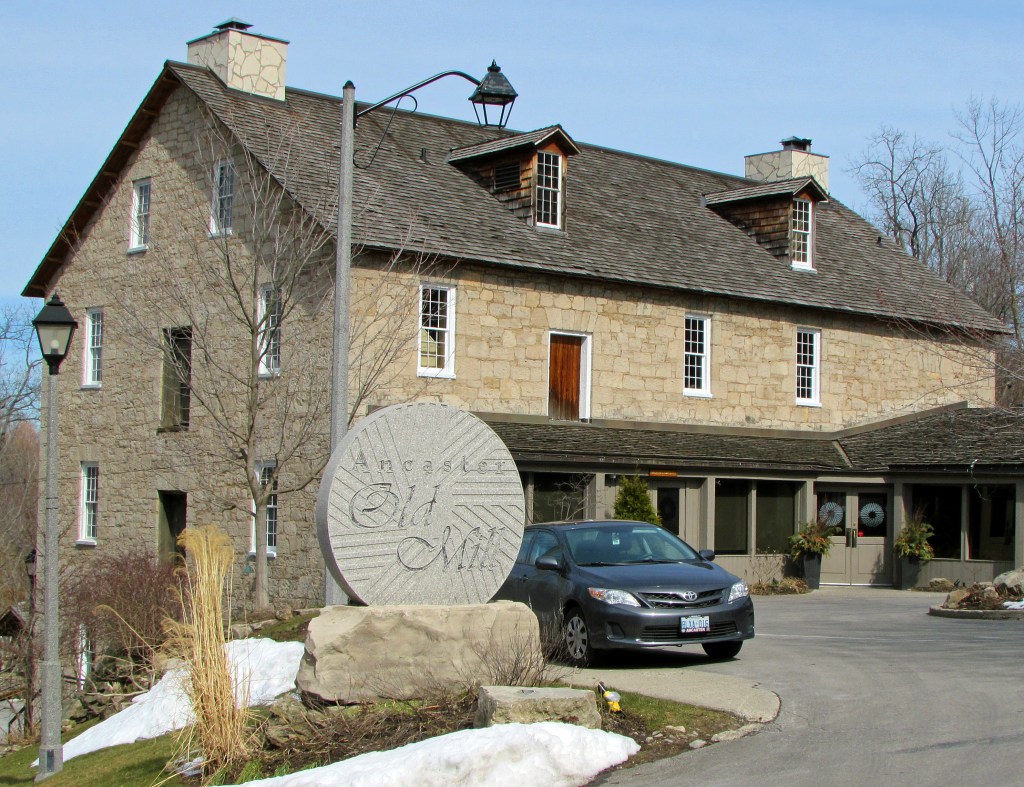
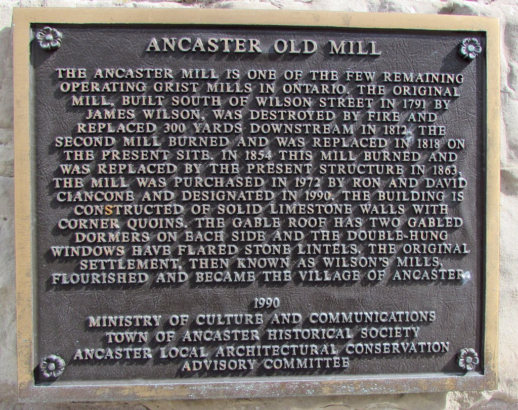
184. As the plaque indicates, this stone beauty wasn’t the first mill building on this location, but it’s been the longest lasting one. Since 1979, Ancaster Old Mill has been operating as one of the most popular restaurants and wedding venues in the area. The site includes an outdoor and indoor chapel, a grand ballroom, and a solarium, as well as photogenic waterfalls, decks, terraces, steps, and bridges. You can explore the exterior grounds of the complex as long as no private event is taking place.
185. Looking southeast along Wilson Street East, we find Ancaster Village in festive regalia. The tower of St. John’s Anglican Church gives the scene its classic villagey focus. However, the sidewalks here rarely bustle: Ancastrians go to Meadowlands, the big-box area 3 km to the east of here, to do their serious shopping.
186. Ancaster got its name indirectly from a village in Lincolnshire, England. The Township of Ancaster was created by Upper Canada’s Lieutenant Governor Simcoe in 1792, who (probably) named it for Sir Peregrine Bertie, 3rd Duke of Ancaster and Kesteven (1714-78), a notable British general of the mid-18th century who had no Canadian connection. The Township was an inverted triangle with Governors Road as its northern edge and its southern point near Carluke. The settlement first known as Wilson’s Mills was the largest in the Township, and took the name “Ancaster” for itself in about 1800. Ancaster considers itself the third oldest settlement in Ontario, after Kingston and Niagara-on-the-Lake. Using the water power of Ancaster Creek over the edge of the Escarpment, it became a successful early industrial centre, and in the early 1820s may have had the second largest population in Upper Canada after Kingston. But thereafter, steam technology, canals, and railways gave nearby towns below the Escarpment (first Dundas, then Hamilton) an advantage. Thereafter Ancaster grew very slowly, and did not gain the status of a town until 1974. Recently, however, its population as a bedroom suburb of amalgamated Hamilton has soared to more than 40,000.
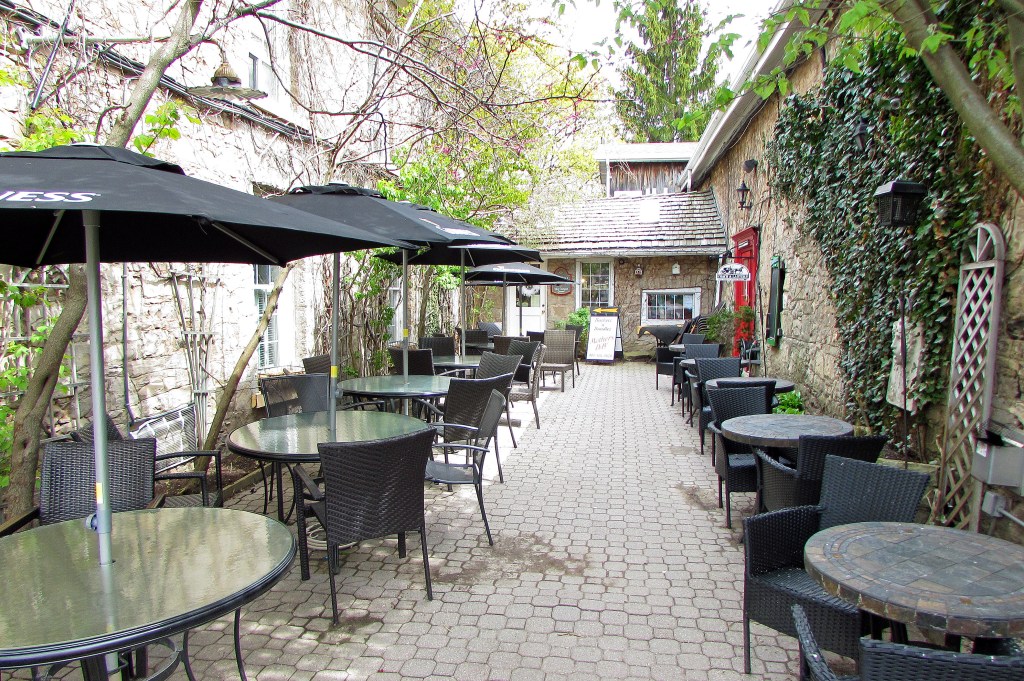
187. There are many charming heritage buildings in Ancaster. The Coach and Lantern pub occupies the stone building on the right, part of which dates from 1823. The pub’s courtyard is a great place to hang out in warm weather, and the interior is snug when cooler temperatures prevail.
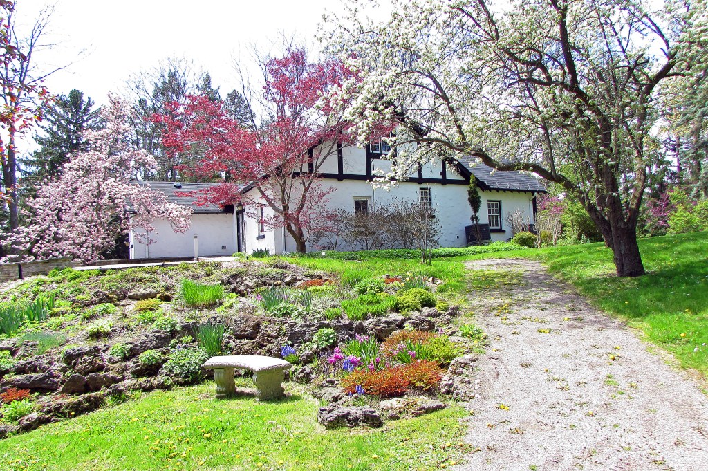
188. As befitting its heritage, Ancaster has a small historical museum, the Fieldcote, though you have to go off trail to visit it. It’s a little way down Sulphur Springs Road (see the bottom left corner of the map above), and in springtime it’s surrounded by beautiful blossom.
189. On Wilson in the middle of the Village is Ancaster’s former Township Hall, built in 1871 at a cost of $2,700. As municipal government is now conducted in Hamilton, this building has been repurposed as … you guessed it … a wedding venue.
190. Yes, there are plenty of picturesque, Instagrammable buildings in Ancaster. But you’ll search in vain for the one above. This lovely old stone building, the Brandon House, stood at 462 Wilson Street East from about 1867. On 4 April 2020, shortly after a City of Hamilton demolition permit was issued, it was torn down by its owner.
But wait! you say. Surely this house was protected by being on the heritage list? Yes, it was on the City of Hamilton’s heritage inventory, but it had not been designated. As the Hamilton Spectator noted on 29 April 2020, “Heritage properties may be on three different lists, properties of ‘interest,’ properties that are registered, and properties that are designated.” Only designated properties are protected by the Ontario Heritage Act, and the filing of a written request for designation will not save a house from being demolished, as was the case here. In Hamilton (and Ontario in general) it’s easy for an owner to get a demolition permit, but painfully slow to get a heritage designation. “As Rob Ziegler of The Cotton Factory [in Hamilton] has noted, ‘In Ontario, it takes 4 weeks to get a demolition permit and yet it took me almost 2 years and tens of thousands of dollars to get the Cotton Factory designated (with the full support and assistance of the City)’” (Shannon Kyles, “The Brandon House–In Memoriam,” Raise the Hammer, 16 April 2020). Note that much recent local media attention to heritage matters came only in the immediate wake of the destruction of the Brandon House, when people were suddenly alerted to the extreme vulnerability of the beautiful old buildings whose continued existence they’d taken for granted.
Kyles’s excellent article, cited above, explains in detail what is wrong with the current heritage protocol in Hamilton. In it, she points out that “the Hanley Building beside the Coach and Lantern pub is similarly unprotected.” Which leads us to the Development Elephant in the Ancastrian Room ….
191. … A little way north on Wilson from the Coach and Lantern, this old stone building stands alone surrounded by a huge, flattened area. It’s the Marr-Philippo House, a Georgian-style stone dwelling built about 1840 and currently occupied by a bridal shop. (Some think of it as the Hanley Building, as it was formerly occupied by Hanley’s Eyewear Boutique.) It has been a designated heritage structure since 1981. However, there are plans to turn this whole site into a large six-or-seven storey upscale condo and commercial development. Perhaps nervous about the new local sensitivity to heritage after the Brandon House debacle, the developers claim to want to preserve this building by moving it 100 metres to the back of the lot, where it would become “an amenity space for residents.” Such a plan hardly conduces to the preservation of Ancaster’s townscape. Moreover, as you can see from the lower photo, the state of its south wall would make moving it a dodgy proposition. (Of course, demolition by accident during such a move would be quicker and more certain than, say, demolition by neglect.)
A recent opinion column by Bob Maton in the Spectator (29 October 2021) suggests that the developers have been assembling and planning to build on this large lot in defiance of regulations, and that they have been assisted by Ancaster’s representative on City Council, his claims to defend the town’s heritage notwithstanding.
Whatever the case, the excessively overbounded City of Hamilton has neither the resources nor the will to protect the historical heritage of the communities on its margins. Locals in the amalgamated towns find it difficult to get the attention of a distant and often indifferent City Hall. Ancaster’s current problems with preserving its townscape should stand as a warning to other former municipalities to get their precious old buildings designated as soon as possible.
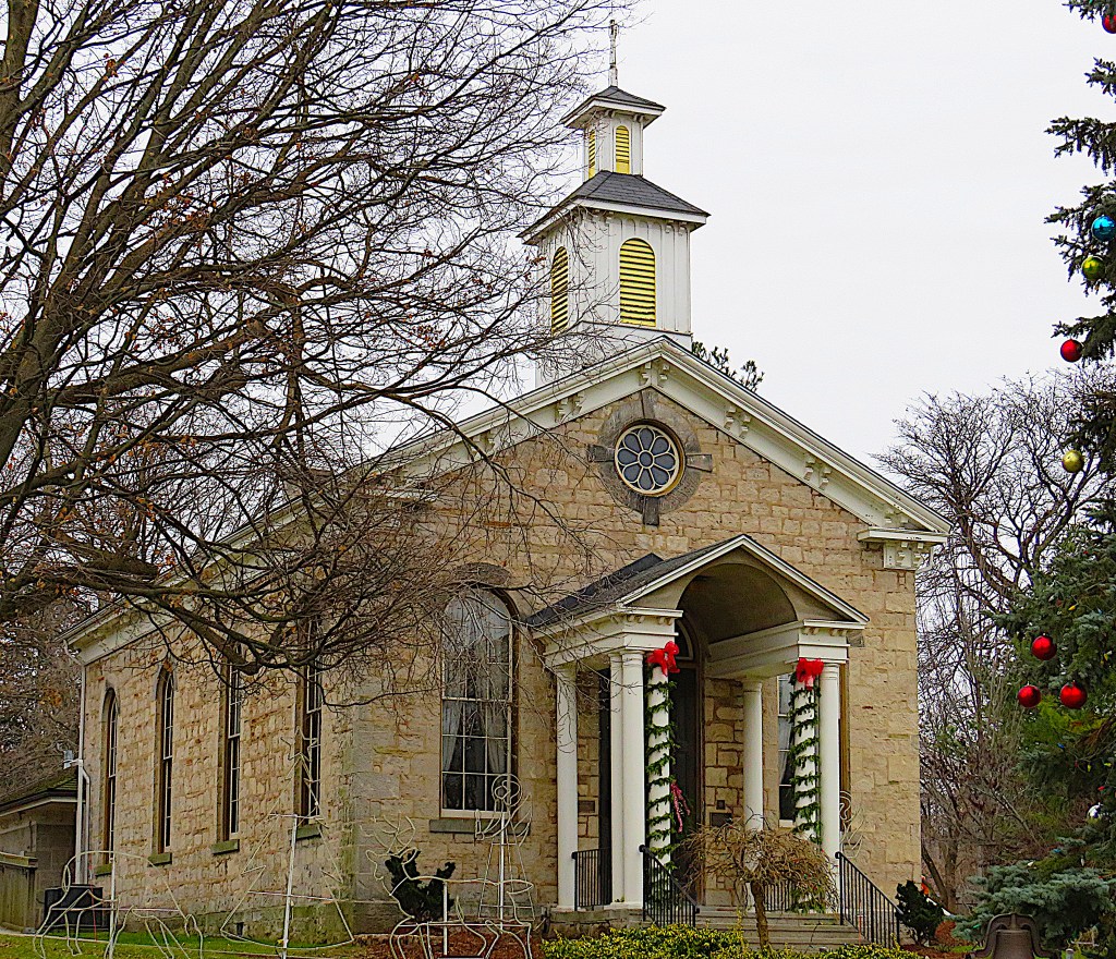
192. Time to move on. This is St. John’s Anglican Church (founded 1824, this building constructed 1869), after which you turn left …
193. … though if you have time you might want to linger in St. John’s atmospheric graveyard. There you’ll find, among 1,700 others, the tomb of Clementina Trenholme Fessenden (1843-1918), a fierce Canadian patriot and Queen Victoria fan who invented Empire Day, a celebration of the British Empire in Canadian schools. Her idea was picked up in England in 1904, “to nurture a sense of collective identity and imperial responsibility among young empire citizens,” where it eventually mutated into now barely-commemorated Commonwealth Day. Clementina was the mother of Reginald Fessenden, the Canadian-American radio and telecommunications pioneer.
194. Behind the churchyard, Ancaster’s Radial Right of Way begins: this is the most direct and pedestrian-friendly way back to your car.
Go to Part 10: Old Dundas Road to Dundas Valley Trail Centre
