From Smokey Hollow to Bayview Park
Date: 5 September 2021
Start Point: Smokey Hollow, Mill Street South, Waterdown
End Point: Bayview Park, King Road, Burlington
Distance Covered: 4.4 km*
Total Distance Covered: 73.2 km
*plus optional ca. 4.4 km return.
348. With this hike of 4.4 km you complete all 73.2 km of the HOLO Loop!
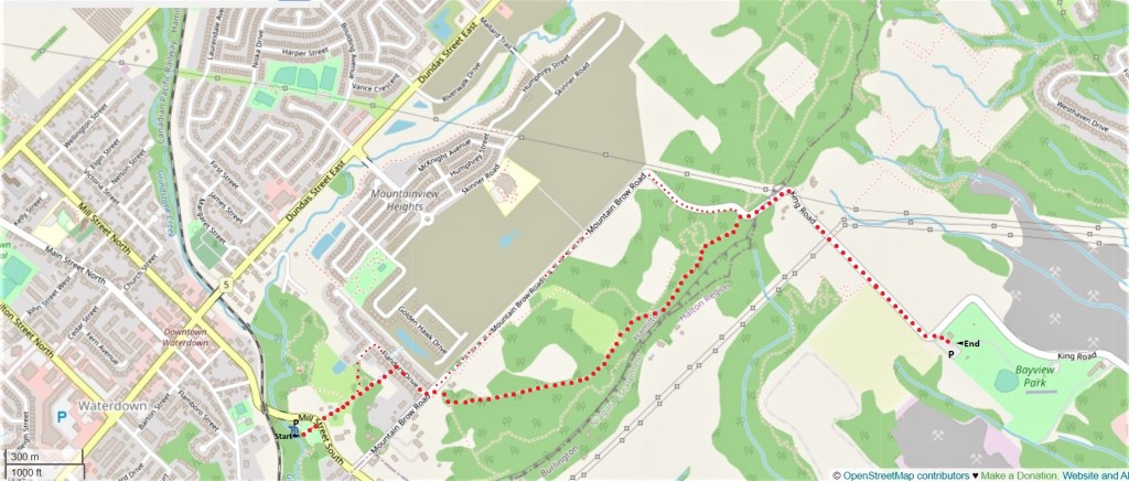
If you have two cars, park the start car in the Smokey Hollow P in the unlikely event that there is room (see #349 below). Otherwise park it in Waterdown Village and walk carefully down Mill Street South facing oncoming traffic to reach the start point. Park your end car in the large free P at Bayview Park on King Road, where you began the loop sixteen hikes ago.
If you have only one car, park it at either end and walk there and back: that’ll be 8.8 km in total. This hike is not very demanding as it’s largely on the flat along the brow of the Escarpment.
There is an optional loop back via King Road and Mountain Brow Road (the smaller red dots on the map above). This return is far from beautiful, but it is instructive, as it runs along the edge of one of the largest new housing developments in the Hamilton area, Mountainview Heights in Waterdown. This return loop is about the same distance as retracing your steps.
As for public transit, see Part 16 for getting to Mill Street South by bus. From Bayview Park you have an extra downhill walk of 2.5 km along King Road to pick up at Plains Road East either the Burlington Transit bus #1 (Plains) to Hamilton or Burlington GO Stations, or the #4 (Central) to downtown Burlington. If you time it correctly you could shorten this by taking the #87 (North Service) bus that offers a very infrequent weekday service from King at North Service Road to Burlington or Aldershot GO stations.
349. Don’t try to squeeze into an illegitimate spot in the Smokey Hollow P, or you’ll get a ticket.
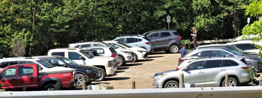
350. Leave the Smokey Hollow P by these steps up to Mill Street South. Cross the road with care!
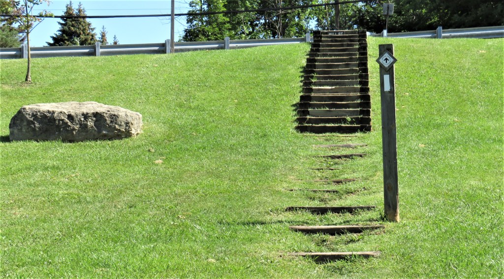
351. Then take the path uphill through what looks like a meadow but is actually a spillway from a stormwater pond at the top of the hill.

352. Then things get a lot less rustic. First you have to go east down Flanders Drive, a suburban street with no sidewalks …
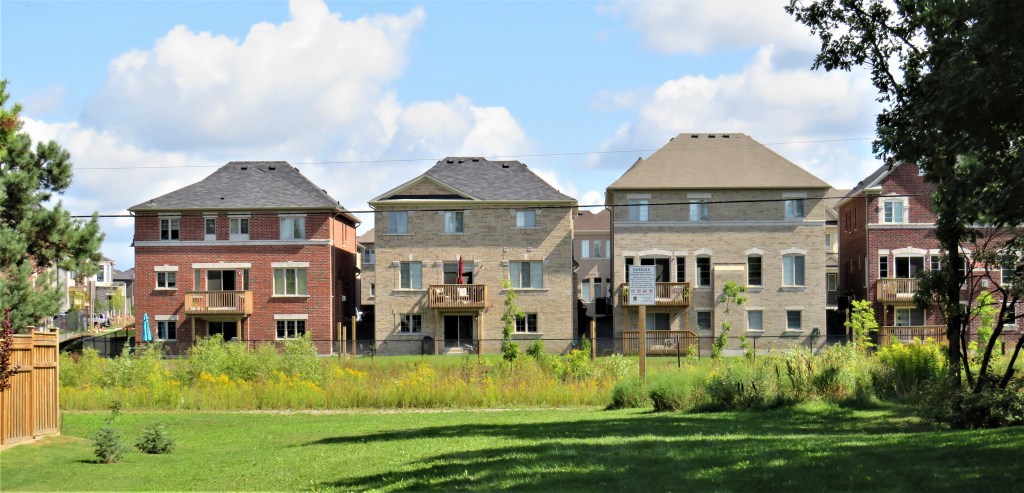
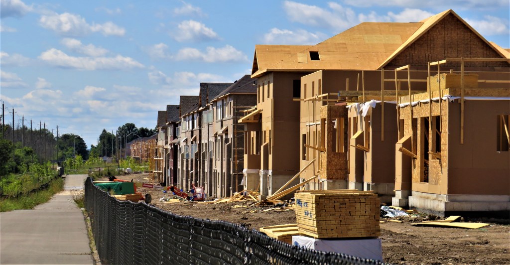
353. … while to the north you glimpse an enormous survey of villas just completed or still under construction, and seemingly spaced only a couple of metres apart. If you take the optional loop return you’ll get a better view of this area.
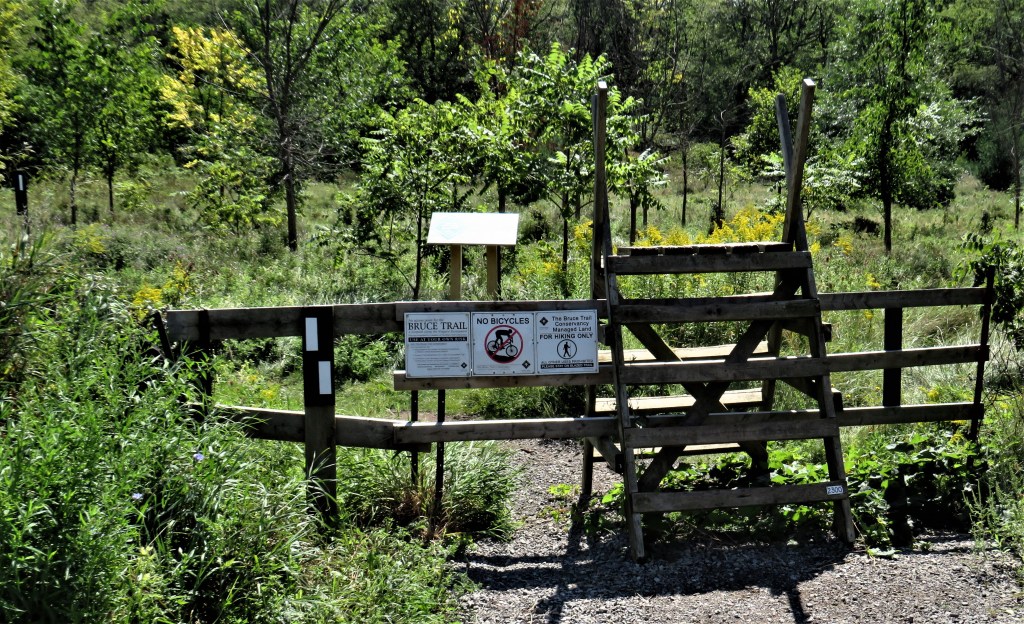
354. You cross Mountain Brow Road and then enter the woods on the edge of the Escarpment via this stile. Stiles are found along the entire length of the Bruce, though there are only two on the HOLO Loop, both on this section of trail. Based on a UK design, a stile is a pair of wooden ladders that enables hikers to climb over a fence (usually one demarcating private property) without damaging it. Where there is livestock, a stile is better than a gate, as it can’t be carelessly left open by hikers. There are no farm animals around here, so this stile is probably to deter cyclists and riders of motorized vehicles. Bicycles and (especially) ATVs are generally banned from the Bruce as they cut up the trail, leaving it a muddy mess.
The safest way to negotiate a stile is to climb to the platform at the top, turn 180 degrees while holding on to the upward-projecting crosspieces, then descend with your back to the trail ahead. If you are physically unable to negotiate a stile such as this, the chances are that the trail ahead will also prove too demanding, and you’d be advised to take an alternative, more accessible route. In this case, simply walk northeast along Mountain Brow Road until it meets King Road, then turn right.
Just beyond this stile is a notice with a pair of brushes attached at the bottom. It asks you to brush off your footwear so you don’t inadvertently import into this ecologically-sensitive area seeds of various invasive plants, such as garlic mustard, common buckthorn, and dog-strangling vine.

355. This section of trail also includes a less common alternative to a stile: a dodge way. This has two arms projecting each at an angle to a fence, leaving a narrow gap that allows the passage of a hiker but makes it difficult for a wheeled vehicle to pass through. Clearly this section of trail needs to be protected from cyclists.
In the UK they call these things “kissing gates.” That’s because the central piece is (usually) a hinged flap that touches or “kisses” the end of one of the arms and has to be moved to allow passage through. But the phrase is suitable for another reason: rustic lovers walking out together found themselves face to face as they squeezed through the gap in turn, at which point osculation tended to occur.
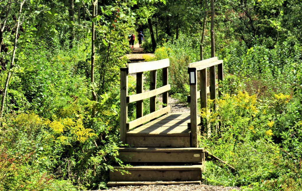
356. Little bridges like this one are constructed by the Bruce Trail Conservatory over streams that cross the trail. Such a bridge must have good clearance over the stream and be securely anchored, as waterways about to descend the Escarpment can get very swollen during spring thaw and will sweep away any structure not firmly fixed. Handrails are constructed when the stream bed is one metre or more below the bridge’s deck. The decking is typically of rough lumber that isn’t too slippery under foot. Such bridges are built narrow to deter snowmobilers in winter. The Bruce Trail in urban areas (and this area of Waterdown is becoming densely populated) has to be protected from the kinds of traffic that will damage it for hikers.

357. The spiny-edged leaves and elongated fruit of common barberry (Berberis vulgaris) by the side of the trail. This shrub is considered a noxious weed as it harbours a fungus, black rust, that destroys cereal crops.
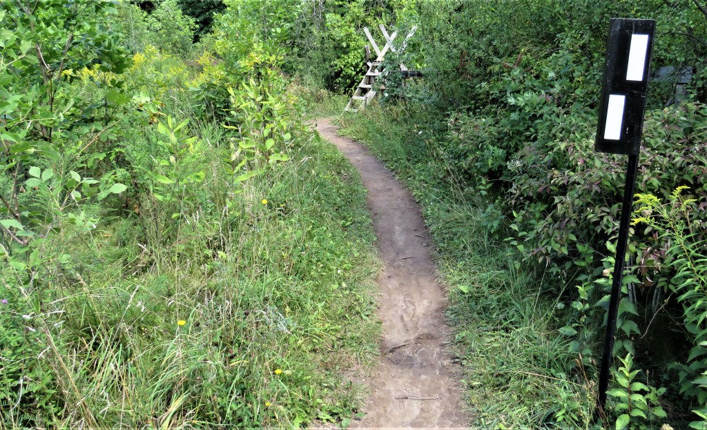
358. And there’s the second stile, marking the end of this smooth, level section of trail.
359. Now we’re in a rocky, rooty section near the edge of the Escarpment. J.H. Smith, in his Historical Sketch of the County of Wentworth and The Head of the Lake (1897), recalls: “When the early settlers first came here, rattlesnakes were very plentiful, especially along the escarpment that forms the northern boundary of the Dundas Valley and extends northward through Halton. So numerous were they that it became necessary each returning spring to organize hunting parties to destroy these dangerous neighbors. When the warm spring sun began to awaken slumbering nature, these snakes, aroused from their winter sleep, issued forth from the crevices in the rocks. On the projecting ledges on sunny days they might be seen gathered together in heaps varying in height from one to two feet, and here they lay basking in the sunshine. It was at these times that the hunting parties visited the mountain side, and with muskets loaded with slugs or coarse shot, fired into these piles and destroyed them by hundreds” (p. 25). These days you have to go more than 200 km north to the Bruce Peninsula before you find any rattlers, and even there they are rare and (understandably) shy of humans.
360. Here the trail meets King Road. You’d normally turn right at this point, but if you feel like a bit more fresh air and exercise, well, the Bruce Trail continues across the road for another 700+ km all the way to Tobermory at the northern tip of the Bruce Peninsula.

361. This section of King Road is paved but carries very little traffic, now that it is no longer a through road. Neverthless, proceed cautiously downhill as there are no shoulders. The speed limit suggests just how tight the oncoming curve will be. The stickers on the sign indicate that this road is beloved of skateboarders, who can coast from here all the way down into Burlington.

362. Rush hour on King Road.

363. The south-facing slope of the Escarpment is a jungle in late summer, the yellow of goldenrod dominating the palette.
364. And soon the Skyway comes into view again, with the piers of the Burlington Canal lift bridge at left.

365. And you are back where you started (see #2 above), at the large free P at Bayview Park.
Return Loop

366. This crude barrier stops vehicular traffic from going between King Road and Mountain Brow Road. In the winter there’s another barrier further down King Road, which stops cars getting access to the small P by the Bruce Trail. Supposedly, once Mountainview Heights is complete, King Road will be reopened as a mountain access route.
367. Looking west along Mountain Brow Road.
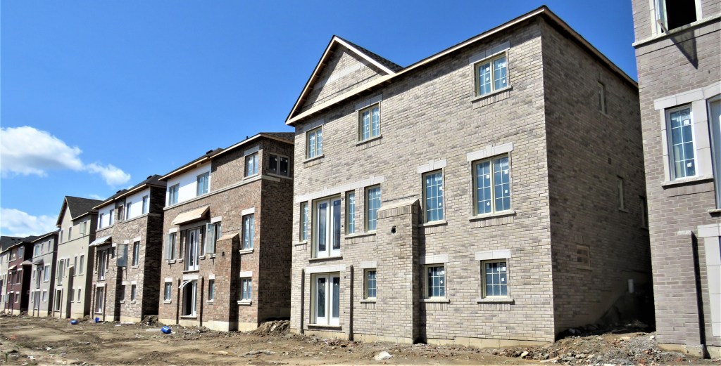
368. You can trace the transformation of this area on Google Street View from 2007 to the present. This is the largest new housing development on the upper edge of the Escarpment along the entire Bruce Trail. Although a narrow band of forest remains through which the Bruce Trail passes, one can only speculate about the ecological impact of this development on the Escarpment only a few hundred metres away.
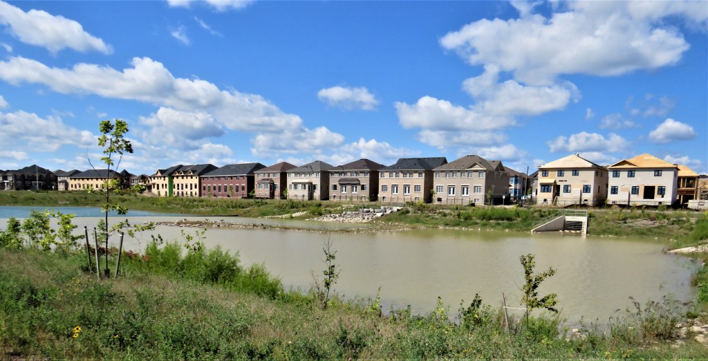
369. There’s a large stormwater pond on this side of the development too. Where does all that water end up, one wonders?

370. The Waterdown water tower looms over half-finished Mountainview Heights.
The greatest danger to the Niagara Escarpment World Biosphere Reserve these days is unrestrained suburbanization of the Mountain brow.

371. As we descend again towards Mill Street, what’s that animal on the edge of the lawn to the left of that single tree?
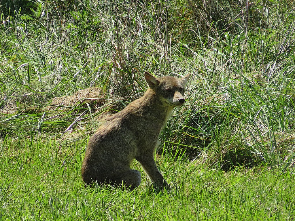
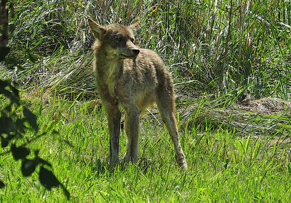
It’s a young coyote, enjoying the sunshine. A memorable end to the HOLO Loop.
Many thanks for following!
