From Hutch’s on the Beach to Queenston Road
Date: 18 July 2021
Start Point: Hutch’s on the Beach, Van Wagner’s Beach Road, Hamilton
End Point: Red Hill Valley Trail at Queenston Road, Hamilton
Distance Covered: 4.1 km
Total Distance Covered: 17.7 km
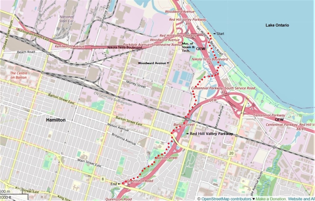
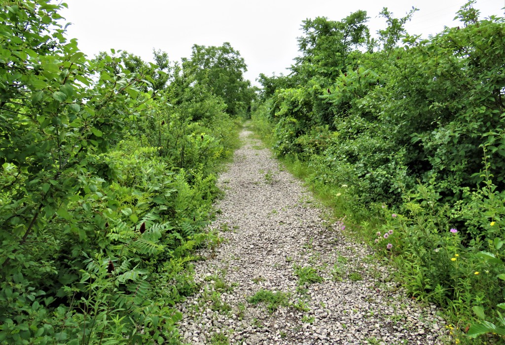
54. This hike takes us from the Waterfront Trail at Hutch’s, over the QEW, and then southwest up the Red Hill Valley Trail (RHVT) as far as Queenston Road (Highway 8). The RHVT follows Red Hill Creek, a small river that descends the Mountain (the Niagara Escarpment), runs through a wooded valley, passes through wetlands on the Harbour side of the Beach Strip, and empties into Windermere Basin in Hamilton Harbour. Once you cross the QEW, the RHVT is always within sound, and often within sight, of the Red Hill Valley Parkway, a freeway connecting the QEW with the Lincoln Alexander Parkway, thus forming the eastern section of the Hamilton ring road. The lower half of the RHVT (i.e., before it starts to ascend the Escarpment) is somewhat similar to the Lower Don Recreation Trail in Toronto: there is heavy traffic often only a few metres away, though in summer it’s usually hidden by vegetation. The main RHVT crosses Red Hill Creek several times and has many junctions with side trails, most of which are not waymarked. So it’s useful to remember that if you’re headed towards the Mountain, you must always keep the Parkway on your left.
At the start there is ample free parking near Hutch’s, and at the end there is a small free parking lot on the south side of Queenston Road specifically for the RHVT. There is no satisfactory loop for return hikers, unless you don’t mind walking on suburban roads: better to retrace your steps. If you’re tired you can take the #11 bus, which plies between Parkdale Avenue South at Queenston Road and Beach Boulevard.
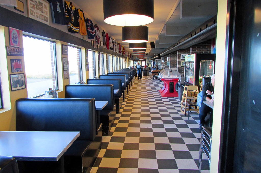

55. Hutch’s was founded by Bill Hutchinson Sr. in 1946 as Hutch’s Dingley Dell. If you didn’t take the opportunity to sample their offerings on the last hike, don’t miss out this time around. Nothing exotic on the menu: they specialize in fish and chips, hamburgers, hot dogs, and ice cream, but what they do, they do well. The Lake side of Hutch’s (top image) is bland and functional, giving little hint of a restaurant devoted to 1950s nostalgia. The interior booths (middle) each has a (non-functioning) mini juke box, there are working pinball and table hockey machines, and the walls are covered with local sports memorabilia. There’s a “Bill Reynolds Memorial Washroom,” a tongue-in-cheek tribute to a local toilet paper salesman. And there are murals on the front of the restaurant by Norman R. Fournier. The original restaurant building, depicted in the mural (bottom), was demolished in the late 1980s and the new location, a converted snack bar and washroom, opened in 1990 a few hundred metres to the west.
Hutch’s is open all year round, except for 25 and 26 December and 1 January … but is occasionally closed for special events, as recently when an episode of The Handmaid’s Tale was filmed there!

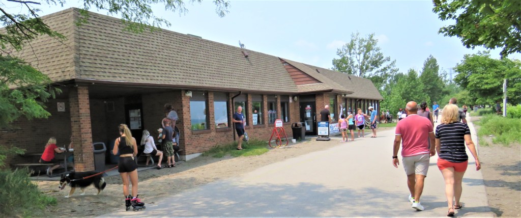
56. Van Wagner’s Beach near Hutch’s is a place for varying forms of play and display, and there is usually a captive audience in and around Hutch’s. You can try to relax on the beach itself …
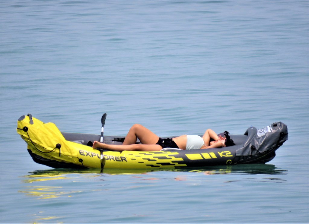
57. … or on the water …

58. … though swimming can be hazardous, as offshore is often commandeered by the operators of noisy, powerful personal watercraft.


59. The Hamilton Globe is about 30 metres tall and 24 metres in diameter. It stands on the grounds of the Woodward Avenue Wastewater Treatment Plant and is partly visible (top image) both to hikers on the Waterfront Trail and to the 130,000 drivers who pass it on the QEW each day. It’s actually a spherical steel tank storing methane gas, a byproduct of wastewater sludge. Since 2006, it’s been hooked up to a cogeneration unit that turns methane into electricity, which is then sold to Ontario Power. The tank was constructed in 1970 and was given a new $4,400,000 paint job in 2017. Whoever repainted it gave Hamilton a very prominent place on the globe: apparently the city now occupies not only all the Golden Horseshoe but also the entire east end of Lake Erie. Once you’re on the RHVT the whole orb of Planet Hamilton becomes visible (bottom), but it’s the less interesting B-side, taken up largely by the Pacific Ocean.
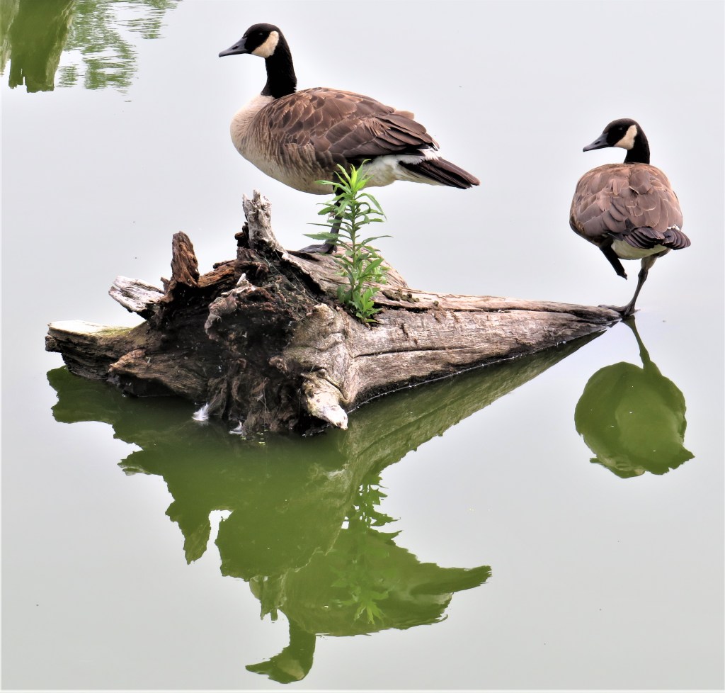
60. Let’s take a shortcut to the RHVT via a narrow stony trail (top) separating the two Van Wagner Ponds. Between gaps in the foliage you might glimpse this sort of statuesque avian composition (bottom).
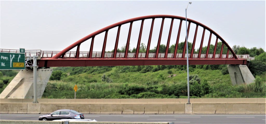
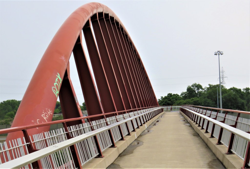
61. We join the RHVT near the east end of this bridge, the official name of which is the East Hamilton Waterfront Link. Designed by engineering consultants McCormick Rankin (MRC), it’s 220 metres long with an 80 metre main span (top image) in the form of a single inclined rib steel tied arch. Opened in 2011, it spans Red Hill Creek, its associated wetlands, and the QEW. Reserved for pedestrians and cyclists (bottom), it is the essential link between the Ontario Lakefront and the Bruce Trail system. Without it, this part of the HOLO loop would not have been nearly so neat and appealing. However, one has to remember that access to the Red Hill Valley from the waterfront was blocked not by nature (Red Hill Creek is only a few metres across) but by the hand of man, in the shape of the twelve-lane QEW, while the Red Hill Valley Parkway, opened in 2007, further inhibited access to the Valley from the east. It cost $14,000,000 to remedy this situation. Painted in fireweed red, the same shade as San Francisco’s Golden Gate, the bridge is intended to evoke the red, iron-rich earth of the Red Hill Valley. “It makes a valuable contribution to Hamilton’s public realm, representing a true integration of structure, architecture and landscape coming together to provide a strong sense of place and civic pride,” as MRC put it. Civic pride might have been greater if the bridge had been made here in Steeltown, but, almost incredibly, the steel was fabricated in Japan, assembled 1,856 km away in Dartmouth, Nova Scotia, and then giant pieces of bridge were trucked here with police escorts.
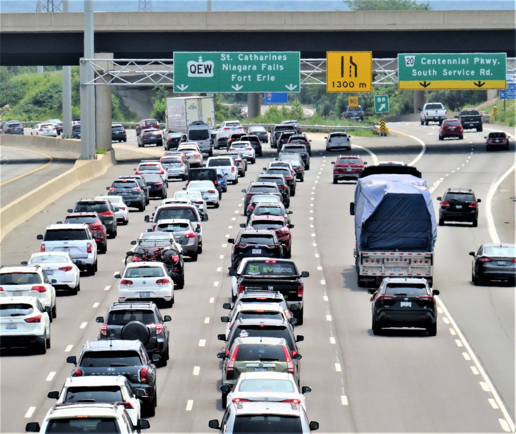
62. The View from the Bridge #1: heavy traffic heads east along the QEW in the direction of Niagara Falls.


63. The View from the Bridge #2A & 2B. (Top) Red Hill Creek and some of its wetlands. (Bottom) A great blue heron stands in Red Hill Creek unfazed by twelve lanes of traffic speeding by only a few metres away.
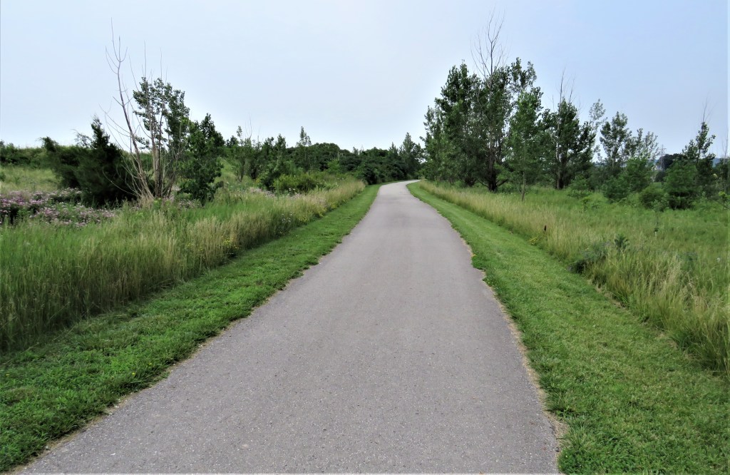
64. The Trail through this low-lying marshy section of the Valley is broad and well paved …

65. … and in midsummer wildflowers bloom at the wayside, including these showy native wild bergamots (Monarda fistulosa).

66. The six-lane Red Hill Valley Parkway just before its junction with the QEW, as seen from the RHVT. The construction of this (mainly four-lane) highway was mired in controversy, which continues even today. The City of Hamilton sued the Federal Government to avoid an environmental assessment of the project. Friends of the Red Hill Valley wanted the project cancelled for environmental reasons, as 14,000 trees had to be removed and the Creek itself rerouted. The Haudenosaunee people had inhabited the Red Hill Valley for millennia, as evidenced by copious archaeological remains—arrowheads, stone and bone tools, pottery, tobacco pipes—dug up during construction. The Six Nations Confederacy sued Hamilton and allied with the Friends to physically block construction, with protestors squatting in trees. The City then countersued the protestors. The construction of the Parkway from 2004-07 plunged Hamilton into debt, and the highway itself, built on a flood plain north of King Street, then steep and winding as it ascends the Mountain, became notorious for flooding, slippery conditions, and crashes. A 2013 report by the City’s Public Works Department detailing the Parkway’s problematic surface failed to be made public for five years. There is no doubt that the Parkway is now well used, but it has also brought significant air and noise pollution to the area. On the other hand, the RHVT probably came into existence as a kind of consolation for those who had unsuccessfully opposed the Parkway.

67. Skyview Redhill Tower, a residential high-rise on Melvin Avenue in Hamilton’s east end, its roof bristling with cell phone antennas, looms as the RHVT runs through Hillcrest Park.

68. The eastern American black walnut tree (Juglans nigra) is native to North America. Pictured is a cluster of three of its not-yet-ripe fruit hanging low by the Trail. Black walnut trees are increasingly abundant at the Head of the Lake, as epidemics have reduced competing species such as ash, chestnut, butternut, hemlock, dogwood, oak, and elm. The nuts feed many creatures including squirrels, deer, and birds, and humans find them delicious. So why isn’t there a black walnut industry? There is, but it’s much smaller than expected: the walnuts you find in most stores are usually the English variety, and black walnuts in specialty stores are likely to be expensive, e.g., $20 plus for a pound. Why? The hull surrounding the black walnut shell, and the very thick nutshell itself, make it difficult to extract the edible kernel without damaging it. Regular nutcrackers just aren’t up to the task. So if you fancy your hand at black walnut gathering, wait till the fall, wear a hard hat if you plan to shake the tree as dropping fruit are hard and heavy, wear work gloves and old clothes or the hulls will leave your fingers and clothing with permanent brown stains, and crack open the shells with a hammer while wearing safety goggles. (Now you see why the things are so expensive.)
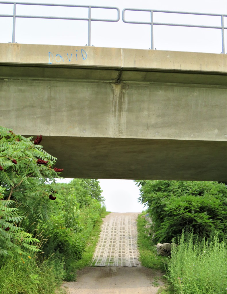
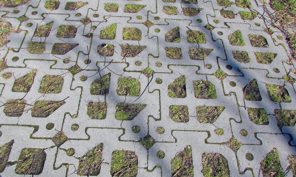
69. (Top image) Some steep sections of the lower RHVT, like this one under a CN rail bridge, are laid with concrete grass-block pavers—a.k.a. grow-through pavers—with (bottom) open cells that allow vegetation to … grow through them. This sort of paving is expensive, but is appropriate in places where it’s necessary to reduce stormwater runoff and recharge groundwater. These sections of the RHVT might otherwise turn into hazardous sheets of ice in wintertime.

70. Here at the Queenston Road endpoint are signs for the HamBur (i.e., Hamilton/Burlington) Loop. This is an established loop trail for cyclists that covers some of the same ground as our HOLO loop, at least in its north and eastern sections. But the Bruce Trail is off limits to cyclists, so the HamBur Loop avoids the Dundas Valley and takes rail trails along the Escarpment and roads along the north shore of Hamilton Harbour. It’s a mere 48.2 km long, thus 25.0 km shorter than the HOLO loop.
On the next leg we’ll scale almost the full height of the Escarpment!
Side Trip
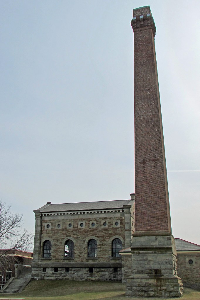
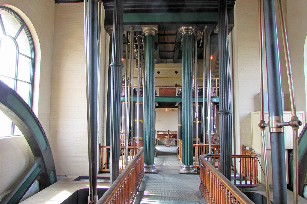
71. Anyone with the least interest in industrial history should visit Hamilton Museum of Steam and Technology at 900 Woodward Avenue, only a three-minute drive from Hutch’s. A National Historic Site, it preserves what was a coal-fired, steam-powered waterworks built in 1859 to pump water from Lake Ontario to serve Hamilton. (A deadly cholera epidemic in 1854 had brought home the urgent local need for clean drinking water.) Its enginehouse contains two massive walking beam engines, the oldest Canadian-built ones still in their original location. They were made by the Gartshore Foundry in Dundas.
(Top image) The stone enginehouse and towering 46 metre chimney, the latter to disperse the coal smoke.
(Bottom) The engine deck, with two fluted iron columns holding up the beam deck, and parts of the two huge iron flywheels.
The Museum is open year round, Tuesdays through Sundays, 10:00 am-4:00 pm, with varying admission fees.
For more images and commentary from the Red Hill Valley, please click here.
