From the Brant Museum to Hutch’s on the Beach
Date: 15 July 2021
Start Point: Joseph Brant Museum, North Shore Boulevard, Burlington
End Point: Hutch’s on the Beach, Van Wagner’s Beach Road, Hamilton
Distance Covered: 7.7 km
Total Distance Covered: 13.6 km

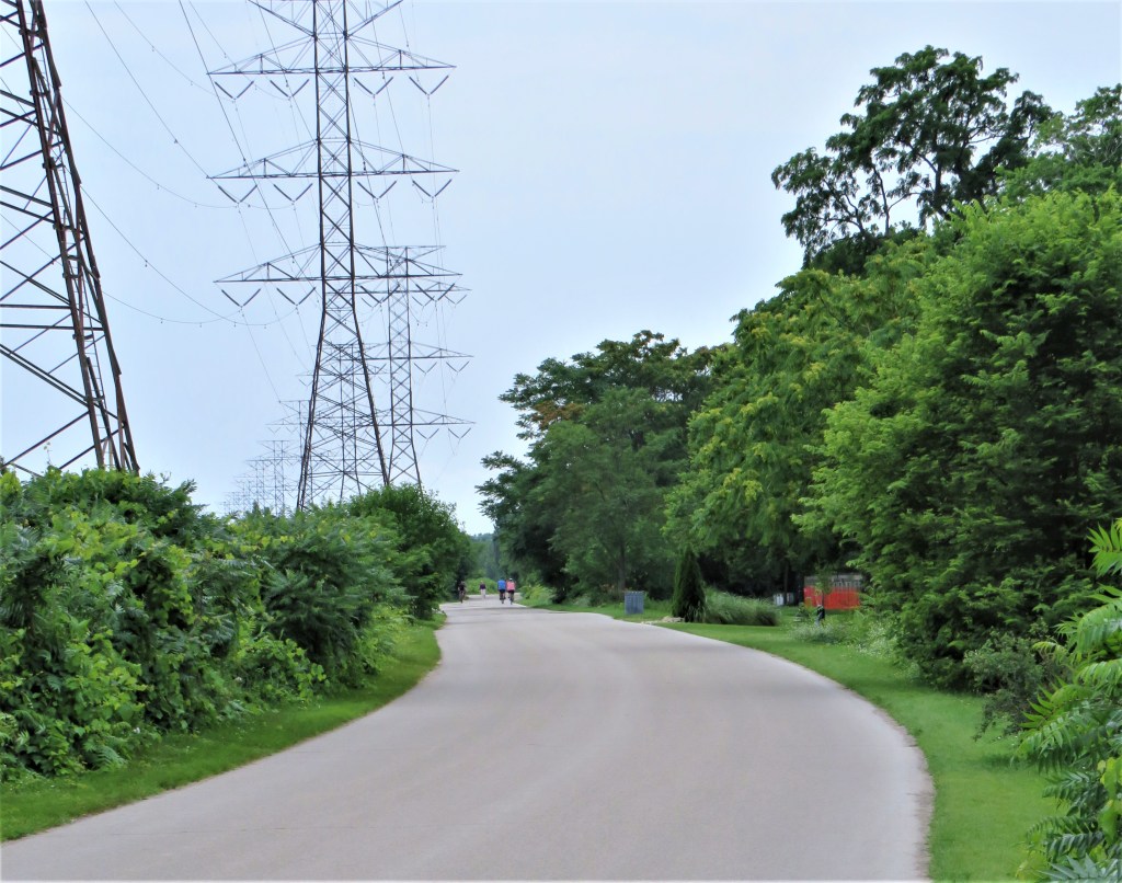
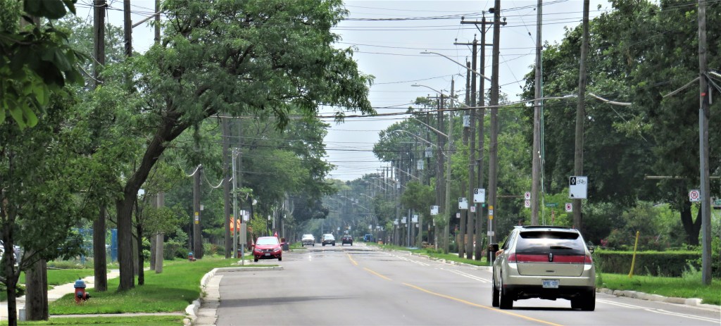
20. The next hike is on what we shall call for simplicity’s sake the Waterfront Trail, though sections of it have various alternative names. It’s an easy, off-road, level, paved pathway along the Beach Strip, it’s full of interest at every time of year, and at 7.7 km, it can be done all in one go, or in two stages if you prefer. Near the start point there is free parking on weekdays in several lots on the east side of Lakeshore Road. At the end point there are large free lots on Van Wagner’s Beach Road. The #11 bus runs in both directions along almost the entire Beach Strip from Lakeshore Road in Burlington to Woodward Drive in Hamilton, making it easy to avoid having to hike the double distance.
The Burlington Beach Strip
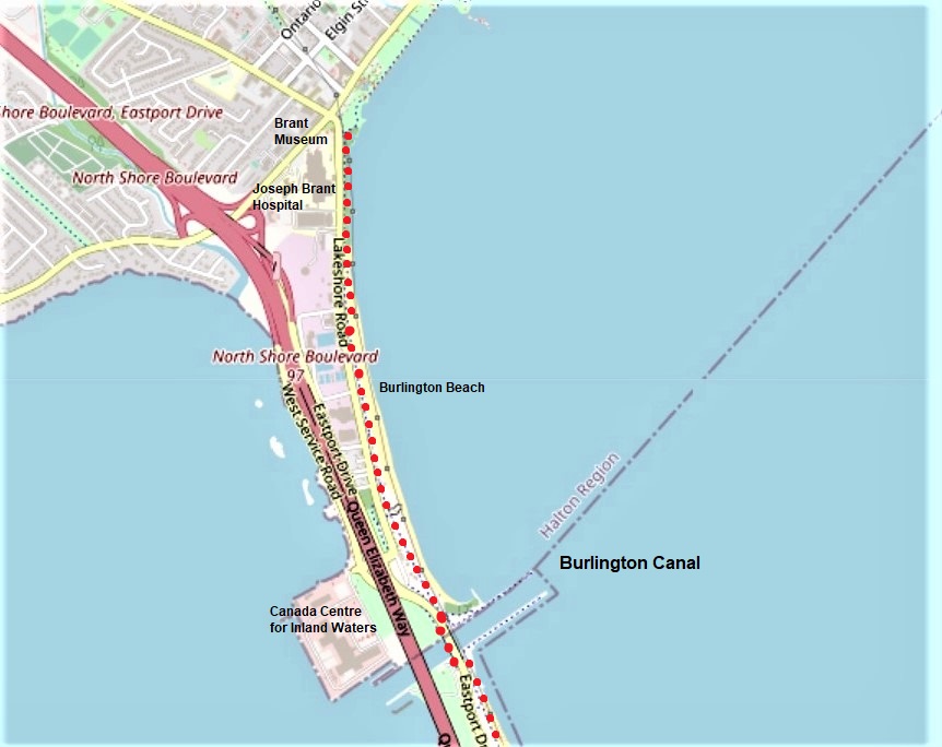
21. The Burlington Canal is the boundary between Halton Region (which includes Burlington) and the City of Hamilton. The map above focuses on the northern, Burlington part of the Beach Strip. This is only about 300 metres wide at its narrowest point, but it carries, west to east: the eight lanes of the QEW on the Skyway; a section of four-lane Eastport Drive and two-lane Lakeshore Road, which meet near the Lift Bridge over the Canal; the Waterfront Trail (our route, marked in red dots); and Burlington Beach on Lake Ontario, dominated by a line of giant transmission towers.

22. If you’re looking for the head of Lake Ontario itself (not including Hamilton Harbour or Cootes Paradise), then this is it: a tiny, secluded cove across Lakeshore Road from the Brant Museum. You’ll have only a duck or two for company.
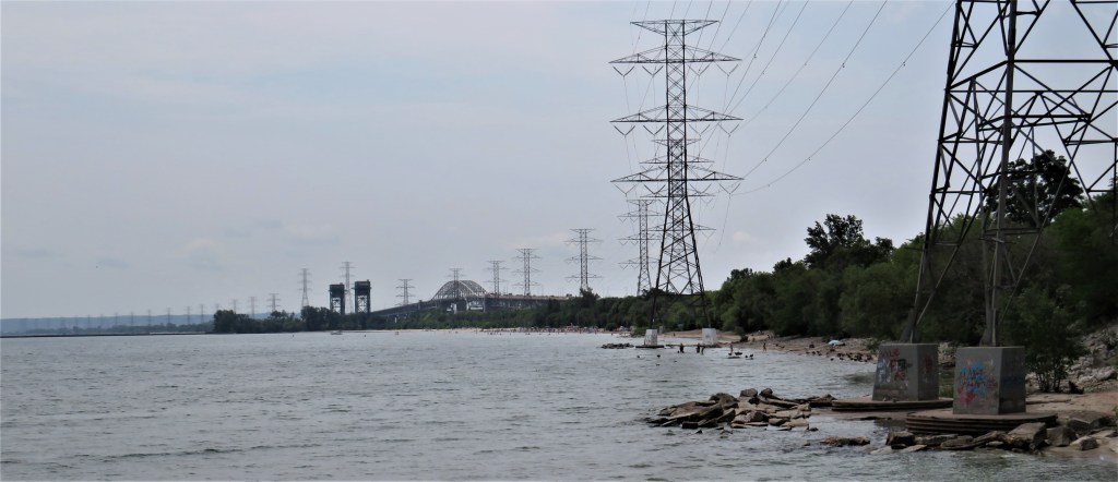
23. And this is the view south over the western end of the Lake. The two distant towers to the left of the Skyway arch are the piers of the lift bridge (see #31 below) that carries Eastport Drive, and our trail, over the Burlington Canal. When the water level of the Lake rises, as it does fairly often during storm surges, the concrete feet of the transmission towers are sometimes completely submerged …

24. … and the rising of the Lake during storm surges has given rise to a popular historical legend, associated with this very spot, that goes by the name of the “Burlington Races.” Before the Burlington Canal 2 km south of here was opened up, there was a shallow natural channel known as the “Old Outlet” through the Beach Strip. (It has long since been filled in.) On 28 September 1813, during the War of 1812, a small British fleet of six ships under Sir James Yeo was confronted off York (now Toronto) by a larger American one of ten vessels under Commodore Isaac Chauncey. To those watching from a distance on shore, the jockeying for position among the two fleets looked like a sailboat regatta, hence the “Burlington Races.” The British flagship, HMS Wolfe, was severely damaged in the encounter, but Yeo was able to save his fleet by a clever defensive manoeuvre involving a retreat to “a small bay at the head of the lake,” as he put it in his report. Over the course of time, the manoeuvre was romanticized: Yeo is supposed to have taken advantage of a storm surge to sail the Wolfe from the Lake through the normally four-foot-deep Old Outlet into the safety of what is now Hamilton Harbour, where the Americans could not follow him, and thus “win the race.” Historians now agree that this last action simply never happened. The information board above gives a more historically accurate account of Yeo’s “Springs on the Cable” manoeuvre close to the shore of the main Lake, probably in the vicinity of Bronte harbour about 12 km northeast of here. But of course that’s not such a good story. For a full account, see Robert J. Williamson, “The Burlington Races Revisited: A Revised Analysis of an 1813 Naval Battle for Supremacy on Lake Ontario,” in Canadian Military History 8.4 (1999).

25. This yellow-and-orange wayside wildflower blooming on the edge of the trail in mid-July is common toadflax (Linaria vulgaris, a.k.a. butter-and-eggs), a European import now common on disturbed land in North America. As you see, it’s a favourite of bees, who pollinate it.
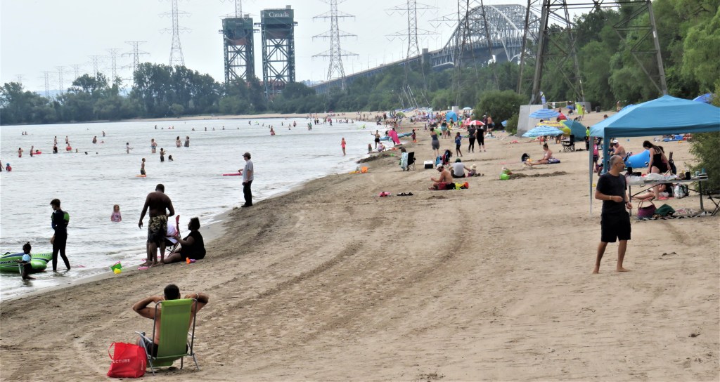
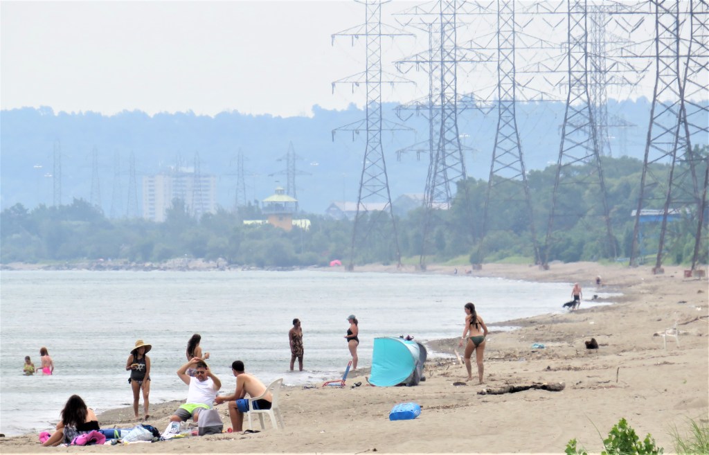
26. You wouldn’t mistake Burlington Beach for Bondi or Ipanema, but the sand here is fine and the water seems clear, and on a hot day, there’s fun for all, regardless of age, on Lake or on shore. Yet only a thin strip of land separates this beach from the waters of Hamilton Harbour which, thanks to the heavy industry on its south shore, are among the most polluted in Canada.


27. “Like breathed-on glass
The sunlight has turned milky. If the worst
Of flawless weather is our falling short,
It may be that through habit these do best,
Coming to the water clumsily undressed
Yearly; teaching their children by a sort
Of clowning ….”
from Philip Larkin (1922-85), “To the Sea” (1970).
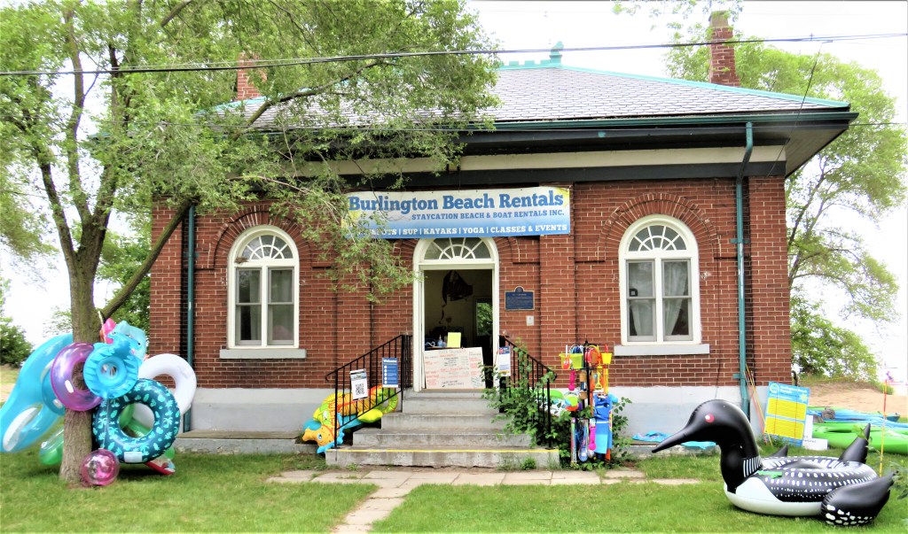
28. A pumphouse that from 1910-36 delivered filtered water to Burlington residents is now a “staycation” rental outlet, where you can rent a kayak or a giant inflatable ring in the shape of a loon.
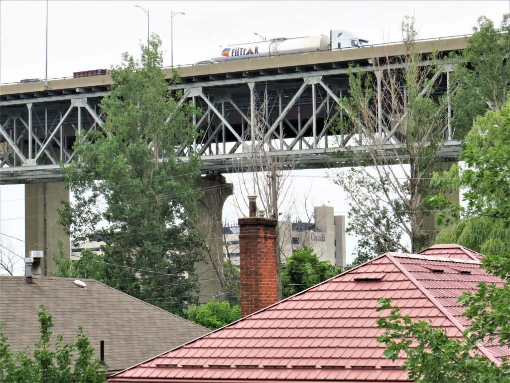
29. There are still a few private residences on the Burlington Beach Strip, though there is a plan for the remaining homes in Beachway Park to be eventually demolished and their sites turned to parkland. It cannot be pleasant having to endure the noise from the eight lanes of traffic roaring along the Skyway over your roof. The large grey building glimpsed between the piers of the Skyway is the Canada Centre for Inland Waters (CCIW), a major federal hydrological research institute on the Hamilton Harbour side of the Beach Strip.

30. The north pier of the Burlington Canal Lift Bridge looms over the trail.

31. The Lift Bridge was opened in 1962, and is the latest and mightiest of the various bridges, starting with a wooden one in 1826, that have straddled the Burlington Canal. The current span that’s lifted vertically is 116 metres long, 19.8 metres wide, and has a maximum clearance when raised of 36.6 metres. When arriving from the Waterfront Trail as a pedestrian, you go through a subway under the bridge then turn right and climb steps to the level of Eastport Drive to access the walkway over the bridge, which is on the Harbour side. Once across, descend the stairs and go via another subway under the bridge again back to the Lake side, where the Waterfront Trail continues. If the traffic signal turns red, a horn sounds, and the striped red and white barriers close, then the bridge is about to lift to accommodate a vessel more than 5 metres tall and you (and all other traffic) must wait patiently for it to descend and reopen. The sight of the roadway being lifting slowly and almost silently is awesome and worth the wait.

32. This is the view of the Lake end of the Burlington Canal from the Lift Bridge. A 30-foot/9.1 metre-wide canal was first cut through the Beach Strip in 1826. It was widened in 1830, widened and deepened further in 1909, widened to 300 feet/91 metres in 1929, and gradually deepened by dredging to 25 feet/7.6 metres by 1943 to accommodate much larger ships. There has been a small lighthouse at the end of the southeastern pier since 1856, though the one now standing dates from 1939.
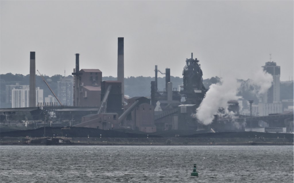

33. The Lift Bridge walkway also allows partial views of the south shore of the Harbour. Hamilton, nicknamed “Steel City” or, more recently, “The Hammer” (pop. about 550,000), is the most heavily industrialized city in Canada. The steel mills are a massive blot on the landscape, though they are grimly impressive in their scale.
Intermission: Two Short Detours

34. If you’re a serious photographer, like the pair above, and want to capture the dramatic heavy-metal scene across the Harbour, you should walk to the far end of the Canal’s southwestern pier to get the best shots.
35. As you do so, you pass right under the Skyway, which from this perspective resolves itself distinctly into two bridges, the one on the left being the more recent construction.

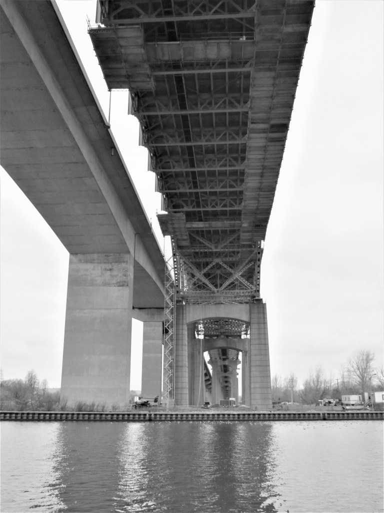
36. To get a good comparative shot of both the Lift Bridge (foreground) and the Skyway, you’ll need to walk some distance toward the Lake end of the northeastern pier of the Canal, then turn around. The last three photographs were taken in midwinter, which seems to provide the best light in which to capture these titanic structures.
The Hamilton Beach Strip
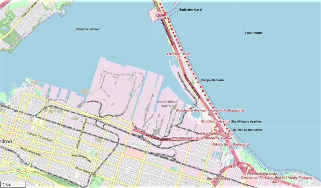
37. The red dots on this map, continuing from #21 above, show the rest of the hike along the Hamilton Beach Strip.

38. Now we’re on the Hamilton side of the Canal. The stone structure first glimpsed on the right in #31 above is the Burlington Canal Main Lighthouse, 55 feet/17 metres high, and built of fireproof dolomite in 1858. An earlier wooden lighthouse had burned down after having been set on fire by sparks from a passing steamer’s smokestack. The lighthouse was decommissioned in 1961 and currently stands empty. The Beach Canal Lighthouse Group aim to raise enough funds both to preserve it and make it publicly accessible, though this will apparently involve moving it from its current location.


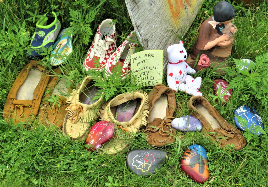
39. Unlike its Burlington counterpart, much of the Hamilton Beach Strip is bordered directly and at grade by the back yards of private dwellings. This area has long been a haven for free spirits who don’t mind the lack of privacy, noise from the QEW, and flooded basements. And if Hamilton Beach Strip dwellers have a message for the public, then their back yards are good places to disseminate it from, as hundreds pass by daily on the Waterfront Trail at most times of the year. The words on the flag refer to the recent disturbing revelations of children’s unmarked mass graves around former Canadian residential schools. These schools were set up supposedly to encourage assimilation of Indigenous children into white society, but have become a byword for appalling child abuse. Empty pairs of shoes are a potent symbol of these lost First Nations children.

40. A song sparrow perches on a staghorn sumac panicle in a Beach Strip back yard. The Hamilton area is “one of the best overall birding regions in Ontario. … The shorelines of the Lake and Hamilton Harbour form a natural ‘funnel’ that defines the movements of birds through the area during migration”: Robert Z. Dobos, “Birding Hotspots in Hamilton and Surrounding Areas, “ in Robert Curry, Birds of Hamilton and Surrounding Areas (Hamilton, ON: Hamilton Naturalists’ Club, 2006), p. 37. The Beach Strip is a premier seabird-watching spot, but also a magnet for birds that frequent backyard feeders. And as it passes so many back yards, the Waterfront Trail is a great place to observe these birds at close quarters.
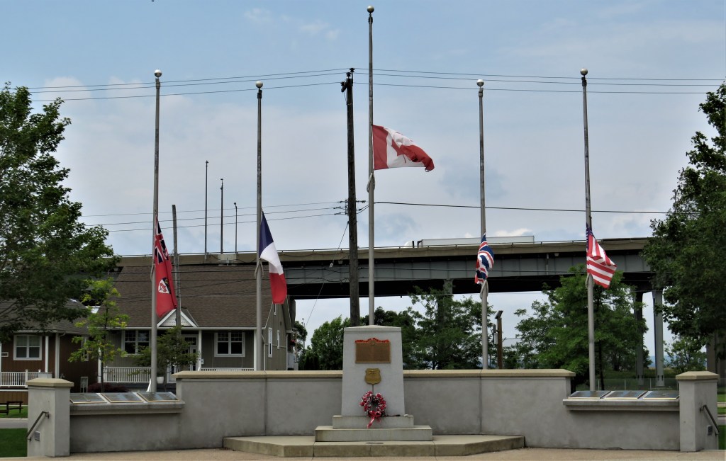

41. Flags fly at half-mast at Dieppe Veteran’s Memorial Park. The Park commemorates soldiers from the Royal Hamilton Light Infantry (RHLI) who fell during Operation Jubilee, namely the failed Allied attempt to capture the French coastal town of Dieppe on 19 August 1942 during World War II. The poorly-conceived amphibious assault against heavily-fortified German positions on cliffs above the town was undertaken chiefly by soldiers from the 2nd Canadian Infantry Division, who had been told that the operation would be a “piece of cake.” The RHLI at Dieppe consisted of 582 soldiers, of whom 197 were killed, 194 wounded, and 174 taken prisoner. The total Canadian toll at Dieppe was 907 soldiers dead, 2,460 wounded, and 1,946 taken prisoner, all in about ten hours. Many historians note, however, that important lessons were learnt by the Allies from the debacle, and implemented to good effect during the Normandy landings of June 1944. Notably, there should be better preliminary intelligence about enemy defences; the time and location of the landings should be a complete surprise to the enemy; and there should be overwhelming support from both air and sea for the soldiers landing on the beaches.

42. So, what’s the origin of the Waterfront Trail? The story begins in the mid-19th century, when Hamilton and Toronto were in competition to be the hub of the southern Ontario rail network. Toronto was fated to win, as Hamilton’s location, boxed in by the Niagara Escarpment and the waters at the Head of the Lake, did not conduce to cheap and easy railroad construction. However, Hamilton gave it a good shot. The Hamilton and Northwestern Railway (HNWR) ran the first line along the Beach Strip from 1876, one that was extended north to Collingwood and Barrie by 1879, and later connected with the Hamilton and Lake Erie Railway (HLER) that went south to Port Dover. These lines were taken over by the Grand Trunk Railway (GTR) in 1888, and later still by Canadian National Railway (CNR) in 1923. This line was abandoned and torn up in 1982. Then there was the Hamilton Radial Electric Railway (HRER) which ran from central Hamilton to the Beach Strip from 1896, making access to the beaches easy, so they became a popular resort in the summertime. The HRER, which ran parallel to and west of the CNR line on the Beach Strip, was eventually extended to Burlington and Oakville. It was one of four such electric lines from Hamilton: the others ran to Dundas, Brantford, and Beamsville. The powerhouse for the Beach Strip HRER line was at its northern end, and the photo above was taken ca. 1898 from its chimney looking south. By the late 1920s all the Hamilton electric radial lines were abandoned, killed by the rise of the automobile. The Waterfront Trail along the beach strip follows the course of the former HNWR/GTR/CNR line.
43. It’s a hot day but this part of Hamilton Beach is sparsely populated.
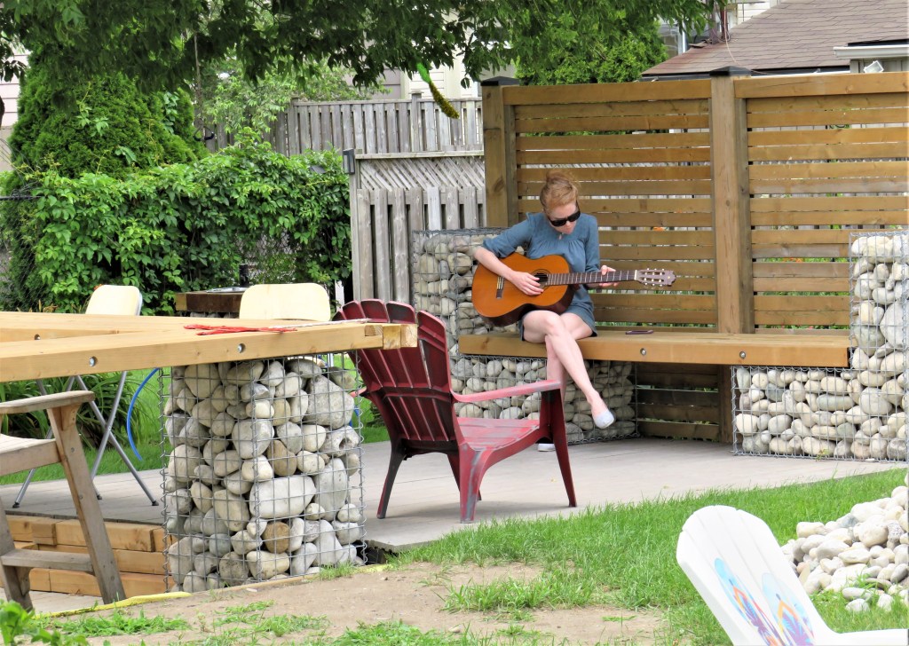
44. Hamilton Beach Strip back yards are potential stages from which to serenade passing hikers.
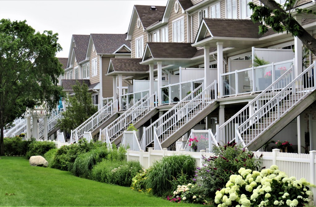
45. The Hamilton Beach Strip is becoming a popular place to live these days, as indicated by these new townhouses. Apparently, recently built homes on the Strip never have flooded basements … because they’re built without them!
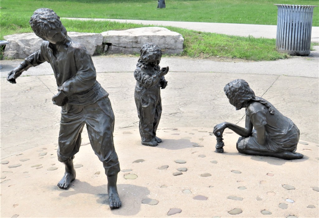
46. At the intersection of Beach Boulevard and Van Wagner’s Beach Road, the group sculpture “Pebbles on the Beach” (2003) by Janus is intended to evoke childhood memories of playing at the water’s edge. The #11 bus stop for the return to Burlington is on Beach Boulevard near here.

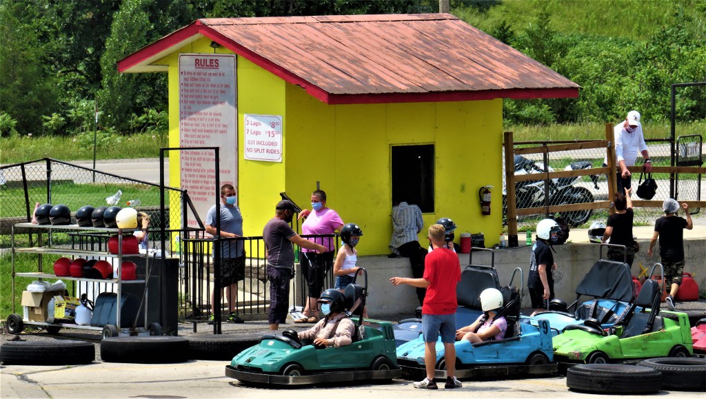

47. As the signs (top) indicate, there are still a number of popular attractions on Hamilton Beach, including a go-kart circuit (middle). But nothing today compares with the Beach Strip in its heyday, as a black and white photograph on a “The Way We Were” information board shows. The cable car run was known as the Skyliner, here passing enormous Lakeland Pool.

Pen and ink drawing (1910) by Owen Staples (1866-1949) based on a ca. 1795 drawing by Elizabeth Simcoe, wife of the Lieutenant Governor, who visited the Inn in that year.
Image Courtesy of Toronto Public Library.
48. Near our end point at Hutch’s is a plaque by the Trail. Headed GOVERNMENT HOUSE (KING’S HEAD INN), it reads in part: “In 1794, with Europe caught in the turmoil of the French Revolution and the talk of war with the United States widespread, Lieutenant Governor John Graves Simcoe found the frontiers of Upper Canada seriously isolated and threatened by the young American republic to the south. In response, he immediately set out to link the far-reaching corners of the colony of Upper Canada. Here, at the head of Lake Ontario where trails converged from York (Toronto), Niagara, and the Thames Valley in the west, Simcoe built a government house, later called the King’s Head Inn. The Inn’s strategic site was located at the ‘Carrying Place’ or Indian portage between Lake Ontario and the mouth of the Red Hill Creek within fifty meters of this plaque. Described as a large two-storey, eight room, wooden structure with two low wings at the rear joined by a colonnade, the Inn was the first government building in this area, It also served as a public house and way station.”
Actually, it seems that “King’s Head Inn” was the building’s first name, and it only came to be known as “Government House” because it was also used to store military supplies as well as a place to officially compensate First Nations for use of the Beach Strip. During the War of 1812, the King’s Head Inn was burned to the ground by the Americans in a commando-style raid from the Lake on or about 11 May 1813. The drawing makes it clear that the King’s Head Inn occupied a very strategic location.

49. On 26 February 1944, Charles R. McCullough wrote in the Hamilton Spectator: “Back in October of last year a group of us visited the site of the King’s Head Inn near the filtering basin at the southern end of the sandstrip. We were the guests of Principal William F. Johnson, of the Beach Bungalow School. Imagine our amazement and satisfaction in being shown in a good state of preservation the sign board that of yore swung before the hospitable door of the old tavern! It somehow had been kept, now stored in a barn, then in a cellar, through the years until the alert Beach historian tracked it down and placed it for safe keeping in his fine school. On one side is a well painted portrait of King George III—King of Great Britain—on the other, in old English text ‘The King’s Head Inn, 1794.’ What a find!” The inn sign is now on display in the Joseph Brant Museum in Burlington.

50. Today’s hike ends at that Hamilton Beach Strip institution, Hutch’s, of which more anon. You’ve earned a refreshment break. Time to don a mask and get in line!
Side Trip

51. If you get tired of the Waterfront Trail, turn right down one of the short streets that connect it to Beach Boulevard (top). Chances are you’ll find some quirky scenes to keep you amused …

52. … like this house. It doesn’t have quite yet the historical aura of its namesake, the 13th-century Schloss Wasserberg in Styria, but give it time …
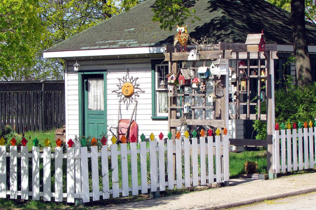
53. … or this cottage, whose gate is covered in bird houses and other eccentric ornaments. A small sign on the gatepost reads: IN 1832 ON THIS SPOT NOTHING HAPPENED.
Please click here for more of my photos and commentary from the Hamilton Beach Strip.
