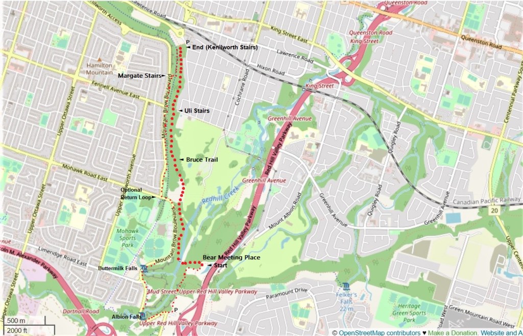
From The Bear Meeting Place to Kenilworth Stairs
Date: 2 August 2021
Start Point: The Bear Meeting Place, Red Hill Valley Trail, Hamilton
End Point: Bruce Trail at Kenilworth Stairs, Hamilton
Distance Covered: 3.5 km*
Total Distance Covered: 26.0 km
*plus 0.8 km from parking lot to start point; 8.3 km total if you take optional round trip.
85. Key to maps above and below:
●●●●●
Hike #5: Bear Meeting Place to Kenilworth Stairs via Bruce Trail (3.5 km)
●●●●●
Access trail from Mud Street parking lot (P) to start point at Bear Meeting Place (0.8 km); optional return via Escarpment Rail Trail, Margate/Uli Stairs, Mountain Brow Boulevard, Mountain Brow Side Trail, Buttermilk Falls and Albion Falls, to Mud Street P (4.0 km).
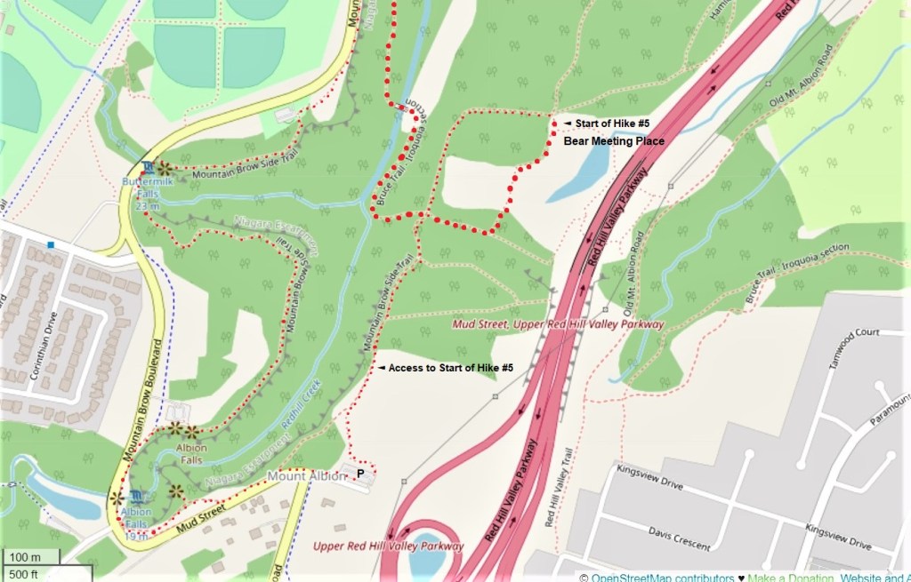
86. A more detailed map of the Mud Street parking lot (P), the 800 metre access trail to the start point of Hike #5, the course of the Bruce Trail from The Bear Meeting Place, and the end of the optional return trip via the Mountain Brow Side Trail and the waterfalls.
You have some decisions to make before today’s hike. If you choose to do the simple linear trail, it’s a mere 3.5 km from The Bear Meeting Place to the Kenilworth Stairs, though you should add on 0.8 km for the access trail from the Mud Street (free) P to the start. At the end point there is free P on Kimberly Drive opposite the foot of the Kenilworth Stairs.
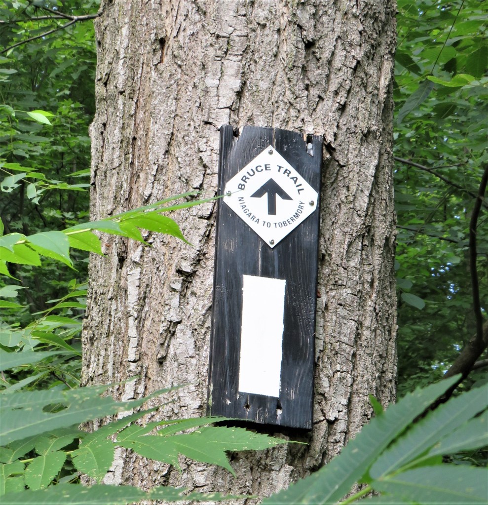
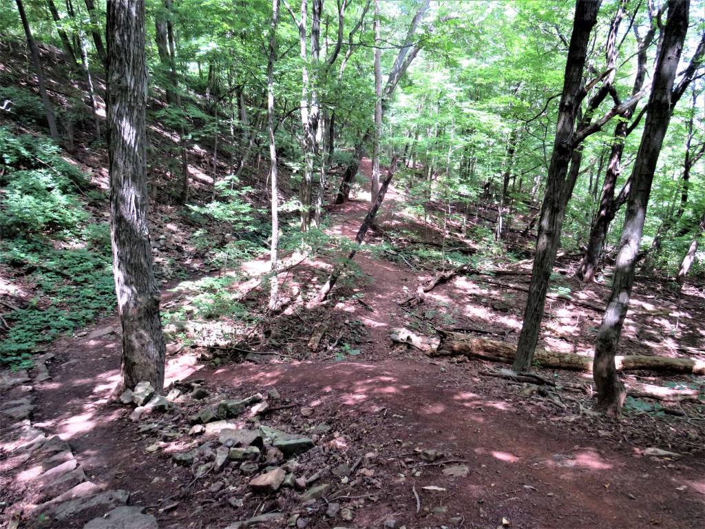
From now on, the HOLO loop will mainly keep to the Bruce Trail, and this famous trail is more challenging than the ones we’ve taken so far. A few sections of the Bruce are paved and level, but you’ll be better prepared for it if you expect a narrow, steep, overgrown path with rocks, roots, and mud, slippery after rain and icy in winter. If you’re unfamiliar with the Bruce, you’ll learn to keep one eye on your feet while the other watches out for the white blazes that keep you on the right track. But there’s a payoff: on the Bruce you are close to nature and the extraordinary landscape of the Niagara Escarpment.
If you are very much up for what I’ve described so far, then you might want to forgo two cars and do a round trip. It’ll be a hike of about 8.3 km in all, but it has several highlights you’ll miss if you stick to the Bruce, including two spectacular waterfalls, Buttermilk and Albion, as well as several viewpoints over Hamilton’s lower city, Lake Ontario and, on a clear day, the distant skyline of Toronto. The suggested return leg is much easier going than the Bruce.
Note: You don’t even have to take one car: HSR Bus #21 (Upper Kenilworth) stops reasonably close to both ends of the hike!
87. From The Bear Meeting Place, follow the white blazes that indicate the course of the Bruce Trail downhill in the opposite direction from the Parkway …
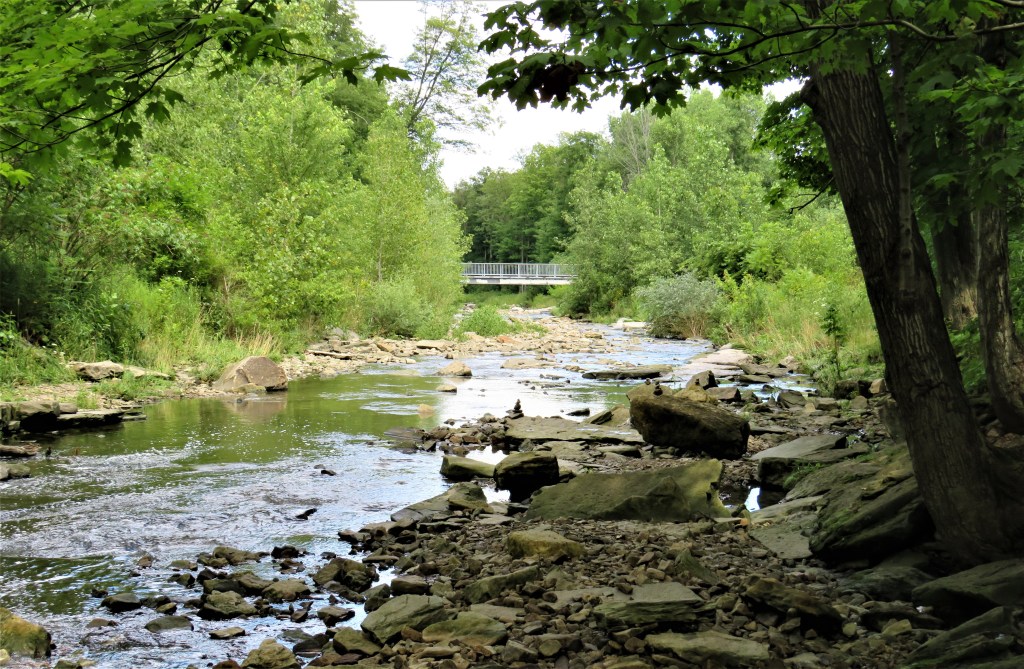
88. … until you get to the east bank of Red Hill Creek, which you cross on that footbridge. On the outward leg of this hike you’ll be heading almost due north.
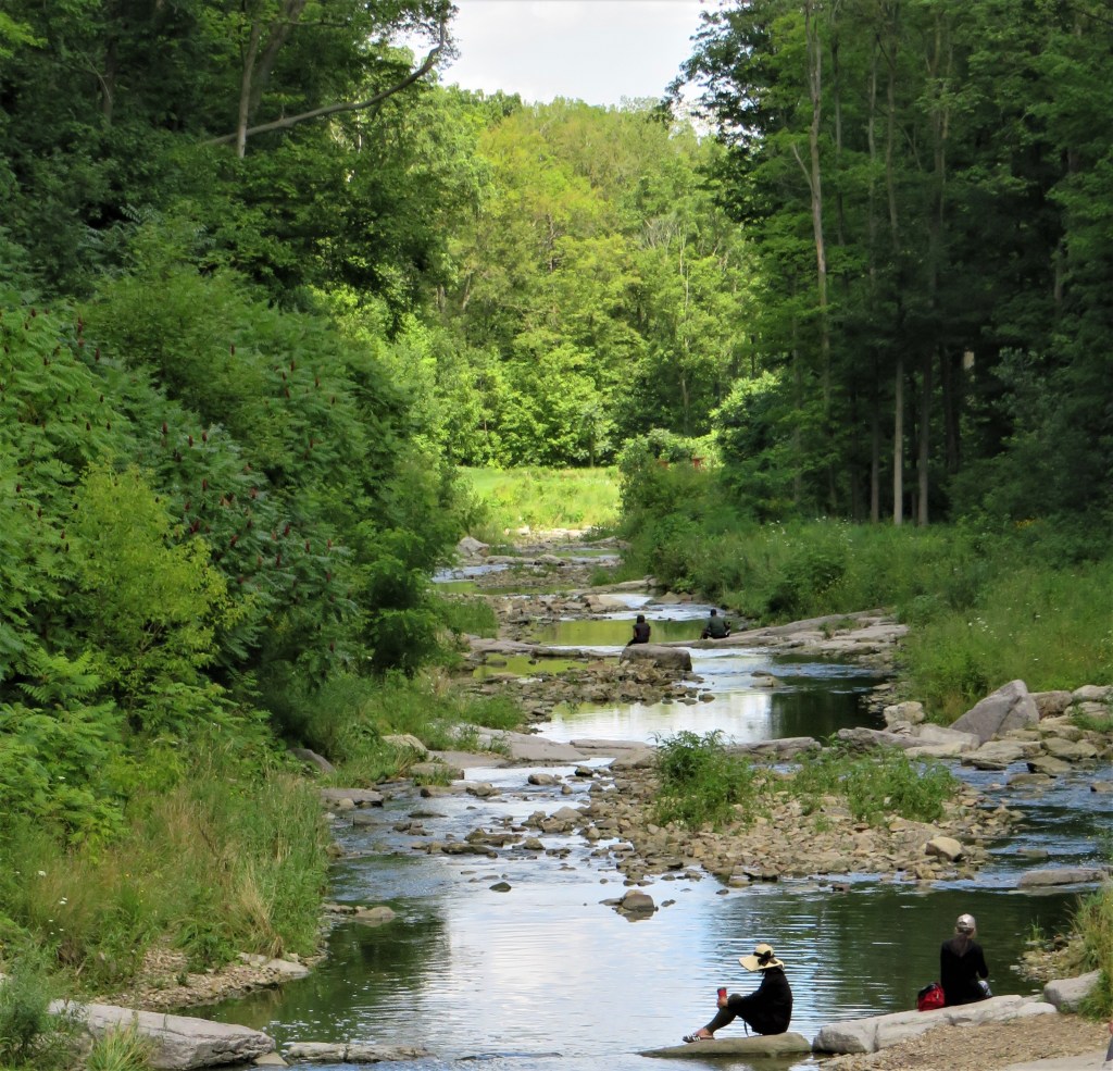
89. This is the view downstream from the bridge. On this hot day in early August, people are enjoying the cooling proximity and calming influence of naturally flowing water. To mark our farewell to Red Hill Creek, here are the last three stanzas of a poem in which the poet, adopting the voice of a rivulet not unlike the one above, places ephemeral human affairs in their true relation to the enduring dance of nature.
“I slip, I slide, I gloom, I glance,
Among my skimming swallows;
I make the netted sunbeam dance
Against my sandy shallows.
“I murmur under moon and stars
In brambly wildernesses;
I linger by my shingly bars;
I loiter round my cresses;
“And out again I curve and flow
To join the brimming river,
For men may come and men may go,
But I go on forever.”
— from “The Brook” (1886) by Alfred, Lord Tennyson
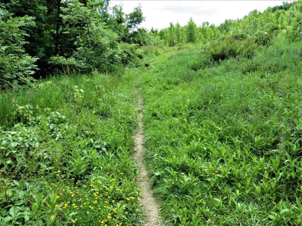
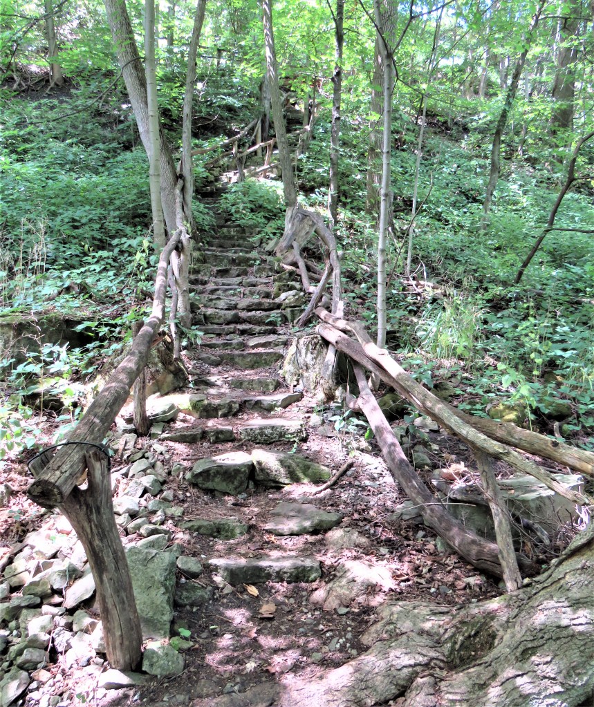
90. This is what the Bruce Trail looks like for much of its length: a tenuous thread that respects the natural contours of the land. So be careful to watch for those white blazes: in less wooded sections like this, they tend not to appear so frequently, as there’s nowhere convenient to put them!
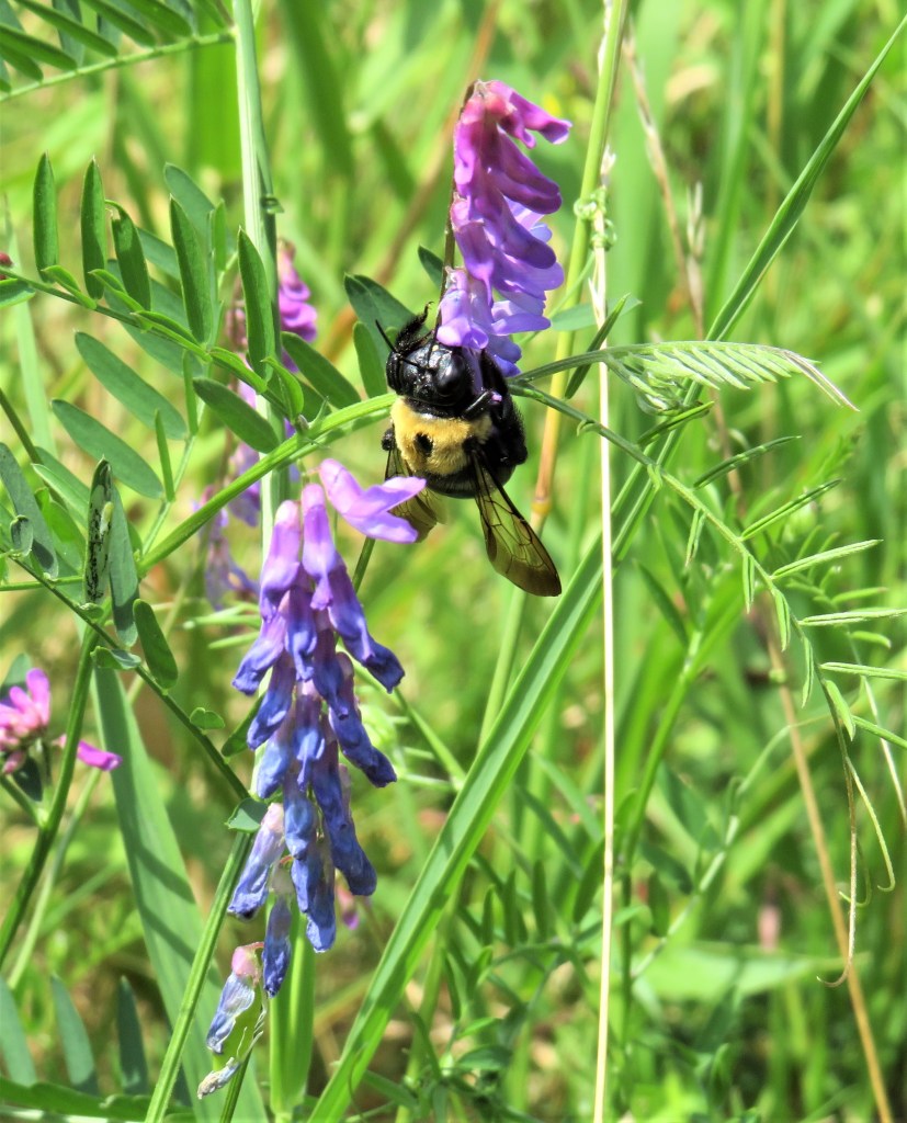
91. A bee gets stuck into this wayside tufted vetch (Vicia cracca). This plant was deliberately imported from the Old World as it provides nutritious forage for cattle, hence its alias: cow vetch. It’s a favourite of bees and butterflies as it produces a sweet nectar. Because all vetches are rich in nitrogen, they can be cut up and used as a fertiliser (“green manure”) for subsequent crops. Vetch even appears in Shakespeare (Tempest, IV.i.) as one of the crops making up a potentially bountiful harvest: “Ceres, most bounteous lady, thy rich leas / Of wheat, rye, barley, fetches, oats, and pease” (f and v were often interchangeable in Will’s day.)
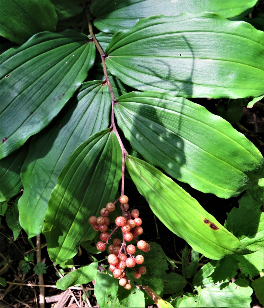
92. The false Solomon’s-seal (Maianthemum racemosum), a.k.a. treacleberry, here with a cluster of not quite ripe purple-spotted berries, is a common native plant. These berries will turn bright red soon, but are perhaps more appealing in their mottled, grape-like phase. There has been a lot of debate about whether these berries are good to eat, though there is not much doubt about their laxative effect. False Solomon’s-seal is only superficially similar to Polygonatum biflorum, the (true) Solomon’s-seal, also a native plant. “Solomon’s seal,” by the way, was another name for the Star of David, the six-pointer that symbolizes Judaism. On how the plant got this name, Mrs. Grieve in A Modern Herbal offers a number of possibilities: “Dr. Prior tells us it comes from ‘the flat, round scars on the rootstocks, resembling the impressions of a seal and called Solomon’s, because his seal occurs in Oriental tales.’ Another explanation is that these round depressions, or the characters which appear when the root is cut transversely, and which somewhat resemble Hebrew characters, gave rise to the notion that Solomon ‘who knew the diversities of plants and the virtues of roots,’ has set his seal upon them in testimony of its value to man as a medicinal root. Gerard maintained that the name Sigillum Solomonis was given to the root partly because it bears marks something like the stamp of a seal, but still more because of the virtue the root hath in sealing and healing up green wounds, broken bones and such like, being stamp’t and laid thereon.’” In other words, no one really knows!
93. Hamilton is a city on two distinct levels: the older Lower City, and the newer Mountain, separated by the steep face of the Escarpment. To get from one to the other, vehicles must take a steep “Mountain Access” road; pedestrians are reliant on six different flights of stairs. (Once upon a time Hamilton boasted funicular-style incline railways, but sadly no longer.) The Bruce Trail crosses all of these flights, and when you’re going northwards the first it meets are Uli Stairs. These stone steps with tree branches for handrails were completed in 2007 by Austrian-born Uli. Uli, which is short for Ulrich (he is too modest to reveal his surname) built them at his own expense as a retirement project at a time, not so long ago, when there was no pedestrian access between this part of the east Mountain and the Lower City. The longest flight (305 stone steps) of Uli Stairs runs between Mountain Brow Boulevard at Fennel Avenue East and the Bruce Trail. Where Uli meets Bruce there is a Side Trail down to Greenhill Avenue, so that Uli enables you to descend (or scale) the whole height of the Mountain on foot. Uli Stairs are featured on Google Maps, where they have a 5-star rating; they also feature as one of the few Hamilton entries on the popular Atlas Obscura website.
94. Here the iron-rich earth that gave the Red Hill Valley its name is clearly visible covering the surface of the Bruce Trail. This red soil is the eroded remnant of the Queenston Formation, the Ordovician shale (about 450 million years old) that’s used locally as the basis for ceramics, and especially for the beautiful red bricks found in older buildings in Hamilton’s Lower City.
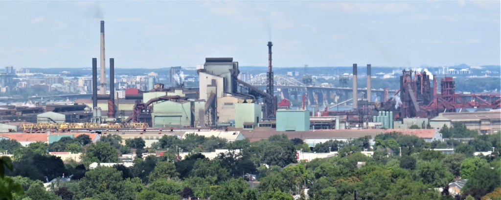
95. There are some remarkable views as we approach the Kenilworth Stairs. To the north, industrial Hamilton in the shape of the ArcelorMittal Dofasco steelworks almost completely blocks off our view of the Harbour. Behind it towers the southern end of the Skyway Bridge, by which we passed on Hike #2. On the horizon, the Mountain looms over Burlington, where we began this HOLO loop …
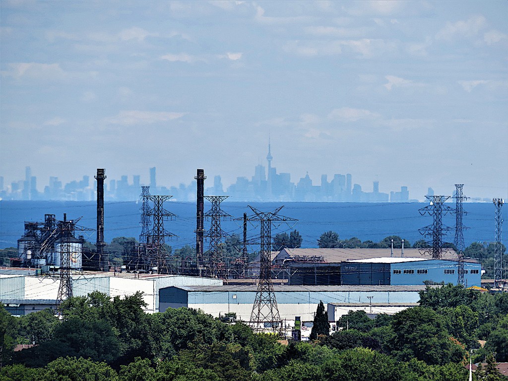
96. … and to the northwest, the downtown Toronto skyline stands out clearly. The driving distance to the CN Tower from here is 70 km, rather less as the crow flies.
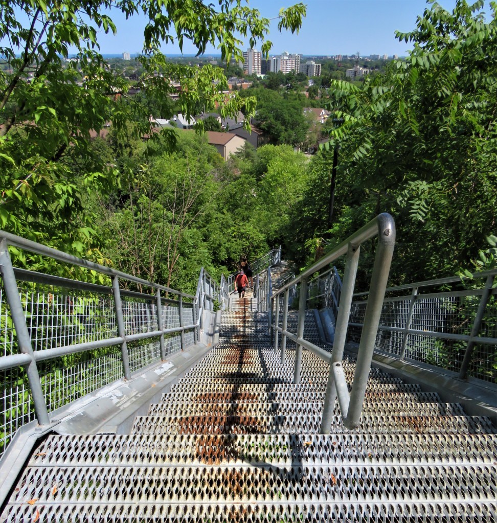
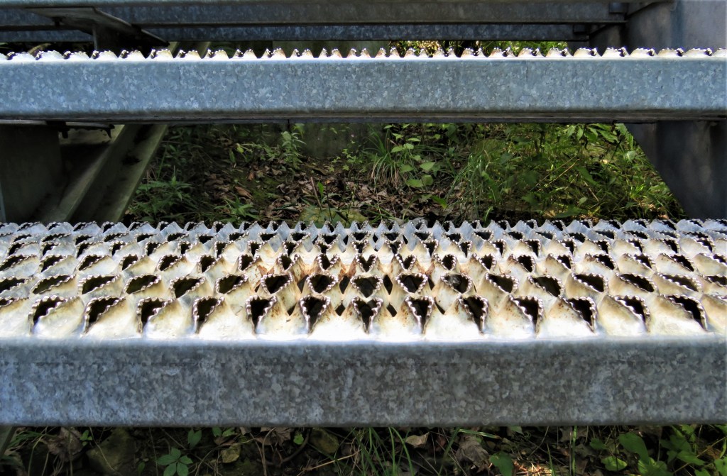
97. The Kenilworth Stairs (top image) are only 500 metres north of Uli’s, and were completed around the same time. They have two lanes of 228 steps with bike troughs at each side, and were built at a cost of $425,000. They only go up as far as the Rail Trail, so if you want to ascend the whole height of the Mountain, you have to go farther south along the Rail Trail to the Margate Stairs (or farther still to Uli’s longest flight of fancy). The Kenilworth steps are more evenly spaced than Uli’s and have metal teeth (bottom) that give shoes a good grip in inclement weather but are very hard on dog’s paws or unshod human feet. Kenilworth Stairs are used by about 500,000 people a year, and had to be fixed recently at an additional cost of $95,000 because all that tramping up and down destabilized them. (And now they’re starting to rust!) If you want a cardio workout, leave the dog at home and jog up and down the Kenilworth Stairs. But if you are feeling adventurous, take the pooch along to Uli Stairs.
If you choose to do the round trip …
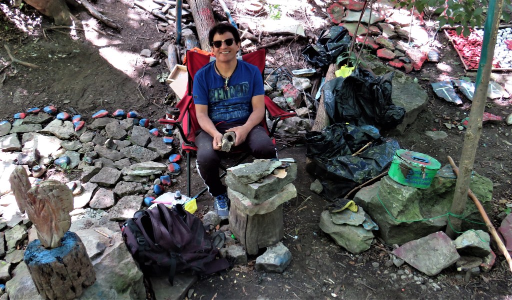
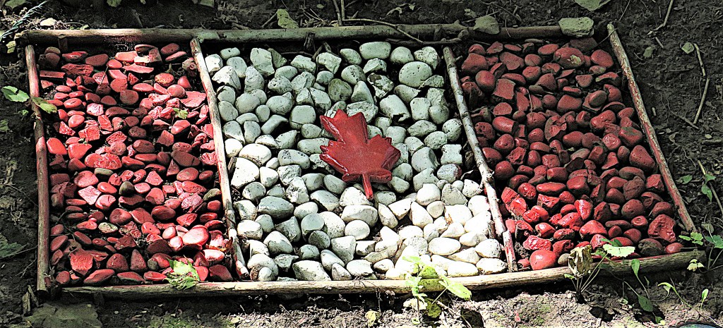
98. Trail Artist Antonio Merino (top image) sits by the Escarpment Rail Trail near the foot of the Margate Stairs, surrounded by his colourful natural sculptures, such as this Canadian flag of painted pebbles (bottom), and inspirational quotations painted on stones. He began creating his folk art at this site in April 2021, wanting to pay tribute to essential workers during the pandemic. The extremely positive reaction of passersby inspired him to stick around. He’s always ready to chat to you about his pieces. Check out this short video about him.
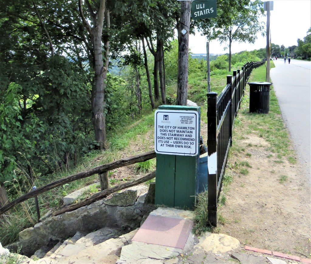
99. This is the top of the longest flight of Uli Stairs, on Mountain View Boulevard at Fennel Avenue East. These stairs run down to the Bruce Trail, crossing the Escarpment Rail Trail en route. There’s a shorter flight between the Rail Trail and the Bruce just north of the Margate Stairs, and a third, shortest flight between the same two trails below Broker Drive. The City of Hamilton may not recommend that you use Uli Stairs, but commendably it has decided (so far) to leave all of them as is. I recommend that you sample (carefully) at least one set of these “adventure stairs,” as Uli calls them: they offer a quintessential Hamilton experience. Meanwhile, from here you’ll take that broad, paved, expensively fenced pathway along the edge of the Escarpment overlooking the Red Hill Valley.
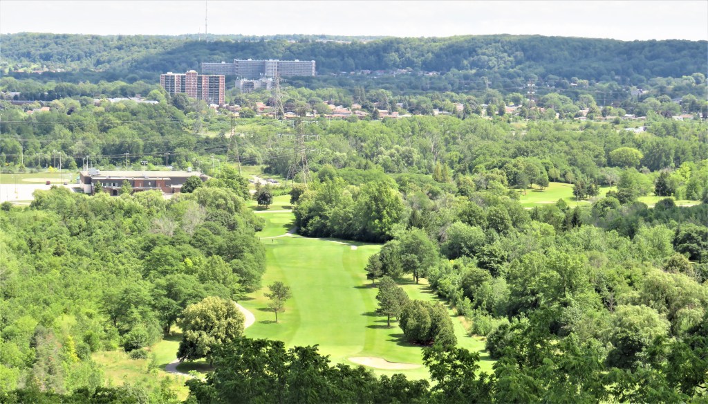
100. From here looking east you can see the whole width of the Red Hill Valley, including one of the fairways of King’s Forest Golf Club. At back, the Escarpment heads east (i.e., to the left) toward Grimsby and Niagara wine country.
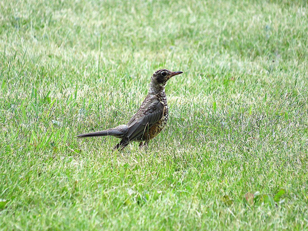
101. An adolescent robin with a spotty breast checks out the vicinity.
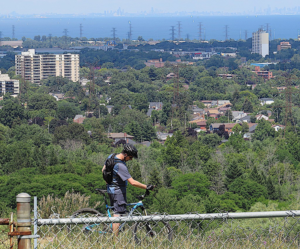
102. Near Matt Broman Park, this cyclist seems to be pondering whether his brakes are up to risking the shorter, faster way down into the Red Hill Valley below. In the background, opposed lengths of the Ontario Head-of-the-Lakeshore can be seen, with Mississauga’s skyline (centre) shading into Toronto’s at right on the horizon.
103. Buttermilk Falls is where a small tributary to Red Hill Creek dribbles over the sheer edge of the Escarpment. It’s a ribbon waterfall 23 metres high, and even though the flow today is unimpressive, the steepness of the terrain is fairly awesome. Geologists get very excited by all those exposed strata!
104. The Mountain Brow Side Trail of the Bruce (follow the blue blazes) takes you on a scenic pathway along the unfenced edge of the Escarpment from Buttermilk Falls to Albion Falls. Watch out for those roots!
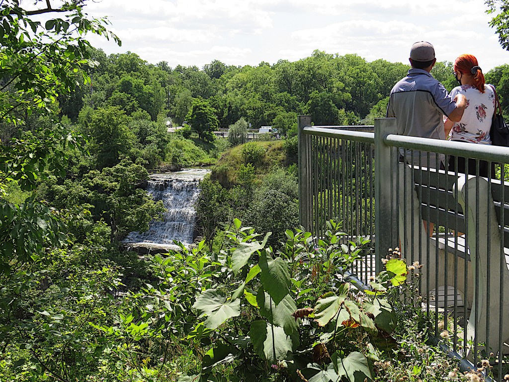
105. Albion Falls is one of the most popular and accessible of the hundred or so waterfalls in the Hamilton area. it’s a 19- metre cascade where Red Hill Creek meets the edge of the Mountain, and, when there’s plenty of runoff, it can be almost as wide as it’s tall. Before the days of steam engines, it was the site of a grist mill using the power of falling water to grind grain into flour. One of Albion Mill’s early owners was John Secord, Laura’s dad, who bought it in 1814. After Mountain Brow Boulevard becomes Mud Street on the east side of the Falls, a small village, later known as Mount Albion, grew around the mill. It continued to operate until 1907 and was demolished in 1915. Remarkably, the mill had been lit by natural gas, as this was one of the first places in Upper Canada where gas was tapped. There’s no longer any legal access to the base of Albion Falls. That’s because the waterfall became notorious for the number of hair-raising rope rescues that needed to be performed on people who had misjudged the steepness of the terrain. (There were 16 rope rescues on the Hamilton Mountain in 2020, while in 2016, before Albion Falls was securely fenced in, there were 23.) This viewpoint may well be the site of “Lover’s Leap,” the legendary place on the edge of the Escarpment near Albion Falls where jilted lovers would hurl themselves into the abyss.
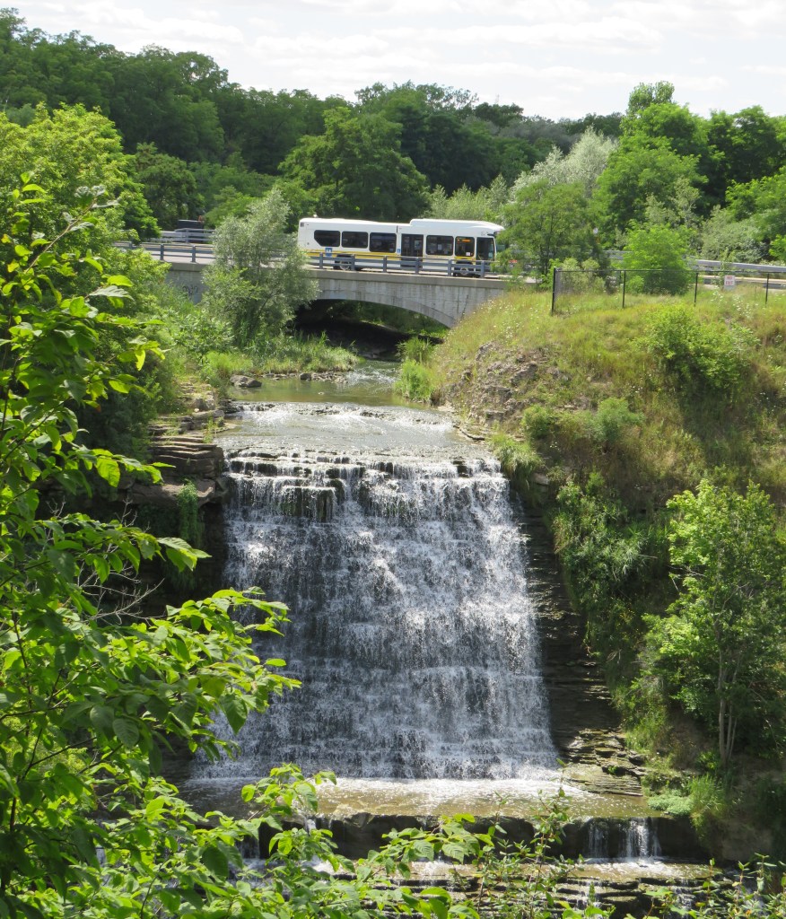
106. To prove to you that today’s hike is accessible by public transit, that’s the westbound #21 bus on Mud Street as it crosses Red Hill Creek just above Albion Falls. Its previous stop was where Mud Street and Pritchard Road meet, right next to the parking lot that’s the end of today’s extended hike.
There’s much more about the Bruce Trail on my photo blog The Bruce Trail End to End. Do please visit!
