
From Kenilworth Stairs to Wentworth Stairs
Date: 3 August 2021
Start Point: Bruce Trail at Kenilworth Stairs, Hamilton
End Point: Bruce Trail/Escarpment Rail Trail at Wentworth Stairs, Hamilton
Distance Covered: 3.9 km*
Total Distance Covered: 29.9 km
*plus 0.2 km from parking lots to start and end points; 9.0 km total if you take optional round trip.
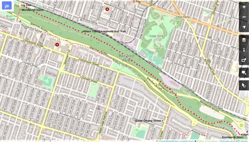
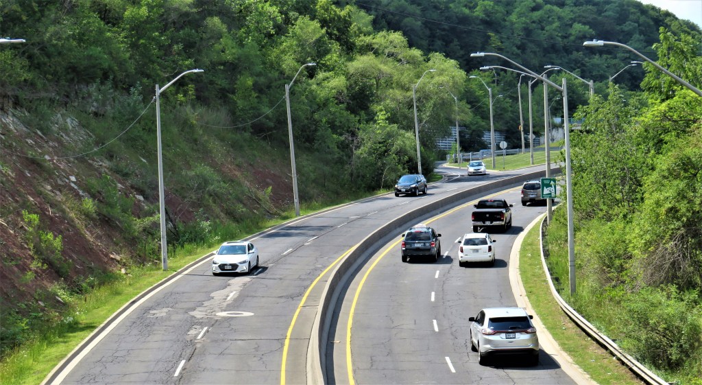
107. Today’s hike, when done linearly with a car at each end, is a modest 3.9 km along the Bruce Trail between two of the City of Hamilton’s steel Escarpment stairs. You’ll go from the P on Kimberly Drive, up what the City on its signage calls the “Kimberly Stairs”—but everyone else calls the Kenilworth Stairs—as far as the Bruce Trail, which here runs halfway up the slope of the Escarpment. The Bruce first goes its own devious way, and later joins the paved, gradually descending Escarpment Rail Trail. At Wentworth Street you are down to ground level, but there aren’t many good places to park, and when I passed through, there was a fenced-off construction zone west of the foot of the Wentworth Stairs. So you’ll test your cardiovascular fitness by climbing the full height of the Wentworth Stairs to your end car at the free P on Mountain Park Avenue.
Note: as with maps for Hike #5, the outward leg is marked by large red dots, the return by smaller ones.
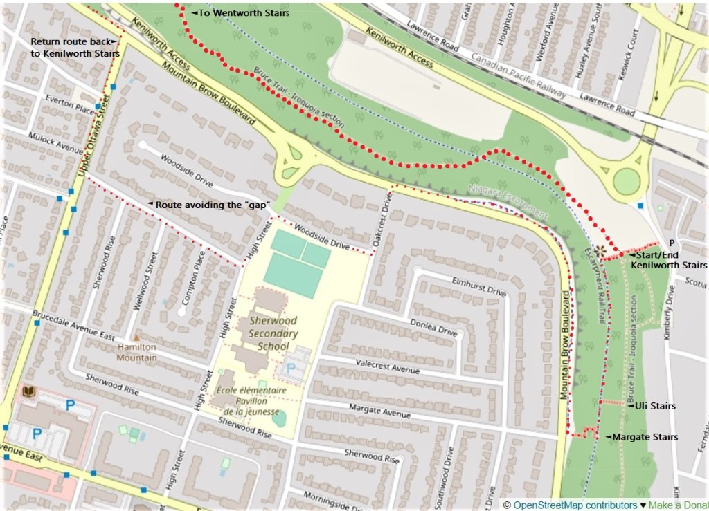
108. As with Hike #5, there is the option of doing a return loop, the benefit of which will be panoramic views over Hamilton. You’ll miss these if you stick to the Bruce/Escarpment Rail Trail. But this time the return route is far from straightforward, and you’ll have to hike 9.0 km in all. (See the detailed map of the Kenilworth start/optional end point above.) You’ll go along the broad, paved, multiuse pathway eastward on Mountain Brow Boulevard until you get to Upper Ottawa Street. At this point, the path unaccountably disappears! So you’ll make a diversion through Mountain suburbia via Upper Ottawa, Edgewood Avenue, High Street, Woodside Drive, and Oakcrest Drive, at which point the path along Mountain Brow Boulevard resumes. (More on this 700-metre “gap” at #128 below.) But even then the return to the Kimberly Drive P isn’t simple. Kenilworth Stairs don’t ascend the full height of the Mountain, so you’ll have to overshoot them as far as Margate Stairs, go down them to the Escarpment Rail Trail, then go north along it till you reach the top of Kenilworth Stairs. (Or you could take a flight of Uli Stairs down to the Bruce if you’re still feeling adventurous.)
Note: you can take the #41 (Mohawk) bus to the start point, or the #12 (Wentworth) bus from the end point, but these routes don’t interconnect. There is no bus service along the relevant section of Mountain Brow Boulevard. Welcome to Hamilton!

109. The Bruce Trail conforms itself to the difficult geography of the Niagara Escarpment. You must adapt to it, and if you do so you’ll find it offers a genuine escape from the surrounding urban grid. You won’t meet many other hikers on those sections where it deviates from the Escarpment Rail Trail …
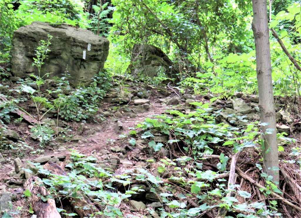
110. … because to hike the Bruce is to have to steer round fallen rocks …
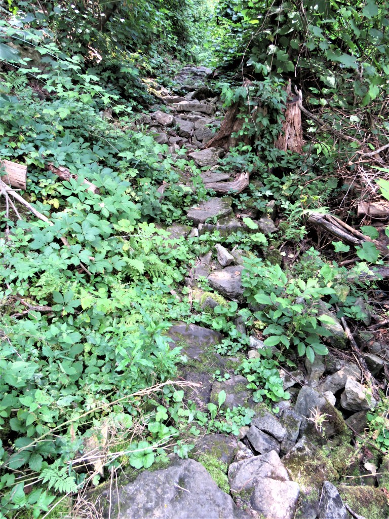
111. … and to discover that fallen rocks, loose and jagged, sometimes constitute the surface of the Trail …
112. … and where there’s deep mud on the Trail, you can relive the experience of travelling on the corduroy roads of yesteryear …
113. … while stepping over trees that fall across the Trail at every season of the year. Yes, the ramifying upper branches of this tree were lying right across the Bruce when I hiked it. But what’s the rush, really? On the Bruce, be patient and tread warily. And if this sort of obstacle puts you off, well, there’s always the Escarpment Rail Trail …
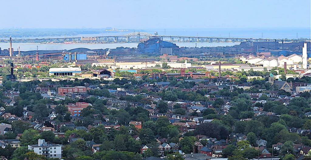
114. … which the Bruce joins for about 2.6 km to the end of today’s hike. This Trail runs for a total of 8.4 km from Ferguson Street in Hamilton’s Lower City to the Albion Falls parking lot on the Mountain. From there it’s only a short jog to the head of the Chippewa Trail that continues southwest 15.2 km almost as far as the town of Caledonia. The Escarpment Rail Trail is paved and popular with cyclists, and it’s an easy way to ascend (or descend) the entire height of the Mountain. It’s pleasant enough, if a little boring, to hike, for views are limited by dense leafage during the summer.
Hamilton’s railroad history is a fascinating and instructive one, and the HOLO loop would not be half so attractive without recourse to some of the repurposed former rail lines like this one that thread the city. In the 19th century, grandiose schemes to make Hamilton at the Head of the Lake, rather than Toronto, the southern Ontario rail hub, were continually foiled by the enormous cost of getting trains over the steep, 100-metre face of the Escarpment.
The line replaced by the Escarpment Rail Trail since 1993 was originally that of the Hamilton and Lake Erie Railway (H&LE), which ran from Hamilton Harbour to Port Dover via Caledonia, Hagersville, and Jarvis. After several false starts, construction began in 1873 to provide a portage route for goods from Lake Erie to Lake Ontario, one that wasn’t dependent on the limited capacity of the Second Welland Canal. However, the expense of engineering a line over the Escarpment soon caused the H&LE major financial embarrassment. By the time Port Dover was reached in 1878, the line had been taken over by the Hamilton and North Western Railway (H&NW). To cut a long story short, the H&NW lines were subsequently bought by the Grand Trunk Railway (GTR) in 1888, and after the GTR went bankrupt in 1919 they were taken over by the Canadian National (CN) Railway in 1923. By 1990, the line from Hamilton to Caledonia, forming most of the current Escarpment Rail Trail and Chippewa Trail, had been abandoned by CN.
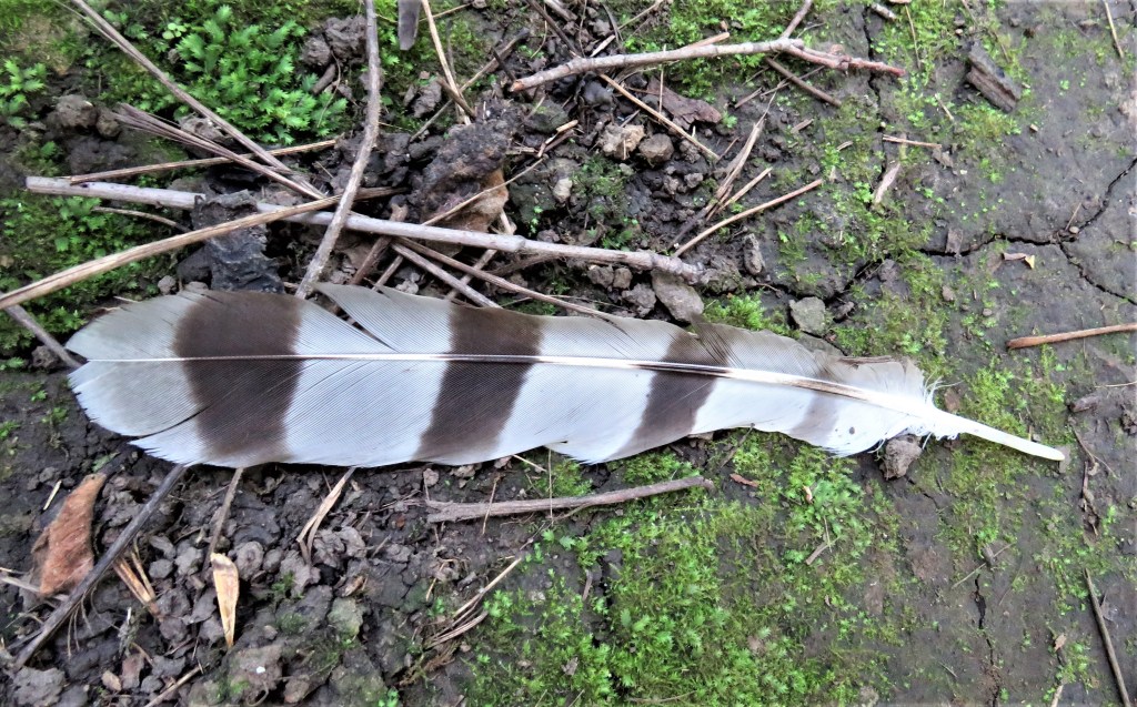
115. A beautiful feather lies by the trail. I’m no plumologist, but I’d guess this barred one with a white tip comes from a hawk or owl. I’d heard that it’s illegal in Canada to collect, or even pick up, discarded feathers like this. So I check it out, and it’s true … sort of. In 1916 the Migratory Bird Treaty was signed between the USA and Canada, making it illegal to kill, capture, or sell migratory birds alive or dead, including parts of birds, feathers, nests, and eggs. A recent Canadian update to the legislation that descended from this Treaty includes protection for 1,093 bird species. (There are exceptions for hunters of game birds and for First Nations using eagle feathers in religious rituals.)
In 1916, perhaps the most important impetus for this pioneering conservation initiative was the extinction of the North American passenger pigeon; the last one died in captivity in 1914. Passenger pigeons had been possibly the most numerous species of bird in the world but were remorselessly hunted to death in the later 19th century. Even before this, there had been a lucrative trade in exotic bird feathers for fashionable ladies’ hats. “Plume hunters” targeted snowy egrets in particular as their feathers fetched huge prices from milliners. It took campaigns by (mostly female) activists to bring this trade to a stop, just in time to save the snowy egret from the passenger pigeon’s fate.
So I’ll let this feather lie. Depending on what bird it came from, I could theoretically be fined or even jailed if caught in possession. After all, I couldn’t prove that I’d merely picked up a discarded plume.
116. Here the Trail goes on a former CN rail bridge over the Kenilworth Access, the road that ascends the Escarpment to meet Mountain Brow Boulevard in the “gap” (see #128 below). Motorists going west also have the option of taking the Sherman Access that leads to Upper Sherman Avenue on the Mountain. The cost of fast automobile travel between Hamilton’s Lower City and Mountain is high: the Escarpment is continually slipping and sliding downwards, so that its slopes are almost perpetually under maintenance to shore them up.

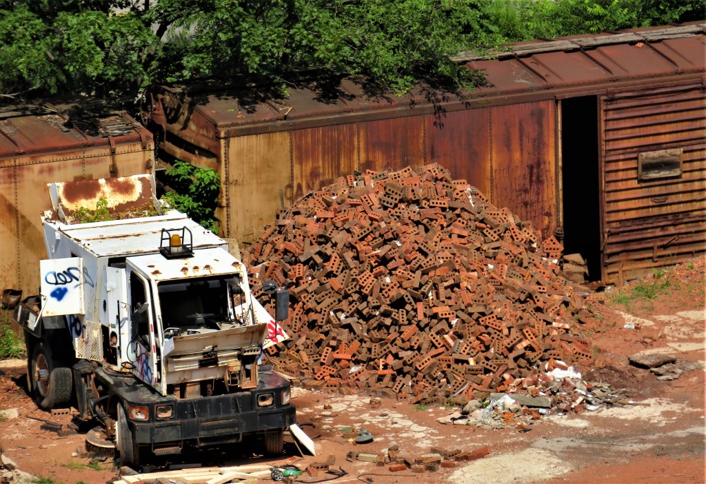

117. On the last hike (#94) we saw how brick-red the earth is in these parts. This site (top image) is the last trace of the local industry that used to exploit it. Hamilton Pressed Brick began operations on Lawrence Road in 1906. As Century Brick it baked 12 million five-pound clay bricks as recently as 1998. But it’s no longer legal to quarry the Escarpment here, and brickmaking with trucked-in clay recently dropped off to almost nothing. And last year the Century Brick site was put up for sale for $4,000,000.
Beautiful red bricks define Hamilton’s lower cityscape. There’s a forlorn pile of them still on site next to that decrepit street sweeper (middle). Isn’t it striking how, viewed from a satellite (bottom), the former brickworks site stands out against the green of the Escarpment? Shouldn’t something creative be done to repurpose this historic complex? For some good and not-so-good ideas, check out the Evergreen Brickworks in Toronto’s Don Valley.
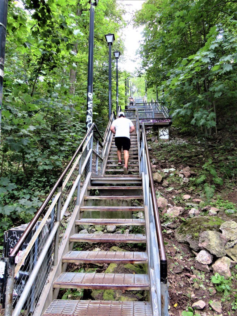
118. Wentworth Stairs are the oldest and longest flight in Hamilton. In 1903, wooden steps were installed by the side of the Incline Railway (see #124 below). After a rock slide, they were replaced by steel steps in 1987. The 498 Wentworth steps ascend the full height of the Escarpment and are illuminated with cute lamps. Be warned: they are quite narrow, and just about everyone coming up is breathing heavily and sweating, so social distancing is not easy. Also, unlike the newer stairs, they don’t have bike troughs. On the Bruce/Escarpment Rail Trail, you currently meet the Wentworth Stairs at their foot, and to continue on the Bruce Trail you’d normally climb more than half their height to the Sherman Access, from where the Bruce continues westward. Now, though, you must climb their entire height …
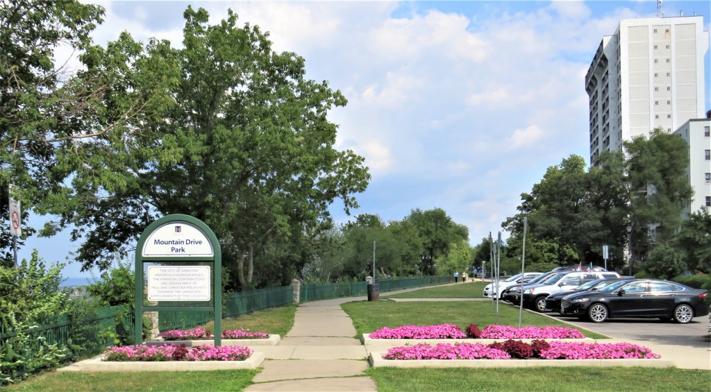
119. … to reach your end car at the free P at Mountain Drive Park. That’s the end of today’s linear hike!
But once you’ve caught your breath, you may fancy doing the return leg, which begins on that enticing footpath along the Mountain brow. So stay tuned.
If you choose to do the round trip …
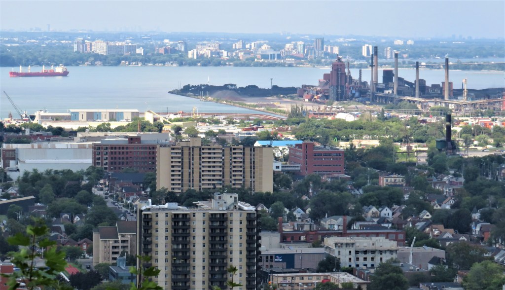
120. … you’ll get some great views from this high vantage point. That’s Hamilton Harbour, with downtown Burlington on the opposite shore …
121. … and here’s a view you don’t normally get except from a plane or drone: the entire 6.6 km length of the Burlington Skyway.
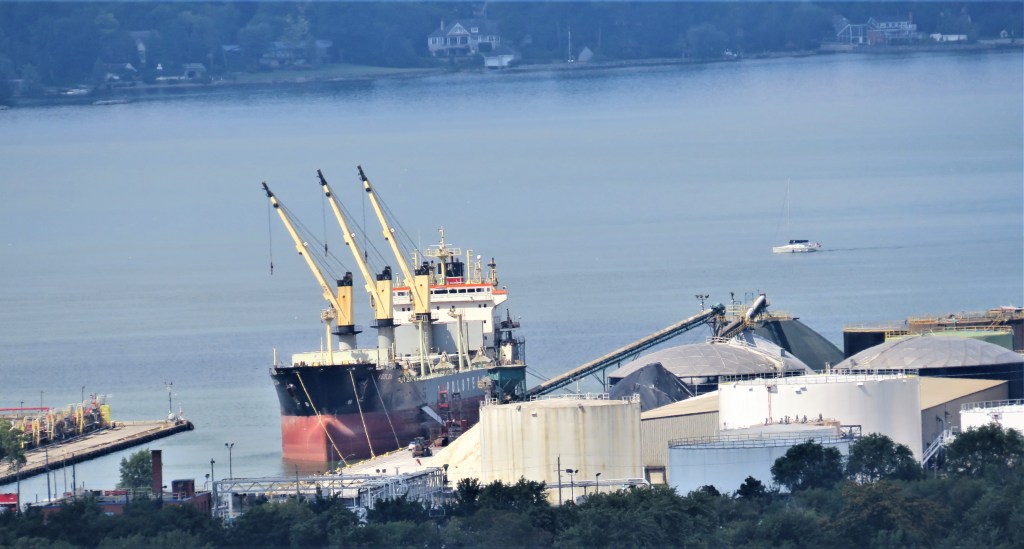
122. The zoom lens picks out a ship docked in the Harbour. It’s the Isolde owned by Polsteam (Polska Żegluga Morska/PŻM), based in Szczecin, Poland. Built in Japan in 1999, 200 metres long, and currently flying the flag of Cyprus, she’s one of Polsteam’s fleet of 13 bulk carriers that ply between Europe and the Great Lakes.
And I bet you didn’t know that from March to November you can cruise across the Atlantic as one of a maximum of six passengers per vessel on Isolde or her sister ships Irma, Iryda, Isa, and Isadora. A cruise agency website notes: “The ships’ Polish officers and crew are experienced in navigating the Great Lakes and St. Lawrence Seaway and passengers can choose among three basic services: 1. Round Trip Tramp Voyage boarding in either Europe or North America. 2. Europe to Great Lakes Trans-Atlantic Voyage from Ijmuiden [Amsterdam]. 3. Great Lakes to Europe Trans-Atlantic Voyage (tramp, usually grain). There are now also sailings from Alexandria, Egypt, and Casablanca, Morocco, to the Canadian ports of Hamilton and Oshawa on Lake Ontario.” Alexandria to Hamilton! Incredible, no? Click here to find details of routes, cabins, fares, etc.
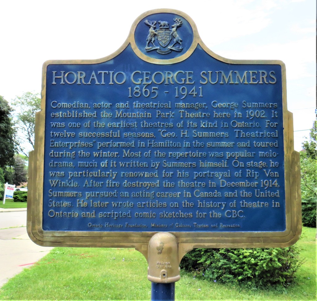
123. At the top of the Wentworth Stairs, this plaque. In May 1902 George Summers’ theatrical troupe began performing in what came to be known as the Mountain Theatre. Open-sided, it seated 700 on the edge of the Escarpment beside the top of the East End Incline Railway at Wentworth Street (see #124 below). Its motto was “Always a Breeze.” Productions were held each summer: admission was 10 or 15 cents, with ice water available. The enterprise was a success, and by 1914 Summers was planning a 2,000 seat theatre. But on 21 December of that year the theatre burned to the ground. Summers moved to New York City, where he later ran a theatrical talent agency.
124. The East End Incline Railway (1900-36) at Wentworth Street was one of two in Hamilton, the other being the Hamilton and Barton at James Street (1892-1931). At Wentworth the ride was one and a half minutes long and cost 25 cents for eight ascending rides, 2 cents for a single descending one, or one cent for a child in either direction. It was the automobile, combined with improved Mountain Access roads, that killed off the Inclines.
125. One of the older buildings of the Juravinski, a general hospital particularly known for its cancer research centre, faces Mountain Park Avenue. This building is likely to be torn down and replaced in the near future in order to maximize a tight location here on the edge of the Mountain. Mount Hamilton Hospital was founded in 1917 as a facility to care for wounded World War I veterans. It later developed into Henderson General Hospital, named after Nora-Frances Henderson (1897-1949), a pioneering local politician, journalist, and women’s rights activist. Since 2010 the hospital has been named for Charles Juravinski (b. 1929), formerly a racetrack owner. He and his wife have to date donated a staggering $43 million to improve health care in Hamilton.
126. If the Juravinski Hospital were being built today, I doubt anyone would consider its current location suitable, due to 1) its extremely constricted setting, 2) its limited parking facilities, and 3) its poor public transit connections. The Ivor Wynne Stadium in Hamilton’s east end suffered from all three of these problems. So what were city councillors thinking when they decided to demolish Ivor Wynne and rebuild Hamilton’s new main sports stadium on exactly the same site? Tim Hortons Field has an artificial turf surface and holds about 24,000 spectators who come to watch the Hamilton Tiger-Cats of the Canadian Football League or Forge FC of Canadian Premier League Soccer. For the $145.7 million cost of construction (not including an endless list of ongoing repairs), Hamilton gained what are essentially two giant bleachers completely open to the elements (except for the executive lounges), a configuration perhaps appropriate in a dry, sunny city like Tucson, Arizona. But this is Hamilton, where these days counterintuitive development options seem to be the only kind ever considered, let alone implemented.

127. This is some of the typical housing around Tim Hortons Field: neat, two-storey detached dwellings built probably with steel workers and their families in mind. The great heavy industrial sector on the Harbour is only a short distance away. At the moment Hamilton real estate has been experiencing an unprecedented boom, possibly because houses here have been historically much more affordable than in areas closer to Toronto, and it’s possible, at least in theory, to commute to Toronto from here in under 90 minutes. Though it’s always risky to generalize, the average price of houses like these is currently likely to be about half that of similar ones in an equivalent location in Toronto.
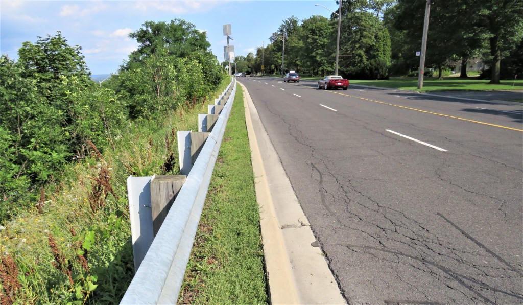
128. And finally, let’s discuss that “gap” I mentioned in #108 above. Here at Mountain Brow and Upper Ottawa, the multiuse pathway simply disappears for 700 metres, abruptly reappearing at Oakcrest Drive. To continue as a pedestrian along Mountain Brow, you must either walk facing oncoming traffic with no protective shoulder, or trudge across the front lawns of the houses opposite, as there’s no sidewalk on that side either. I don’t advise you to pursue either of these options, so if you want to get back to Kenilworth Stairs in one piece, you should take the diversion indicated on the map at #108 above.
But how did this ridiculous situation arise? It probably had to do with the intersection between Mountain Brow and the Kenilworth Access that’s 500 metres along from the spot pictured above. Incredibly, that junction has no pedestrian crossings! (On the other hand, maybe that’s just as well, as motorists arriving there for the first time are likely to be seriously confused.) Such a junction should never have been constructed that way in the first place … but that’s water under the bridge.
The City is not unaware of the problem, and published a “Mountain Brow Multi-Use Pathway Feasibility Study” in March 2018 with lots of colourful diagrams but no conclusions. One guesses that the cheapest solution, to extend the multiuse pathway on the south side of the Boulevard, would be fought tooth and nail by property owners who’d stand to lose some of their front lawns. So, space for pedestrians must be found between the edge of the Escarpment and the two westbound lanes of Mountain Brow Boulevard, which is four lanes wide for the length of the gap. As the rest of Mountain Brow carries only two lanes of traffic, an obvious solution presents itself! (But see my conclusion to #126 above.)
Such an absurdity is, sadly, not unique in the vastly overbounded* City of Hamilton. Briefly, there have been many municipal “visions” about how to increase the accessibility and tourist appeal of Hamilton’s extraordinary setting between Harbour and Mountain. But there has been little will to implement these visions either consistently or completely. We have already encountered a number of examples of this failure, and there will be even more egregious ones to come.
*In urban studies, “overbounded” means “having a boundary that is larger than appropriate for its population.” By implication, it suggests that such a municipality is likely to have insufficient means to administer such a large area efficiently. The City of Hamilton covers an area of 1,138 km²; the City of Toronto, with five times the population, occupies a mere 630.2 km². Enough said.
