
From Dundurn Stairs to Filman Road
Date: 14 August 2021
Start Point: Dundurn Stairs, near south end of Dundurn Street, Hamilton
End Point: Filman Road, Ancaster
Distance Covered: 6.1 km*
Total Distance Covered: 40.0 km
*plus very short distance from parking places to start and end points
This hike, traced with red dots right to left on maps 151A & 151B below, is straightforward if done with a car at each end.
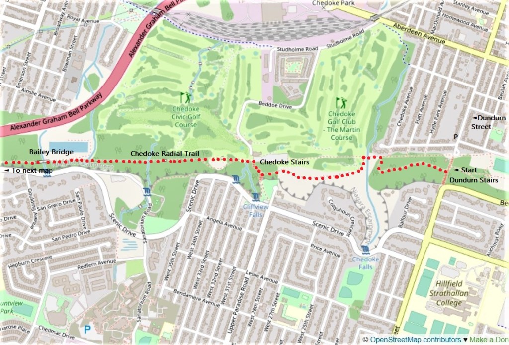
151A. You park your start car at the south end of Dundurn Street and climb halfway up Dundurn Stairs until you meet the Bruce Trail. Then you follow the white blazes of the Bruce in a westerly direction to your end car. Note that the Bruce periodically joins the more direct, well-paved Chedoke Radial Trail.
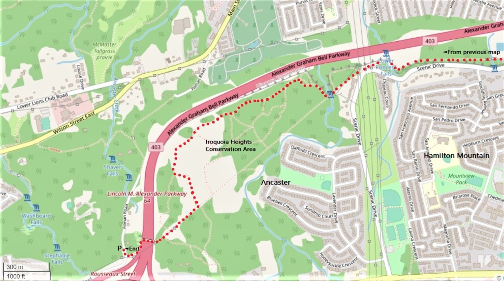
151B. Where the Radial Trail meets Scenic Drive at the Mountain brow, you enter Ancaster, a historic former village that is now the most affluent suburb of the amalgamated City of Hamilton. In Iroquoia Heights Conservation Area, the Bruce leaves the Radial Trail to meander through woods close to the edge of the Escarpment. Keep following the white blazes; the blue ones indicate a side trail. At all times of the year you’ll hear the heavy traffic on Highway 403 just beneath the edge of the Escarpment, though when the leaves are out you’ll only glimpse it occasionally. Eventually the Bruce rejoins the Radial Trail for a short spell, then crosses the 403 on a footbridge. Your end car will be parked on the west side of Filman Road where it meets the Bruce. Make sure that your car doesn’t obstruct the roadway and you shouldn’t have any trouble leaving it here, as there is little traffic on dead-end Filman Road.
If you have only one car, there is no recommended return loop on this hike, but you can cut out at least 1 km of the outward distance by going back on the Chedoke Radial Trail the whole way. You’ll hike about 11 km in all.
By public transit, you’ll take the #7 Locke bus from downtown Hamilton to the Hillcrest loop at the foot of Dundurn Stairs and climb halfway up the stairs to the Bruce. At the other end, you’d be advised to extend the hike by about 1.7 km via northbound Filman Road and the blue-blazed Filman Road Side Trail, picking up the #51 University bus where Filman Road meets Main Street West in Hamilton. It will take you back downtown.
When you have completed this hike you’ll be more than halfway around the HOLO loop!
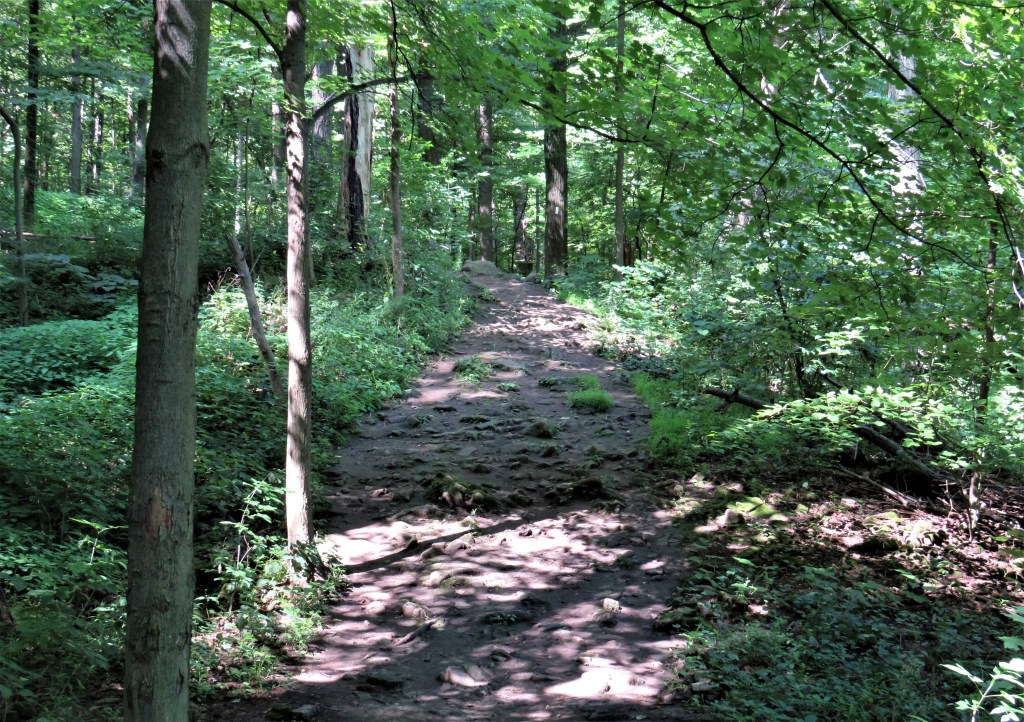
152. Off Dundurn Stairs, you’re in typical Bruce Trail territory half way up the scarp face. The Bruce very rarely takes the direct way: it is 377 km, about a four-and-a-half hour drive, from Queenston Heights to Tobermory, but the Bruce Trail between those points is 900 km long. A very fit and determined person will need between 30 and 60 days to hike it end to end. When it comes to the HOLO loop, I make no apology for preferring the Bruce Trail over more direct alternatives. It will give you a new respect for the Niagara Escarpment which, if you live in the Hamilton area, you may have come to view as a nuisance, an obstacle to be surmounted and eventually eliminated. The Bruce is a conduit to the real world in which nature, rather than mankind, is the dominant force on earth and will prevail sooner or later over any attempts to “defeat” it. But if for any reason you find the Bruce too hard going, you can usually opt to take an easier, more frequented route …
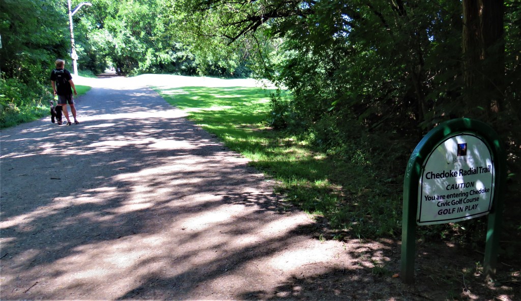
153. … such as the Chedoke Radial Trail, which directly connects today’s start and end points, and offers such civilized delights as a stroll through Chedoke Golf Course. Someone, not Mark Twain, quipped that “golf was a good walk spoiled.” That wit did not realise that in these latter days, no walking at all need interrupt a round of golf. So why not go a stage further and take Jack Benny’s advice? “Give me golf clubs, fresh air and a beautiful partner, and you can keep the clubs and the fresh air.”
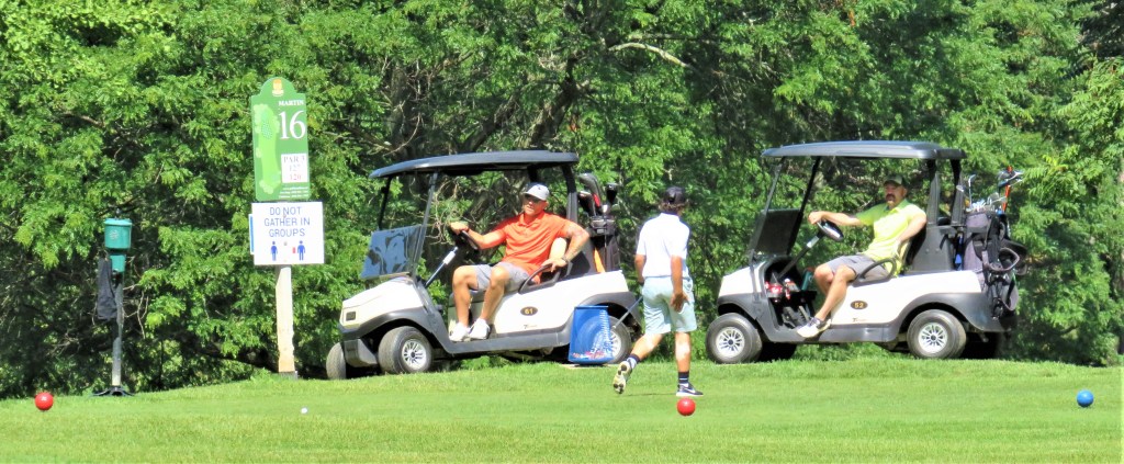
Chedoke Civic Golf Club, founded in 1924, now comprises two 18-hole courses, the Beddoe and the Martin. Owned by the City of Hamilton, it was conceived as a facility where the “working man” could afford to play golf.
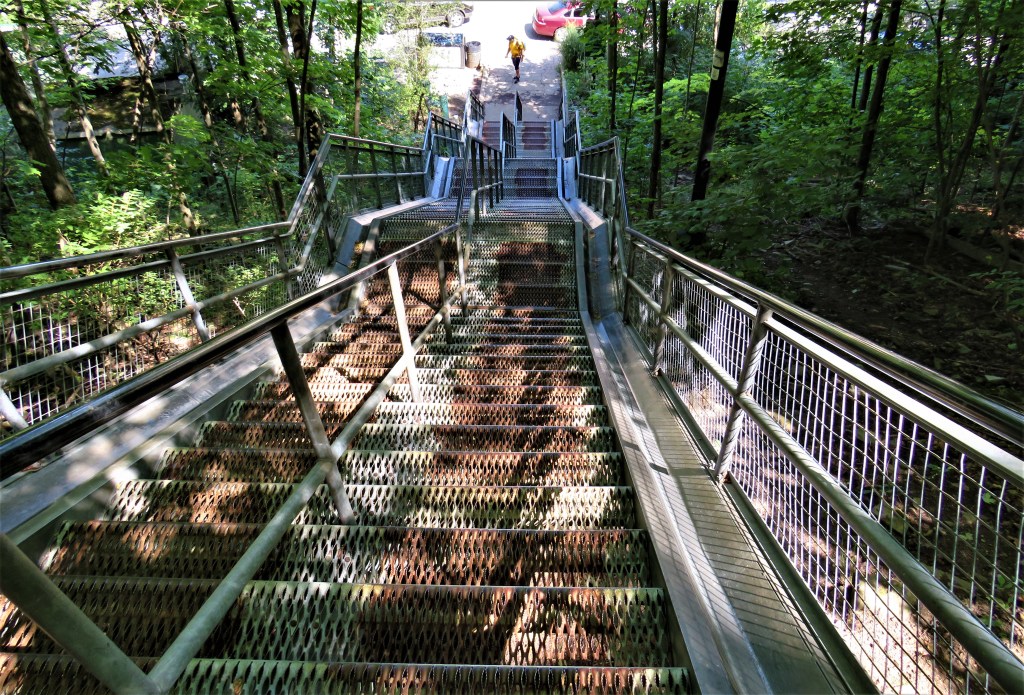
154. This is the view down to the foot of Chedoke Stairs, with the Golf Club parking lot to the right. This flight is the westernmost of Hamilton’s steel escarpment staircases, and the most popular. It has 289 steps divided into two lanes, with bike troughs at the sides. The Stairs descend from Upper Paradise Street on the Mountain down to Beddoe Drive, the road leading down via Studholme Road to Aberdeen Avenue in the lower city. The Bruce meets Chedoke Stairs about two-thirds of the way up, and turns down them to the foot of the Escarpment.
“Chedoke,” incidentally, is a place-name exclusive to Hamilton. There have been fanciful attempts to derive it from First Nations languages, but it would seem that actually it’s a corruption of “seven oaks,” and a reference to a local cluster of those trees.
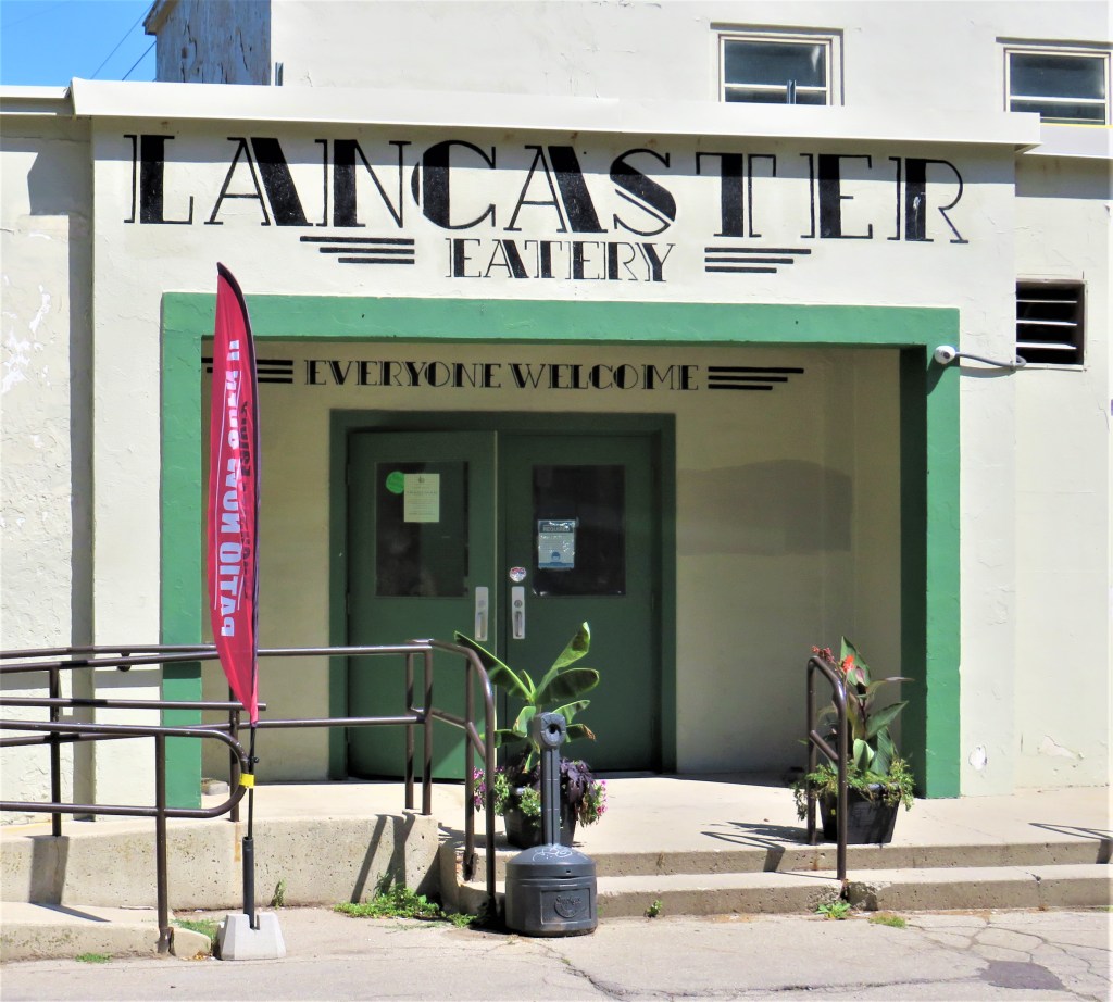
155. The entrance to Lancaster Eatery, in the bunker-like clubhouse of the Chedoke Golf Club, faces the foot of the Stairs. The lettering is a variation of Broadway Art Deco font, evoking the period of the Club’s foundation. It’s admirable that a golf club, often a byword for exclusivity, should provide a public eatery on this spot right on the Bruce/Chedoke Radial Trail. If you’re returning to Dundurn Stairs after doing today’s hike in both directions, you’ll almost certainly feel that you’ve earned some R & R at the Lancaster. Note, however, that like the golf course itself, the Eatery is closed during the winter season.
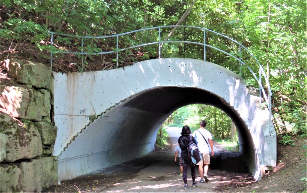
156. This little tunnel on the Radial Trail is one of the few visible remains of Chedoke Winter Sports Park. This facility began operations in January 1962 with the aim of encouraging Hamiltonians of modest means to participate in winter sports. The tunnel allowed pedestrians to pass under a tow rope that carried skiers up to the start of the downhill run at the top of the Mountain. Eventually the Winter Sports Park boasted three T-bar lifts, a chair lift, illuminated night skiing, tobogganing, snow making equipment, ski rentals, and instruction; at first an all-day lift ticket was $1 for adults and 50 cents for students, and there was free instruction for kids on Saturdays. (Check out current daily fees at Blue Mountain, and you’ll see what a bargain this was!) But poor snow conditions, increasing costs, and declining attendance doomed the facility: it closed “temporarily” in the winter of 2002-03 and never re-opened. Parts of the infrastructure can still be found in the vicinity. You go through the tunnel …

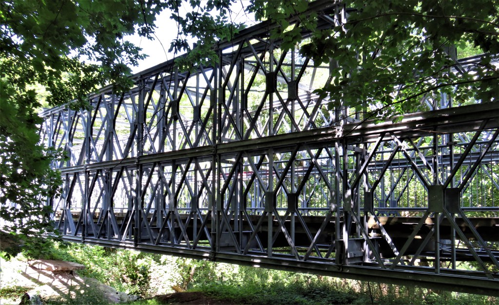
157. … and then across a shallow ravine on a Bailey bridge. Such structures are named for the British engineer Sir Donald Coleman Bailey (1901-85), who drew one speculatively on the back of an envelope in 1940. A Bailey is a steel bridge with portable components that can be assembled quickly under fire in wartime. In World War II Baileys could be rolled complete across rivers and could often bear the weight of several tanks. Baileys allowed armies to rapidly replace bridges destroyed by a retreating enemy, and they have been credited as a key element in Allied victories.
In Ontario, Bailey bridges have been used to good effect in peacetime. After Hurricane Hazel washed out many bridges on 15 October 1954, some were quickly replaced by Baileys: notably on Old Finch Avenue over the Rouge River east of Toronto, where the Bailey is still in place almost seventy years later. The one above, 85 metres long, is more recent: it was opened in January 2012 and cost almost a million dollars. As it doesn’t have to bear the weight of passing tanks, it will undoubtedly last a long time.
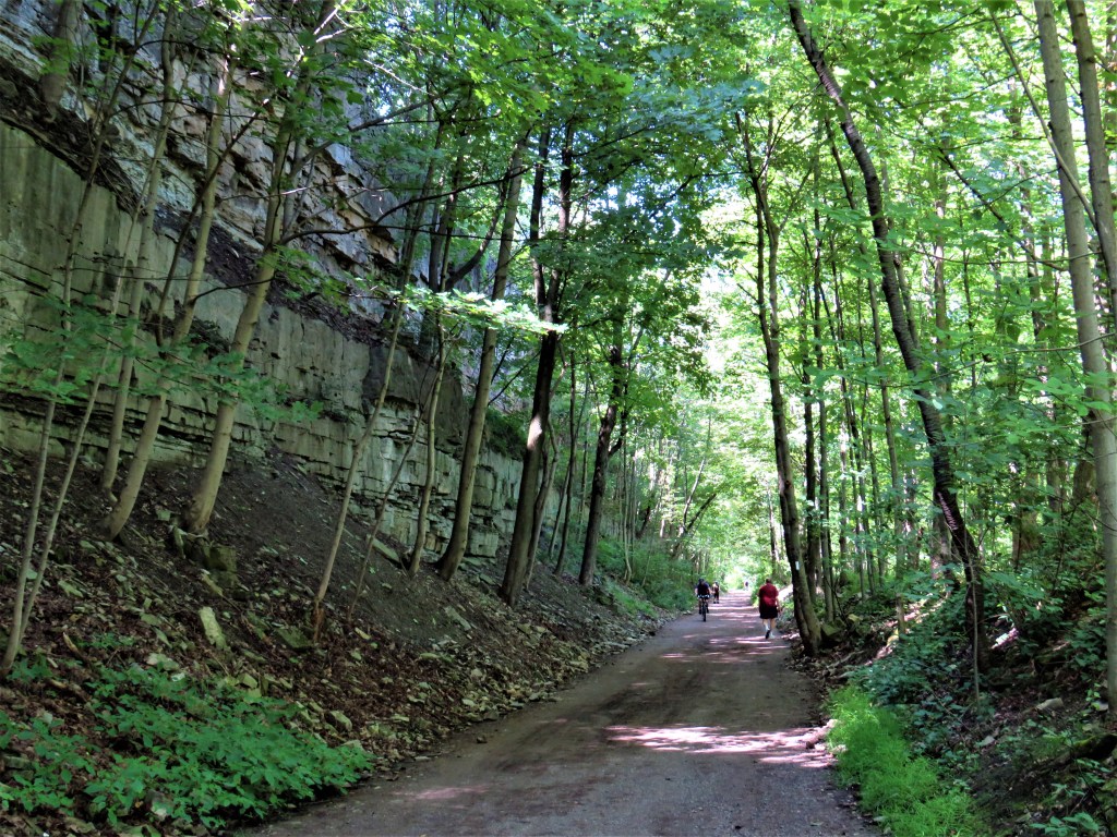
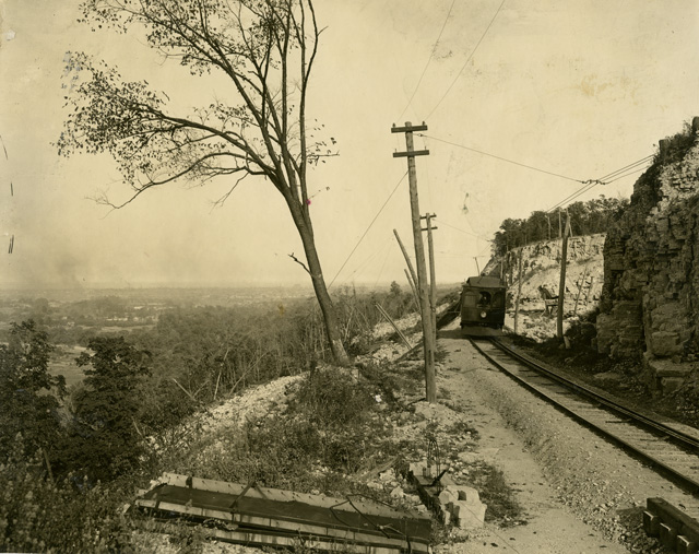
158. A long straight stretch, gently ascending the Escarpment through a cutting, reminds us that the Chedoke Radial Trail occupies the bed of a former rail line: in this case, the Brantford and Hamilton (B&H) Electric Railway (1908-31). The full, complicated story of the B&H can be found at “Hamilton Transit History” on the Trainweb site. Here’s an extract: “The B&H was built to very high standards, with relatively heavy rail and very few curves. From the Hamilton Terminal Station the B&H travelled through Hamilton along Main and Hess to Aberdeen, then cutting cross country to the southwest reaching the base of the escarpment near Garth St (modern day Dundurn St. South). It then turned west and began ascending the escarpment at a 2½% grade, reaching the top of the escarpment near Horning Rd. (today’s Scenic Drive). The B&H curved to the southwest towards Ancaster, crossing Wilson St. near Halson Rd. It then paralleled what is today Wilson St. and Colborne St. through Alberton, Langford, and Cainsville before reaching Brantford. The line entered Brantford running on Glenwood Drive, then paralleling the Mohawk Canal.” This line lasted only until 1931, killed by the automobile like the other three Hamilton electric radial lines, and the track was torn up completely by the next year.
Imagine if Hamilton had had the foresight to preserve and upgrade its electric radial transit system! We’d have a fast, quiet, non-polluting, scenic suburban line to Ancaster and on to the airport at Mount Hope. I suppose that the Radial Trail is small compensation for such a loss.
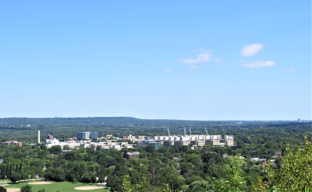
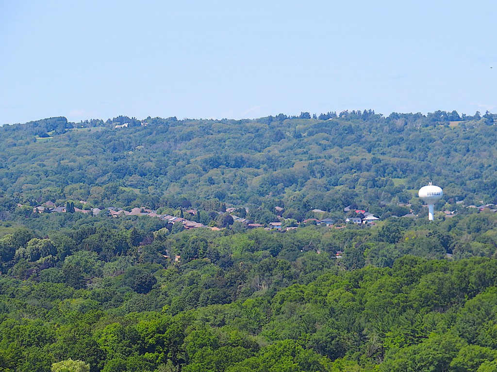
159. Through gaps in the foliage, the Dundas Valley starts to unfold before us. This valley is technically a re-entrant, namely a low area between two parallel ridges. To conceive its shape, imagine the Niagara Escarpment hereabouts as a U lying on its right side with its mouth towards Lake Ontario in the east. We are perched about 100 metres up on its lower arm, and on the horizon about 5 km away we can see the end of its upper arm, which turns sharply away from us in the centre of the picture. In the foreground is the main campus of McMaster University, from the giant brutalist McMaster Children’s Hospital at right to the student dorms and nuclear reactor at left. Yes, McMaster has had a medium flux nuclear fission reactor on campus since 1959.
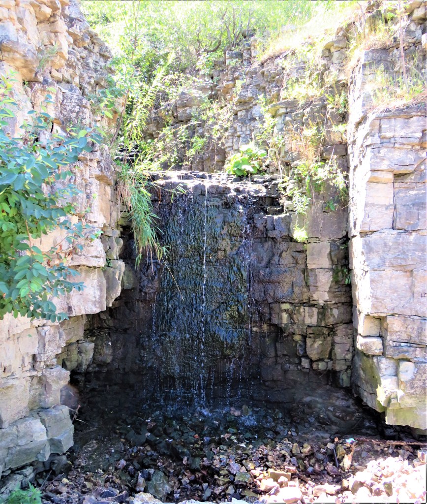
160. On this hike we have already passed several waterfalls, though most are not easily visible or accessible. An exception is 7-metre Upper Princess Falls, which is right by the Trail. There’s a Lower Princess Falls too, but it can only be seen from Hwy 403.
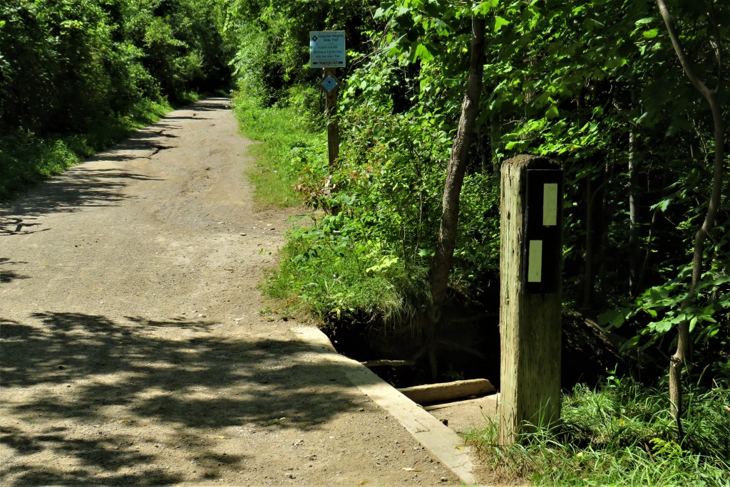
161. The white blazes here indicate a sharp right turn where the Bruce diverges from the Radial Trail and goes wandering in the woods along the edge of the Escarpment. The Radial Trail continues straight on, the blue blazes indicating that it is shared by the Iroquoia Heights Bruce Side Trail.
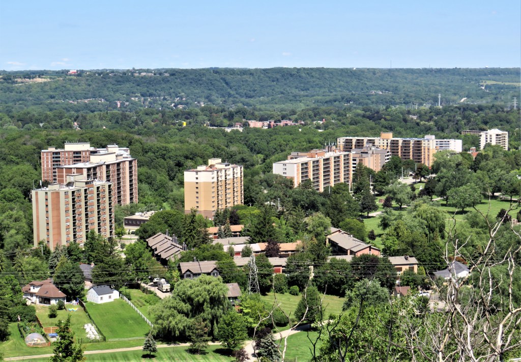
162. There’s only one place on this section of Trail where you can get unobstructed views over the Dundas Valley in summer, and it involves going through a hole in a fence. Below is the extreme western end of the (pre-amalgamated) city of Hamilton, in the shape of apartment blocks lining Main Street West. Changing its name to Wilson Street, Main West will soon start the steep climb up this southern arm of the Escarpment towards Ancaster.
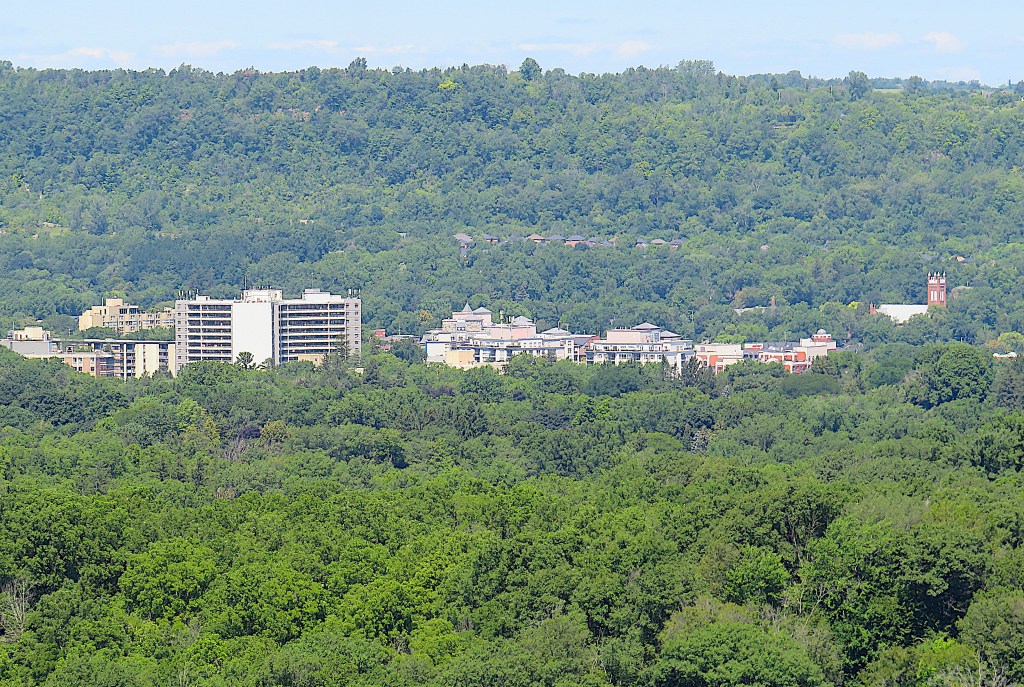
163. A little to the west and more distant is the town of Dundas on the Valley floor, from St. Augustine’s Roman Catholic Church at right to St. Joseph’s Villa, a long-term care home, on Governors Road at left …
164. … and farther west still, suburban Dundas peters out in ribbon development along Governors Road. Much of the forested tract in the foreground lies within the Dundas Valley Conservation Area.
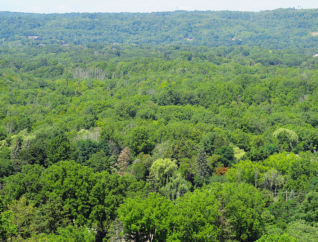
165. A little farther west still, and from this angle, the Dundas Valley seems an unbroken sea of trees. This is one of the northernmost pockets of Carolinian Forest on the continent, including such species as tulip trees, sassafras, and pawpaws. They thrive here because the Valley enjoys warmer average temperatures, longer frost-free seasons, and milder winters than most other regions of Ontario. However, the broadleaf canopy masks the encroachment of lowrise suburbia in Greensville, Dundas itself, and Ancaster. Still, the current situation could have been far worse …
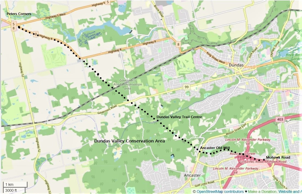
166. … for Thomas A. Beckett, in his memoir My Path to the Dundas Valley (2018), recalls how in 1967 there was a plan by the Ontario Ministry of Highways to slash a four-lane highway, the Dundas By-Pass, diagonally through the Valley from Peters Corners to Hwy 403/Mohawk Road in Ancaster. This highway “was to cut through hills, valleys and streams, destroying all in its path. … It was to pass close to Old Ancaster Mill and tear up the Escarpment face as it took out such historic places as the Tamahaac Club. It was to destroy what we know today as the Maplewood property and the Dundas Valley Trail Centre.” (127-28). Beckett himself led the ultimately effective resistance to this “grossly stupid” (131) proposal. The black dots on the map above show the approximate path this highway would have taken.
167. This is one of the more open sections of the Bruce through Iroquoia Heights CA. If you’re lucky, you’ll see white-tailed deer feeding among the tall grasses. In the late fall this area and some others in the Dundas Valley may be closed to the public for a few weeks as the Haudenosaunee (i.e., the Six Nations of the Iroquois Confederacy) exercise their treaty right to an annual deer hunt.
The Bruce then rejoins the Radial Trail for a short spell …

168. … then crosses this pedestrian bridge over Hwy 403 …
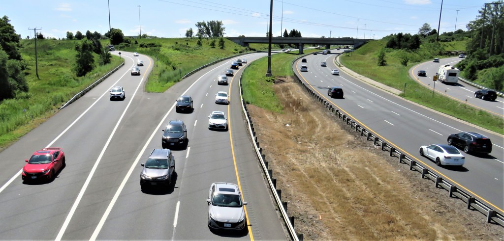
169. … from which you can look down dizzily on vehicles hurtling toward Hamilton (left) or Brantford (right), or interchanging (far right) with the Lincoln M. Alexander Parkway (on the bridge in the distance) that will take them westward across the Hamilton Mountain.
170. Then you descend a steel staircase and are confronted with this unedifying sight. Google Maps calls it “Graffiti Alley,” but you’re in for a disappointment if you imagine it’s up there with that passage of the same name off Queen Street West in Toronto. These are crude tags, not street art! Time for the City of Hamilton to hire some talented muralists to beautify this bleak concrete wall.
And where this alley meets Filman Road is the end of today’s hike.
If you are still feeling energetic, you can extend the hike by another 3 km or more by following the traces of the old B&H Radial Line into Ancaster. You turn left on Filman Road and follow it down to Mohawk Road. Cross Mohawk and take the short alley on the other side through to Hiawatha Boulevard. Follow Hiawatha as far as Cayuga Avenue, where a pedestrian trail, the “Radial Right of Way,” begins. Follow it to its end at Wilson Street, Ancaster’s main drag.
If you’ve had quite enough for today, the next hike will offer a return loop that includes Ancaster Village.
