
Part 59: George Street to Crawford Drive Side Trail
Date: Tuesday 1 September 2020
Start: George Street, Wiarton
End: Crawford Drive Side Trail, South Bruce Peninsula
Distance Covered: 12.8 km
Total Distance Covered: 744.5 km
733. Our progress at the start of today’s hike is marked by the black line, the Trail still to complete by the red line. We have just passed a pair of milestones: we have left Grey County, where we have been hiking since we turned west down Pretty River Road many moons ago, for Bruce County; and we have left the Bruce Trail Sydenham Club Section for the Peninsula Club Section, the last of the nine Club Sections we still have to complete. We’ve done about 82% of the Trail.
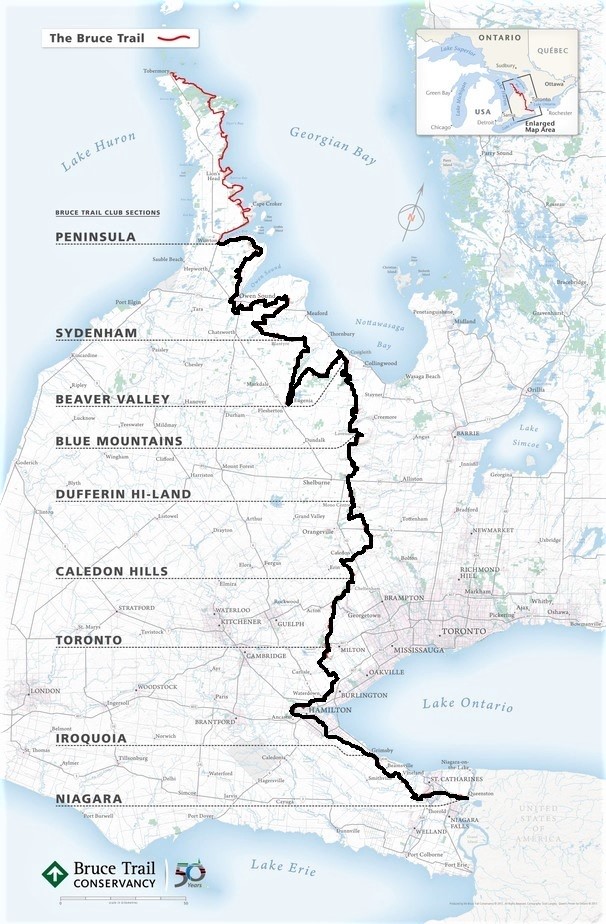
734. Wiarton (pop. 2,000), where we begin today, is an attractive small town at the head of the long inlet of Georgian Bay called Colpoy’s Bay. Most reference sources tell you that Wiarton’s odd name derives from the birthplace in Kent, England of Sir Edmund Walker Head (1805-68), Governor General of the Province of Canada from 1854-61, the period when Wiarton was first settled. However, there is no “Wiarton” in Kent or anywhere else in England. Head was born in Wierton Place, a large house still standing in Boughton Monchelsea, a village near Maidstone, Kent. And it’s not just the spelling of the two names that differs. Wiarton here in Ontario is pronounced “Wye-er-ton” but (as far as I can gather) the place in Kent is pronounced “Wee-eh-ton.” Go figure.
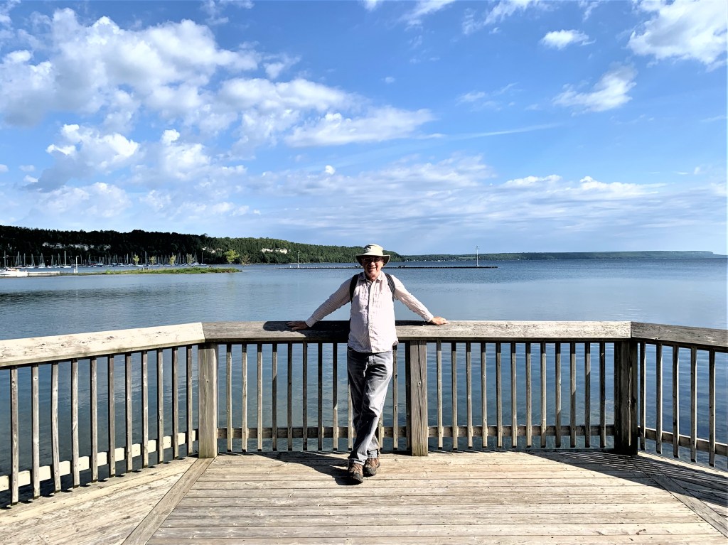
735. Part of Wiarton’s Bluewater Beach Park is under water, probably from the intense rainstorm that hit the South Bruce Peninsula on 20 August, when as much as 100 mm of precipitation was reported in a 24-hour period in Owen Sound. We must be distracted by the flood waters, because we manage to miss the statue to Wiarton’s most notable citizen: Wiarton Willie, the albino groundhog who every 2 February (Groundhog Day) since 1956 has forecast whether there’ll be an early spring. If Willie (that is, his latest avatar, as groundhogs are not remarkable for their longevity), emerging from hibernation, sees his shadow, then spring will be delayed. Wiarton Willie is the Ontario version of Fred La Marmotte (Québec), Punxsutawney Phil (Pennsylvania), Buckeye Chuck (Ohio), et al.
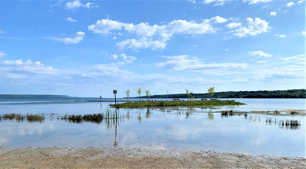
736. Kids practice their canoeing skills in the Harbour, while at back lies Wiarton Marina under the impressive stretch of Escarpment that forms part of Spirit Rock Conservation Area.
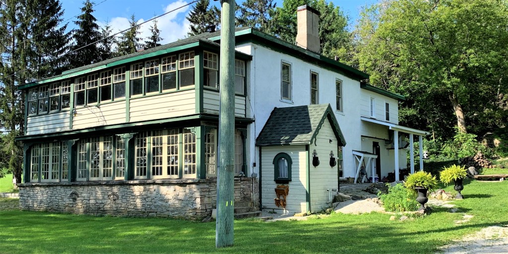
737. On Bayview Street heading north out of Wiarton we pass this house. It was built by Charles Cooper Jones between 1870-80 in rubble stone covered with mortar that was then incised to resemble ashlar. For fifty years from 1929-79, Myrtle Langford (who died in 1991) ran it as The Anchor Inn, a boarding house and tourist hotel. Mrs. Langford was evidently a splendid hostess if the poetic tribute to her entitled “The Anchor Inn” in the Bruce County Museum archives is anything to go by. (Click on the link to read the poem.)

738. This is the view northeast up Colpoy’s Bay towards Georgian Bay. The profile of the Escarpment looms distantly over both shores: Skinner’s Bluff on the right, whence we came, and Malcolm Bluff on the left, whither we hie. You may have noticed some striking cloud formations in recent images. Richard Kosydar in Natural Landscapes of the Niagara Escarpment (1996) explains: “Two large bodies of water surrounding a narrow peninsula create a natural stage, over which the heavens paint an ever-changing canvas of clouds and light. In this essentially marine environment, atmospheric conditions are complicated by the sliver of land with temperatures that differ from that of the water. The result is a sky often covered by spectacular cloud formations lit by theatrical lightning, with gold and turquoise as common hues” (p. 20). I hope any “theatrical lightning” holds off till we’re safely under cover.
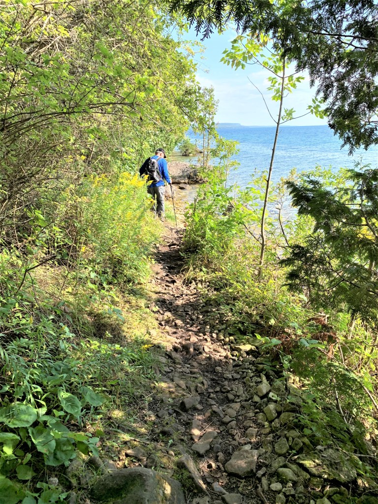
739. The Trail, quickly dwindling to a stony track as we leave Wiarton, hugs the shore of a Great Lake.
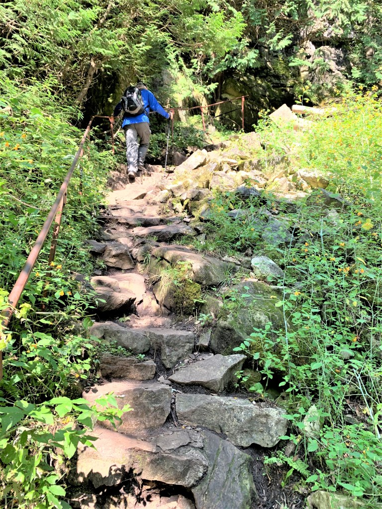
740. We were wondering how we’d get “above the rock,” as they say in these parts, namely to the top of the sheer bluff that the Escarpment presents here. The answer is a steep rocky climb …
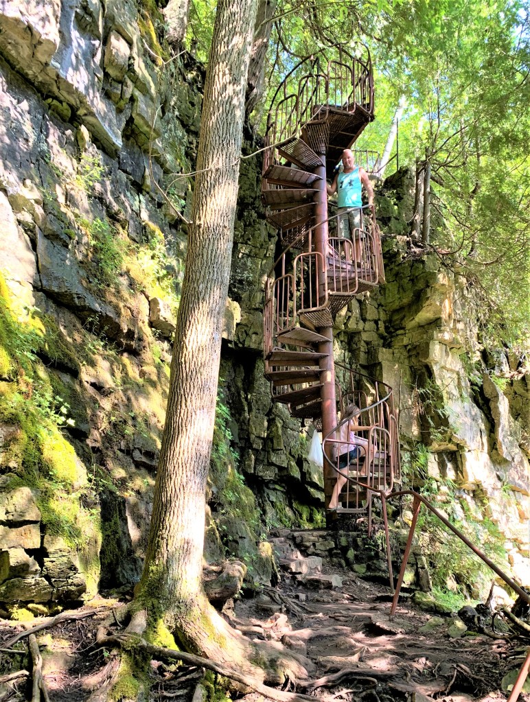
741. … ending at the foot of a spiral metal staircase that gets us up the last vertical bit! (We have to wait while this father shepherds his excited kids off the staircase.)
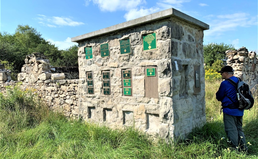
742. [Corrected entry 30 March 2021: many thanks to Tom Hall of the Peninsula BTC for this.] Part of a surviving wall of the Bull Homestead serves to support more than a dozen BTC plaques recognizing local donors. Near here in the Spirit Rock Conservation Area lie the ruins of The Corran, a seventeen-room stone mansion built between 1882-90 by Alexander McNeill (1842-1932), the Liberal-Conservative (yes, there was a party of that name then) MP for Bruce North from 1882-1900. McNeill’s wife Hester was the driving force behind its construction but she died before it was completed. Subsequently McNeill planted rose bushes, peonies, and 500 fruit trees in the gardens. Wikipedia’s biography of McNeill recalls: “Dominion Day 1901, a long line of carriages paraded down the main street of Wiarton and up the steep hill to the great stone gates where the coachmen turned their carriages right to the Corran. People came from throughout Ontario, the rich, the politicians and gentry to spend a day amongst the roses and peonies with the music of violins filling the air.” After Alexander’s death The Corran was inherited by his only son, who never married and whose fortune gradually dwindled away until his death in 1956. The Corran was left to a faithful housekeeper, but it was beyond her ability to maintain it. The house was abandoned by 1964 and set on fire by vandals in the 1970s. Omnia mors perimit et nulli miseretur.
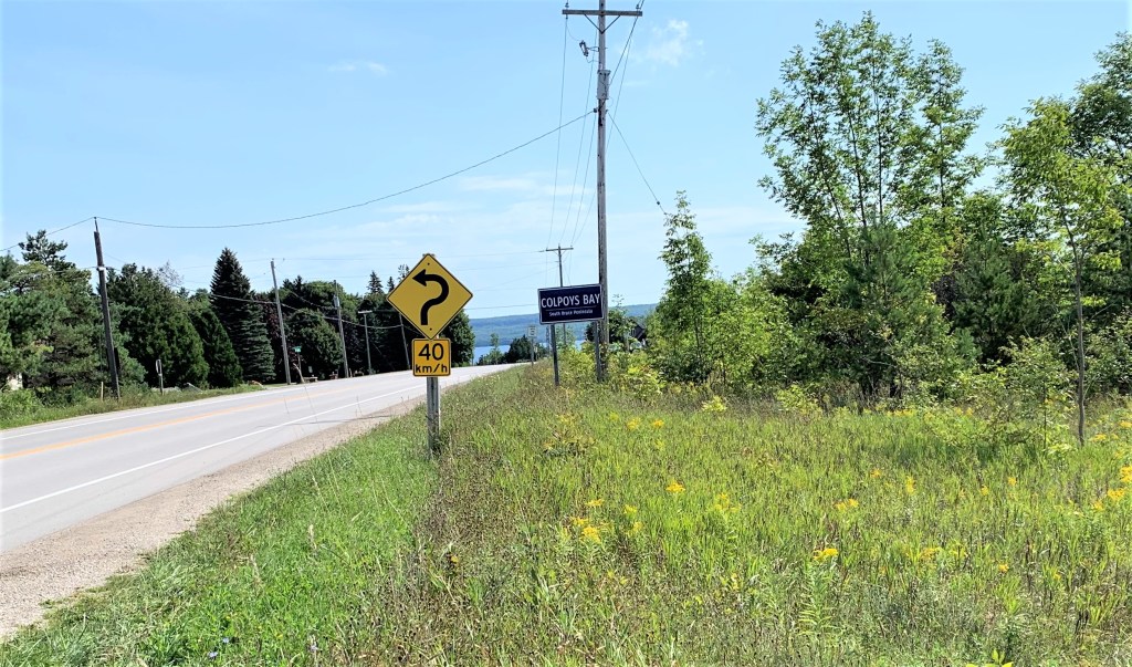
743. The sign indicating the limit of Colpoy’s Bay Village on Grey Road 9 has no apostrophe …
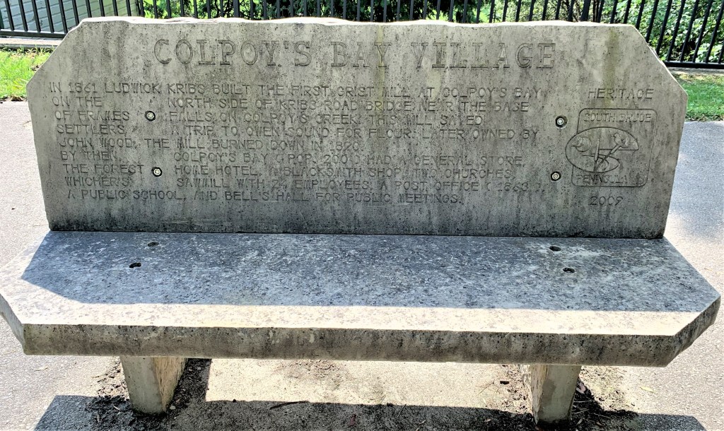
744. … but the ugly concrete bench (2009) inscribed with the history of the village does: “In 1861, Ludwick Kribs built the first grist mill at Colpoy’s Bay on the north side of Kribs Road Bridge near the base of Frames Falls on Colpoy’s Creek. This mill saved settlers a trip to Owen Sound for flour. Later owned by John Wood, the mill burned down in 1890. By then, Colpoy’s Bay (pop. 200) had a general store, the Forest Home Hotel, a blackmith shop, two churches, Whicher’s Sawmill with 24 employees, a post office (1863), a public school, and Bell’s Hall for public meetings.”

745. These millstones are the only surviving pieces from John Wood’s grist mill, the one that burned down in 1890. A grist mill, by the way, is one in which grist – grain having been separated from its dry husk (chaff) by threshing and winnowing – is ground into flour. The lower stone with a circular central hole is the bedstone, slightly convex and fixed in position. The upper with the “Spanish cross” hole in the centre is the runner stone, which is slightly concave and turns on top of it. Both stones were salvaged from the shore of Colpoy’s Bay, where they’d been used to anchor cables holding the stack of a sawmill in place.
Go to Part 60: Crawford Drive Side Trail to Coveney’s Side Trail
