Part 60: Crawford Drive Side Trail to Coveney’s Side Trail
Date: Monday 14 September 2020
Start: Crawford Drive Side Trail, South Bruce Peninsula
End: Coveney’s Side Trail, South Bruce Peninsula
Distance Covered: 8.7 km
Total Distance Covered: 753.2 km
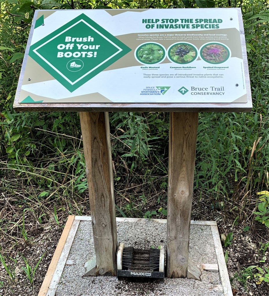
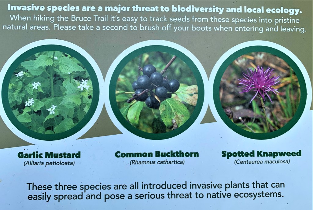
746A & B. Our sixtieth hike is shorter than expected for reasons that will be explained in due course. Steps are taken at many Trail parking lots here on the Bruce Peninsula to lessen the impact of a gang-of-three of invasive plants. Garlic mustard displaces native wildflowers like trilliums and trout lilies, interferes with the growth of mycorrhizal fungi, threatens several species at risk, and isn’t a useful food source for native creatures. Common buckthorn is a dense shrub that shades out native plants, and hosts rust fungi and soybean aphids that damage crops. Spotted knapweed is the most villainous of the trio: the Ontario Invasive Plant Council have produced a whole booklet devoted to detailing in full colour the malevolence of this purple horror. Abashed, we dutifully apply the brushes provided to the soles of our boots.
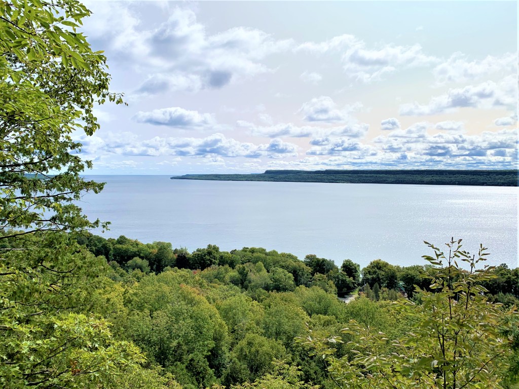
747. Colpoy’s Bay from Colpoy’s Bluff. That’s Skinner’s Bluff across the water.
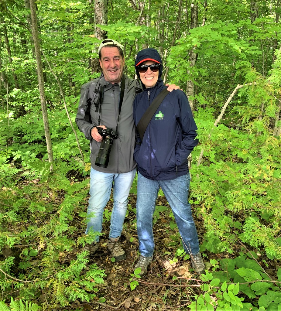
748. We meet Sylvain and his good lady on Malcolm Bluff. I remark that I’m envious of his camera (mine is still in the repair shop), and he tells me he is a professional freelance photographer who is searching out suitable locations to photograph when the fall colours are at their height. Later I check him out on Google: my goodness, what magnificent photography! Waterfalls, birds, sunsets, animals, rural and urban landscapes, motorsports! if you have ever read illustrated magazines about the Niagara Escarpment, you’ll have seen and admired his work. Check out his online portfolio here.
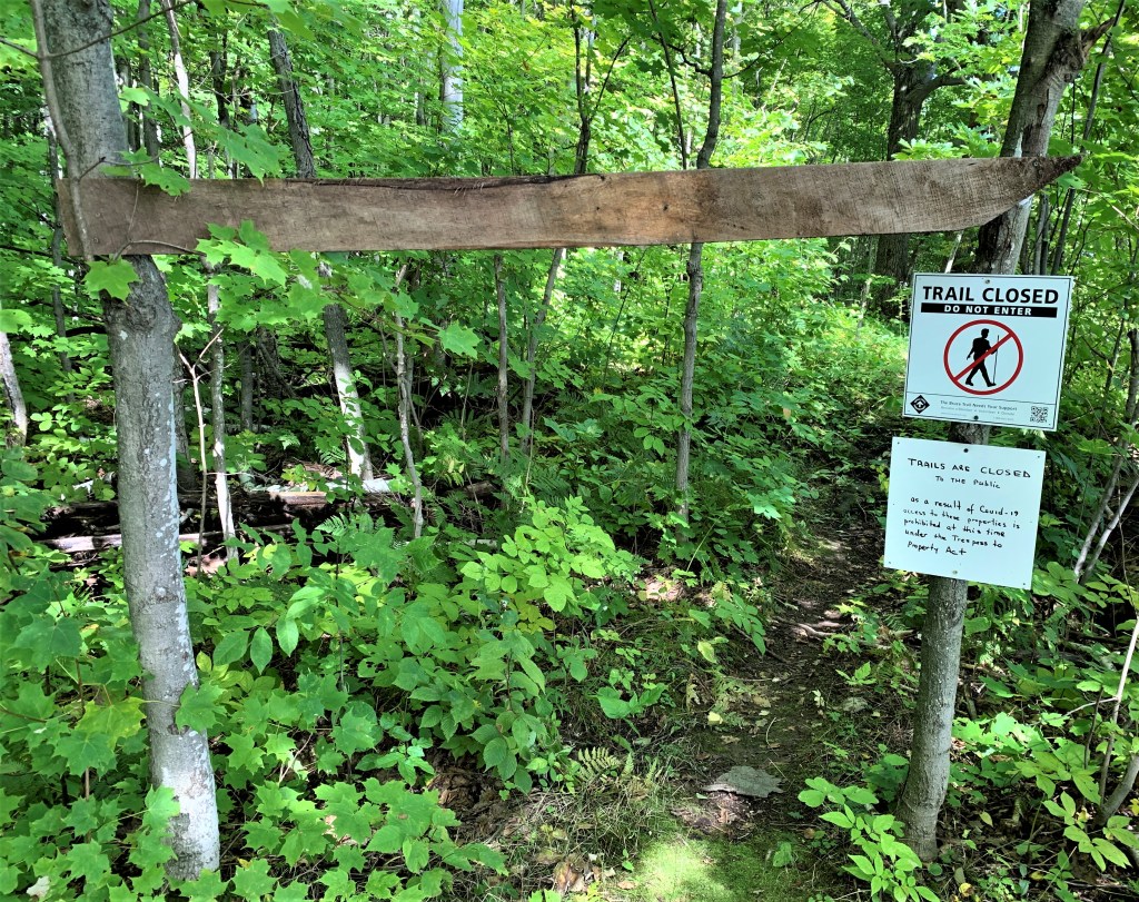
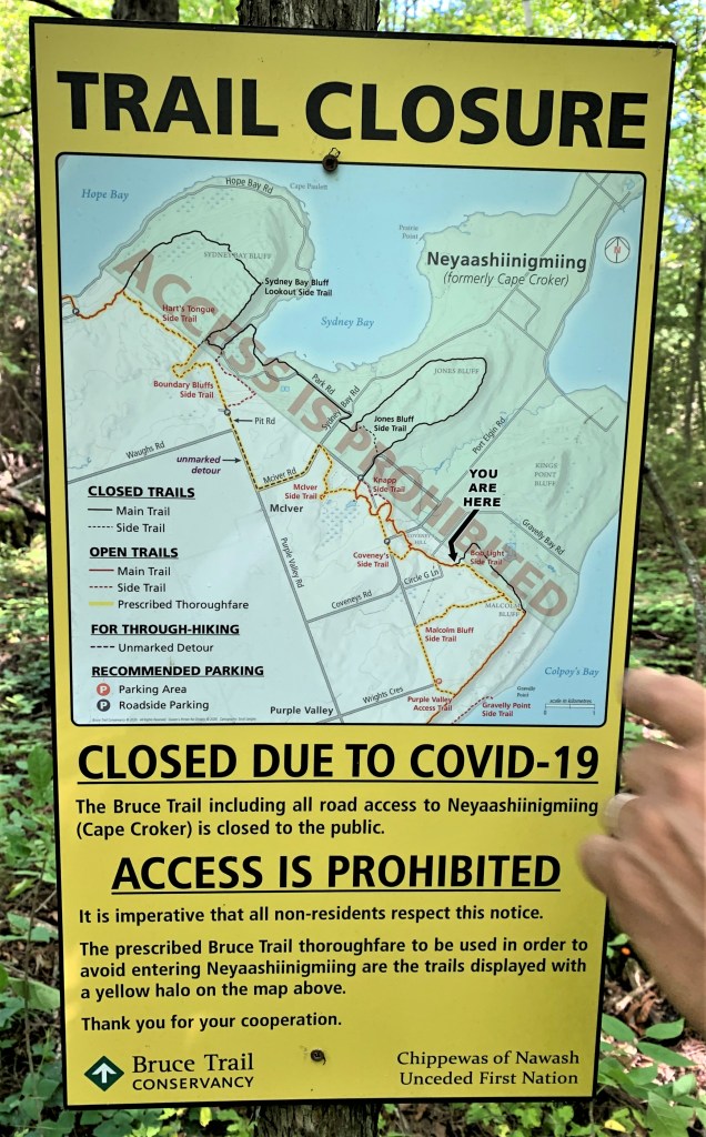
749A & B. Almost all the Bruce Trail has reopened after its closure during the first wave of the pandemic. But one area remains off limits: the Neyaashiinigmiing Reserve of the Chippewas of Nawash Unceded First Nation. (Neyaashiinigmiing, which means “point of land surrounded on three sides by water,” has been the official name of Cape Croker since 1992.) Since the closure, the main Trail has been rerouted down side trails and roads so as not to infringe upon Neyaashiinigmiing territory. The reason for the closure is to protect the members of this First Nation from a disease that may be inadvertently brought in to the Reserve by outsiders. But politics and history almost certainly play an unspoken part in the closure. The Chippewas of Nawash together with the Saugeen First Nation are currently in the midst of a multibillion dollar legal claim. This is for land and water on the Bruce Peninsula that belongs to the Crown but which they claim was taken from them in defiance of signed treaties. (They make no claim on the greater portion of the Peninsula that rests in private hands.) There is no doubt that ever since the colonial period, First Nations here, as elsewhere in North America, have all too frequently had their ancestral territories illegally appropriated by settlers. You can read about this shameful history as it affected the Saugeen Ojibway here. Moreover, many First Nations suffered terribly from European diseases to which they had no immunity, smallpox for example. In light of this history, it’s completely understandable that the Chippewas of Nawash are extra cautious in the face of today’s pandemic. As far as we are concerned, the Bruce Trail will be shorter here than its specified length in Edition 29 of the Trail Guide, as several loops into Neyaashiinigmiing territory are closed for the foreseeable future. However, recent reroutes have added to the Trail’s total length, so it’s unlikely that our End-to-End will fall very far short of 898 km.
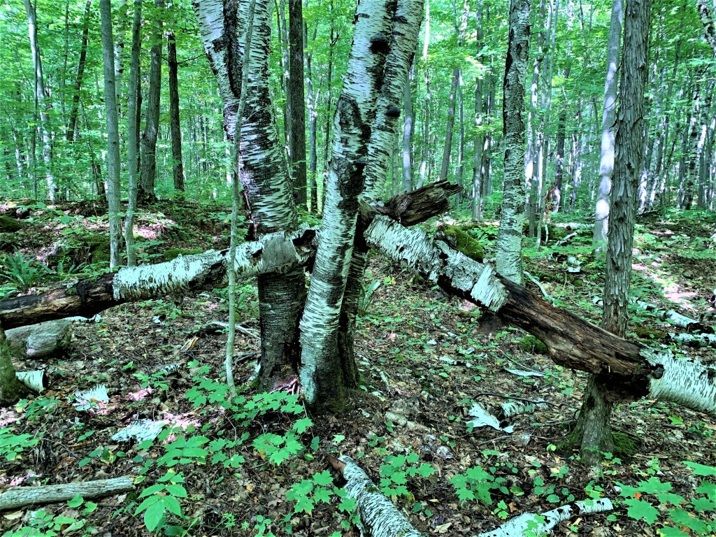
750. A sculptural arrangement of paper birches in various stages of decrepitude and decomposition by the side of the Trail on Malcolm Bluff. These trees are short-lived, rarely attaining an age of more than … 140 years.
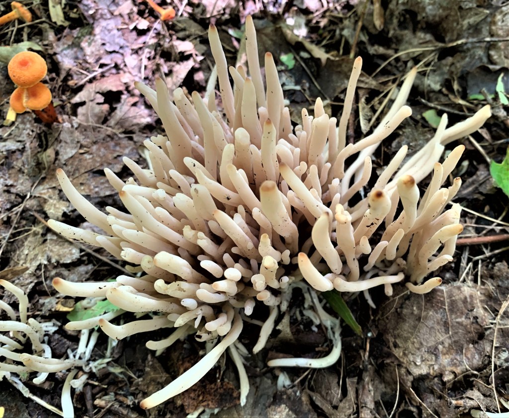
751. Clavaria fragilis, a.k.a. fairy fingers, a wormlike coral fungus.
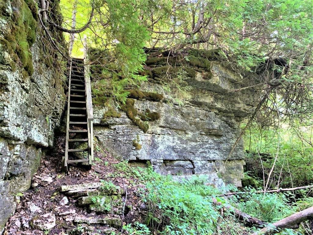
752. The Moss Crevice Ladder descends the steep top face of the Escarpment, leading us down towards the junction of Crooked Toe Road with Coveney’s Road, our end point.
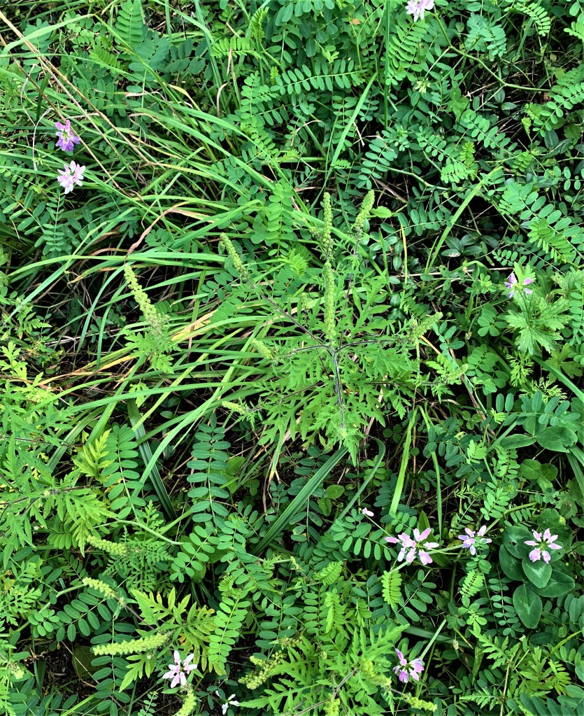
753. The focus here is not on the pretty pink flowers of wayside vetch. It’s on the low-profile, innocuous-looking plants with erect spiky yellowish flowers and toothed leaves in the centre of the picture: the dreaded ragweed (Ambrosia). Ragweed is a North American native that has been exported to the Old World, possibly in unconscious revenge for all the invaders that came in the other direction. Ragweed plants each produce up to a billion pollen grains every season, all of which are dispersed on the wind. (Goldenrod, with its highly visible masses of yellow pollen, is supposed by many to be the bane of allergy sufferers, but that’s a mistake, as goldenrod is pollinated by insects.) Ragweed allergies are widespread and may cause any of the following symptoms: itchy or burning skin, swelling of mouth and throat, watery eyes, runny nose, coughing and wheezing, insomnia, decreased sense of smell and taste, hives, allergic eczema, vomiting, diarrhea, asthma, and anaphylaxis. A substantial minority of Canadian residents suffer from ragweed allergies, especially those newly arrived in the ragweed hotbed of southern Ontario. I’m sure that some experiencing a severe reaction to ragweed for the first time think they have contracted Covid-19. Ragweed season runs from August through to the first frost in October, and thanks to global warming it’s getting gradually longer: from 1995-2015, it increased by 25 days in Winnipeg and by 24 days in Saskatoon. And ragweed thrives in cities where the microclimate is slightly warmer than the surrounding area. Rain reduces the airborne ragweed pollen count, but long dry spells, such as we have had this summer, worsen it. Ragweed pollen has been found 5 km up in the atmosphere and 500 km out to sea. You can’t avoid it, and if you are seriously allergic you are advised to take antihistamines and stay indoors between 10:00 am and 3:00 pm when the pollen count is highest. And don’t hang your washing outside on a line to dry!
