Part 68: Halfway Dump Side Trail to Crane Lake Road
Date: Tuesday 3 November 2020
Start: Halfway Dump Side Trail, Bruce Peninsula National Park
End: Crane Lake Road, Miller Lake
Distance Covered: 14.1 km
Total Distance Covered: 865.5 km

852. It’s a cool, overcast morning, newly fallen leaves bestrewing the ground. We’ll do this long hike from north to south, having read in the Trail Guide that 6 km of today’s hike is part of a 10.6 km coastal section “considered to be the most challenging hiking along the entire length of the Bruce Trail. Be prepared!” (The words are in bold in the original.) So, we’ll do that demanding 6 km stretch first, while we are fresh and alert. We drive up Emmett Lake Road, park at a large National Park lot at the end, then walk along the Halfway Dump Side Trail for 900 m until we meet the Main Trail near the shore of Georgian Bay. Halfway Dump? Sounds like a bad case of constipation. Actually its full name is “Halfway Log Dump,” and it’s a low point on the Escarpment roughly halfway between Cypress Lake and High Dump (see #861 below). Halfway Dump offered relatively easy access to the Bay for the lumber industry that once dominated the Bruce Peninsula. Along what is now the Side Trail, logs were carted to the shoreline and dumped there until they could be towed by boat to a lumber mill.

853. Though it’s early November almost as far north as you can get in southern Ontario, the forest understory is still colourful in places. These dark green plants are pipsissewa (Chimaphila umbellata), a.k.a. prince’s pine, ground holly, or love-in-winter, a member of the wintergreen family. They are evergreens, needing mycorrhizal associations, i.e., the presence of nearby fungi, to thrive. The word pipsissewa perhaps derives from Eastern Abenaki kpi-pskwáhsawe, meaning “flower of the woods.” An aboriginal medicine, pipsissewa has been used to flavour root beer and other soft drinks and the word may possibly have influenced the naming of a certain popular cola.


854A & B. Looking west: (A) on the horizon right is Bear’s Rump Island; (B) in the foreground is Cave Point.
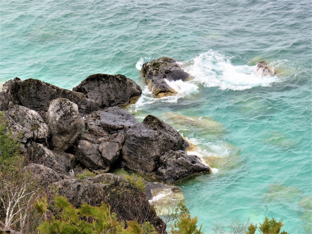
855. There’s a swell on Georgian Bay today, producing a fair amount of spray over the rocks.
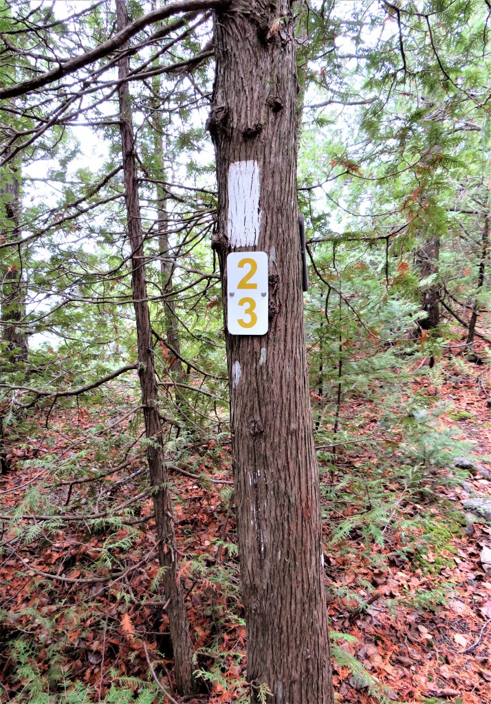
856. We are curious about these signs with descending numbers that appear periodically along the Trail, in this case under a Bruce blaze. They don’t appear to be exact distance markers. As no other explanation offers itself, we infer that, because cellphone reception in this remote area is unreliable, they represent numbered stations to assist a rescue team in locating hikers in difficulty. But in that case, wouldn’t you need a cellphone to let the rescue team know what number you were near …?

857. A flash of late autumnal colour provided by unfallen maple leaves against the trunks of birches.
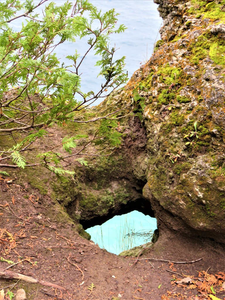
858. The cliff edge of the Escarpment is continually being eroded by the elements. This little natural arch provides an unusual window onto Georgian Bay: contrast the greenish colour of the water seen through it, to the pale blue water above. The chromatic difference may be accounted for by the differing depths of water in combination with the angles of observation.

859. Though this particular stretch of Trail has thrown nothing at us that we haven’t dealt with before, it’s certainly longer and more gruelling than most, and our progress has been, at 1.5 km/hr or less, hardly rapid enough to warrant such a warning. SLOW signs are usually posted on the few stretches of Trail that are legitimately shared by ATVs or snowmobiles. It does seem that, for dubious historical reasons, snowmobiles are allowed in some parts of the National Park, though not on the Bruce Trail. Surely not on the Bruce Trail…?

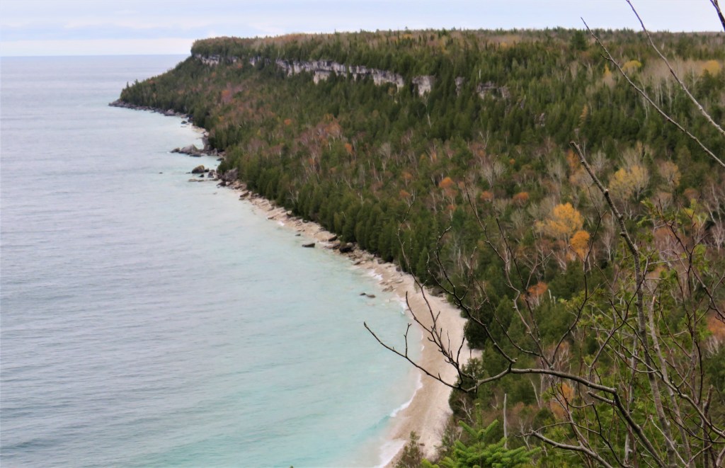
860A & B. We’re looking northeast at the coastline over and beyond High Dump. This was where lumber was once shoved over the edge of the Escarpment and slid down a steep log flume to water level. Now there’s a wilderness campsite near the beach down there …

861. … accessible by this Side Trail and involving a rope-aided descent down the course of the former flume. During the main season, the campsite is very busy and needs to be booked well in advance, but all’s quiet at this time of year. That “00” sign on the tree suggests that this is where the mysterious numbering begins. For us going against the grain, the Trail turns inland from this point and the hike suddenly gets much easier.
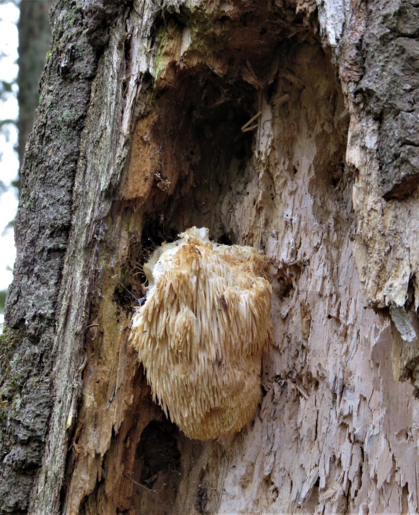
862. A lion’s mane fungus (Hericium erinaceus) hangs like a dense cluster of icicles on a wound in a hardwood tree trunk. Other names for this saprophytic fungus include: bearded tooth mushroom, hedgehog mushroom, satyr’s beard, bearded hedgehog mushroom, and pom pom mushroom. Apparently all forms of this fungus are edible, even delicious, though they must be wrung out before cooking, as they absorb lots of moisture. However, this one’s brownish colour indicates it’s past its “Best Before” date.

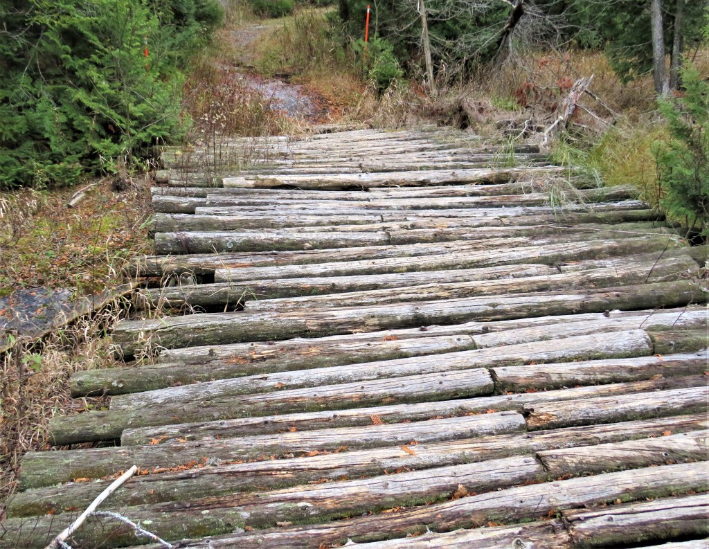
863A & B. The Trail passes by four marshy lakes as it heads south toward Crane Lake Road. (A) is Upper Andrew Lake, where beaver dams have raised the water level so that the Trail must pass over several crude bridges (B) made of logs placed side by side. One day, surely, the resources of the National Park and Bruce Trail Conservancy will combine to replace this jumble with a boardwalk.
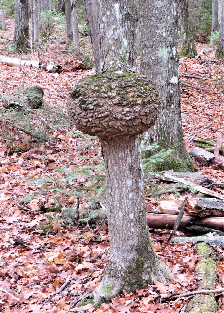
864. There’s a spectacular burl on this tree by the Trail. Such tumid growths are caused by a physical injury to the tree, or possibly by a virus or insect infestation. Wikipedia notes: “Burls yield a very peculiar and highly figured wood, prized for its beauty and rarity. It is sought after by furniture makers, artists, and wood sculptors. There are a number of well-known types of burls (each from a particular species); these are highly valued and sliced into veneers for furniture, inlay in doors, picture frames, household objects, automobile interior paneling and trim, musical instruments, and woodturning.” The huge burls on California redwood trees are sometimes poached for their valuable wood, causing severe injury to the tree.
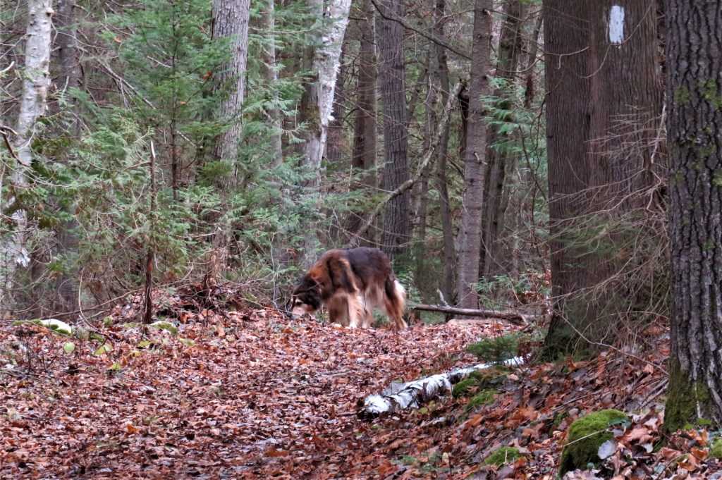
865. An information board at the parking lot at the end of Crane Lake Road, which we are now approaching, notes that there is a small population of black bears in these woods. When a large animal suddenly materializes on the path ahead of us, just for a second we think we have sighted a bear. It turns out to be no more than a friendly shaggy dog being taken for an off-leash walk by his owners.

866. This is either Long Marsh, as a sign on the Trail refers to it, or Big Marsh, as it appears on the map in the Trail Guide. While it took us four and a half hours to cover the first 6 km of this hike, we have done the last 8 km in no more than two hours.
