
Part 67: Crane Lake Road to Cottrill Lake Side Trail
Date: Tuesday 27 October 2020
Start: Crane Lake Road, Miller Lake
End: Cottrill Lake Side Trail, Dyer’s Bay
Distance Covered: 14.6 km
Total Distance Covered: 851.4 km
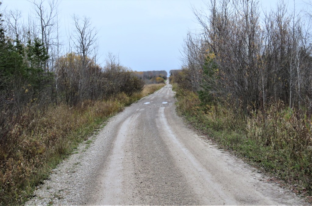
838. Rain is forecast for the morning, brighter weather for later in the day. We decide to hike north to south, as that way we begin with almost 8 km along roads, much easier to negotiate in the wet than the rocky edge-of-the-Escarpment scramble to follow. Crane Lake Road is the longest, roughest, back-country-single-lane-gravel-Trail-access that we have yet encountered. We begin by walking 4 km along it southeast. The land on the right is part of Bruce Peninsula National Park, while that on the left is privately owned and studded with No Trespassing signs. The tiny figure coming toward us in the distance is an elderly gentleman taking his morning constititional.

839. As it’s a dead end in rough shape, Crane Lake Road doesn’t have much traffic. This section is under several inches of water, as a creek flows across it from right to left into a marsh just over the road.
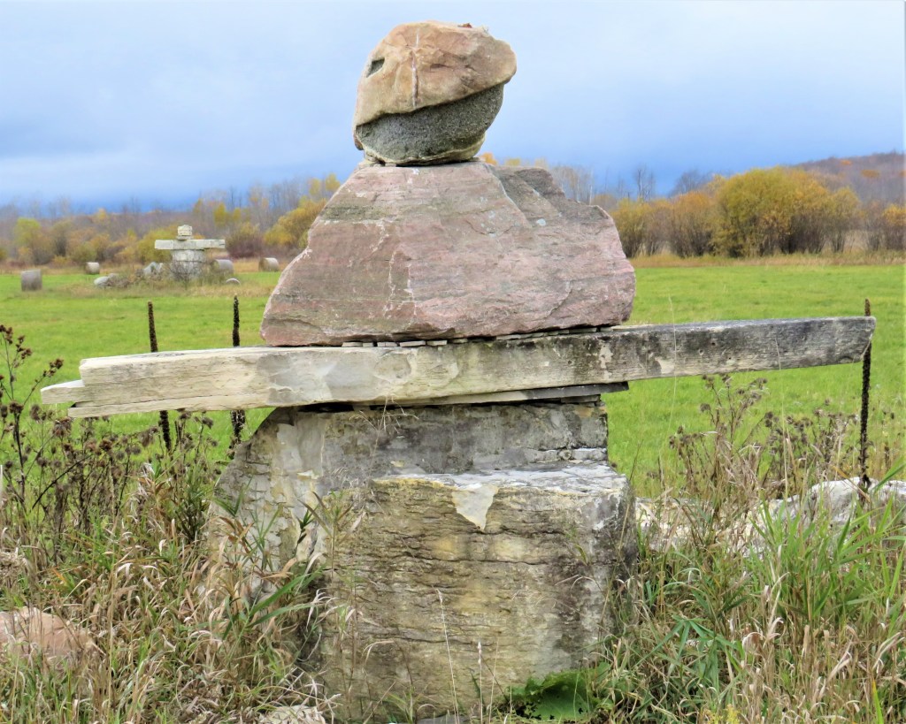
840. A huge, forbidding inukshuk looms over Crane Lake Road near its junction with Lindsay Road 40. There are several more in this farmer’s field, including the one in the background. Inuksuit are supposed to serve as spirit guides, but this one seems to be warning Bruce Trail hikers to keep off private land.

841. The landscape of the interior of the Peninsula is bleak and monochrome at this time of year. But these maples that have retained their leaves provide welcome splashes of colour as heavy cloud starts to roll in from the west.
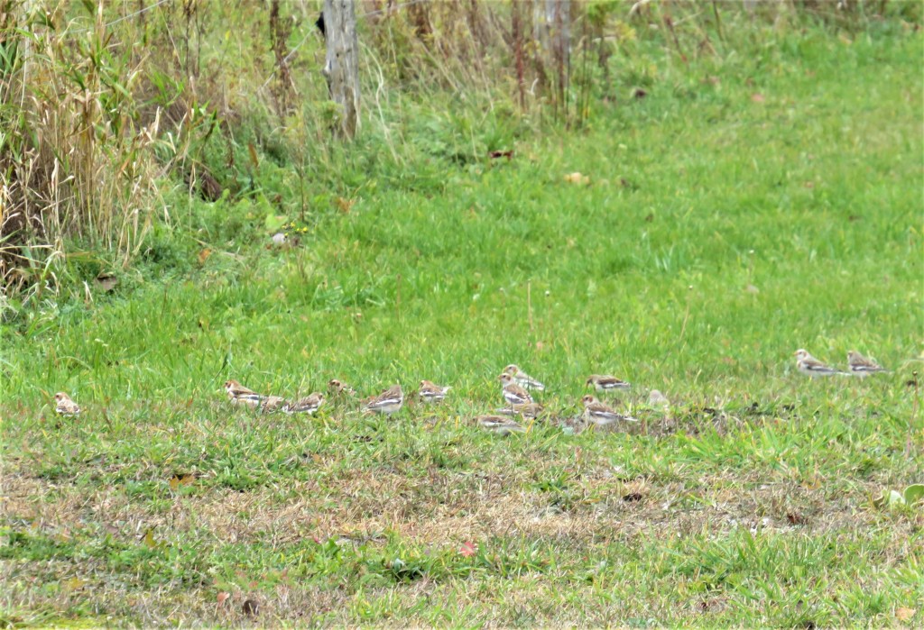

842A & B. Small birds with distinctive wing markings flutter into a nearby field like a flock of large black-and-white butterflies. They are snow buntings, birds that venture farther north than any other songbird and breed in the high Arctic in summer. This group, sporting non-breeding colours, has come south for the winter to forage for seeds and waste grain. Snow buntings that arrive in southern Ontario at this time of year have probably come from Greenland.
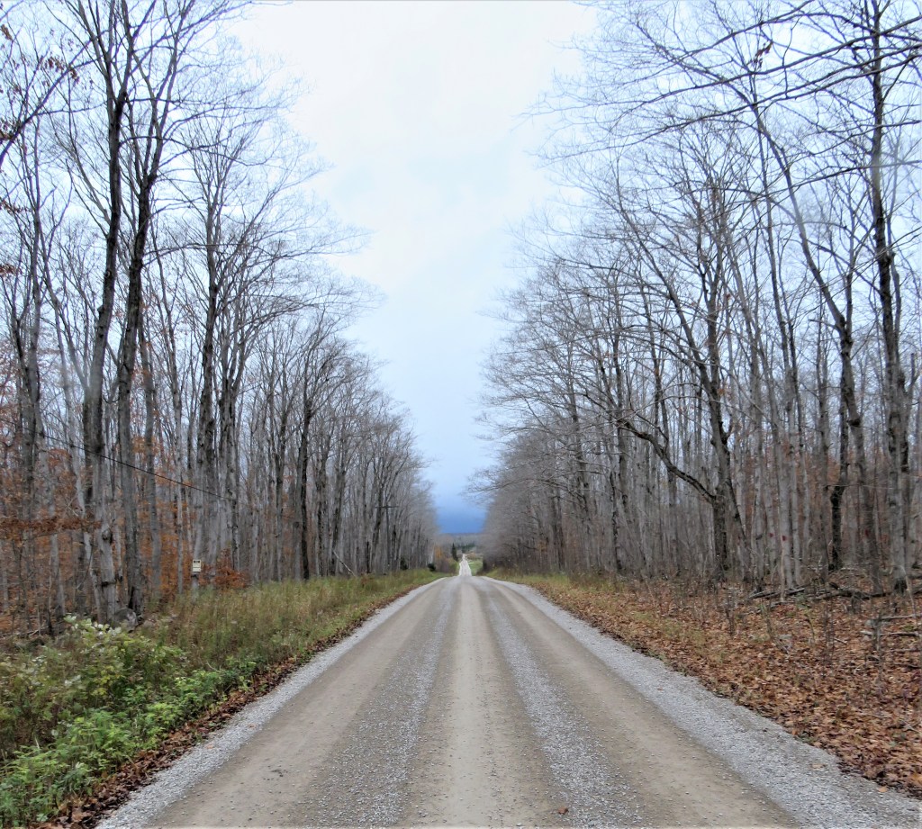
843. The sky is heavily overcast and rain is almost upon us. We are making good progress, though: on these back roads we can do 4 km per hour. It was not always thus: “The inhabitants of Dyer’s Bay and Tobermory sections are at a great disadvantage, being so far removed from a line of railroad, and the roads leading to those places are in an almost impassable condition. Land is so sparsely settled that it is utterly out of the power of the people of these townships to maintain the roads”: from the Report of County Valuators, 1901, in History of the County of Bruce, Ontario, Canada: Township of Lindsay.
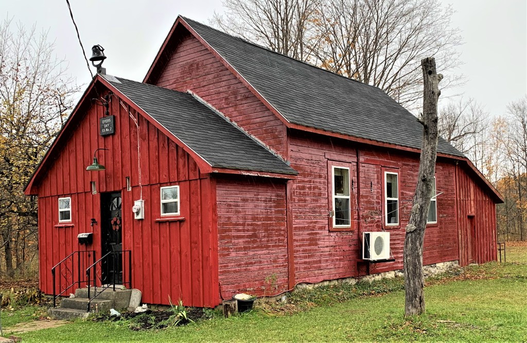
844. As the rain starts, we stop to chat briefly with the owners of this distinctive little red residence on Lindsay Road 40. This is, of course, a converted schoolhouse: the plaque over the front door reads “Dyers Bay SS [i.e., School Section] No. 2.” The first school in the former Lindsay Township was established in 1879, but I cannot find the date for the foundation of this second one.
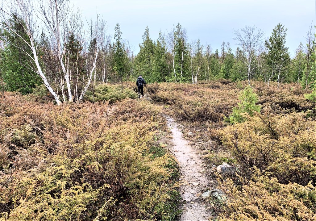
845. We pass through this alvar covered in juniper as we approach the shoreline of Dyer’s Bay.
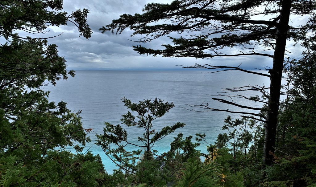
846. The rain is starting to ease off as we get our first glimpse of Dyer’s Bay on this hike. Here’s a historical anecdote from this area: “On a warm day in August, 1902, a six-year-old son of Mr. Robt. Bartley, residing north of Dyer’s Bay, playing about his home bare-footed and bare-legged to his knees, was so unfortunate as to step on a three-foot snake, which was lying basking in the sun. The rude awakening aroused the temper of the reptile, and in a twinkling its fangs were buried in the child’s leg. An angry snake strikes very quickly, and before the child got beyond reach the beast struck him in five different places. His screams brought his mother to the scene, and realizing the trouble and danger, instead of fainting or going into hysterics, she bravely sucked the wounds, tied a ligature tightly round the limb to stop the circulation of the blood, then hitched a horse and started on a fifteen-mile drive to Lion’s Head with the boy. Before reaching medical aid at that village the child was nearly crazy from the pain caused by the ligature stopping the circulation in the limb, and his cries could be heard for a long distance. But the heroic woman held on and fortunately found Dr. Sloan at home. The wounds were cauterized and dressed, and fortunately little or no ill effects resulted from this exciting experience” (from History of the County of Bruce, Ontario, Canada, Township of Lindsay). The snake will have been an Eastern Massassauga rattlesnake, the only venomous snake native to Ontario. It’s described as a “sluggish, solitary, and passive creature” (unless stepped on by small boys), and is still to be found on the Bruce Peninsula, though it’s now an endangered species. If you’re bitten by one, Lion’s Head is still the nearest place to go for snake venom antidote.

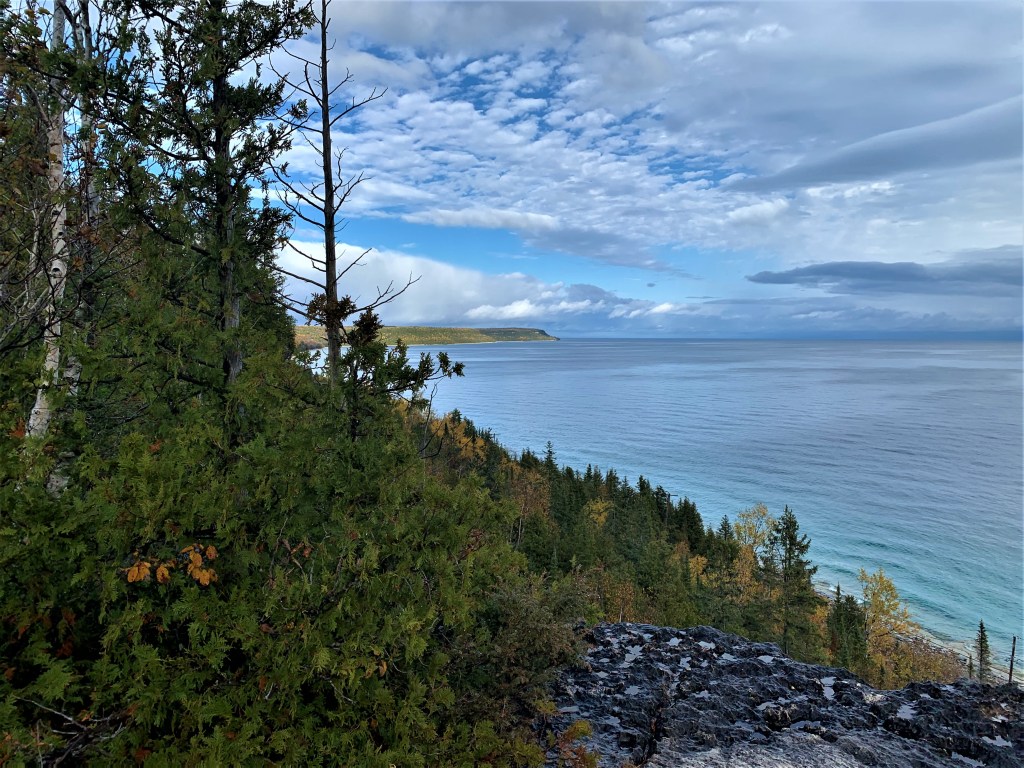
847. The rain clouds start to move offshore over Dyer’s Bay and we catch a glimpse of now distant Cape Chin to the south. Dyer’s Bay (the apostrophe is discretionary) was named by Admiral Bayfield (see #789) for John Dyer (fl. 1814-35), Chief Clerk of the Admiralty.
848. As we look north, patches of blue sky appear over Cabot Head.
849. Now we are above the hamlet of Dyer’s Bay, the sun illuminating the fall foliage. “Sanson’s map of 1656 indicates that the lost Jesuit mission of St. Simon and St. Jude was in the vicinity of Dyers Bay. Father Du Creux in 1660 reaffirms the site of the mission in a geographic sketch. It is possible that the remains of the lost mission may some day be discovered in the vicinity of Dyers Bay. In 1725 the geographer de Léry drew a map of the area showing an Indian village on the site that is today, Dyers Bay. The village was shown as ‘Papinachois,’ meaning, ‘Funny Men.’ The Indian village disappeared and eventually the community that took shape became known as Dyers Bay”: James E. Kraemer, “A Socio-Postal History of Municipality of Northern Bruce Peninsula, Part II” in The Grey, Bruce, Dufferin & Simcoe Postal History Study Group Newsletter #31, vol. 6, no. 3 (March 2003), p. 296.
850. A rocky spur is the perfect place for a selfie for hikers less acrophobic, or more foolhardy, than ourselves.

851. Our hike nears its end as the shades of evening descend on Dyer’s Bay.
Go to Part 68: Halfway Dump Side Trail to Crane Lake Road
