

Map 21. The map takes us from A, the border at Kerns Road between Hamilton and Burlington, to B, the junction with Highway 407 Express Toll Route (ETR). We enjoy the panoramas in City View Park, then head steeply down the Niagara Escarpment. Dundas Street here divides suburban Burlington to the south from countryside to the north.* It’s becoming an increasingly important thoroughfare in this area, linking the sprawl of development between it and Lake Ontario. With the exception of the valleys of creeks flowing into the Lake, the entire lakeshore south of Dundas Street between here and Toronto is built up.
Is Dundas Street a viable alternative route into Toronto for motorists from this area? Well, Google Maps indicates that during working hours, it takes about two hours to drive the length of Dundas Street from Brant Street in Burlington to Yonge Street in downtown Toronto. That’s a long time to go about 60 km, but it can take just as long on the 403/QEW freeway at busy times. If you take the 407 ETR, you can do it in an hour, but at a cost. If you drive a light vehicle, you’ll pay roughly $1 per km, or about $50 one way. Then you have to pay for gas, P, and the return journey. In short, unless you have the patience of a saint or money’s no object, don’t even think about driving into downtown Toronto from here. P for free at a GO Station and take the train.
*Dundas Street runs southwest to northeast, as the map suggests. But to simplify things, I’ll pretend that it runs west to east.
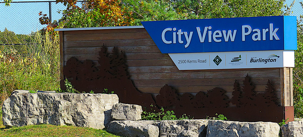
242. You access City View Park via the east side of Kerns Road. There are two entrances, each leading to a large free P. This park is also a convenient access to the Bruce Trail. The northbound Trail, which only a few years ago forced hikers to scamper across Dundas Street through gaps in the high speed traffic, now takes to suburban streets when it exits the Park, and allows hikers to cross Dundas Street at the lights at Brant Street.


243. From either P, go south to a short trail that, fenced along the very edge of the Escarpment, offers a variety of scenic views.
(Top) The Burlington Skyway Bridge carries the QEW along the Beach Strip, a sandbar separating Lake Ontario from Hamilton Harbour. The two squat towers to the left of the bridge’s central arch are those of the Lift Bridge that, when raised, allows large vessels to pass through the short Burlington Canal that connects the two bodies of water. It was the opening of this canal in 1826 that triggered the growth of Hamilton, which is today a major Great Lakes port. On the horizon is the Niagara Escarpment, towering above the lakeshore in the Grimsby area.
(Bottom) Downtown Burlington, Lake Ontario beyond, and, just visible on the horizon, the taller buildings in Niagara Falls, 50 km away across the western end of the Lake. Burlington (pop. about 200,000), at the centre of the Golden Horseshoe, is a pleasant, affluent city, regularly named among the best places to live in Canada.

244. At 1107 Dundas Street on the north side just east of Kerns Road is this fine house, “Stoneacres.” It was built in 1854 by Charles Tuck for his wife, nine daughters, and one son. A prosperous farmer, Tuck gave each of his daughters on her marriage a dowry of $1,000, three cows and ten sheep.
In 2008 the house was placed on a heritage register, leading to a protest that has since become familiar. The owners feared that a heritage designation would reduce the value of the property. In December 2022 the house was listed for $2,795,000.

245. The panoramic view down the Escarpment threatens to distract the motorist from maintaining a safe speed of descent. On the horizon at extreme left are the towers of downtown Mississauga about 32 km away. On the central horizon, large buildings show where Oakville is starting to build an “Uptown Core” on Dundas Street. The originally straight course of Dundas Street over what is about 20 km is now wiggly, thanks to deviations necessitated by its intersections with highways and rail lines, and by new bridges over creeks. Downtown Toronto, about 50 km away as the crow flies, can also be seen on a clear day.


246. (Top) St. John’s Anglican Church (1839), at 2464 Dundas Street on the south side just before Guelph Line, is a survivor. From its website: “Founded in 1835, it’s the second oldest Anglican church in [Burlington], and worship has taken place in our present building since 1839. In those early days, local settlers gathered in the nearby Ballykill Bay schoolhouse, visited by travelling clergy who came by horseback. As the congregation grew, our modest pioneer style classic Canadian wooden church was built for the princely sum of $300 on land purchased from a local farmer, the very same beautiful jewel of a church building where we continue to worship today.”
(Bottom) Traffic on Dundas Street whizzes by St. John’s old graveyard. These two stones, unusually legible given their age, commemorate a married couple born in late eighteenth-century Ireland. The wife, Susannah, died just over a year after her husband James. As was typical of the time, Susannah is referred to by her maiden name and described as the “relict” of her husband.

Map 22. This map takes us from C, the junction with 407 ETR, to D, Bronte Creek, one of the larger creeks that Dundas Street crosses on its way to Toronto. We are still in the City of Burlington. The 407 (built 1997-2001 and privately operated) has encouraged the construction of a large survey of houses north of Dundas Street, the first major development on that side since Waterdown. Building new highways encourages creeping suburban sprawl, a blight that will become increasingly obvious as we head farther east. It is to Burlington’s credit that it has extended bus services to its newest developments, and has a plan to make transit free for all in the near future.

247. This building, formerly St Paul’s Presbyterian Church at 3318 Dundas Street just east of the 407 junction, is another survivor from an earlier time. It abuts a cemetery, but it’s no longer a church. From a local history website: “Rev. William King organized a congregation here in 1819. The first frame church was built on Dundas Street and was opened for service in 1822 … The present church was begun in 1867 a little to the west of the original frame building … The first known burial [in the cemetery], which predates the erection of the first church, was Sarah Bastedo daughter of Gilbert and Marion Bastedo who died in 1817 at the age of 21 days. Many veterans from the War of 1812 are buried here … The church remained the home of St. Paul’s congregation until 1993 when the congregation moved to a new church east of the older building.”
It’s a Designated Heritage building that’s been converted to a private dwelling. It was last listed for sale at about $1,100,000.

248. As we reach Appleby Line and the first of the many cone farms that indicate ongoing work to upgrade Dundas Street, let’s stop and look back. The Dundas Street cut up the Escarpment is now plainly visible. It’s about 4 km to the top of the Escarpment from here. And from a mere two lanes in Vinegar Hill in Waterdown, Dundas Street at this junction has now swollen to eight lanes.

249. As we look south from the bridge, an apparently endless freight train on the CN Halton Subdivision line passes under Dundas Street just east of Appleby Line.
The rail line, originally part of the short-lived Hamilton and North-Western Railway, opened in 1876 and was absorbed into the CN system in 1923. Today, the 79.4 km Halton Subdivision starts in Vaughan, joins the GO line just west of Georgetown, heads south through Milton, and joins the Toronto-Hamilton-Brantford CN mainline just west of Burlington GO Station.

250. From the slight elevation of the rail bridge, you can zoom in on Mount Nemo about 4.5 km to the west. It’s one of the more spectacular sections of the Niagara Escarpment, now protected from the quarrying industry by a Conservation Area and by the activism of singer-songwriter Sarah Harmer. The sheer sides of the Escarpment here make it one of the most popular rock climbing spots in southern Ontario. If you’re not up for dangling from a rope but are reasonably fit, you can make a strenuous direct ascent of Mount Nemo by the Bruce Trail from a P on Walker’s Line at No. 2 Sideroad. From viewpoints atop Nemo, 287 metres above sea level, you can easily see the skyscrapers of downtown Toronto on a clear day. Of course, Nemo isn’t really a mountain. It’s a tight bend in the Escarpment where weathering has eroded away softer rock and exposed the hard dolostone upper strata.

251. We’re approaching Bronte Creek, the next major ravine that Dundas Street crosses. Don’t you wish you’d invested in the traffic cone manufacturing industry?


252. (Top) The brand-new, not yet quite fully open Dundas Street bridge over Bronte Creek.
(Bottom) Bronte Creek from the bridge. Water is low after a dry spell in late summer.
The Creek, Eshkwesing-ziibi in Ojibwe, rises in Puslinch and flows into Lake Ontario at Bronte, a former fishing village that’s now a lakeside suburb of Oakville.
“Bronte” has nothing to do with the three Victorian sisters who wrote the famous novels. It refers to a title bestowed on the great British naval officer Horatio Nelson. In 1799 Nelson was appointed Duke of Bronte (a town in Sicily) by Ferdinand III, King of Sicily, to thank him for having saved his kingdom from invasion by Napoleon. Nelson had destroyed the French fleet at the Battle of the Nile the previous year, giving the British fleet control of the Mediterranean.
As we shall see, there are several Nelson references in local place names. Burlington and Oakville were once small settlements in the Townships of Nelson and Trafalgar, respectively. The two Townships were named and opened for settlement in 1806, just a year after Nelson’s greatest victory – and his death – at the Battle of Trafalgar. That victory over the combined French and Spanish fleets thwarted Napoleon’s plan to invade Britain and confirmed British naval supremacy for the next century.
Nelson and Trafalgar Townships became part of Halton County in 1816, and were gradually absorbed by their largest towns. In 1974, Halton County became the Regional Municipality it is today, with the City of Burlington now occupying the former Nelson Township and the Town of Oakville similarly replacing Trafalgar Township.


253. Bronte Creek was formerly known as Twelve Mile Creek, to indicate its distance from the western end of Lake Ontario (now in Hamilton Harbour). But as there is a better-known Twelve Mile Creek on the Niagara Peninsula, the name Bronte Creek was preferred. The older name has been preserved, however, in the 12 Mile Trail, that starts on Dundas Street and runs for 10.9 km on the Creek’s west bank all the way to Bronte Provincial Park just north of the QEW. As yet, there’s no dedicated P at the Dundas Street end.
(Top) The ravine here is very steep, and the continuous fence along the 12 Mile Trail warns hikers that there’s no safe access down to the Creek itself.
(Middle) The old low-level Tansley Bridge over Bronte Creek, about 1916. Before the first high-level bridge was completed in 1919, early motorists had to creep down a steep “hogback” road to the old metal truss bridge, and then would reverse up the opposite bank of the ravine.* To lighten the load, passengers in the cars would walk, though apparently a cable car was at some point provided across this ravine.
(Bottom) The Dundas Street Bridge over the Creek, as seen from the 12 Mile Trail. The ravine here is 200 metres wide and 30 metres deep. When you see how such a large and complex bridge is needed to cross a gorge like this these days, you can imagine how difficult it must have been to negotiate Dundas Street in the early days. The new bridge replaces one built in 1948 and rehabilitated in 1979. In the foreground, the concrete piers of the 1919 bridge have been reused to carry a watermain from Lake Ontario to newly developed suburbs to the north of Dundas Street.
*The lack of a fuel pump in gravity-fuelled engines could cause stalling on steep slopes when the tank was depleted, while very low reverse gearing often gave better traction than a forward gear.

Map 22. This map takes us from E, the boundary between Burlington and Oakville at Tremaine Road, to F, McCraney Creek, just west of the junction with Third Line. Once in Oakville, Dundas Street adds “West” to its name.

254. The “Oakville Welcomes You” sign looks rather battered at the moment. That’s because there are major construction works here at the junction between Tremaine Road and Dundas Street. Undoubtedly the sign will be replaced with a shinier one when the job’s finished.
Oakville (pop. about 250,000) is Ontario’s largest town. It’s more populous than the City of Burlington next door, but since its incorporation in 1859, it has been content with the lowlier designation. “Town” suggests a small, neighbourly place, which is how Oakville sees itself. It has a small historic centre where Sixteen Mile Creek meets the Lake. With its downtown full of high-end independent stores and its parade of over-the-top McMansions along Lakeshore Road, it’s a very affluent place. In fact, if the criterion is median household income – here about $155,000 p.a. – it may be Ontario’s wealthiest large community.


255. Palermo was a former crossroads village where Dundas Street met Bronte Road. It was settled as “Hagartown” in 1805, and took the more exotic name in 1837. Why? Nelson again! He’d managed to evacuate the Sicilian Royal Family safely from Naples to Palermo, the capital of Sicily, and Nelson himself lived in Palermo for a year in 1799, after he and Emma Hamilton had become lovers.
(Top) St Luke’s Anglican Church, at 3114 Dundas Street West, Palermo. It was built in 1845 by William Peacock in Carpenter Gothic style. Peacock had been a sea captain in England. He came to Halton County in 1832 with his wife Harriet and six of their eventual eleven children. William and Harriet are buried in the cemetery here.
“William Peacock was often called upon to settle disputes and quarrels among his neighbours. His law library as a sea captain; his genial personality, dignity and interest in people all were helpful in his fair decisions. It was through this work that he was made trustee tax collector, and later named the first Justice of the Peace of Halton County. He … soon set up his own registry office to register the deeds of property so that owners wouldn’t lose land over squatter’s rights. Each settler received 200 acres of land which he was to clear, and if he remained for five years, it was his. The unfortunate part was that a settler would clear from the front half, and many times others settled and worked on the back half, registering their deeds in Hamilton. Many farmers lost property this way. After the registry office was set up at Merton, it could no longer happen.” More about Peacock here.
(Bottom) In 1945 this cairn was erected at St. Luke’s to commemorate its centennial.

256. Oakville Trafalgar Memorial Hospital (OTMH) currently stands in splendid near-isolation on the north side of Dundas Street West. It’s clearly visible in #245 above. A $2.7 billion general hospital, it opened on 31 December 2015, replacing a smaller facility on Reynolds Street. It took four years to build the 1.6 million square foot hospital, which contains 457 patient beds and employs more than 2,400 staff. There are plans to surround it with a new Hospital District including medical offices, laboratories, clinics, long-term care homes, rehab centres, supportive housing, and related commercial premises. Dundas Street, here widened to six lanes and divided, will play an important role in the northward expansion of Oakville. The town’s plan is well articulated, though it remains to be seen whether more urban sprawl isn’t the result.

Map 23. The map takes us from G, Sixteen Mile Creek, to H, Ninth Line, close to the border with Mississauga at Winston Churchill Boulevard. At Trafalgar Road, Dundas Street West becomes Dundas Street East. For the 2 km between Ninth Line and Winston Churchill Blvd., Dundas Street East itself serves as the boundary between Oakville (Halton Region) and Mississauga (Peel Region).

257. Let’s turn south off Dundas Street West at Lion’s Valley Park Road. This little church at the junction is another survivor from a simpler time. It’s the oddly named Knox Presbyterian Church Sixteen at 1150 Dundas Street West. ‘Sixteen” refers to Sixteen Mile Creek, on the east bank of which the church was built. From its website: “Knox Sixteen Church was … built in 1845 by the Presbyterians of Trafalgar. Originally a wood frame structure measuring 40 feet long, 30 feet wide and 18 feet high … the small church became a regular meeting place for the farming community … Knox Sixteen was built on a ¼ acre of donated land and the adjacent lot was purchased for a cemetery … The building was enlarged and bricked over in 1899, the interior redecorated in 1925, and electric lights were installed in 1943, one year before its centennial … The old country atmosphere remains. Knox Sixteen is a welcome sanctuary from the busy fast-paced world in which we live.”


258. (Top) We continue along Lion’s Valley Park Road, which dips down the bank of Sixteen Mile Creek and curves under the Dundas Street bridge, to end at a P. There’s a short trail to the north over this footbridge, and a longer one to the south, that follows the Creek as far as the QEW. Sixteen Mile Creek rises in Milton and Georgetown and debouches into Lake Ontario in the oldest part of Oakville. In early October the trees are starting to adopt their fall finery, and if you stand on the footbridge and look carefully …
(Bottom) … suddenly the surface of the shallow creek erupts. The fall chinook salmon run has started. When dozens of these huge fish churn up the surface of a shallow stream, the run’s one of the most spectacular sights local nature provides. The salmon above is alone, however. It’s about a metre long, and has left the waters of Lake Ontario and headed upstream here on Sixteen Mile Creek to reproduce. If it’s a female, she’ll build a nest (a “redd”) on the river bed and lay eggs to be fertilized by a passing male. Once fertilization takes place, the adult salmon die, and huge salmon carcasses floating upside down in a creek like this make an eerie sight in mid-October. It’s grande bouffe time for turkey vultures and other carrion eaters.


259. There was once a village called, at various times, Sixteen Hollow, Chalmer’s Mills, and Proudfoot Hollow, down here at the creekside. It boasted a dam, grist mill, saw mill, general store, blacksmith shop, distillery, tavern, and several houses. But when the railroad bypassed it and Oakville began to grow, the village was doomed, and it ceased to exist by the 1880s. The first dependable (low-level) bridge across Sixteen Mile Creek was built in 1885, too late to save the village. The Presbyterian Church (#257 above) is the only surviving building from the settlement.
Crossing Sixteen Mile Creek in the early days was no easy feat. After his failed Rebellion in 1837, William Lyon Mackenzie and a companion were travelling west on Dundas Street. With the militia in hot pursuit, the pair left the exposed Street and forded the swollen creek: “We … stripped ourselves naked, and with the surface ice beating against us, and holding our garments over our heads, in a bitter cold December night, buffeted [by] the current and were soon up to our necks … The cold in that stream caused me the most cruel and intense sensation of pain I ever endured” (qtd. Byers 75).
The first concrete high-level bridge was built in 1921, and Dundas Street was paved in 1925 after it became a provincial highway. But it wasn’t until 1960 that this bridge was expanded to carry four lanes. The current four-lane bridge, 276 m long, was built in 2008.

260. The Moccasin Trail runs along the west bank of the Creek. It features a series of 13 plaques containing Indigenous stories, verses and information relating to the land, water and sky, giving hikers a better understanding of the local Indigenous heritage.


261. (Top) Postville Pond is on the north side of Dundas Street West just before its intersection with Trafalgar Road. The “post” part of the name might be expected to refer to the local mail service (see #262 below) but actually Postville was a crossroads village named for one Ephraim Post who ran a stagecoach inn here in the 1830s. The village was later renamed Trafalgar, but no trace of either settlement remains.
(Bottom) Postville Pond today is a little bit of rewilded nature in a rapidly developing residential area. A part of Morrison Creek, the pond has a trail along its east side, where hundreds of saplings have recently been planted. The black and white tower block, 2489 Taunton Road, is on the south side of Dundas Street. It too is visible on the horizon in #245 above.


262. (Top) Trafalgar Road is now the main route from here south into the heart of old Oakville. It was originally called Seventh Line, but from 1835 it was renamed … Dundas Street! Why this apparent plunge into confusion? It would seem that at the time, our Hwy 5 was better known as “The Dundas Highway.” Along it ran a stage coach between Toronto and Dundas, stopping at Seventh Line where it provided Oakville with a mail service (see Ahern 63). So Oakville’s “Dundas Street” was its main connection to “The Dundas Highway.” The road was renamed Trafalgar Road as late as 1962, when Trafalgar Township was amalgamated with Oakville.
(Bottom) Looking north from its junction with Dundas Street, it’s clear that Trafalgar Road is the nexus of Oakville’s growth north of Dundas Street.

263. Joshua Creek crosses Dundas Street East at Meadowridge Drive. Here a rewilded trail follows the Creek for some distance to the south. A footbridge is the only sign of human presence, yet the Creek is actually surrounded by dense residential housing. Such developments partially mitigate the bleakness of this suburban area.

264. From Meadowridge Drive, Dundas Street East, a six-lane divided highway heavily developed on the north side, heads up the slight slope to the bridge that carries it over Hwy 403.

265. After the 403, Dundas Street East briefly forms part of the boundary between Oakville and Mississauga. Roads to the south, like Winston Park Drive above, sport “Oakville Welcomes You” signs. To the north, Mississauga fails to reciprocate the greeting.
Part 10 coming soon.

