

Maps © OpenStreetMap contributors
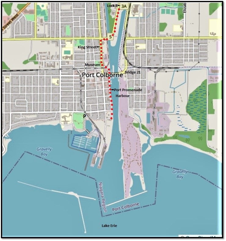
166. The final leg of this hike takes us about 10.1 km from Townline Tunnel Road to the southern end of the Port Promenade in Port Colborne. At the start of the hike, you can use the free P at the Flatwater Centre, as at the end of the previous hike. At the end of the hike in Port Colborne, you can park on a side street or use the large free P at H.H. Knoll Lakeview Park.
Marked by larger red dots on the two maps above, the hike is flat and well paved and may take you a little over two hours. Once you reach the outskirts of Port Colborne, there are plenty of opportunities to rest and refuel mid-hike. On the day of our hike, we had to take the diversion (marked by the smaller red dots in the top map) due to reconstruction of the Canals Trail, a route not to be recommended under normal circumstances. You may want to extend the time of this hike by a visit to the Port Colborne Historical and Marine Museum (see #178 below), or extend its length by exploring Port Colborne itself.

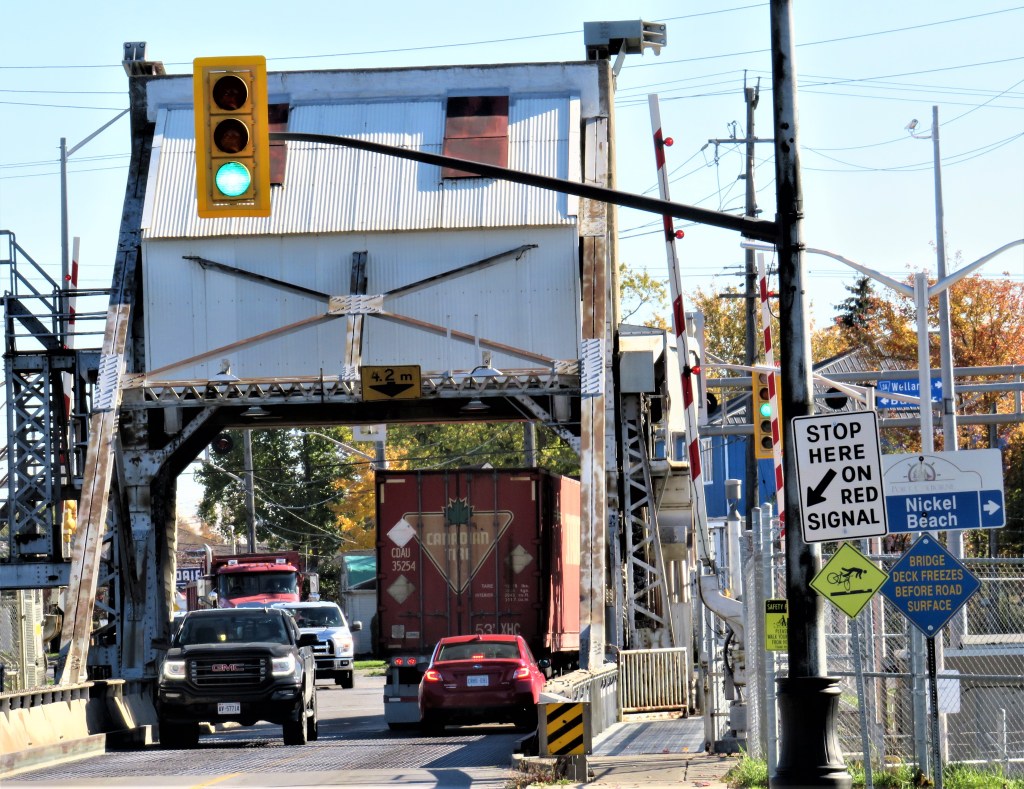
167. Bridge 17 carries a single railroad track over the southern reach of the Recreational Waterway (a.k.a. the Old Canal) to Dain City. A lift bridge that no longer needs to be lifted, as the Waterway no longer entertains shipping, it is narrower than the other vertical lift bridges that carry roads over the Canal. The track, formerly part of the CN system, is now owned by Trillium Railway, a short line based in Port Colborne that connects various industrial operations in this area.
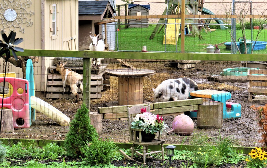
168. There was a Bridge 18 that used to span the Old Canal at Forks Road, but this was removed in 2019. We discover that the section of the Welland Canals Trail south of Forks Road is closed for reconstruction. We’re diverted west along Forks Road then south down Elm Street. This charming little menagerie is at the intersection of Forks Road and Elm Street.
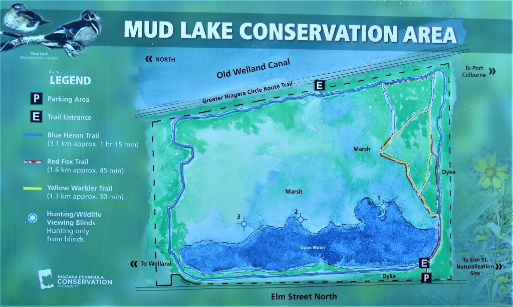
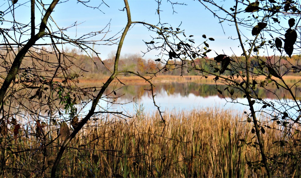
169. Almost 2 km down Elm Street is the main entrance and P for Mud Lake CA. Mud Lake was originally a dumping ground for spoil from the building of the Fourth Canal. Now it’s a protected wetland. The trail through the southern part of the CA is as muddy as expected, but it offers a peaceful diversion before we rejoin the Canals Trail south of the closed section. Note that there is no sidewalk, only a narrow shoulder, on Elm Street, so this route is not to be recommended to hikers under normal circumstances. You can usually enter and explore Mud Lake directly from the Trail at the upper point E on the map above.
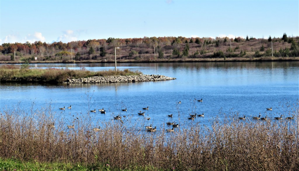
170. Back on the Trail south of Mud Lake, we reach the point where the southern section of the Recreational Waterway (in the foreground) rejoins the Main Canal …

171. … and looking north, there’s some shipping in view. The nearer, northbound vessel is Algoma Conveyor (built 2019), a self-discharging bulk carrier owned by Algoma Central Corp. This was the ship that, full of road salt, ran aground in Green Bay, Wisconsin in March 2020. The farther vessel, also northbound, is too distant to identify.
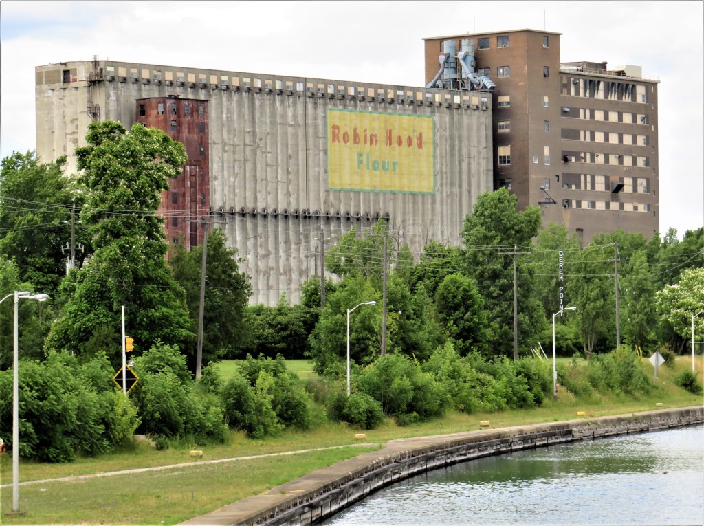

172. Where a surviving section of the Third Canal diverges briefly from the Fourth Canal to form an island (known as “The Island”), stands this huge structure. Formerly used to manufacture and store flour by the Robin Hood Company, it was later converted to a grain elevator and was more recently acquired by Ceres Global Ag. Corp. of Minnesota, though it still retains the Robin Hood logo. The structure, built in the 1940s, has seen better days. Bypassing it, the Trail crosses the Old Canal to Derek Point on The Island.

173. A good place to rest and refuel very close to the Trail is the Flying Squirrel Bistro. It’s opposite Lock 8 Gateway Park at the west end of Bridge 19 on The Island.
174. Bridge 19 is the Main Street Bridge from The Island to the east bank of the Ship Canal in north Port Colborne. This original bascule bridge over a narrow stretch of Canal is operated remotely. The northern gate of Lock 8 sits a little way south of this bridge.

175. Lock 8 in Port Colborne looking north, with Bridge 19 (see #174 above) in the distance. This lock, 420.6 metres in length, is the longest on the Canal and differs from the other seven in that it’s a “guard lock.” As such, its function is to respond to the fluctuating water level in Lake Erie (the chief source of the Canal’s water) so that there is always a sufficient depth of water in the rest of the Canal north of this lock.
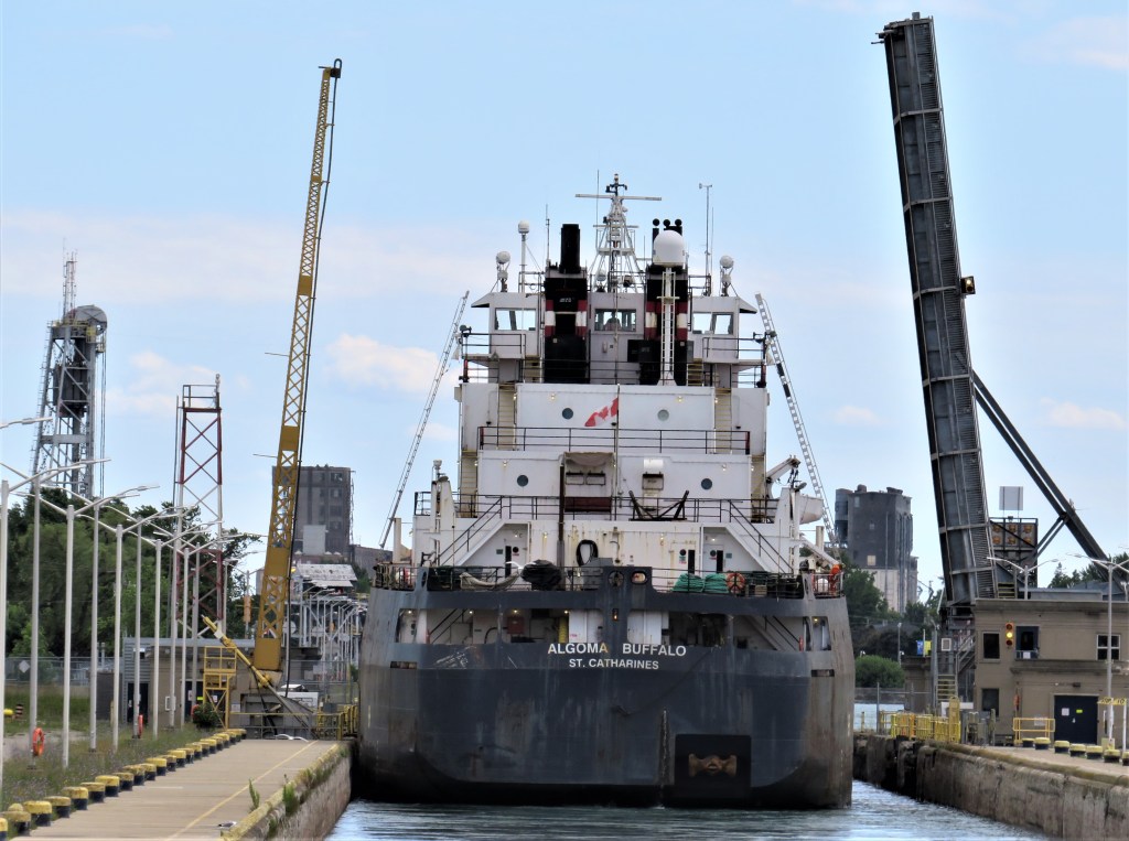
176. Lock 8 looking south, with Bridge 19 raised and Algoma Buffalo (see #187 below) about to enter the guard lock on her way to Lake Erie. One of the piers of Bridge 21 is visible at left.
177. A pause for reflection on King Street, Port Colborne.
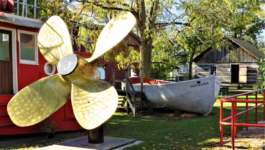
178. Port Colborne Historical and Marine Museum at 280 King Street opened in 1975. It is based on a house and property bequeathed by Arabella Williams (who died in 1950), to the city of Port Colborne. The Museum is open daily from 1 May through 20 December and admission is free.
From left to right: one of the Museum’s latest exhibits, a laker’s brass propeller donated by Algoma Central Corp.; Hochelaga, a 50-passenger lifeboat (1949); a log schoolhouse (1835).

179. A typical farmhouse of the 1840s: the Sherk Log House (1844) in the grounds of the Museum.
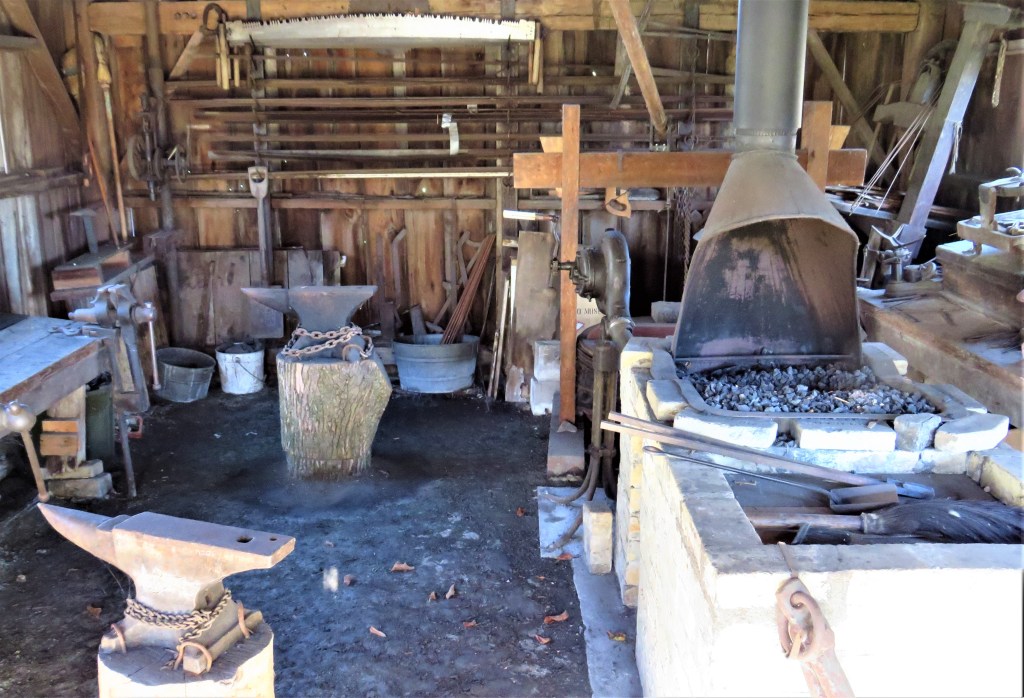
180. Inside the Blacksmith’s shop (1880) at the Museum.

181. Bridge 21, the Clarence Street Bridge (1929) in downtown Port Colborne, rises to let Algoma Buffalo (see #187 below) through. This vertical lift bridge, the southernmost crossing of the Canal, sits on remaining lock walls of the Second and Third Canals.

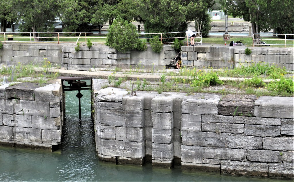
182. Port Colborne (current population 20,000) has been the southern terminus of the Welland Canal since the First Canal reached it in 1833. It was so named in that year by Canal founder William Hamilton Merritt for Sir John Colborne (1778-1863), then Lieutenant Governor of Upper Canada.
Top and bottom: Remains of the Second and Third Canals in downtown Port Colborne. Short sections of each of the older canals run parallel to the Ship Canal.
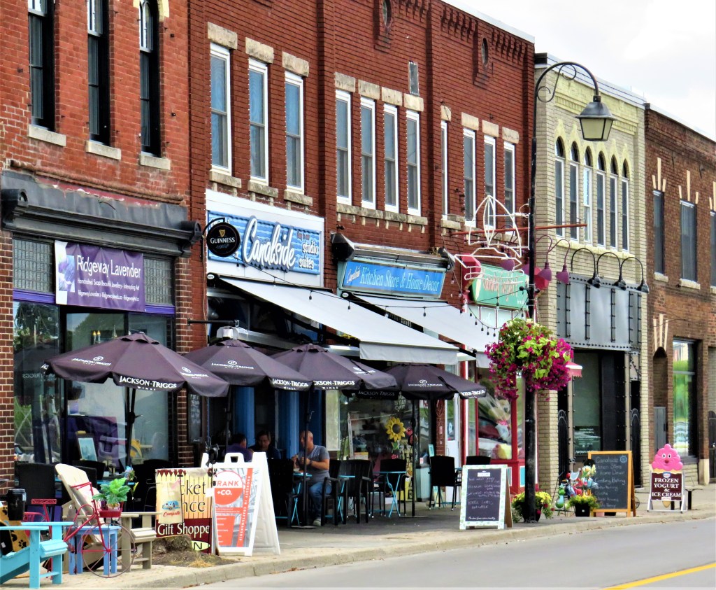
183. Canalside businesses along West Street in downtown Port Colborne.
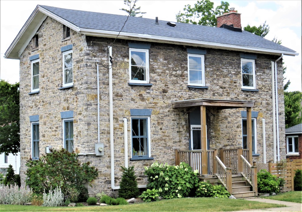
184. The older part of Port Colborne contains some interesting buildings. This is 44 King Street, Port Colborne (built ca. 1835). Historic Port Colborne notes: “The land on which this house sits was originally owned by William Hamilton Merritt, the chief promoter of the Welland Canal…. The walls, made of limestone taken from the Welland Canal, are more than half a metre thick.”

185. This quaint property, part commercial, part residential, is at 19 Victoria Street between King and West Streets.
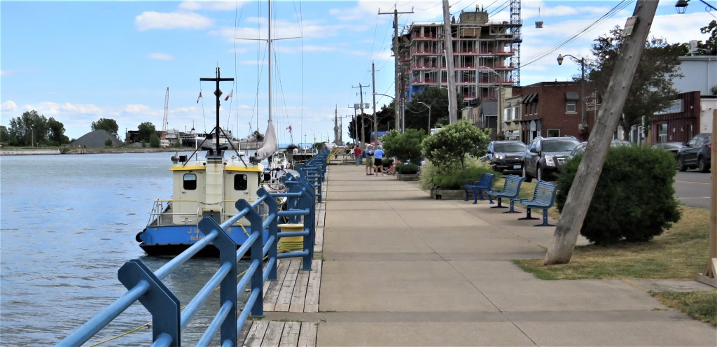
186. The Port Promenade along the west side of Port Colborne Harbour looking south. That’s South Port, a highrise condo building with harbour views, under construction at back. Opening in 2023, it’s already sold out.
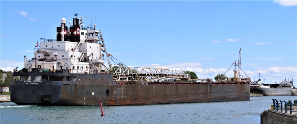
187. Algoma Buffalo heads through Port Colborne harbour towards Lake Erie. She’s a self-unloading bulk carrier 194 metres long built in 1978 in Sturgeon Bay, Wisconsin and then named simply Buffalo. In 2017 she was bought by Algoma Central Corp. of St. Catharines, Ont. from the American Steamship Co.
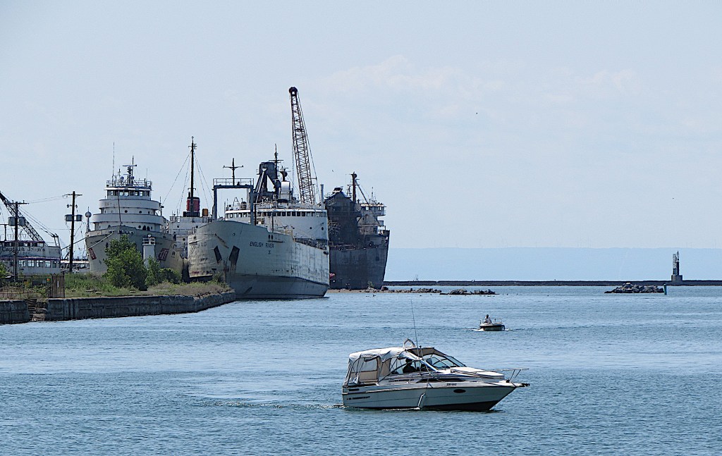
188. The lower harbour at Port Colborne: recreational vessels ply back and forth in the foreground; large ships like English River are moored on the east side waiting to be broken up and sold for scrap; a breakwater at the mouth protects the harbour from storms on Lake Erie; and, faintly in the distance, the American shore looms on the other side of the Lake.
Our hike is done! Many thanks for accompanying us along the Welland Canals from Lake Ontario to Lake Erie.
