Maps © OpenStreetMap contributors
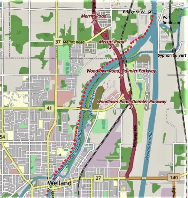
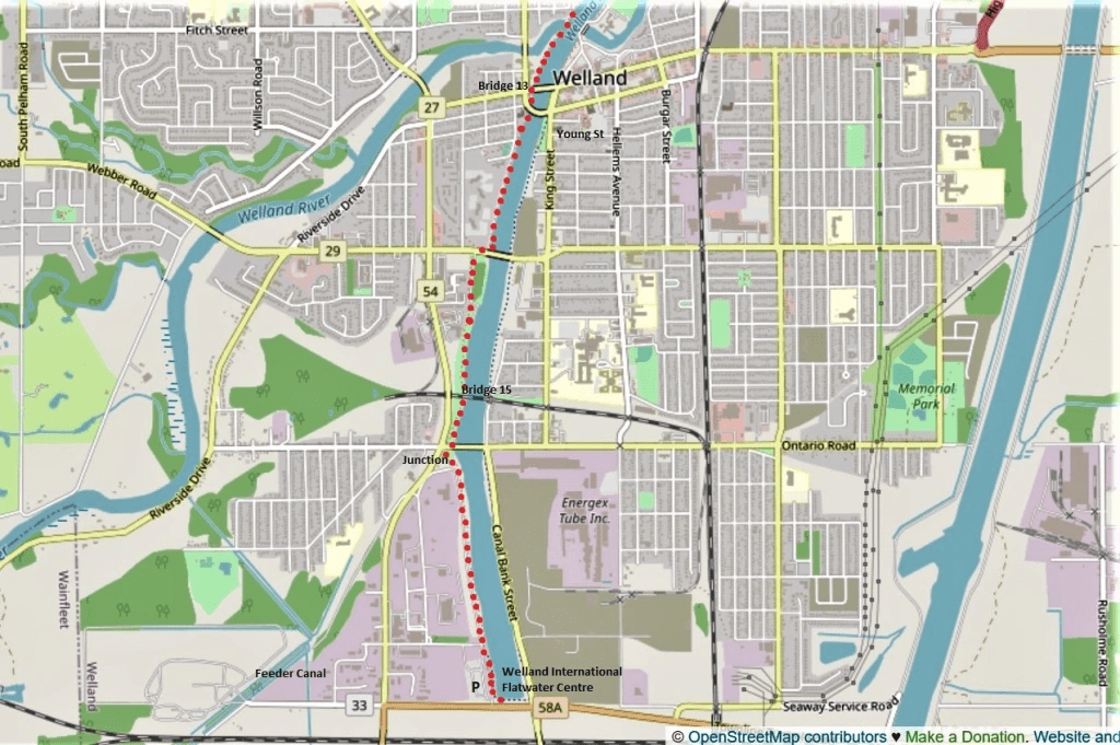
145. Today’s hike, marked with red dots on the two maps above, is 10.2 km long and will take you about 2 hours, though you may want to go a little off-piste to explore downtown Welland. You start where you finished last hike, at the free P on Bridge Street West in Port Robinson, and you finish at the large free P at the Welland International Flatwater Centre just off Townline Tunnel Road (Hwy 58A). Considering the length of this hike, you may choose to do it with a friend using two cars with one parked at each end.
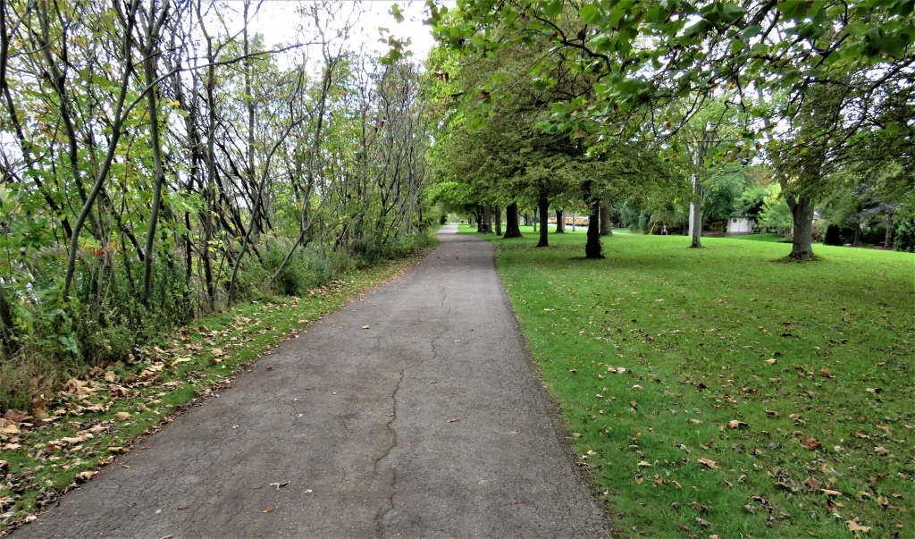
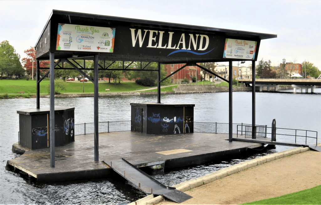
I keep this route simple by following the Welland Canals Parkway Trail on the west bank of the Welland Recreational Waterway the whole way. This means leaving the main Welland Ship Canal at Port Robinson. Let me explain. From 1967-72, a new 13.4 km section of the Fourth Canal was constructed, bypassing the City of Welland to the east and further straightening the course of the Canal. Most of the former Fourth Canal through the heart of Welland has been preserved as the Welland Recreational Waterway, and it’s now a major centre for Canadian watersports.
At various points you can cross the Recreational Waterway and follow a trail along the eastern bank. There is, or was, also a trail along the eastern bank of the main (Bypass) Canal, though this doesn’t seem to be supported by the local municipality any longer. Better to follow the well-paved and signposted Welland Canals Parkway Trail.
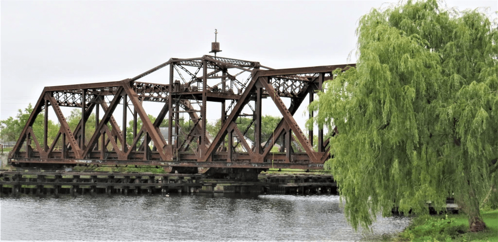
146. This is the point where the main Ship Canal (left) splits off from the former Fourth Canal, now the Welland Recreational Waterway (right). For the moment I’m on the east side of the Canal, having followed River Street south from downtown Port Robinson …
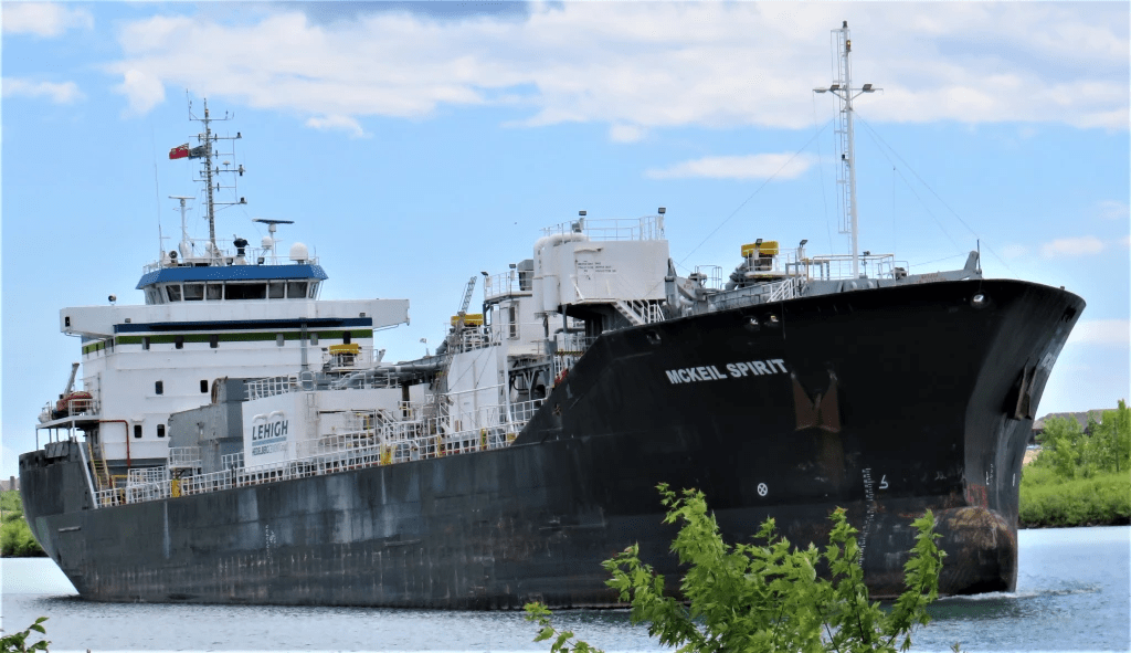
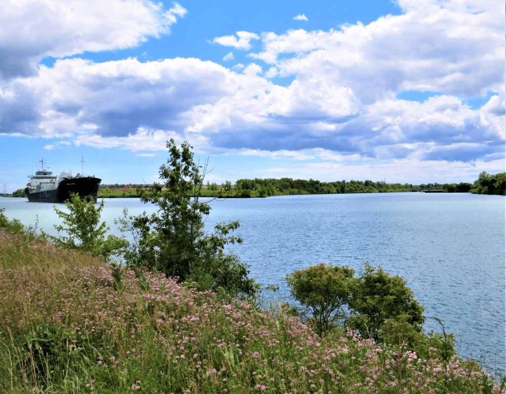
147. … and this is the last big ship we’ll be seeing until we rejoin the main Canal near Ramey’s Bend on our final hike. A shallow-draft cement carrier, McKeil Spirit, 140 metres long, has four holds that can accommodate 13,770 metric tonnes of cargo. Built as Ardita in 2007 in the Netherlands, she was acquired, renamed, and repurposed by McKeil Marine in 2016.

148. What I wanted to see here on the eastern bank was this massive concrete structure. The Welland is the longest river in the eastern Niagara Peninsula, and flows west to east. Thus it must cross the south-to-north-flowing Ship Canal at right angles, but to keep the water level in the Canal stable, the two waterways must be kept apart. Aqueducts carried the Welland River over the first three canals. But the Ship Canal’s greater required depth demanded that the Welland River be taken under it by an inverted syphon culvert. This is the outflow of the syphon culvert constructed to take the river under the Welland Bypass section of the Canal. (There’s another, older syphon taking it under the former Canal in downtown Welland.) No pumping is needed. Gravity alone causes the river to fall into massive tubes below the bed of the Canal, and water pressure provided by the normal west-east flow of the river forces it up here, on the other side of the Canal.
149. I’m back on the east bank, following the Welland Canals Parkway Trail as it approaches Notre Dame College School on Chippewa Street in north Welland. There won’t be any big ships on view for a while, but there are some natural compensations.
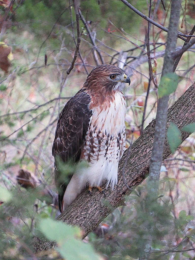
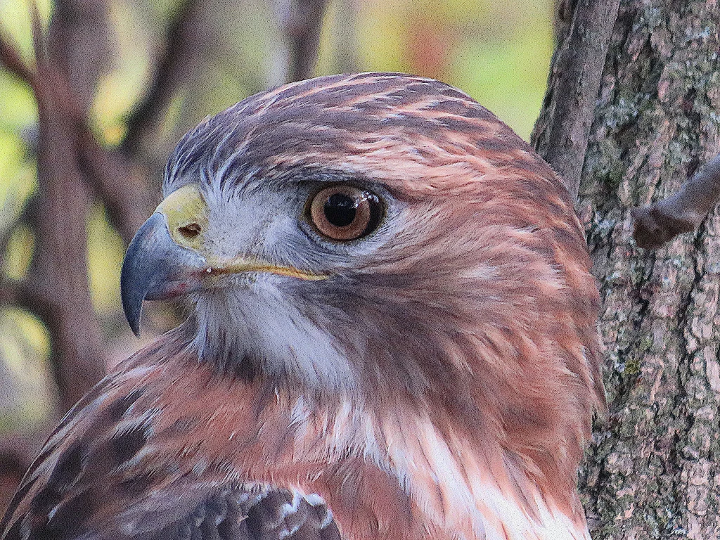
150. At this point there’s a strip of forest between the Trail and the Waterway. And there perched almost motionless on a low branch is this magnificent red-tailed hawk (Buteo jamaicensis).
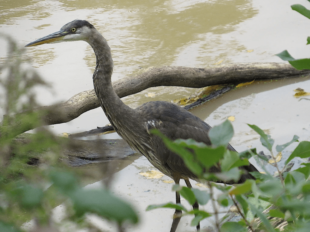
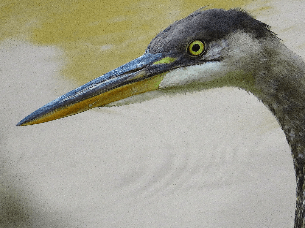
151. By the bank of the Welland River in central Welland, just before it plunges into the syphon culvert beneath the old Fourth Canal, there’s a great blue heron (Ardea herodias) totally focused on catching its next slippery meal.
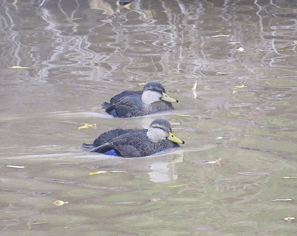
152. Here on the Welland River, too, are a pair of American black ducks (Anas rubripes). This was once the most common duck in Ontario until mallards, with which it interbreeds, took over. Male and female black ducks are very similar, but the male has a more yellowy beak. Note the purple patch – the speculum – on the secondary wing feathers.
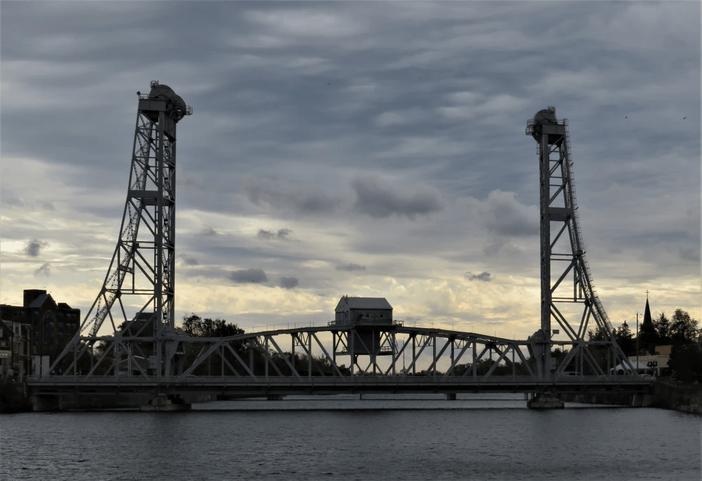
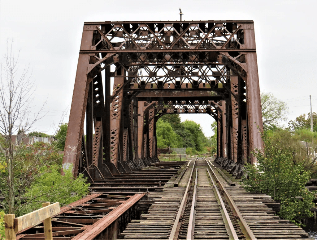
153. A moody shot of Bridge 13 in central Welland. This vertical lift bridge carries Main Street over the Recreational Waterway, and is locked permanently in the lowered position. It needn’t ever be raised because no big ships ply this Waterway any longer.
154. You probably assume that the Welland Canals were so named for what they all flowed through, namely the City of Welland (pop. 52,000) … and of course you’d be wrong. “Welland” was first attributed to the River that rises west of Hamilton Airport and flows eastward for about 140 km into the Niagara River at Chippawa. The namer was Lieut.-Gov. John Graves Simcoe in 1792, after a river in Lincolnshire, England. (Simcoe liked to anglicize First Nations names, and had a thing for Lincolnshire.) Before Simcoe the Welland River was known as Chippawa Creek, and that name is still used locally. In 1851, this whole area became Welland County, after the River.
The Welland Canals (which, as we know, date back to the early 19th century) were named for the River, even though they have not actually used any section of the River since 1833, when the First Canal was extended southwards to Port Colborne (see #8 above). The settlement that became the current City of Welland was named after the River and/or County in 1858; formerly it was called Slab Town, later Merrittsville. The Feeder Canal joined the First Canal a little way south of downtown Welland (see #163 below). The Welland River and the Fourth Canal do still cross in Welland (see #148 above for an explanation).
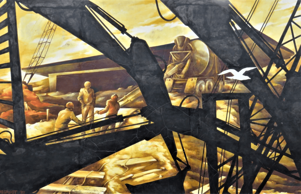
155. One of the most striking features of Welland today are its giant outdoor murals. There are at least 26 of them, most created from 1988-90. You’ll need to cross Bridge 13 to the east bank to view most of them. This one, on the front of the Welland Museum facing Young Street, is called “Canal Construction.” It depicts a scene from the building of the Welland Bypass Canal. It’s by local artist Bas Degroot (Netherlands/Canada, 1948-2001).
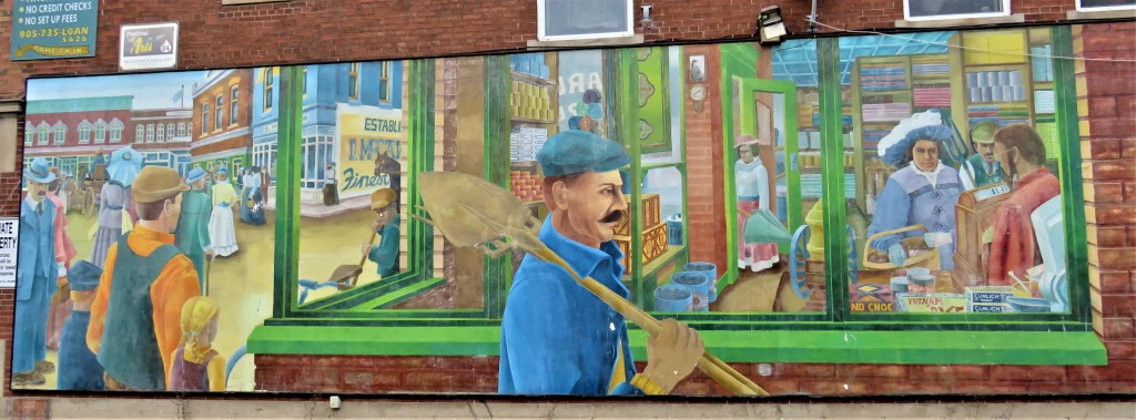
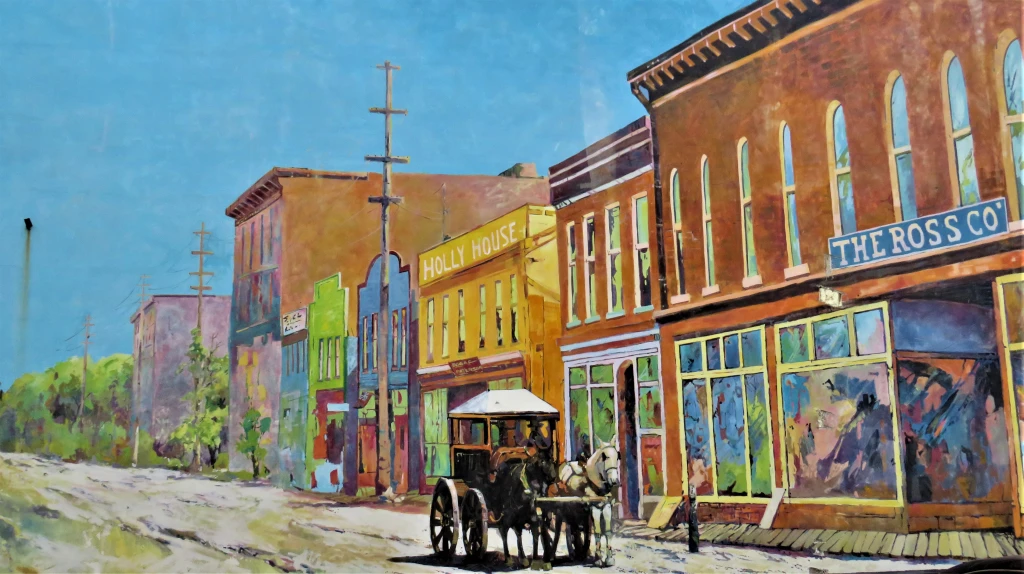
156. Two more murals with a common historical theme, namely Welland streetlife in the late 1800s.
Top: “Downtown Welland” (1989) by Philip Woolf (South Africa/Canada, 1952-), at 14 King Street.
Bottom: Detail of “Main Street” (1989) by Mike Svob (Canadian, 1955-), at 22 King Street.
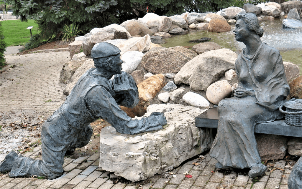
157. This is a detail of the Welland Canal Memorial Monument, unveiled in 2001 in Merritt Park. The sculpture is the work of Bas Degroot (see #155 above), who died before it was quite finished, and bronze caster William Jurgenson. It celebrates the workers who came from all over the world to build the Welland Canals.

158. The Morwood House at 28 Young Street. Richard Morwood was the owner of a general goods store on West Main Street. His house was begun in the 1860s and enlarged over time. In 1913 it was turned into a duplex but remained with the Morwood family until 1943. It’s now a designated heritage property. (I only noticed the dogs in the windows long after I’d taken the photo.)
159. I’m back on the west bank just south of central Welland. The Schooley-Rose House (1867-69) at 33 Frazer Street is in Italianate style. The original occupant of the house was Dr. Jay W. Schooley, one of Welland’s earliest doctors. Much later the house suffered extensive fire damage until it was bought in 2000 by a couple who have restored it and its grounds beautifully.
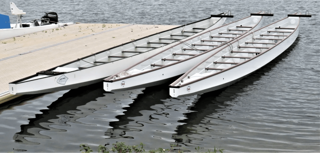
160. The calm waters of the Recreational Waterway are popular with all kinds of racing boaters.
161. A shaggy mane mushroom (Coprinus comatus) on a lawn by the bank of the Canal.
162. Bridge 15 (ca. 1910), a Baltimore Truss swing bridge at Crowland in south Welland, carried the former Canada Southern Railway over the Fourth Canal. The bridge is owned by Canadian Pacific but the single remaining track no longer connects to the CPR network, and has only sporadic industrial use.
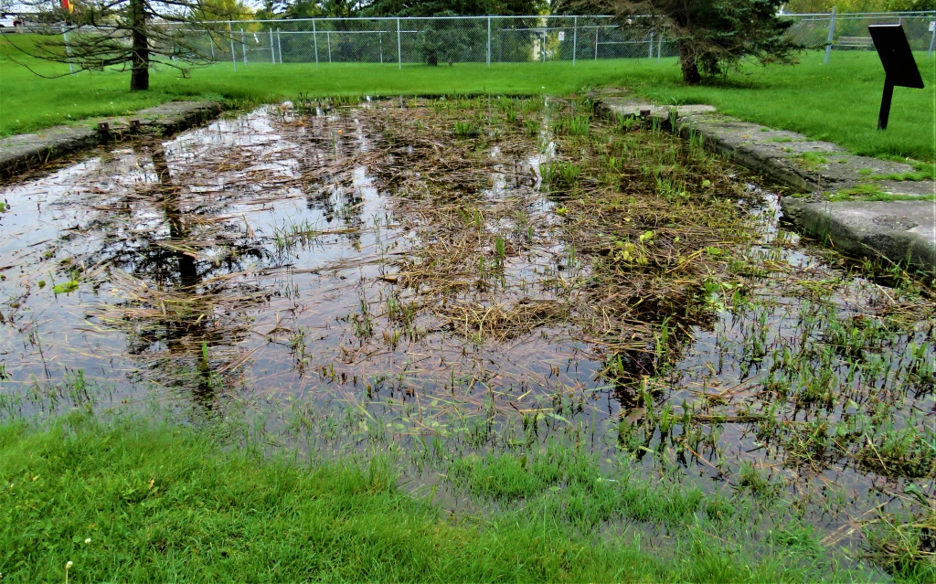
163. What seems to be a little pond near the Welland Dog Park south of the Ontario Road Bridge is surrounded by historical plaques. That’s because it marks the site of Junction, a small settlement where the Feeder Canal met the Port Colborne extension of the First Canal. The Feeder was opened on 14 November 1829, and while its primary purpose was to maintain the water level in the First Canal by “feeding” it water from the Grand River at Dunville, it also offered shipping an alternative route to Lake Erie, and was so used until 1892. This pond is all that remains now of the original east end of the Feeder. For more on the Feeder Canal, see #65-66 above.
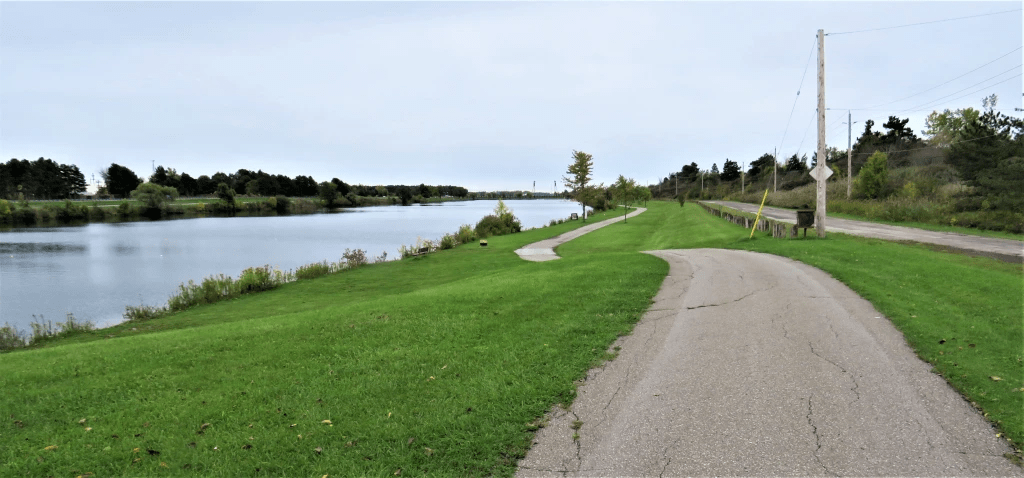
164. A panorama of the Recreational Waterway and the Trail looking south. The towers of vertical lift Bridge 17, carrying railroad tracks over the former Fourth Canal at Dain City, can be seen in the far distance.
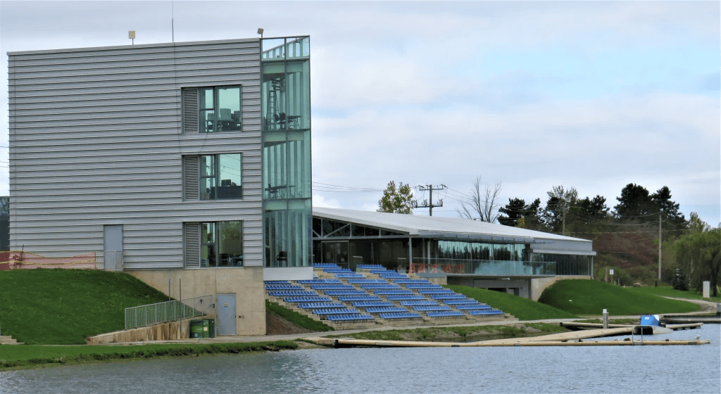
165. The Welland International Flatwater Centre lies at the dead end of this section of the Recreational Waterway, and marks the end of today’s hike. International regattas using courses up to six lanes wide and from 500 to 2,000 metres in length are held here on the North Course and there are 500 permanent seats for spectators plus room for thousands more on the surrounding banks. This facility even has an indoor paddle tank and rowing, canoe, kayak, and dragon boat training.
Go to Part 10: From the Flatwater Centre to Port Colborne
