
14. The centre of Port Dalhousie is small, and all the places mentioned in the text to follow can be visited in an hour or so. You can extend your hike to a half day by walking to the end of the western pier and back, exploring the large marina area and lighthouses on the eastern pier, taking the walkway over Martindale Ponds to Royal Henley Park, and exploring the leafy residential section along Dalhousie Avenue and vicinity.
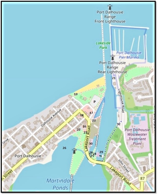
Numbers on the map above locate the entries below. Note: the P at Lakeside Park is a costly $3 per hour during tourist season, and requires you to download a special app to pay. If this turns out to be too complicated, you may do better by finding a more remote free parking space and walking in.
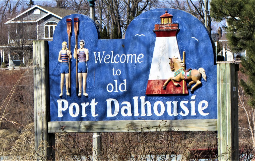
15. Port Dalhousie at the mouth of Twelve Mile Creek was settled by United Empire Loyalists, i.e., Americans who fled to Upper Canada after the American Revolution so as to stay under British rule. It was named for George Ramsay, 9th Earl of Dalhousie, Governor General of British North America from 1820-28. In his former role as Lieutenant Governor of Nova Scotia, Ramsay founded Dalhousie (pronounced Dal-howzy) University in 1818. But this little port’s name is pronounced Duh-loozy, possibly because that’s how Scotsmen living locally pronounced it. It was the northern terminus of the First, Second, and Third Welland Canals from 1829 to 1932. For the oarspersons on the sign, see #27 below; for the lighthouse, see #21; and for the horse, see #16.

16. Port Dalhousie today, technically a suburb of St. Catharines since 1961, is a former canal village surrounding an extensive harbour. It has welcomed daytrippers since at least 1884, when the paddlewheeler Empress of India provided summer passenger service from Toronto. The horse on the sign at #15 above refers to the enclosed, carefully preserved carousel in Lakeside Park, the only remnant of the amusement park that developed after 1902 to keep tourists amused. At the moment, though, Port Dalhousie is trying to turn itself into something quite different, and there’s quite a lot of new construction going on.
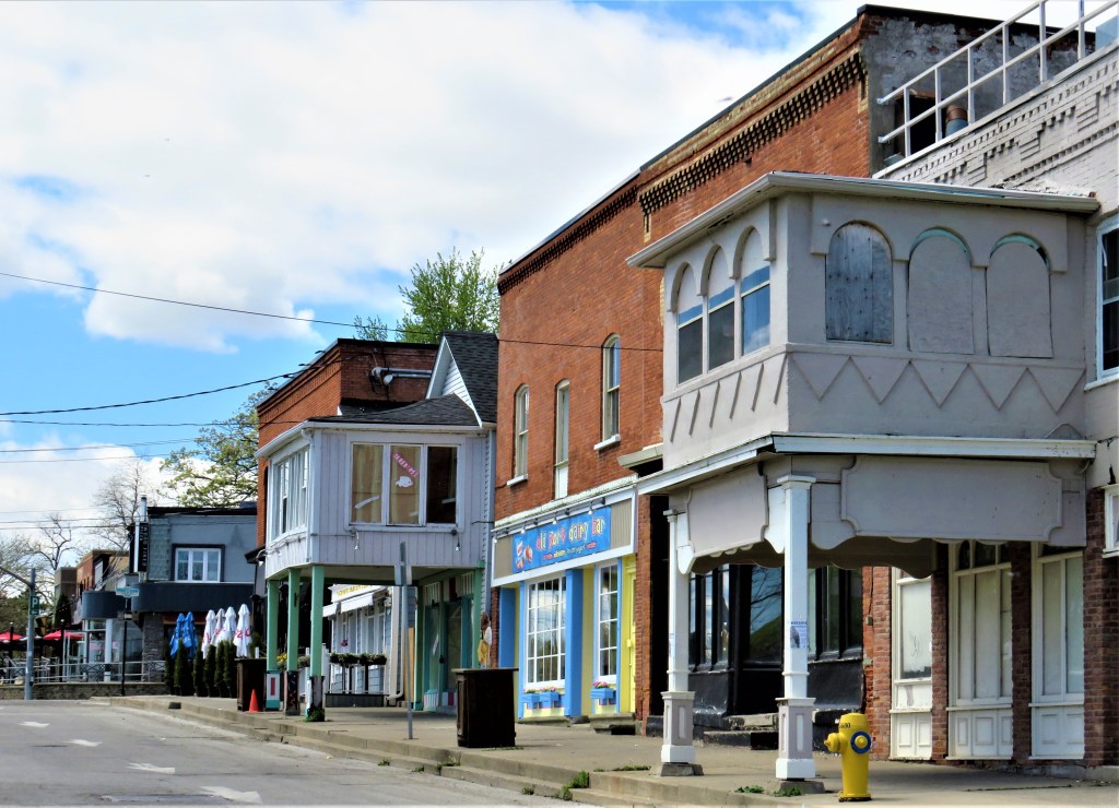
17. Aside from its setting, the chief appeal of the central village is in the older Victorian buildings, some of which are looking worse for wear, as here on Lakeport Road.
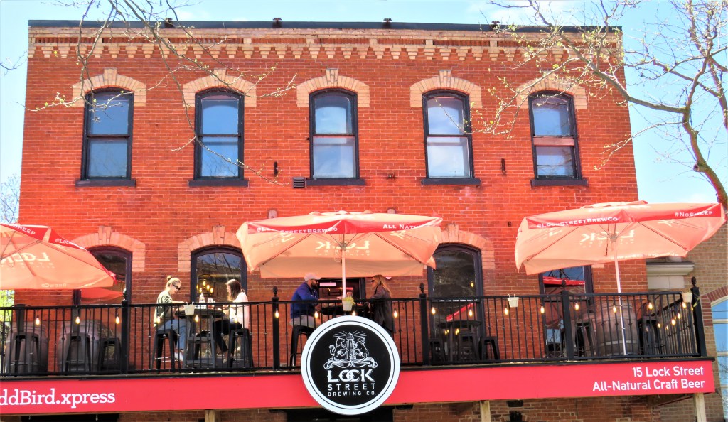
18. Here on Lock Street is the sort of revitalization that does suit the old village …
19. … while here, blocking one end of the beach at Lakeside Park, is an example of the kind of development that probably should have been avoided.
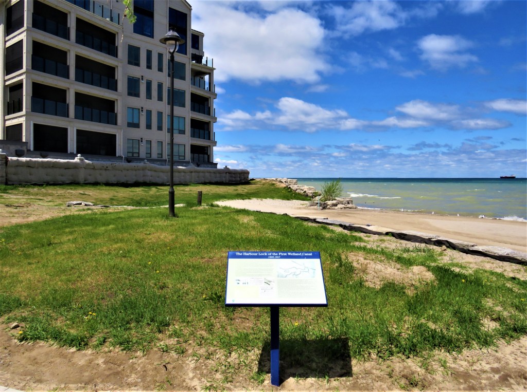
There’s a lot of early Welland Canal history in Port Dalhousie. Though the current Ship Canal bypasses the village entirely, the first three canals’ indirect legacy is considerable. The information board in the foreground is the only visible clue that the entrance to the First Welland Canal from Lake Ontario was right on this spot.
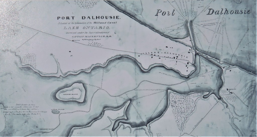
20. As the old map above shows, the First Welland Canal (started 1824) had a harbour lock (completed 1826) and two breakwaters pointing northwest (completed 1828). There was a dam across the estuary of Twelve Mile Creek that created what is now Martindale Pond behind it. This was the beginning of Port Dalhousie, and as early as May 1828, even before the First Canal was opened, a schooner optimistically named Welland Canal set out from this harbour with 600 barrels of flour destined for Montréal.
The “navvies” (i.e., navigators, a fanciful term for canal labourers) who built the harbour section of the First Canal were described in The Farmers’ Journal, and Welland Canal Intelligencer as “a motley assemblage of good and bad from almost every part of the civilized world,” though the newspaper noted that not a single complaint had been lodged against their behaviour (20 September 1826). Their work was backbreaking and dangerous, and many of them died during an outbreak of cholera in 1833. Then in 1848, a new harbour and first lock were completed for the Second Canal, and the terminus of the First Canal was filled in and abandoned. Many of the earlier stages of the evolution of the current Welland Canal have been obliterated, though there has been a recent initiative to better memorialize the heroic efforts of the early canal builders.
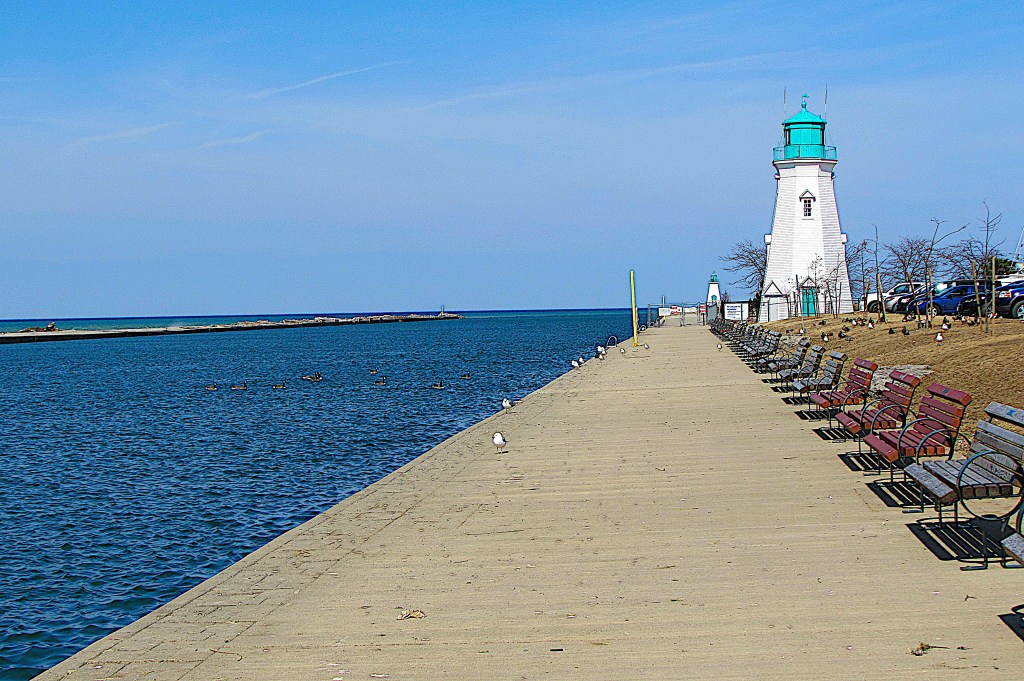
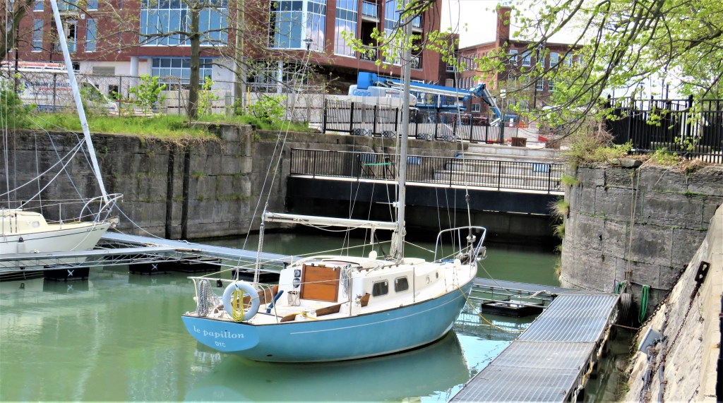
21. This is the current entrance to Port Dalhousie harbour, where both the Second (constructed 1842-53) and Third (constructed 1872-87) Welland Canals began. The view is from near Michigan Beach, so called because the towboys who camped on this side would go to Michigan to cut timber for a living after the canal closed down for the winter. The towboys may have stabled as many as 500 horses in what is now Lakeside Park during the Second Canal’s busiest periods. The tow teams (which included oxen as well as horses in the early days) found themselves gradually phased out as steamships, towed by steam tugs, prevailed during the heyday of the Third Canal. The octagonal wooden inner lighthouse was built after its predecessor was struck by lightning and burned to the ground in 1898. A smaller, outer lighthouse can be seen at the end of the eastern pier in the distance.

the chief engineer of the fourth Welland Canal, in Brock University Archives & Special Collections.
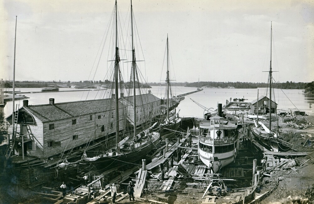
22. Alexander Muir, a Scot from Ayrshire with a puritanical belief in the sanctity of Sundays and a detestation of strong drink, came with his five brothers to Port Dalhousie in about 1839, when the village of only fourteen houses boasted three taverns, the latter, needless to say, established for the benefit of the canal labourers. Here in 1850 Muir built the first dry dock for servicing ships on the Great Lakes, and in 1852 he began shipbuilding, progressing from wood and sail to steel and steam. His vessels, whose names all began with A, plied between Duluth and Liverpool. “Muir refused to insure his ships. To do so, he believed, would show a lack of faith in the Almighty” (Dorothy Turcotte, Port Dalhousie, p. 10). Dalhousie House (ca. 1865), now in Rennie Park (reclaimed from the former dry dock), was one of Muir’s dockside offices. Though it was expensively renovated in 2011, it currently sits empty, waiting for the municipality to find a use for it.
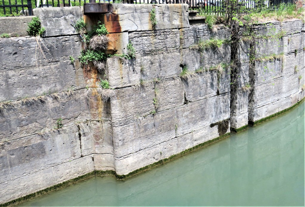
23. Part of Lock One (completed 1848) of the Second Canal has been preserved at Pawling’s Point. The First Canal’s timber-lined locks had deteriorated quickly, and the Canal itself had soon become too narrow and shallow for newer shipping. So after the government of Upper Canada had taken over Merritt’s private company, labourers, many of then recent Irish immigrants, were hired at low wages to widen and deepen the canal and its locks. Skilled stonemasons, many of them of Scottish origin, lined the walls of the Second Canal’s locks with shaped and dressed dolomite blocks from a quarry at Queenston. Their stonework has lasted remarkably well.

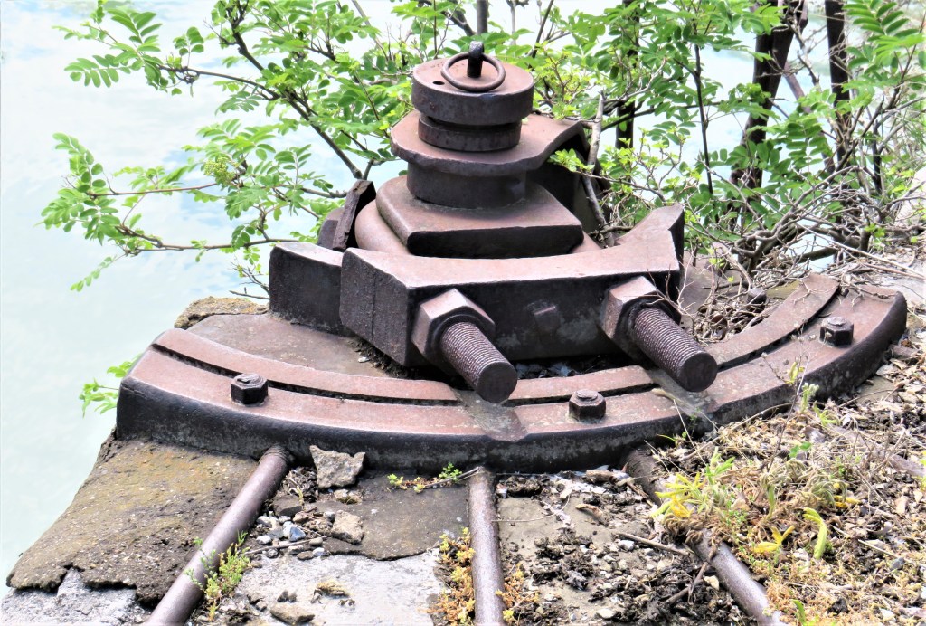
24. Lock One of the Third Canal, on the former site of a shipyard, replaced Lock One of the Second Canal in 1882. The federal government had taken over the Second Canal after Confederation in 1867, and work on building this much larger lock farther inland began in 1876. For the first time, steam-driven machinery supplemented the picks and shovels of the navvies. All the locks of the Third Canal were made larger and deeper to accommodate steamships, and the expansion of the Canal led to the rapid development of industry around this lock. It was decommissioned as recently as 1968 and its southern end filled in. There is currently no access by boat to Martindale Pond from the harbour.

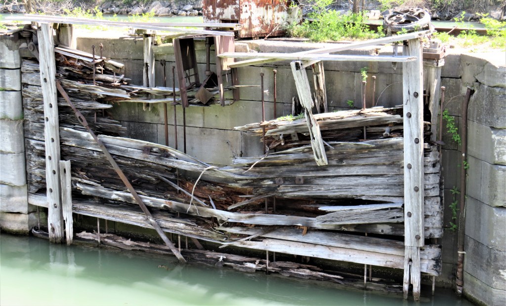
Rusting metalwork survives from the machinery opening the lock gates. The bottom picture shows one of the Third Canal’s lock gates in decrepit condition. An eyesore like this surely detracts from one of the main aims of heritage conservation, which is to inspire the present by preserving the worthy achievements of previous generations.
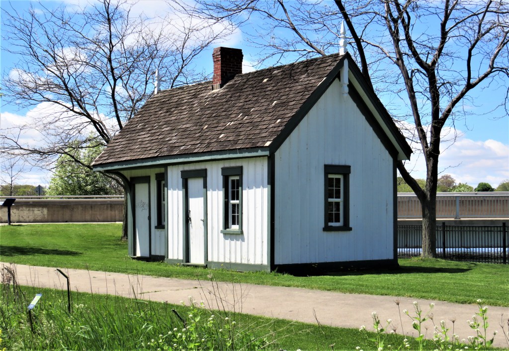
25. This hut standing by Lock One of the Third Canal was originally a shanty where the locktender collected fees from shipping passing through the Canal.
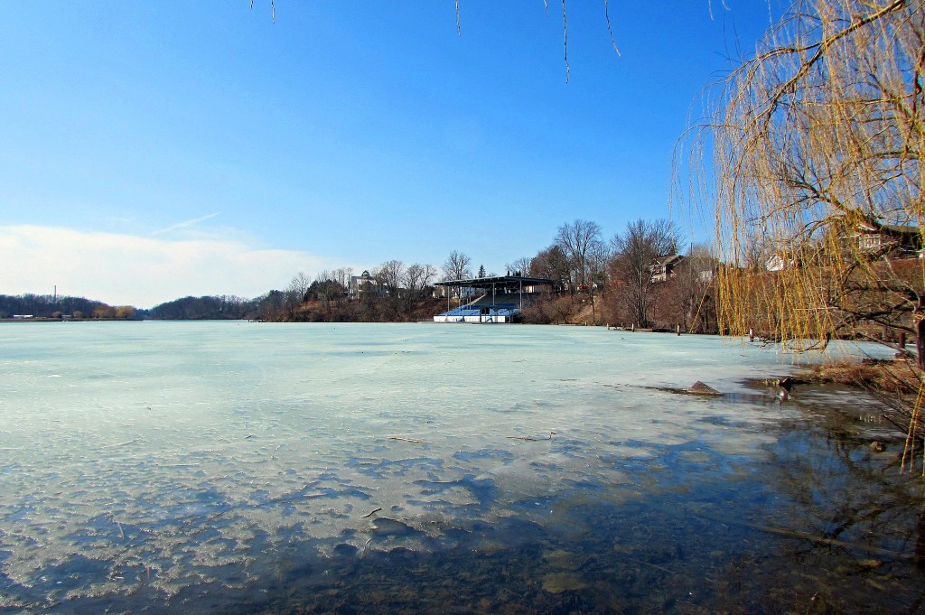
26. Martindale Pond, behind the hydro plant and weir, is still frozen in March. Its tendency to freeze over by the end of October limited the operating season of the early Welland Canals that ran through it. That grandstand, however, suggests another legacy of the early canals …
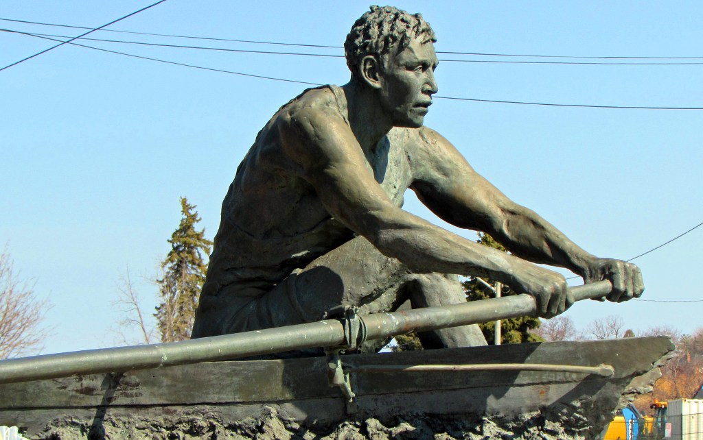
27. … namely, water sports. Martindale Pond has been the site of the the annual Royal Canadian Henley Regatta since 1903. It has even held the World Rowing Championships. Perry P. Wakulich’s sculpture “The Spirit of St. Catharines” (1999) celebrates the area’s long connection with rowing.
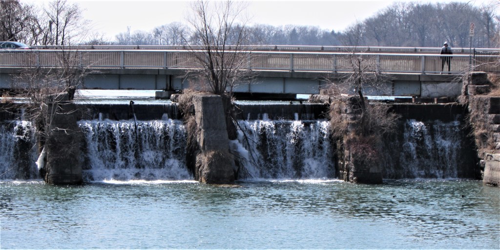
28. The weir allowing excess water from Martindale Pond to bypass Lock One of the Third Canal is still in place immediately to the west of the old lock …

29. … and on the east side of Lock One is the Heywood Generating Station, a small hydroelectric plant that can power about 2,000 homes. The Third Canal’s legacy lives on.

Archives & Special Collections, Brock University Library.
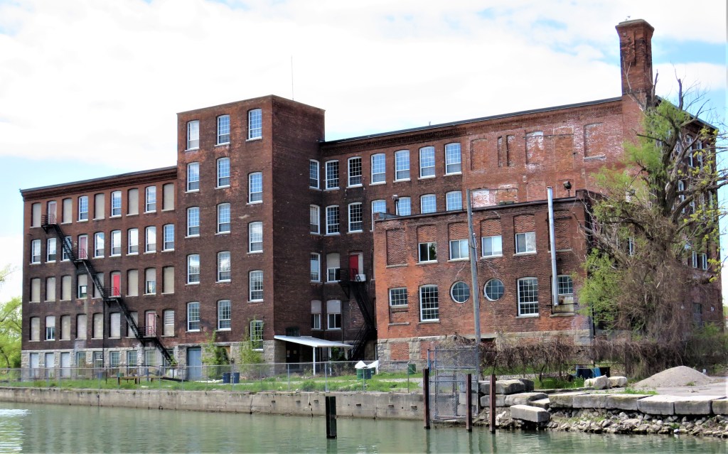
30. The 1900 factory of the Maple Leaf Rubber Company overlooking the former basin of the Third Canal is the most striking survival of industrial Port Dalhousie. In 1955 this building was taken over by Lincoln Fabrics, weavers of specialty fabrics, who occupied the building until 2017. It’s currently being redeveloped as a 120-unit loft-style condo building called The Harbour Club.
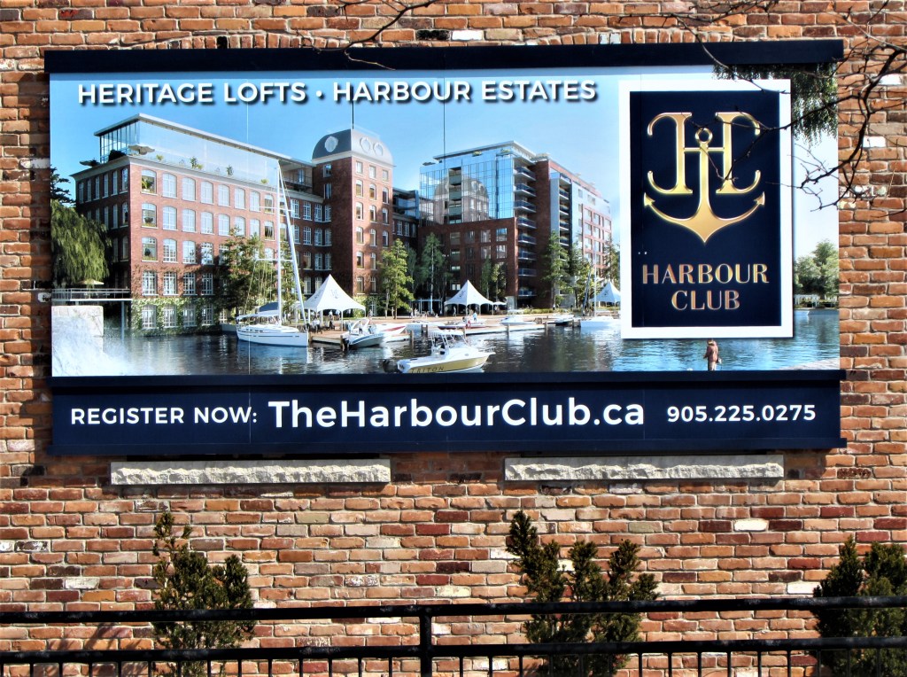
31. The developers have promised residents many things: an infinity pool, a yoga and fitness studio, ride-share cars, a pet-grooming station … the current aim of the old canal village is to become a “lifestyle destination.”
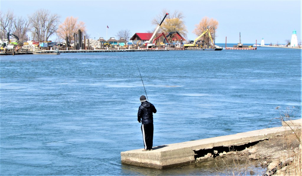
32. A view of Port Dalhousie harbour in late winter shows a great deal of construction on the western shore …
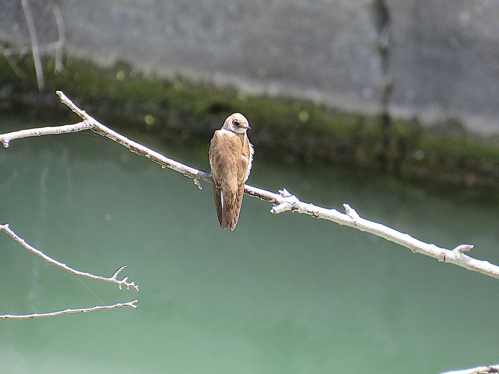
33. … but in spite of all the disruption, the Harbour is a good place all year round to spot birds that frequent water. In May a bank swallow briefly alights on a branch over Lock One of the Third Canal …
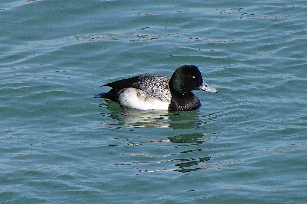
34. … and in early March a male greater scaup swims in the lower Harbour. The word scaup is a Scots term for a bed of mussels, the favourite feeding ground of this diving duck.
