reproduced in Roberta M. Styran and Robert R. Taylor, Mr. Merritt’s Ditch (1992), p. 37.
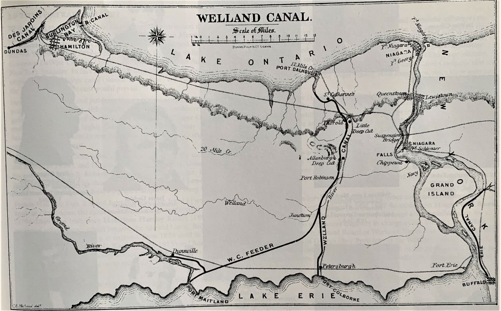
35. A map of the Second Welland Canal in about 1860. In the upper left corner, note other nearby examples from the great age of canals: the Burlington Canal (completed 1826) that still gives vessels entry into Burlington Bay (now Hamilton Harbour); and the Desjardins Canal (completed 1837) that more briefly allowed ships into Dundas from the Head of the Lake.
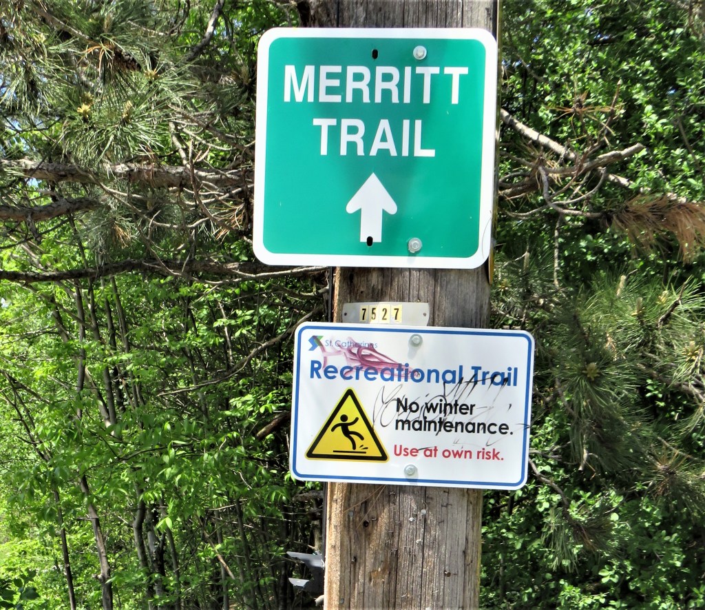
36. Most of the places in Parts 3 and 4 of this photoblog are supposedly connected by the Merritt Trail. In practice, this trail is often poorly waymarked, fragmented, and periodically disrupted by construction. But the influence of William Hamilton Merritt, the founder of the Welland Canal, permeates the area.
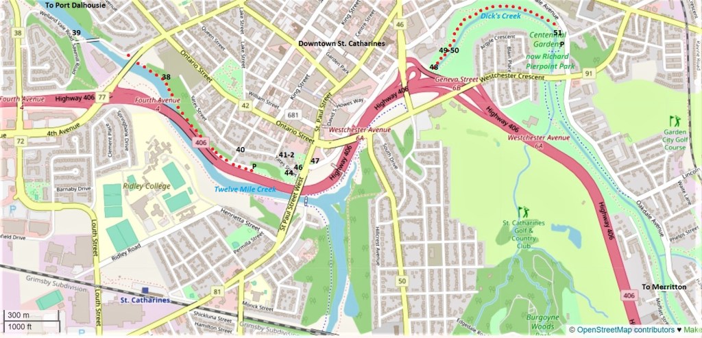
37. On the map above, red dots mark two discrete sections of the Merritt Trail. Numbers refer to locations of the respective entries below. From the P near #40, you can go along Twelve Mile Creek as far as the Welland Vale Bridge and back, and it’s also handy for visiting sites on and near Yates Street. From the P near #51 you can go west along the north side of Dick’s Creek and then, if you wish, loop back along the south side. Because of construction near #46, there is no easy way to hike these two sections of the Merritt Trail consecutively.
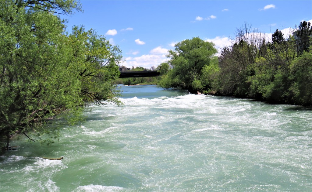
38. Twelve Mile Creek in St. Catharines flows rapidly towards Port Dalhousie and Lake Ontario. The Creek’s name derives not from its length but from the distance of its mouth from that of the Niagara River, the border with the USA. The germ of the Welland Canal was Merritt’s self-interested plan to link Twelve Mile Creek to the Welland River so that the latter would feed a substantial volume of water to the former, year round. It seems strange today that such a powerful stream was not a reliable source of power to Merritt’s mills, located on its bank not far from here. But much has changed since the early nineteenth century. Now Twelve Mile Creek’s headwaters, supplemented by water from Lake Erie via the Welland Ship Canal, have been damned upstream to form artificial Lake Gibson. This Lake is the source of St. Catharines’ drinking water, and the controlled release of its waters over DeCew Falls has generated hydroelectric power since 1898. The result is that there is much more water here in lower Twelve Mile Creek than there was in 1824, the year the First Welland Canal was begun.
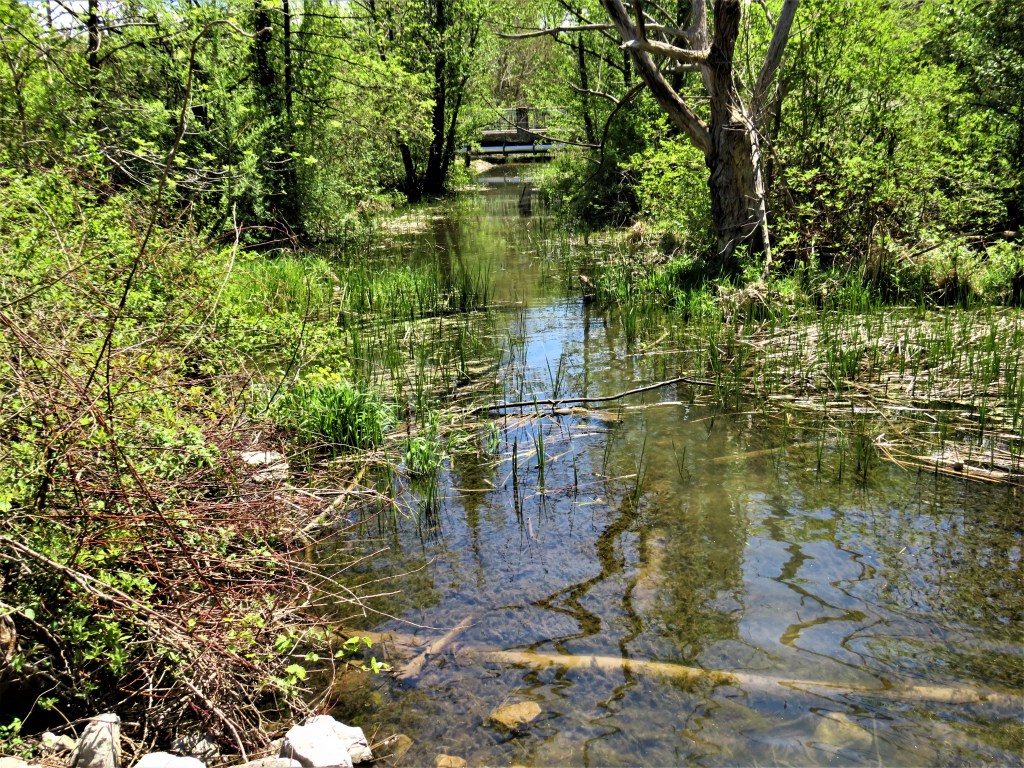
39. Near the Welland Vale Road bridge is a quiet backwater running parallel to the west bank of Twelve Mile Creek. According to John N. Jackson (The Four Welland Canals, p. 44), this is “the only surviving remnant of the First Welland Canal.” Aside from the Feeder Canal, all other traces of the First Canal have been obliterated by the Second Canal (1840-45), time, and change.
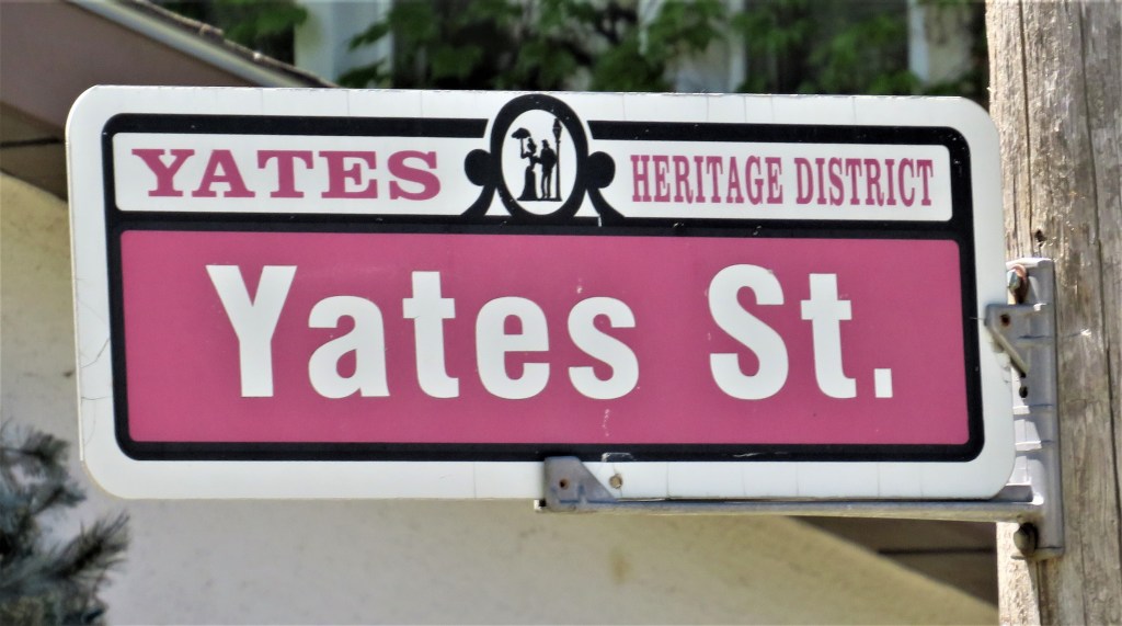
40. Leave the Merritt Trail (now on the east bank of Twelve Mile Creek) and climb steep Salina Street. In one block you’ll come to the junction with Yates Street, one of the oldest and most attractive residential streets in St. Catharines. It’s named for John Barentse Yates (1784-1836), a New York businessman who was the principal funder of the First Welland Canal. Yates operated a private firm that ran lotteries, so before payout time he had lots of cash to invest at short term. He was a far more experienced speculator than his friend Merritt, and without his investments and fundraising skills the Welland Canal project would probably have been stillborn. American money chiefly funded the construction of the First Canal (1824-29, then extended to Lake Erie by 1833), though its charter demanded that its directors be resident in Upper Canada. Otherwise, the Canal from the outset would have fallen under American control. And note that Merritt and Yates had literally fought on opposite sides during the War of 1812 only a decade or so earlier than their collaboration began!
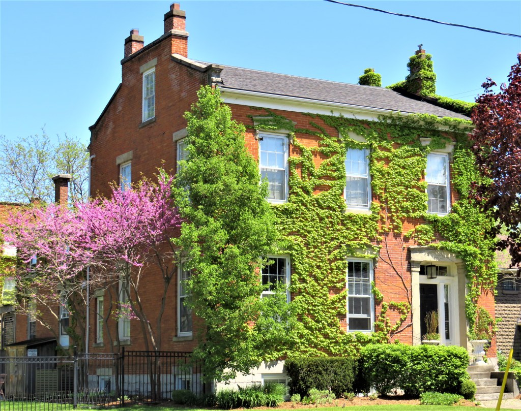
41. There are several fine houses on Yates Street, like this Georgian-style beauty (ca. 1863) at number 38 …
42. … and this cottage at number 32. Some of these residences were built by owners of mills on Twelve Mile Creek below. Almost all of that former canalside industrial area has now completely vanished. As the map at #37 shows, Highway 406, a freeway connecting the QEW with Welland, now occupies the east bank of Twelve Mile Creek (the former route of the First and Second Canals) as it bypasses downtown St Catharines.
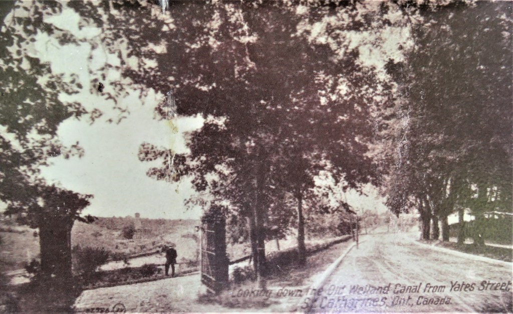
43. This is what Yates Street looked like during the time of the Third Canal, which bypassed this area. That’s why the caption refers to the “Old Welland Canal” (i.e., the Second) down in the valley.
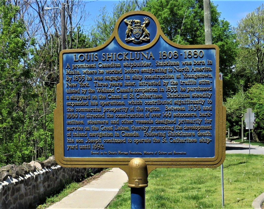
44. This sign commemorating the shipbuilder Louis Shickluna is near the eastern end of Yates Street. It suggests that the early Welland Canals were a powerful industrial stimulus to St. Catharines.
courtesy of Brock University Archives & Special Collections.
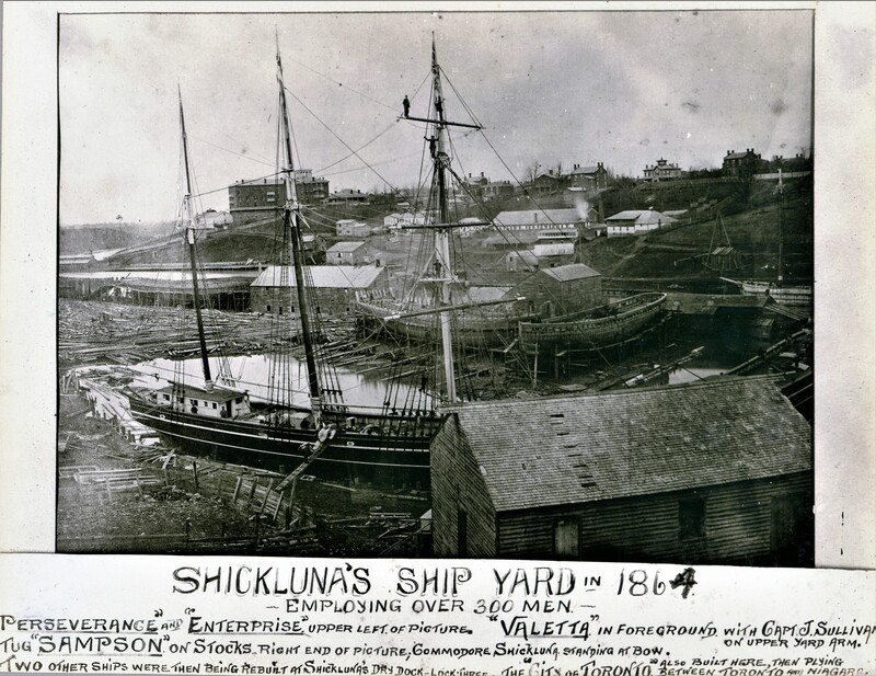
45. A photograph from 1864 shows Shickluna’s shipyard in the canalized valley of Twelve Mile Creek, with some of the mansions on Yates Street visible on the skyline.
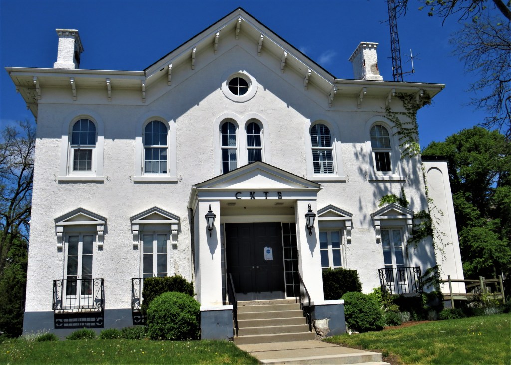
46. This is the house at 12 Yates Street where Merritt lived in the last two years of his life. His former residence on this site, where he planned the first two canals, burned down in 1858, and this one was completed in 1860. Merritt’s wife Catharine died in January 1862, and Merritt himself died in July of the same year. This house is now the headquarters of CKTB, a St. Catharines talk radio station.
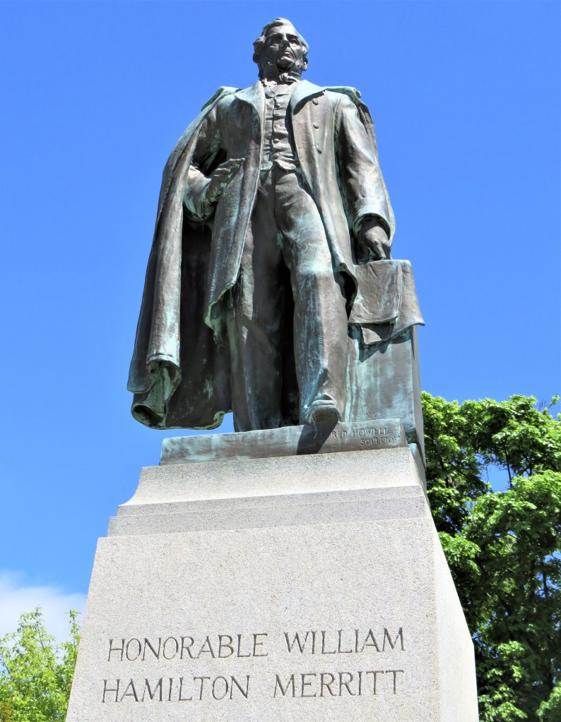
47. Merritt’s statue stands at the intersection of McGuire and St. Paul Streets, across from the house above. A plaque on the back justly refers to Merritt as “the Father of Canadian Transportation.” Even aside from the Welland Canal project, his achievements and influence were considerable in the larger context of pre-Confederation Canadian history. He believed in lowering trade barriers with the USA as that country was Canada’s nearest neighbour and potentially a more reliable trading partner than the distant UK. (He supported the Reciprocity Treaty that was signed in 1854 allowing a measure of free trade between Canada and the US.) He played a key role in lobbying for the construction of the international suspension bridge at Niagara Falls (in operation 1855-97) that carried three railroads over the Niagara River. He spoke out publicly against jailing debtors (which he said only benefitted lawyers), and on behalf of First Nations. He supported the Underground Railroad that helped escaped slaves enter Upper Canada, and he helped found local educational institutions, libraries, and historical archives. Merritt, then, had a considerable hand in not only the early development of St. Catharines, but also the transportation networks that would shape the future of Canada.
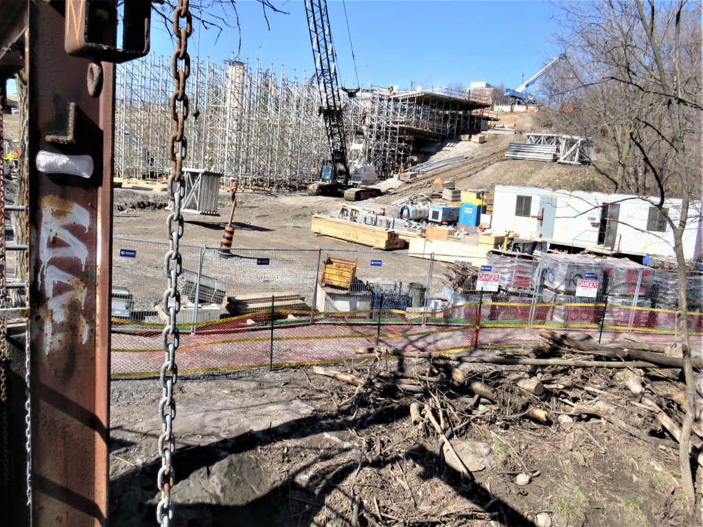
48. Near this point but down in the valley, the First and Second Canals left Twelve Mile Creek and branched off to the southeast along smaller Dick’s Creek. There were major construction works when I visited that made it very difficult to follow the Merritt Trail on foot from one waterway to the other.
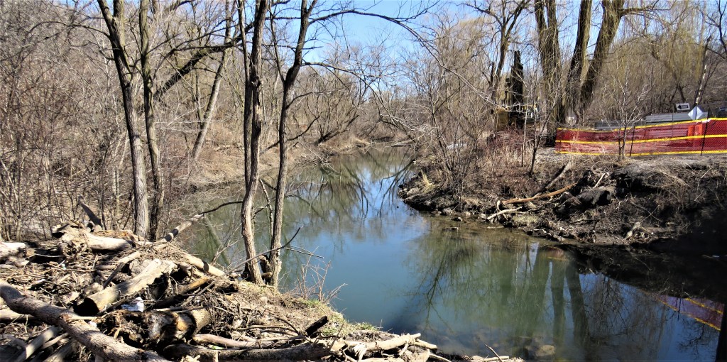
49. This is Dick’s Creek just south of its (now culverted) connection with Twelve Mile Creek …
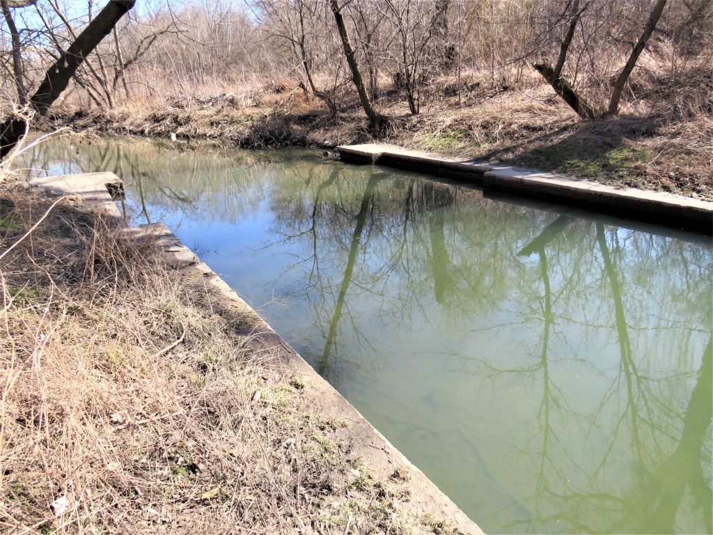
50. … but there are a few traces indicating that this was once the course of the First and Second Canals.
courtesy Canadian War Museum/1.E.2.4-CGR2
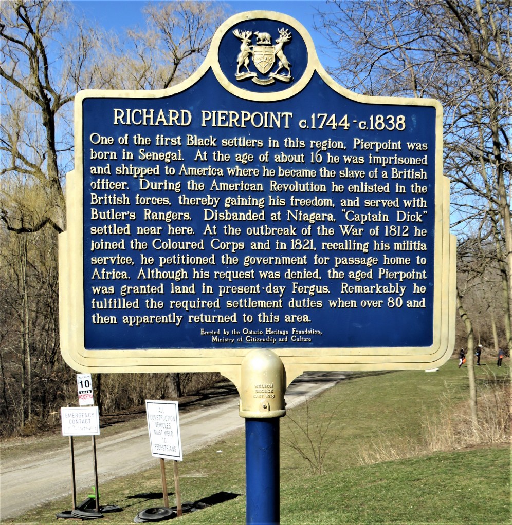
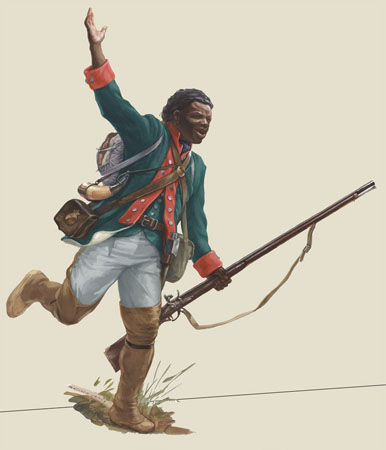
51. The name of Dick’s Creek almost certainly commemorates the early Black settler Richard (“Captain Dick”) Pierpoint, as the sign above indicates. Note that the British government offered freedom to any former slave who fought on its side during the American Revolution, and Pierpoint was one of eight Black members of the noted Loyalist regiment Butler’s Rangers. During the War of 1812, Pierpoint, who by then was probably in his late sixties, served in the Coloured Corps and saw action at Queenston Heights, Lundy’s Lane, and elsewhere. He was probably in his mid-90s when he died, and his burial place is unknown. As a Black Canadian who served the Crown loyally throughout his long life, he certainly deserves the recent initiative by the City of St. Catharines to formally rename Centennial Park along Dick’s Creek, “Richard Pierpoint Park.” For more on Pierpoint and Dick’s Creek, read Alun Hughes’s piece here.
The Merritt Trail follows Dick’s Creek through Richard Pierpoint Park. We’ll pick it up again in Merritton.
