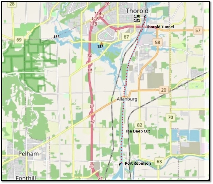
129. Today’s hike is 9.8 km one way along the west bank of the Canal from Lock 7 in Thorold to the Port Robinson ferry. It’s marked by the red dots on the map above. There are no locks on this mid-section of the Canal, so its chief interest is either in the shipping going by, or in less obvious highlights, some of which aren’t directly by the Canal itself. As this hike is long, you might want to go with a friend in two cars, park one at each end, and walk between them. If you are alone, you could take a bike in your car if you don’t want to have to walk both ways. There’s a small free P at Lock 7, but you can also park on the residential streets in the vicinity. At Port Robinson you can park by the roadside at the eastern end of Bridge Street West.
The Welland Canals Trail is flat and well paved, so that it poses few challenges to the hiker and is perfect for cyclists. A car is probably necessary to explore the Thorold hinterland. You can also take public transit between the start and end points, though you’ll have to change buses at the Pen Centre Mall on Glendale Avenue and the one-way journey will take over an hour. From May through October you can take the ferry over the Canal and back to visit Port Robinson village on the east bank.
Before legging it down to Port Robinson, we’ll begin with a short excursion in Thorold. You might want to do this by car or bike. Numbers 130-133 on the map above give the approximate locations of the next few entries.
A Short Excursion in Thorold
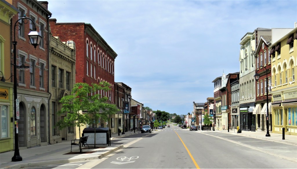
130. Thorold sits atop the Niagara Escarpment and has a population of about 23,800. The original township was named for Sir John Thorold, 9th Baronet of Marston (1734-1815), a British MP who represented the county of Lincolnshire from 1779-96 and who opposed war with America. The current city of Thorold has its origin in a canal village settled by workers constructing the First Welland Canal (1824-29). Front Street South in downtown Thorold (above), once adjacent to the First Canal, has some fine period facades that have recently been renovated.

131. Thorold was the site of the Battle of Beaverdams (24 June 1813), an important victory over the invading Americans during the War of 1812. The event is famous for Laura Secord’s advance warning to the British about the position of US troops. Overhearing loose talk among Americans forcibly billeted at her Queenston home, and with her husband incapacitated by wounds from an earlier battle, Secord took it upon herself to trek over 30 km to alert Lieut. James FitzGibbon, the local British commander, at Decew House about 5 km west of here. Secord’s journey is now an essential element of the Canadian national mythology. It’s less well-known that it was almost entirely First Nations troops (Caughnawaga Iroquois and Mohawks) that ambushed and terrified 500 Americans into surrender at Beaverdams, though FitzGibbon (and subsequently Secord) got much of the credit. This small, recently renovated park about 500 metres west of Lock 7 commemorates the battle. There are several historical plaques here, including a memorial to the American soldiers who died in the battle, and there are also the remains of a stone lock of the Second Canal.
So, was this park the actual site of the battle? No, it wasn’t! The US forces surrendered in a field on what is now the other side of the Ship Canal near the eastern mouth of the Thorold Tunnel about 2.5 km from here. There you’ll find a “historic boulder” at the corner of Davis Road and Thorold Stone Road installed as recently as 2013 with plaques marking the actual battlefield site.

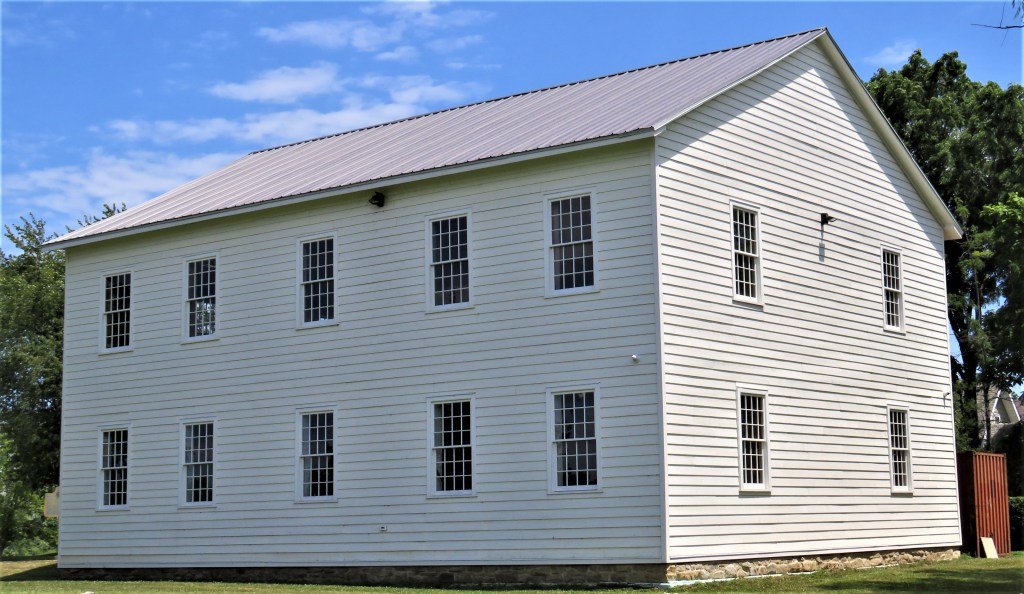
132. About 3 km southwest of Battlefield Park is Beaverdams Church (1832) on Marlatts Road. This is one of the oldest Methodist places of worship in Ontario. It was founded by Empire Loyalists and is one of very few in Canada built in New England Meetinghouse style: plain and simple with a white clapboard exterior. Now deconsecrated, it has recently been renovated with the aim of using it for concerts and other gatherings.


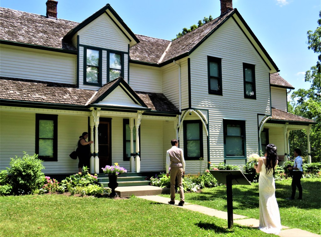
133. About 4 km west of #132 is the property now called Morningstar Mill on Decew Road.
Top: The sawmill at the head of Decew Falls on Beaverdams Creek, one of the few watermills in Ontario still operational, albeit now as a museum piece.
Middle: The stone grist mill, powered by a turbine from 1872.
Bottom: The attractive Miller’s House, now a popular wedding venue, was built for Wilson Morningstar and his wife Emma in 1895. They had bought the whole property in 1883, and gave it its current name.
There’s also a blacksmith and carpentry shop onsite. Visits inside the buildings are sometimes possible. There’s free admission to the grounds (donations welcome) which are open several days a week from Victoria Day through Thanksgiving. Both the Bruce Trail and the Laura Secord Legacy Trail run through the rear of the property.
And now back to the Welland Canals Trail, southbound from Lock 7 to Port Robinson.
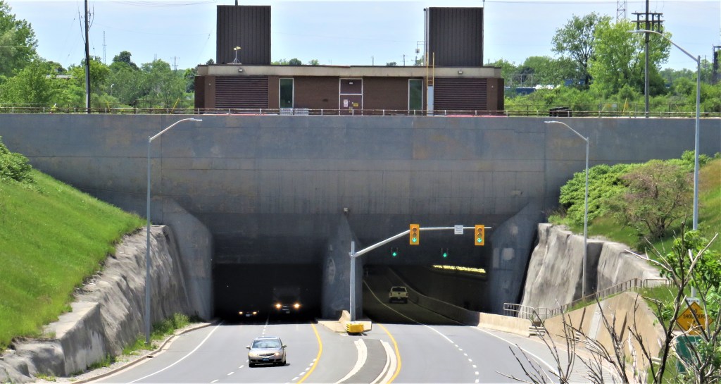

134. Tunnels under the Canal obviate the disruption to traffic caused by raised bridges. The most northerly of the three current tunnels is the Thorold Tunnel that takes Highway 58 under the Canal. Built 1965-67, it consists of two parallel tubes each 840 metres long and each carrying two lanes of traffic. (The other two tunnels are both south of here in Welland.)
Top: The eastern approach to the Tunnel.
Bottom: There’s a sidewalk for pedestrians in the westbound Tunnel.
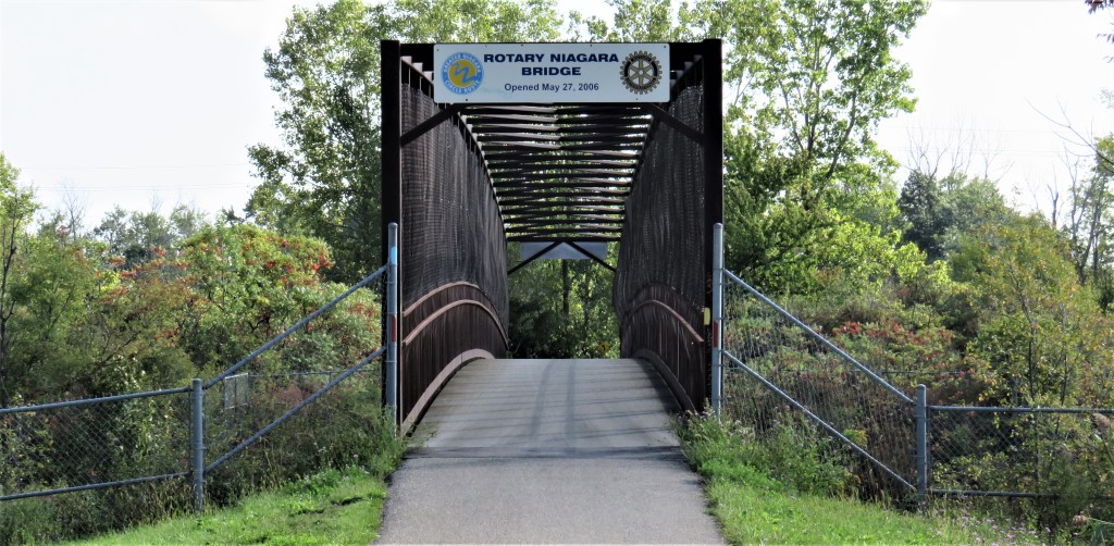
135. The Rotary Niagara Bridge takes the Welland Canals Trail over a remaining section of the Third Canal where it meets the Ship Canal north of Allanburg.
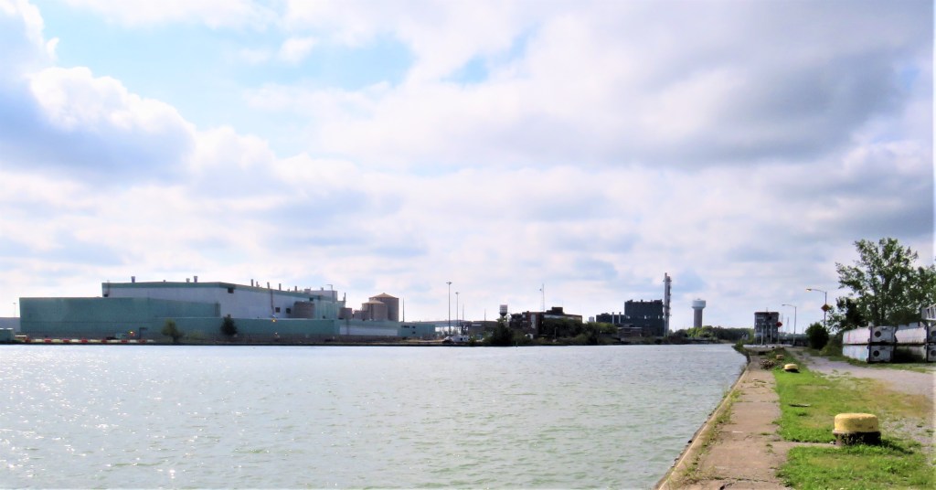
136. The view south from the Trail of a large industrial area on the east bank of the Canal. From left to right: HOPA (Hamilton Oshawa Port Authority) Multimodal Hub; Northland Power Station (with the tall stack); Thorold South Water Tower.

137. Ruins of a former Ontario Paper Company mill, directly across the Canal. This whole area on both sides of the Canal is of great interest to the industrial archaeologist.


138. The end of a stretch of the former Third Canal with a disused water control structure and a pier now colonized by seagulls. The Ship Canal is on the far side of the pier.

139. Cyclists approach Allanburg Bridge, which is just being lowered …

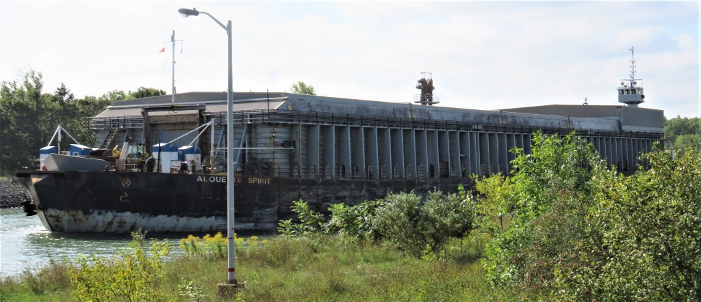
140. … after the barge Alouette Spirit, pushed by the tug Wilf Seymour (see #127 above), comes through on its way north.

141. Bridge 11 (Allanburg Bridge) is a vertical lift bridge, 61 metres long, built in 1932. It carries Highway 20, a.k.a. Lundy’s Lane, over the Canal. On 11 August 2001, this bridge was accidentally lowered onto the freighter Windoc as the vessel was passing through. The Windoc’s wheelhouse and smokestack were destroyed, and the ship drifted downstream, caught fire, and grounded approximately 800 meters from the bridge. The Windoc was a total loss, while the bridge sustained lesser damage. Fortunately, there were no serious injuries among the Windoc’s 22-man crew. The Marine Investigation Report concluded that it was likely that the bridge operator was “impaired” and lowered the bridge too soon. You can watch a dramatic video report of this accident online.

142. The view looking north towards Allanburg from mid-Canal near Port Robinson. This section of Canal is known as the Deep Cut. Grand Summit Ridge was the highest elevation on the Canal, and caused innumerable problems for the builders of the early canals, in particular frequent landslides of unstable heavy clay. Each of the four Welland Canals used this same alignment (the only stretch of which this is true), though in each case the Canal has been successively widened and deepened. The canalside foliage masks the high berms of spoil dug out from the bed of the Canal over the past two hundred years.


143. Top: The little Port Robinson ferry, the only one of its kind on the Canal, plies the waterway.
Middle: The ferry Bridge-It at its western dock. The service is free and runs May to October.
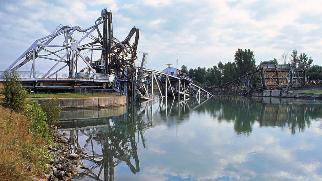
Bottom: This used to be Bridge 12, a vertical lift bridge like one at Allanburg, here at Port Robinson. But on 25 August 1974, the bridge was struck by the ore-carrier Steelton and utterly destroyed. At the time this was the costliest accident in the history of the Canal, though no one was killed. The Canal was closed until 9 September that year. You can find details of the accident here. In this case, the fault almost certainly lies with the vessel: it seems clear that Steelton failed to heed the usual approach warnings and struck Bridge 12 before it was fully raised.

144. Bridge 12 has not been replaced and probably never will be, as the cost of a new fixed crossing to serve a small population would be astronomical. So if you want to go from the west bank of the Canal to downtown Port Robinson on the east bank in any vehicle larger than a bicycle, you’ll have to make a long detour via either Allanburg Bridge to the north or the East Main Street Tunnel in Welland to the south. Port Robinson is now a sleepy little place, but that’s how the residents like it!
