From Livingstone Drive to Rock Chapel Parking Lot
Date: 27 August 2021
Start Point: Livingstone Drive at Sydenham Street, Dundas
End Point: Rock Chapel Parking Lot, 318 Rock Chapel Road, Dundas
Distance Covered: 3.2 km*
Total Distance Covered: 58.6 km
*plus ca. 0.3 km on side trails; plus ca. 3.0 km optional return loop.

266. There’s no getting away from it: today’s hike, short though it is, involves climbing the full height of the Niagara Escarpment.* If you have two cars, park your start car for free on Livingstone Drive by Cascades Park, as on the previous hike. Park the end car in the Rock Chapel Conservation Area P on Rock Chapel Road. This P, and the Conservation Area itself, are administered by the Royal Botanical Gardens (RBG), so unless you display an RBG membership tag, you’ll have to pay to park. Then follow the white blazes of the main Bruce Trail, which is shared with the RBG’s Escarpment Trail once you enter the Conservation Area.
The main attractions of this hike are the views over the Dundas Valley. The best unobstructed panorama of the Valley is from a viewpoint (marked on the map above) on Sydenham Road. This has a small free parking lot which is almost always busy with motorists taking photographs. To get to it, attain the top of the Escarpment, then follow the 80 metre long Sydenham Lookout Side Trail, marked with the usual light blue Bruce Side Trail sign and blazes. Then return to the main Bruce.
At the end of Romar Drive, you enter the Conservation Area, and have a delightful stroll through woods along the edge of the Escarpment. The Trail here becomes so broad, level, and well-drained that you can do it comfortably in almost any weather. If you are at all interested in Escarpment geology, watch for a sign for the Armstrong Trail and a steel staircase descending steeply over the edge. (This is likely to be closed during pandemic lockdowns.)
If you have only one car, park it on Livingstone Drive. When you get to the end P, take the loop trail through a lush naturalized meadow back to the Bruce/Escarpment Trail. Then retrace your steps to the start as there is no safe alternative to the Bruce on Sydenham hill for pedestrians. But it’s downhill all the way!
By transit from downtown Hamilton, take the HSR #05 Dundas bus going to Head Street, and get off at King and Sydenham in downtown Dundas. Then walk 700 metres up Sydenham Street to join today’s hike at Livingstone Drive. Your return is the reverse of the course just described, so you’ll walk an extra 1.4 km. Note that there’s no public transit anywhere near Rock Chapel Road.
If you’re in need of refreshment during this hike, make a short detour by foot or car to Dyment’s Market and Bakery at Sydenham and Fallsview Road East, about 600 metres north of the Lookout. It’s not a café, but they sell some very appetizing foodstuffs there to go.
*Well, you can get away without the climb if you do this hike in reverse, i.e., anticlockwise. But then you’ll definitely need a car at either end.

267. This is the view northeast up Sydenham hill from near its foot. This three-lane (two up, one down) road is the main Mountain access from Dundas to the north. Sydenham Road (its official name) climbs the 100 metre scarp face in about 1 km, with the steepest grade around 11% (1 in 9).
In 2001 a dump truck lost its brakes coming down this hill, went through stop signs and a red light, and crashed into the Memorial Square wall of what is now Shawn & Ed’s craft brewery. And according to a YouTube video, a huge truck suffered a similar loss of brakes again in December 2014. In both cases, mayhem was averted more by luck than any other factor. Unconscionably, Sydenham Road is still a Hamilton truck route, though there is currently an initiative to delist it. Given Dundas’s location on the Valley floor, there are few safe ways for heavy vehicles to enter the town, and this is not one of them.
Sydenham Road is well paved, but there are no sidewalks or shoulders on this section … yet it’s part of the main Bruce Trail! You take that narrow worn path on the road side of the crash barrier. At the second street light, you have to cross the road … just before that curve.

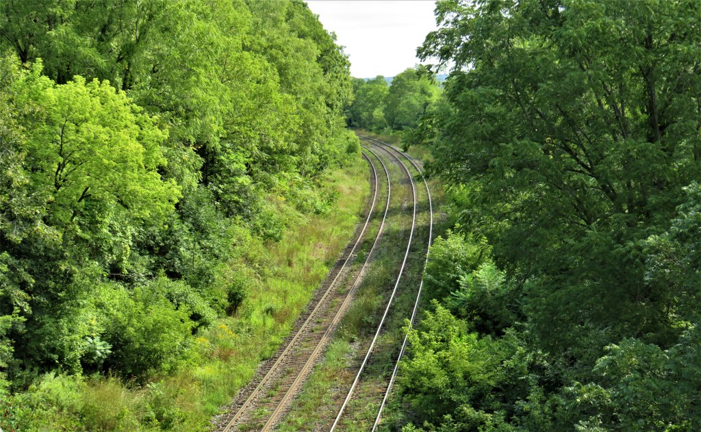
268. Having crossed the road very carefully, take the segregated sidewalk on the right for the short stretch over the CN railroad lines. The sidewalk (top, looking south) was the result of the 1971 construction of the Cameron Dyment Bridge over the CN tracks (bottom). Presumably there were once plans to extend the sidewalk the whole length of the Sydenham hill, but this never happened. An opportunity lost to display the beauty of the Dundas Valley safely and accessibly to everyone, without the need to burn fossil fuel!

269. Sydenham hill is famous among the sport cycling fraternity. It was where Clara Hughes (b. 1972 in Winnipeg), Canada’s most laurelled Olympian, trained; a plaque now marks this stretch of road as “Clara’s Climb.” As a cyclist Clara won two bronze medals in the 1996 Summer Olympic Games, and as a speed skater she won one gold, one silver, and two bronze in the three succeeding Winter Olympics. She is one of only six athletes who have ever won medals in both Summer and Winter Olympics, and she’s the only athlete, male or female, to have won multiple medals in both those competitions. In a car ascending Clara’s Climb you’ll overtake cyclists, visions of gold medals dancing before their eyes, pedalling furiously in lowest gear to maintain a speed that’s less than walking pace. Descending, your vehicle can barely keep up with them as they coast down at 60-70 km/h.

270. From this short section of sidewalk you get a fine view over Dundas. This is a panorama of downtown, from the pink Town Hall cupola on the extreme left, to St. Augustine’s brick tower and the stone tower of the old post office on the right. The brick building with the steeply pitched roof and chimney in the foreground is Knox Presbyterian Church on Melville Street. Aside from the central cluster of residential highrises, Dundas seems to occupy a dense forest that covers the floor of the entire Valley. The town’s present climate is moist and temperate, with 95.2 cm of precipitation yearly, similar to rainy Seattle, WA. Will climate change heat up and dry out the Valley, so that forest fires become possible? One certainly hopes not!

271. At this point the sidewalk gives out and the Bruce takes to the woods. From here, the ascent to the top of the Escarpment is quite arduous and by no means universally accessible, especially not in wet or icy weather. Tread carefully!
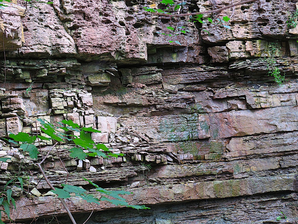
272. The damp strata exposed here indicate that you are passing another waterfall: Dyment’s Falls, reduced to a trickle in summer. This Falls was supposedly “discovered” as recently as 2007, though anyone climbing this section of the Bruce on a cold winter’s day can spot the white profile of this tiered Falls frozen in place through the leafless trees. Note the honeycomb weathering of the top stratum.
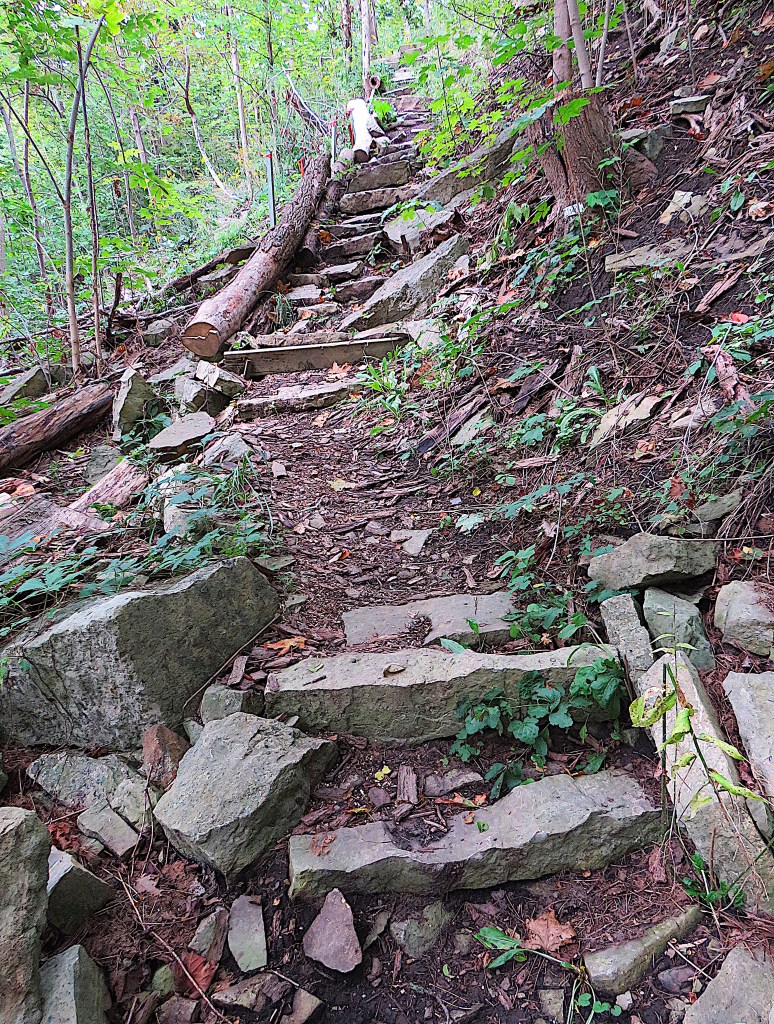
273. Here you ascend rustic stairs that Bruce Trail volunteers have built to help hikers up the steepest section.
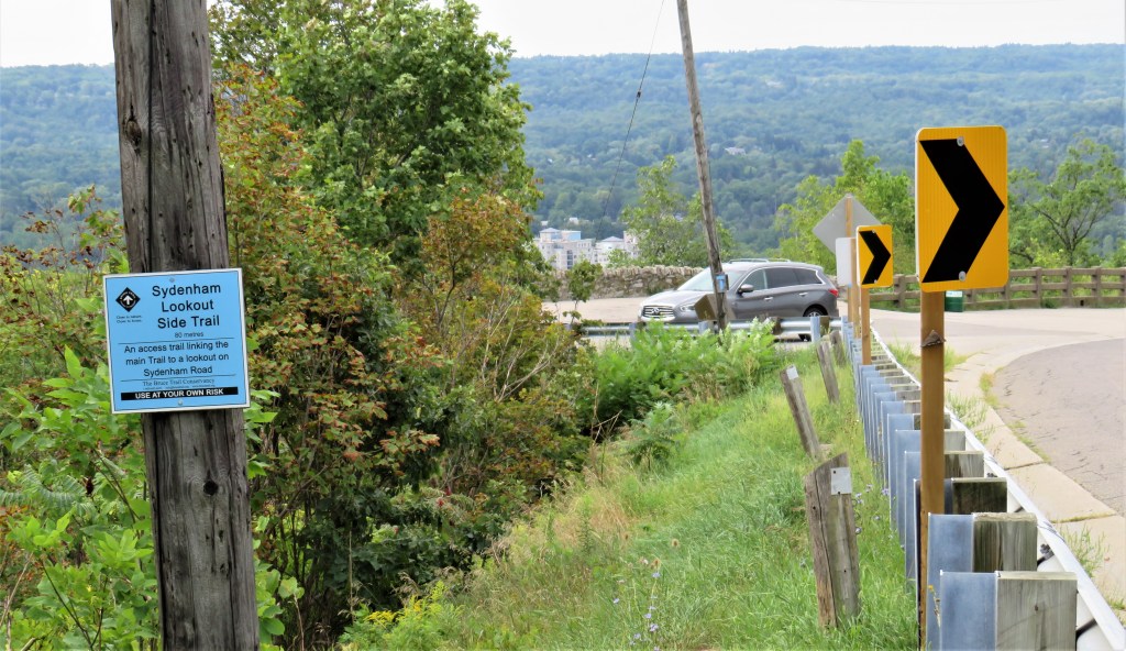
274. At the top there’s the sign indicating the 80 metre Side Trail to the Sydenham Lookout. It’s so short that it doesn’t really count as a side trip. The parking lot is busy at all times of the year …
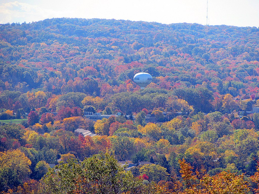
275. … and especially during the fall.

276. On Romar Drive, the nine houses on the right are built right on the edge of the Escarpment. They undoubtedly have amazing views from their back windows. But would you like to live on the very brink of an active geological formation? (See #284 below.)
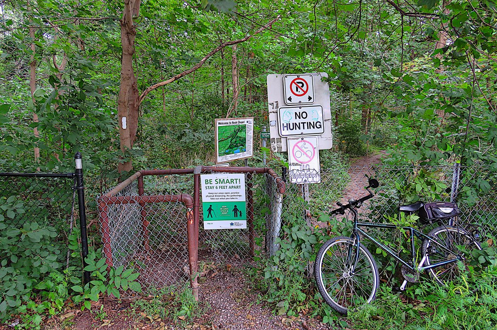
277. At the end of Romar Drive, this kissing gate, plastered with the usual warning notices, gives access to Rock Chapel Conservation Area. There’s no cycling allowed anywhere on the Bruce Trail.
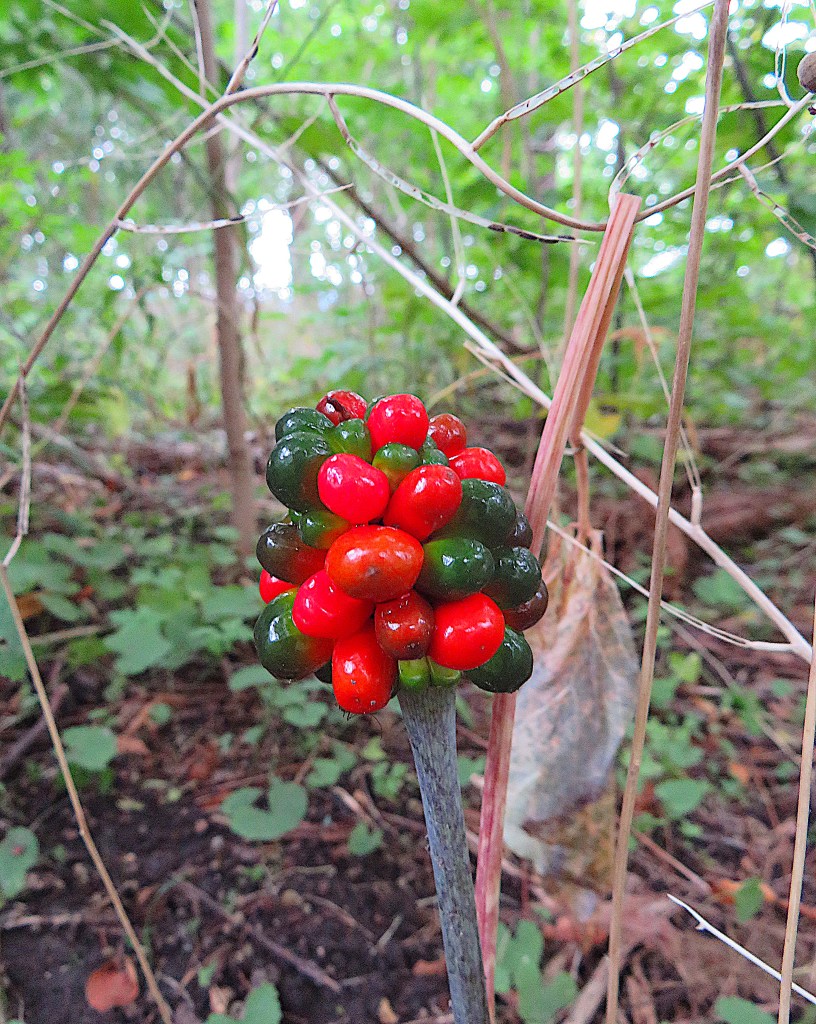
278. You may have seen an isolated tight cluster of berries on the top of a stalk (technically, a spike or spadix) close to the ground in the woods. They are the fruit of the Jack-in-the-pulpit (Arisaema triphyllum), a native plant in the arum family. Now in late August the green berries are turning a brilliant red. Gone are the flower (the spathe, or “pulpit”) that formerly curved like a hood over the spadix (the spike, or “Jack”). All parts of this plant are poisonous to humans, though birds and mammals eat them.

279. In the summer there are only occasional gaps in the foliage through which to glimpse distant views. This one reveals downtown Hamilton, with Cootes Paradise in the foreground and the slope of the Mountain looming over the central lower city behind. The Red Hill Valley (see Hikes #3 and #4) lies hidden to the right between the nearer and farther heights of the Mountain.
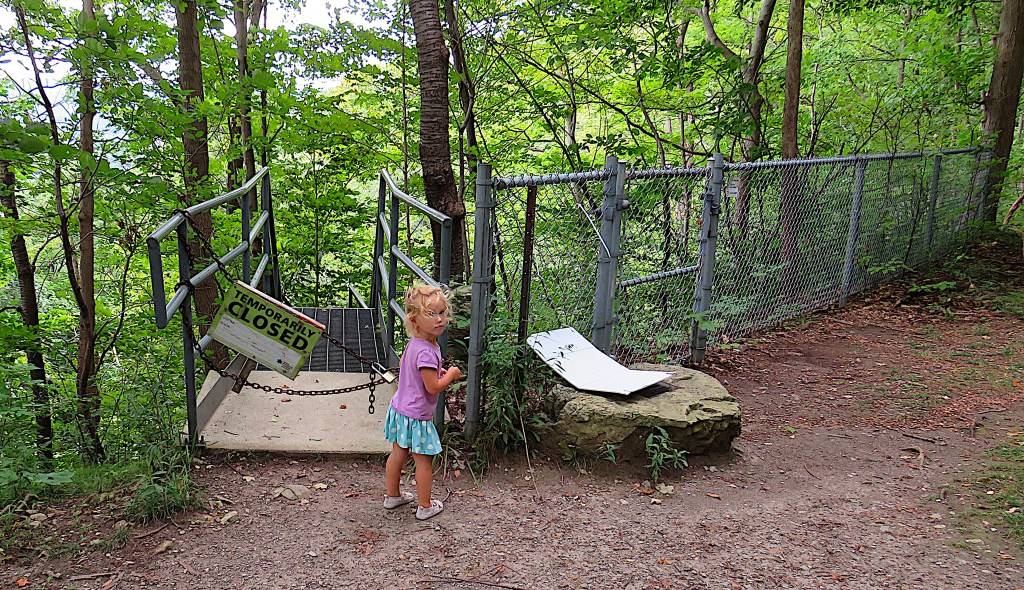
280. This little one seems disappointed that the Armstrong Trail staircase is closed during the pandemic. But it’s true that social distancing would be difficult on it.


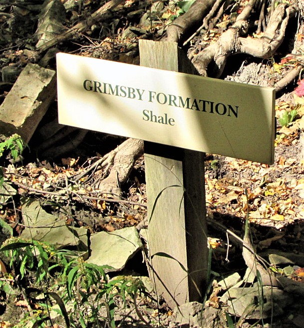
281. This is what the 10-metre-long stairs look like when it’s open. As you descend it, there are signs indicating the name and composition of the six geological strata of the Escarpment visible here. The Lockport Formation (Silurian) is the relatively hard dolomite that forms its most “recent” top layer or cap. Dolomite is limestone hardened by contact with magnesium, possibly through microbial action under greenhouse conditions. Under it lie the following Formations, in order of descent: the Rochester (Silurian: grey shale); Irondequoit (Silurian: dolomite); Reynales (Silurian: dolomite); Thorold (Silurian: sandstone and grey shale); and Grimsby (Silurian: red shale and sandstone). The Escarpment’s lowest and oldest layers, from the Cabot Head (Silurian: shale) through the Queenston Formations (Ordovician: red and grey shale), are not visible here as they are buried under a talus slope.
To descend this staircase, then, is to time travel back to an almost unimaginably distant past: the Silurian Period of the Palaeozoic Era, when the Escarpment took the form that you see here today, was from 444-419 million years ago.
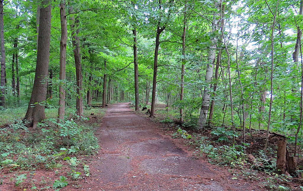
282. This is the Bruce/Escarpment Trail in the central part of Rock Chapel CA. The soil here is thin (only 30 cm over the caprock), but that’s sufficient to support an oak and maple forest, and an occasional birch too.

283. This is the view to the east where the trail meets the small gorge through which flows Borer’s Creek. The three tall lamps show the course of Highway 6 where it ascends the Escarpment towards Guelph. You’ll be continuing through that forest on the rugged edge of the Escarpment that here divides Waterdown from Burlington. That crest is where the Escarpment begins to turn to the north, eventually reaching Tobermory on the Bruce Peninsula.

284. Towards the end of today’s hike, there’s a viewpoint to the east with three information placards. They note that the Niagara Escarpment is an International Biosphere Reserve that ranks with the Florida Everglades and Galápagos Islands in global importance. Rock Chapel, having narrowly escaped the attentions of the quarrying industry, has been a protected nature sanctuary since 1942. The placards also explain how the Escarpment was formed, starting with sand and shale sediment from a gigantic river delta that then lay at the Earth’s equator. The Escarpment later served as the rim of the prehistoric Michigan Basin, filled with a shallow sea whose marine creatures, dying, formed a harder layer of partly organic sediment on top of the softer inorganic shales beneath. This Basin was subsequently uplifted by tectonic forces, causing the sea to drain away and leave the exposed cliff. Erosion by wind and water and by several more recent glaciations have caused the softer lower layers to crumble, undermining the hard cap. This geological process continues implacably, so that the scarp face retreats over time, and does so particularly quickly around waterfalls, as here near Dyment’s and Borer’s Falls. (This is why you don’t really want to build your house on the edge … or near the foot, for that matter!)
Look through that small gap in the foliage at the centre of the image …

285. … and you’ll see the Gurdwara Shaheedgarh Sahib, the Sikh temple on Old Guelph Road that you glimpsed from a distance in #140 above.

286. At the end P, the RBG provides a relief map of the area. You are standing at that yellow floral sign at the upper left of the map, on a high, wooded section of the Escarpment overlooking the RBG’s properties on the north shore of Cootes Paradise. The RBG is an excellent custodian of the natural areas under its care, so if you had to pay at this P, your money has gone to support a good cause.
If you are hiking back to the start, take the trail marked Rock Chapel Loop, which is the one to the far right of the pay station in the P.
