
Part 65: Moore Street Side Trail to McKague Road
Date: Monday 19 October 2020
Start: Moore Street Side Trail, Lion’s Head
End: McKague Road, Lion’s Head
Distance Covered: 12.2 km + 1.0 km* = 13.2 km
Total Distance Covered: 822.0 km
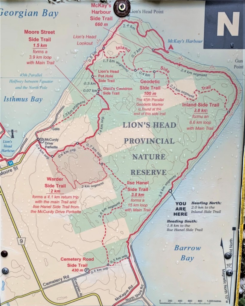
810. Lion’s Head is a stubby, almost rectangular peninsula poking northeast into Georgian Bay midway between Wiarton and Tobermory. Much of it is a Nature Reserve, and aside from Moore Street, which reaches a little way up its western flank, there are no roads to disturb the wilderness. The story of today’s Hike #65, in which we tackle three sides of Lion’s Head, actually begins just over three weeks ago on the afternoon of 27 September, just after we had completed Hike #64. On that day, we were driving out of Lion’s Head village back to Wiarton, where we were staying overnight, when my car’s engine warning light came on and the engine lost power. The car was able to limp into Wiarton and I took it into a garage early the next morning so the engine problem could be diagnosed and, hopefully, fixed. We then decided, based on a favourable weather forecast that turned out to be quite wrong, to do our planned hike #65 while waiting for the garage’s verdict. Having only one car was, however, a problem, as a loop hike would be much longer than a linear one. So, we hired a Wiarton taxi to follow us to Forbes Street at Lion’s Head harbour, where we dropped Mike’s car, then asked the taxi driver to take us to the north end of McKague Road, where we had ended hike #64, aiming to circumnavigate Lion’s Head anticlockwise. But rain started to fall at the “YOU ARE HERE” point on the besprinkled map above, and the Trail became treacherous due to rain-slicked rocks slanting towards the precipitous edge of the Escarpment. We found ourselves continually slipping on these rocks and feared one or both of us might suffer a serious fall if we continued along the Main Trail. So, we decided to take the easier Inland Side Trail west across the Peninsula. We rejoined the Main Trail near the Lion’s Head Lookout and followed it to Mike’s car parked at the harbour. That day, 28 September, we walked 12.6 km, 8.3 km of it on the Main Trail, having omitted only 4.8 km of Main Trail across the top edge of the Peninsula. So, why didn’t we just do the missed 4.8 km today? Well, if you study the map above, you’ll see that when planning hike #65.2, we found it was impossible to cover the omitted section without either repeating the whole 12.2 km hike linearly or doing a loop that was far longer. *Of the aborted hike #65.1 on 28 September, only 1.0 km, the distance between the parking lot on Forbes Street and the parking lot on Moore Street, counts towards our cumulative total, as there was no need to repeat this short on-road section in Hike #65.2.
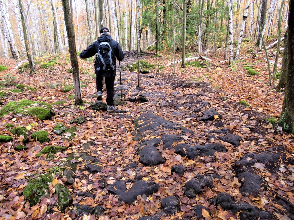
811. We decide for the sake of variety to do the Lion’s Head hike clockwise today, that is, in the opposite direction to our earlier abandoned attempt. The parking lot on Moore Street is busy and there are quite a few other hikers on this section of Trail, though most will go no farther than the lookouts above the western shore. Even the relatively flat inland opening section is challenging, as we must navigate very uneven dolomite pavement, its crevices obscured by fallen leaves. Most of the other hikers are young and seem to us to have totally unsuitable footwear, though the insouciant vigour of youth will probably see them safely back again. We, on the other hand, are more anxious about this hike than any other until now. Still, the weather is good and we’re well prepared for the rigours of Lion’s Head, if only because we know what we’re up against.

812. I should mention that I have a Canon camera in hand again. My last camera, only six months old, suddenly ceased to work on 19 July (hike #52), and I returned it to the manufacturer with whom it was under warranty. I was told to expect the repair to take six to eight weeks, and when that time had elapsed without a result I was told that wheels turn more slowly during a pandemic. Last week, losing patience, I made a bit of a fuss and was immediately given a new camera to replace the old one. The iPhone camera that I used in the meantime was surprisingly good at close range, but its digital zoom was very poor. As much of the photographic appeal of this northernmost stretch of the Trail involves panoramas of distant headlands, lake, and sky, it’s a relief to have a decent optical zoom lens again.
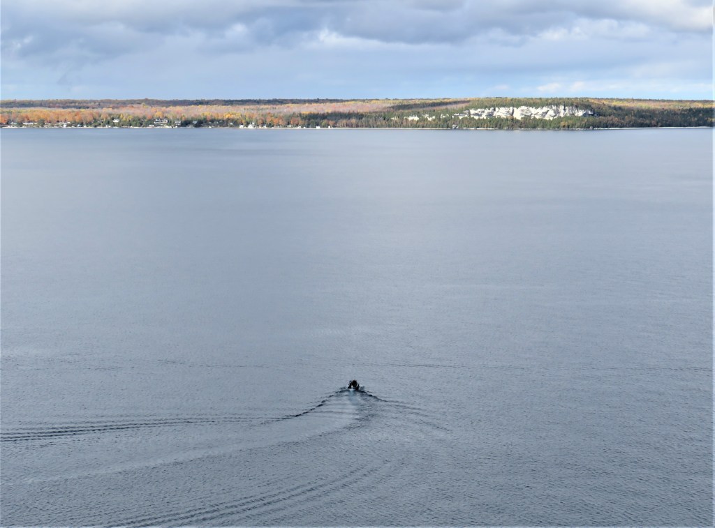
813. A small powerboat heads toward White Bluff. You don’t see many watercraft on this part of Georgian Bay these days, but things used to be very different. The waters here conceal many wrecks from the time when travel in the area was conducted chiefly by boat. The steamer Asia, plying between Collingwood and French River via Meaford and Owen Sound, went down in a gale off Byng Inlet on 14 September 1882 with a loss of about 125 passengers and crew (the exact number of victims remains uncertain). The captain had disregarded a weather warning and the vessel, constructed to navigate calm inland waterways, was underpowered and severely overloaded. In the Meaford Monitor of 21 October 1892, Duncan A. Tinkiss, the only male survivor, took up the story: “The wind suddenly chopped from the south west to the northwest, and with a crash the vessel rolled over on her beam ends. The sea was now a mountainous whirlpool and the ship was helpless. The aft gangway leading from the promenade to the main deck, was jammed with men, women and children who could get neither up nor down. At every pitch this mass would writhe and twist like a serpent while the waves broke over then from above. The horses in the meantime — there were about ten of them aboard — had broken loose and at every roll they were thrown from one side of the main deck to the other.” Seventeen people managed to get into one of the lifeboats (the others capsized under the frantic mass), but only two 18-year-olds, Tinkiss and Miss Christina Ann Morrison, survived what became eighteen hours in an open boat. The pair were then marooned for two days on shore near Pointe au Baril until they were rescued by an aboriginal couple who took them by boat to Parry Sound. The sinking of the Asia was the worst maritime disaster ever on Georgian Bay; the remains of the vessel have never been found.
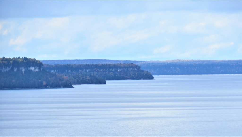
814. A shot impossible with an iPhone. Looking north, headlands succeed one another: White Bluff is nearest, then Smokey Head, then Cape Chin, and finally, in the background, the shoreline west of Cabot Head. In each case, it’s the Niagara Escarpment, moving sinuously up the eastern shore of the Bruce Peninsula, that provides the vertical dimension.
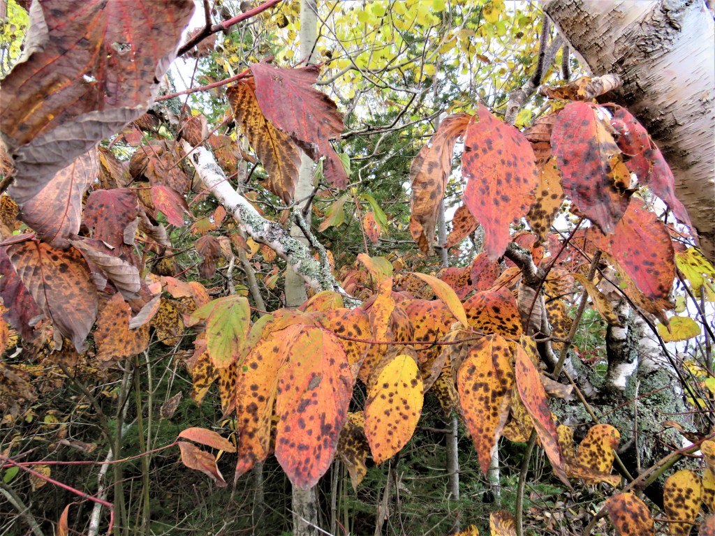
815. Even in decay, Nature is an exquisite colourist.

816. On the north coast of Lion’s Head, the Trail briefly and abruptly descends to the lakeshore at McKay’s Harbour. Nick poses by some inukshuk-like structures made from pebbles …

817. … as does Mike. We are girding our loins to face the climb back up to the top of the Escarpment, followed by the long section along the peninsula’s eastern shore that defeated us three weeks ago.
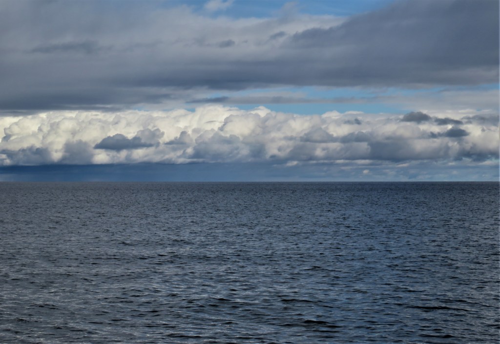
818. The cloudscapes of the Bruce Peninsula are spectacular. Here’s a stanza by the lyric poet who best captured the sublimity of these evanescent natural phenomena … by pretending to be a cloud:
“I am the daughter of Earth and Water,
And the nursling of the Sky;
I pass through the pores of the ocean and shores;
I change, but I cannot die.
For after the rain when with never a stain
The pavilion of Heaven is bare,
And the winds and sunbeams with their convex gleams
Build up the blue dome of air,
I silently laugh at my own cenotaph,
And out of the caverns of rain,
Like a child from the womb, like a ghost from the tomb,
I arise and unbuild it again.”
— Percy Bysshe Shelley (1792-1822), from “The Cloud” (1820)
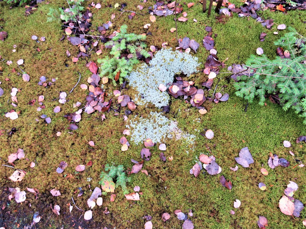
819. An abstract expressionist collage of moss, lichen, fallen leaves, and spruce seedlings.
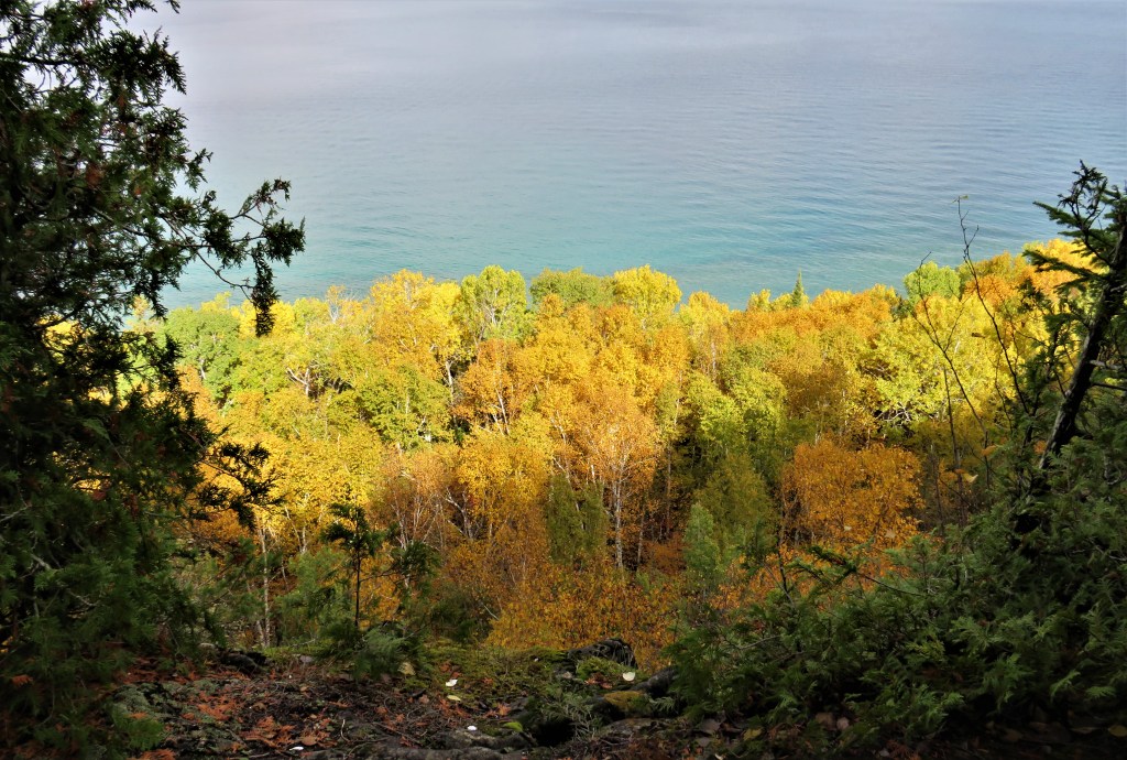
820. A stray sunbeam illuminates the deciduous forest below the edge of the Escarpment.

821. We have rounded the northeast corner of Lion’s Head and now look southeast across Barrow Bay toward Cape Dundas (foreground) and part of Cape Croker (background).

822. This is the part of the Trail that defeated us three weeks ago: slanting blocks of dolomite pavement that become slippery when wet. But today they are dry and we successfully complete our tour of Lion’s Head Peninsula in about five hours and twenty minutes. As we started today’s hike with considerable trepidation, we now feel a Conquest-of-Everest kind of elation. (Except the summit of Everest is crowded, while here on Lion’s Head we are almost entirely alone.)
Go to Part 66: Cape Chin Side Trail to Cottrill Lake Side Trail
