
Part 66: Cape Chin Side Trail to Cottrill Lake Side Trail
Date: Tuesday 20 October 2020
Start: Cape Chin Side Trail, Lion’s Head
End: Cottrill Lake Side Trail, Dyer’s Bay
Distance Covered: 14.8 km
Total Distance Covered: 836.8 km
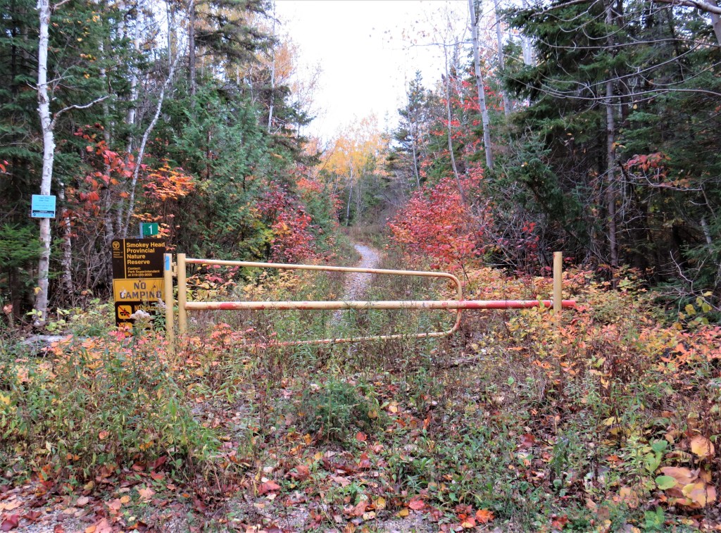
823. The start point of today’s hike: the colourful entry to the Smokey Head Provincial Nature Reserve.
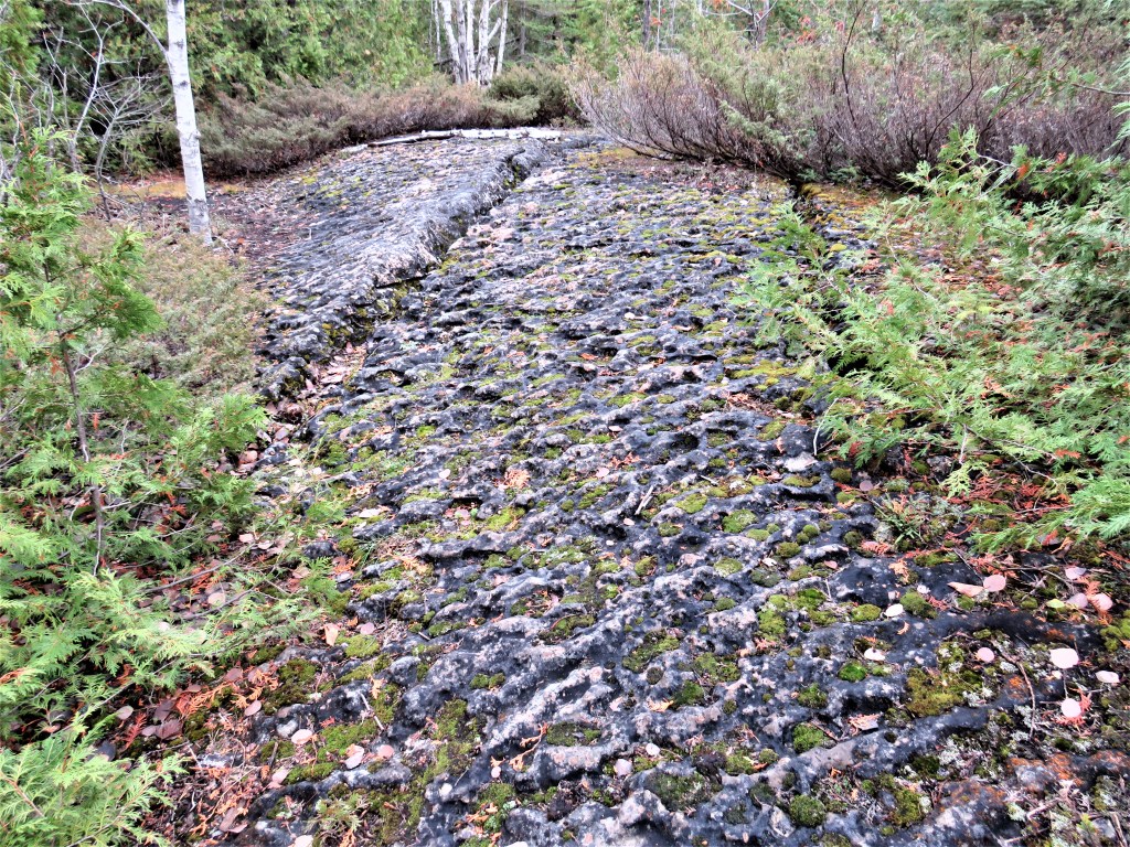
824. As we approach Cape Chin, the Trail is paved with dark, slanting, pitted dolomite. It’s not too bad a hiking surface when dry like today, but becomes very slippery when wet.
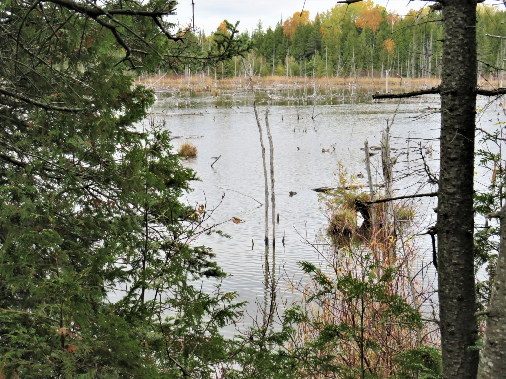
825. The Trail turns inland from Cape Chin and passes this nameless beaver pond.

826. A potential hazard very different from the one in #824. At this time of year, the Trail’s course through forest areas often disappears completely under fallen leaves. Frequent well-positioned blazes to guide hikers now become more important than ever. Thanks to the local Trail markers for that little white rectangle on the tree trunk in the centre of the picture.

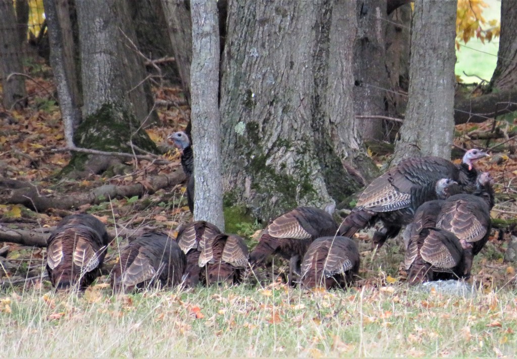

827A, B & C. As we emerge from the woods, we see a group of large birds foraging at the edge of a field. It’s a rafter of about a dozen wild turkeys. The ones with red wattles are males, known as toms; the hens are smaller and less colourful. The bird is a North American native, and the domestic Thanksgiving turkey was bred from these wild ancestors. It was the British who gave the bird its name, mistakenly associating its origin with the country of Turkey, from where merchants first exported the birds to the UK. By the 1940s wild turkeys had been almost extirpated from Canada by overhunting, but they were reintroduced during the 1980s and are now well reestablished.
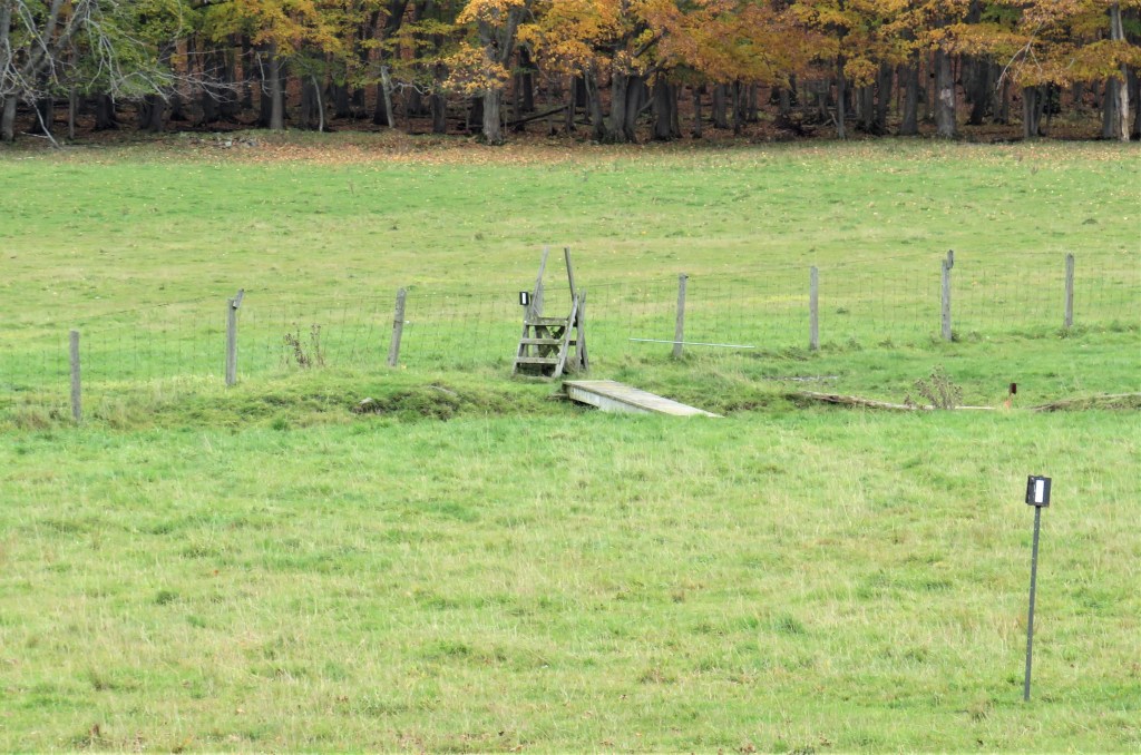
828. The Trail cuts across a sodden field, vaults over a classic stile …
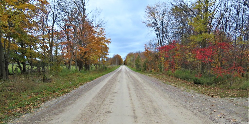
829. … and joins Cape Chin North Road for a short distance heading northwest. Peak colour has come and gone on the Northern Bruce Peninsula, but Nature’s palette is still lively enough to illuminate our way.

830. A scarecrow shrugs its shoulders in a field to the east of the road. Farmers have used scarecrows to deter seed-eating birds from time immemorial and there is a diversity of British names for these humanoid mannequins: Hodmandod, Mommet, Gallybagger, and Malkin in England, Tattie Bogle in Scotland, Bwbach in Wales. Do scarecrows actually work? There’s evidence that more intelligent birds (such as crows) quickly learn to ignore them. However, stationary scarecrows, if they are dressed in bright clothing and have recognizably human facial features, apparently work better to warn off the dumber kind of bird. Of course, scarecrows are primarily intended to keep birds off newly sowed fields in springtime. In the fall (i.e., now) the presence of a scarecrow is more likely to have been inspired by the upcoming Halloween festival and by the innumerable scarecrow-like supervillains who invade movie screens at this time of year.

831. In the middle of nowhere, and for no apparent reason … a sign! Tobermory, our ultimate destination, is a lot closer than Niagara: only about 60 km to go.

832. Another pleasing autumnal composition: living ferns, dead leaves, mossy rock.

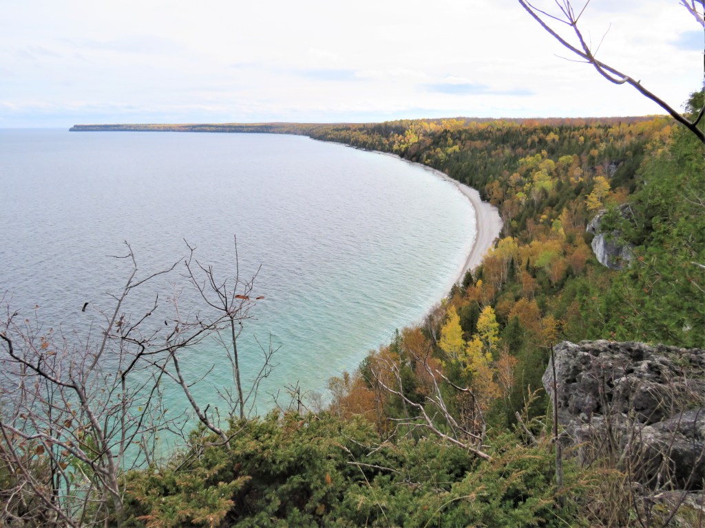
833. Dyer’s Bay sweeps round to the northeast, with Cabot Head on the horizon at right.

834. A striking contemporary (2018) three-bedroom house on Borchardt Road, the upmarket cottage road at the end of Cape Chin North Road. The top deck gives a spectacular view of Dyer’s Bay, but if you fancy this property, you’re TOO LATE, to use the annoying realtor’s catchphrase of the moment. It recently sold for around $2 million.
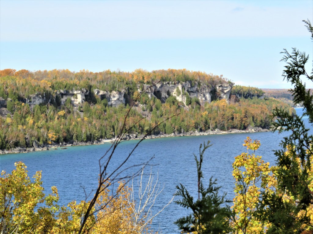
835. The shoreline bluffs just north of the Devil’s Monument.

836. This is as close as the Main Trail gets to the Devil’s Monument itself. What is it? It’s the largest flowerpot formation on the Bruce Peninsula itself. So, what’s a flowerpot? It’s a top-heavy, unstable stack of horizontally-layered hard rock detached from the edge of the Escarpment and sculpted several thousand years ago by the wave action of the vast glacial lake that preceded (and was 17 meters higher than) Lake Huron, and by erosion by wind and water ever since. There are several of these stacks on the Bruce Peninsula’s offshore islands, and some of them have trees and other vegetation growing on top, so they look a bit like planters on pedestals. Some of these flowerpots are so popular with tourists that they have been artificially stabilized with concrete. One day, probably not too long in the geological future, this one, 14 meters high, will collapse into Georgian Bay unless treated in the same way.
837. As we near the end of today’s hike, let’s look back the way we came. This is a panorama of Dyer’s Bay looking southeast, with Cape Chin in the distance. We started out well below Cape Chin on this hike, so we’ve come a fair way today. As for the origin of Cape Chin’s odd name: “One old timer said that the cape resembled a man’s chin and hence the name. Until a better explanation is discovered this will have to suffice for the present.” See James E. Kraemer, “A Socio-Postal History of Municipality of Northern Bruce Peninsula, Part II” in The Grey, Bruce, Dufferin & Simcoe Postal History Study Group Newsletter #31, vol. 6, no. 3 (March 2003), p. 302.
