
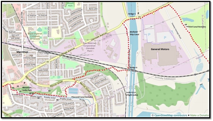
52. Mountain Locks Park in Merritton is about 3.5 km south of Richard Pierpoint Park (see #51 in Part 3) via Oakdale Avenue and Merritt Street. The red dots on the map indicate the course of the Bruce Trail in this area. If you decide to hike the Bruce from Mountain Locks Park to the remains of the Third Welland Canal, it’s roughly 4.5 km one way. A section of the Merritt Trail runs along the south bank of the Second Canal parallel to Bradley Street. You can use it as the return loop for a short hike around the remains of the Second Canal. There’s free parking at the P (Glendale Place) north of Mountain Locks Park. For the Third Canal, the only convenient P (also free) is just east of Bridge 5 on Glendale Avenue. By car it’s 2.4 km along Glendale Avenue between the two Ps. Numbers on the map refer to the locations of subsequent entries in Part 4.

53. Merritton, named for William Hamilton Merritt (see #46-#47 in Part 3 above), was once a thriving canalside industrial hub at the foot of the Niagara Escarpment. It was incorporated as a village in 1874 and a town in 1918, then was absorbed by the city of St. Catharines in 1961. The First and Second Canals started their main ascent of the Escarpment here, their passage to the summit eased by a natural ramp of glacial deposits. The stone building with the chimney in the background was once an annex of the Beaver Cotton Mills, the first large industrial complex in the area. Later it housed the Independent Rubber Company, and it’s now a branch of the well-known steakhouse chain, The Keg.
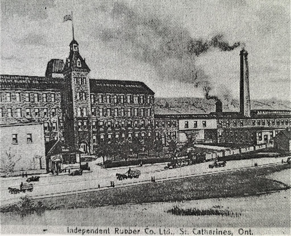
54. While the First Canal had back ditches and raceways around its wooden locks, the wider Second Canal required large dammed ponds that drained superfluous water via powerful weirs and flumes around its masonry locks. In 1851, the Welland Canal Company bought land along the Second Canal to establish what we would now call an industrial park based on water power provided by these weirs and flumes. In 1857 William and Alexander Waite built the Beaver Cotton Mill at lock 15 to take advantage of that water power and the proximity of the new railway. For from 1853, the main east-west line of the Great Western Railway (now a CN line) from London to Niagara Falls crossed the Second Canal near lock 12 about 500 metres north of this spot. Moreover, 40 km of the Welland Railway (no longer extant in this area, but depicted above), running north-south along the east bank of the Second Canal, was opened in 1859. All this development led to the construction of twelve more water-powered industrial installations in Merritton. In 1881 the Beaver Cotton Mill burned down, to be rebuilt in 1885. From 1912 the stone buildings were occupied by the Independent Rubber Company that made rubber footwear … until the Great Depression killed that industry. Thereafter the buildings were used for storage by the Interlake Tissue Mills, until the main four-storey building (at left above) burned down in 1961. The smaller surviving building (with the chimney at right above), after extensive renovations, reopened as The Keg in 2002. For more about industrial Merritton, read Robert R. Taylor’s article here.

55. A close-up of the pink sandstone façade of what is now The Keg.

56. Just west of The Keg, there are remnants of the Second Canal including former locks, weirs, and sluices. The local pond disgorged a flume that drove two water wheels providing power to the Beaver Cotton Mill and its successor, the Independent Rubber Company. Sadly, explanatory historical plaques in this area are either illegible or absent.
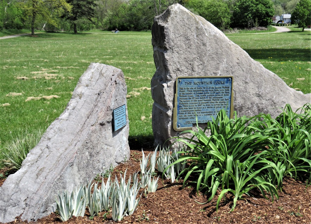
57. South of The Keg, Mountain Locks Park is a long thin park encompassing what was once known as “Neptune’s Staircase,” namely the six locks (locks 16-21) that took the Second Canal over the Escarpment. The First Canal, of which there are almost no traces left around here, followed the sinuous course of Merritt Street (see the map at #52 above) along the Canal’s north bank. The Second Canal took a straighter route about 50 metres south of the First, and what is now Bradley Street ran parallel to its south bank.

58. You can make a short loop hike following the course of the Second Canal through Mountain Locks Park by taking the wooded Bruce Trail along the north bank of the Canal, crossing at the footbridge, and returning along the more open Merritt Trail along the south bank. The masonry locks of the Second Canal here are in surprisingly good condition.
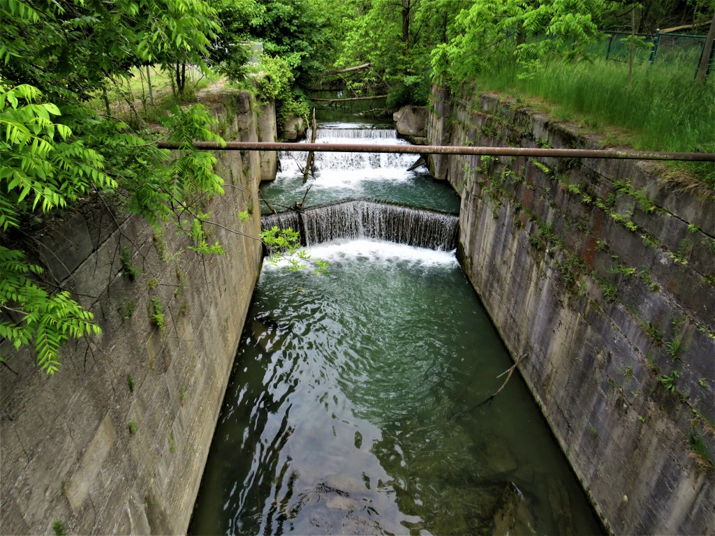
59. However, fences along the entire length of the former Canal make it very difficult to get good views. The best viewpoint is from the sole footbridge over the Canal.

60. Two stone locktenders’ cottages from the period of the Second Canal are still standing, both of which were originally semi-detached but have been converted into single family dwellings. The one above, 135 Bradley Street (1849-51), is built of local limestone with dressed quoins at the corners. Its back yard was once a quarry from which some of the stone for the Second Canal’s locks was derived.

61. The other cottage at 77 Bradley Street (1851) is built of beautiful red-brown Grimsby sandstone. Its current owners maintain a magnificent front garden. Both 77 and 135 Bradley Street are designated heritage buildings.

The Welland Canals: The Growth of Mr. Merritt’s Ditch (1988): p. 87.
62. Before these locktenders’ cottages were built, there had been much sectarian violence between Protestant and Catholic Irish immigrants in nearby Slabtown, a poor area of Merritton where navvies working on the Second Canal had built shanties from wooden slabs left over from the local sawmill. The “Battle of Slabtown” at Duffin’s Inn on 12 July 1849 had resulted in two fatal shootings and two serious woundings. Such disturbances, which eventually had to be put down by the military, had interfered with the smooth operation of the locks on Neptune’s Staircase. The stone cottages on Bradley Street were intended to provide comfortable accommodation for locktenders and their families nearer the locks and farther away from the trouble zone.
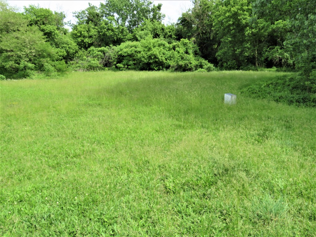


63. And what about the First Canal? Well, there’s little more than a plaque, half concealed by the long grasses of summer, marking the location of its lock 24. This lock was excavated in 1987 by archaeologists … and then reburied. To find its location by car, go from Merritt Street down a short service road that leads between Scotty’s Auto and Truck Service and the Niagara Dental Health Centre to the back of a used car dealership. You can also access this grassy area by foot from the Bruce Trail, though there’s no signage to assist you.
Mountain Locks Park is currently not a worthy memorial to the first two Welland Canals. True, wooden lock 24 is probably too fragile to be exposed permanently to the elements. Still, a dedicated parking lot, a loop trail with maps and signage, informative historical markers, and better views of the Second Canal need to be provided.

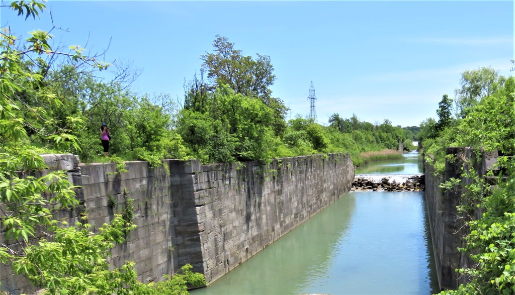
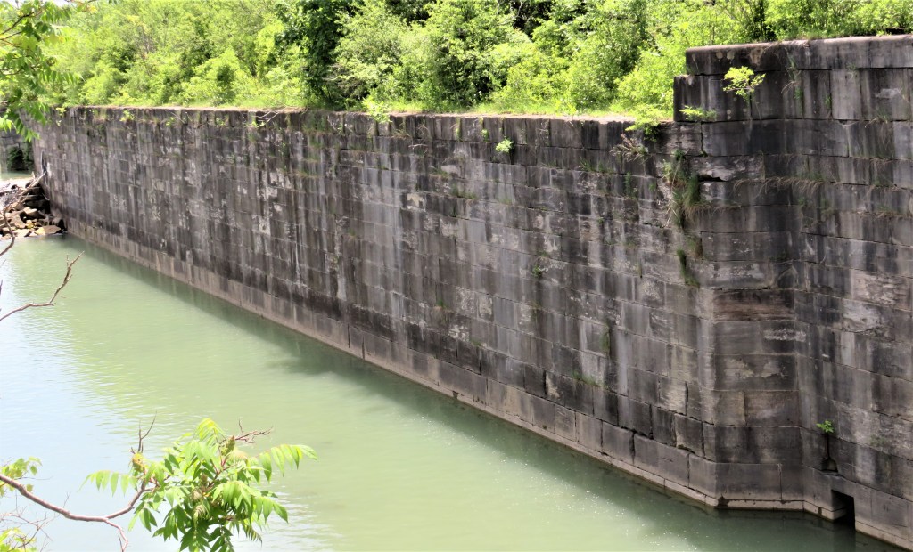
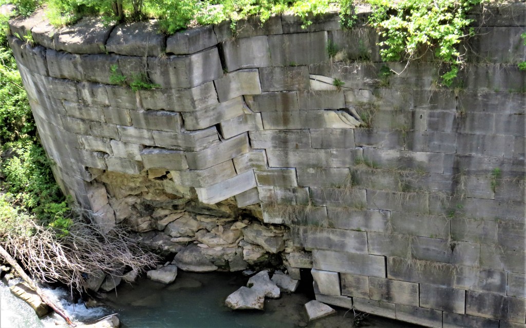
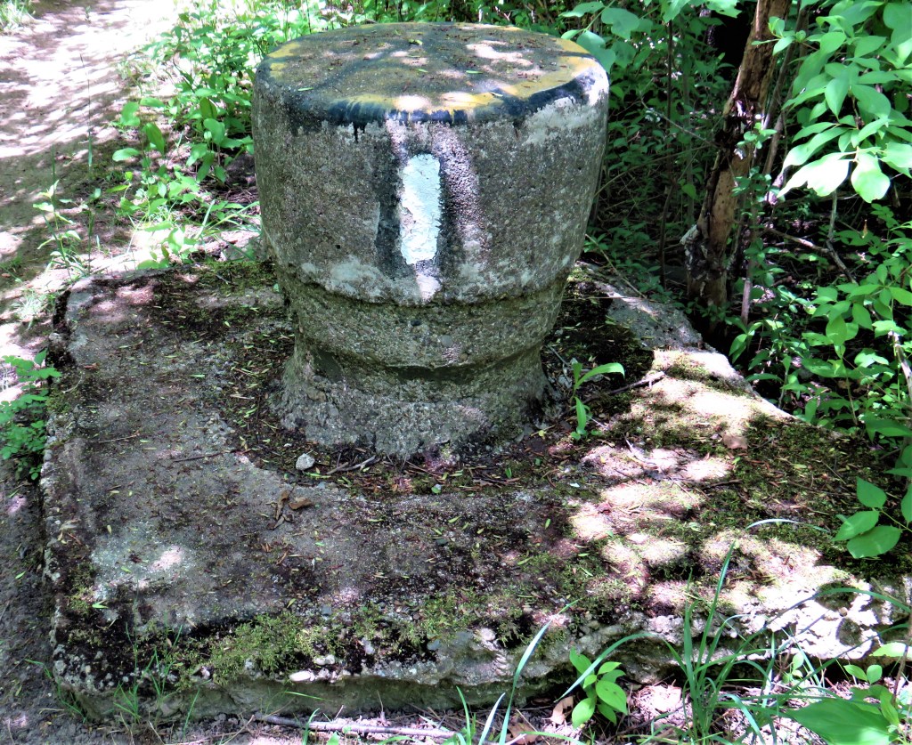
64. To visit accessible (and impressive) remains of the Third Canal, head by car northeast of Merritton along Glendale Avenue (see the map at #52 above). Park at the P by the eastern bank of the Welland Ship Canal just after Glendale crosses it on Bridge 5 (the lift bridge). Then walk about 500 metres east along the south side of Glendale, following the white blazes of the Bruce Trail (top image). When you reach the remains of the Canal, follow it south along the Bruce Trail through the woods for about one kilometer. Unlike in Mountain Locks Park, there are no fences at all here, so your view of four massive masonry ex-locks is unobstructed, though you should be careful where you step: the lock walls are sheer. By the side of the Bruce Trail you’ll also see bollards used to anchor vessels while they negotiated the locks (bottom image). There are no historical plaques at all in this area!
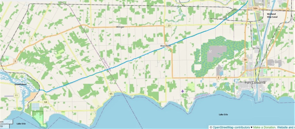
65. Finally, we’ll briefly visit the Feeder Canal. Its approximate course between Welland and the Grand River is indicated by the solid blue line on the map above. Wainfleet, where the next two images were taken, is 40 km southwest of St. Catharines and 14 km west of Port Colborne.
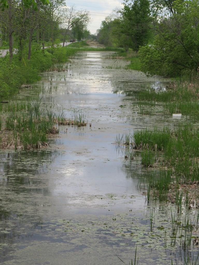

66. The Feeder Canal was dug in 1829 to “feed” water from the Grand River into the First Canal so as to ensure the latter always had an adequate water supply. The Feeder was upgraded to a shipping canal from 1842-45, giving vessels a secondary route into Lake Erie aside from the primary one via the Second Canal into Port Colborne. When the Third Canal was built, Lake Erie itself became the prime source of the Canal’s water, and from 1887 the Feeder was used only for local barge traffic. In the 1920s the Feeder fell into disuse. Only a few sections of the Feeder today are fully watered: one of the best places to view it is at the village of Wainfleet (map at #65 above), where there is also a plaque about the Feeder.
This concludes our survey of what’s left of the first three Welland Canals. The remaining episodes of this hike will follow the Welland Ship Canal (the fourth Canal) from Port Welland on Lake Ontario to Port Colborne on Lake Erie.
Go to Part 5: The Welland Ship Canal from Lake Ontario to Bridge 1.
