67. We’re now on the first leg of a hike from the northern end of the Welland Ship Canal at Port Weller on Lake Ontario to the Canal’s southern end at Port Colborne on Lake Erie. If you have a car, you may want to do this leg in two stages (marked with red dots on the map above), with a short drive to connect them.
We want to start our hike at the mouth of the Canal, which means from the tip of one of the two giant breakwaters that enclose Port Weller Harbour. Only the eastern breakwater is open to the public along its entire length, and you can’t drive up it. So, on the first stage you’ll park at the free P at Jones Beach and walk along the well-defined George Nicholson Memorial Trail as far as the tip of the breakwater, then retrace your steps. (Or you can, if you wish, then loop back along the eastern side of the breakwater as far as the Marina.) This first stage is 2 km each way, or 4 km in all.
Then you’ll get back in your car and drive south down Broadway and Seaway Haulage Road to Lakeshore Road, turn right to cross the Canal at Bridge 1, turn right at Arthur Street, and then go via Beachaven Drive and Lombardy Avenue to the P at Sunset Beach (you have to pay here from May to September). It’s an 8 minute drive.
The second stage is along the Waterfront Trail that follows the left bank of the Canal from Sunset Beach. Walk south on this Trail through Malcolmson Ecopark as far as Bridge 1 on Lakeshore Road. If you keep the Canal on your left, you won’t go astray. This stage is roughly 1.5 km each way, or 3.0 km in all. So with one car, the total distance for this leg is 7.0 km. If you take two cars, you can park the second at the free P at Charles Ansell Park just south of Bridge 1. But you can only reduce the total hiking distance by 1.5 km.
If you feel up to hiking the whole distance, park your car at Sunset Beach P. The distance from there to the tip of the eastern breakwater and back via the Lakeshore Road Bridge to Sunset Beach is about 10.2 km. Such a hike is not arduous, as you’re on a good, level surface the whole way.
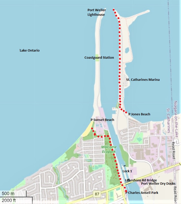
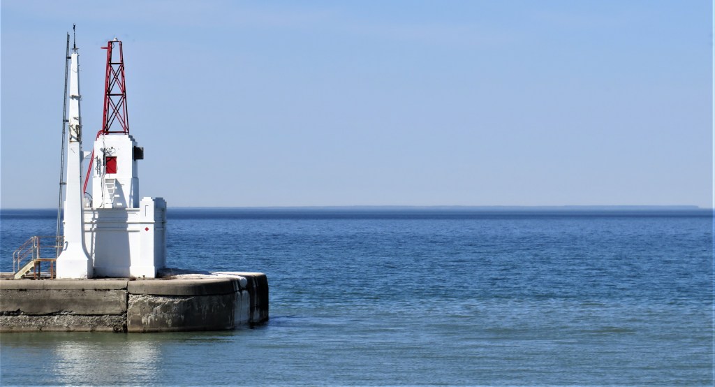
68. This is the view from the George Nicholson Trail of the north end of the Canal, where (as the map above shows) the two tips of the breakwaters converge like pincers to leave a passage only 122 metres wide. Unlike the entry to the first three canals at Port Dalhousie, where there is a natural harbour, Port Weller Harbour between the breakwaters is entirely manmade.
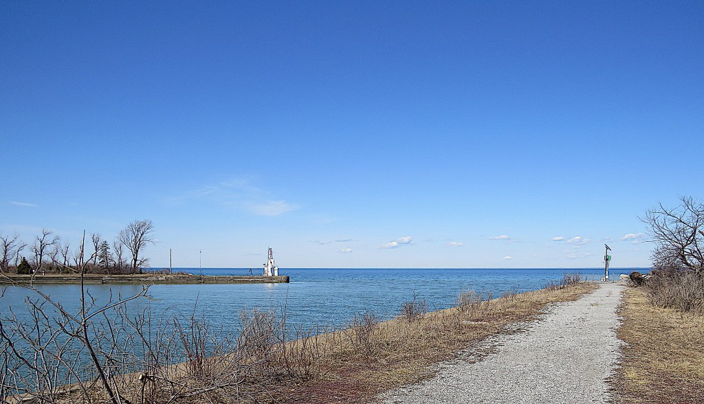
69. At the extreme tip of the eastern breakwater is a light powered by a solar panel to aid mariners. It’s fenced off.
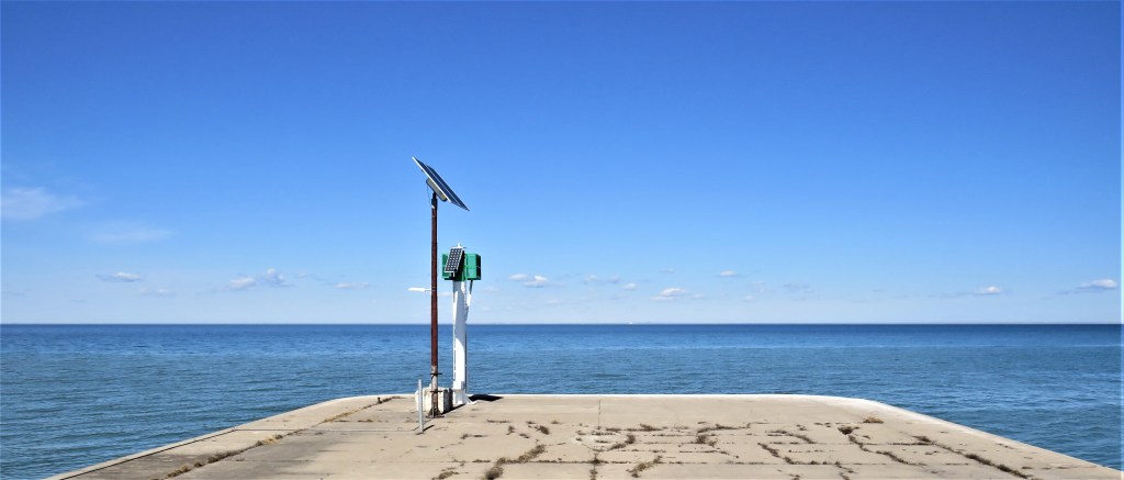
70. Standing on the eastern tip on a clear day like today, you can see the downtown Toronto skyline almost directly across the end of the Lake. The CN Tower at left is only about 46 km away as the crow flies. By road, however, it’s about 116 km from Port Weller to downtown Toronto, and it would take you at least 90 minutes to drive it.
71. On the tip of the western breakwater across the Canal is the front lighthouse (1931), topped by a metal tower. Below it is the fog horn building in Art Deco style. When it’s foggy, the horn sounds for two seconds, then is silent for eight.
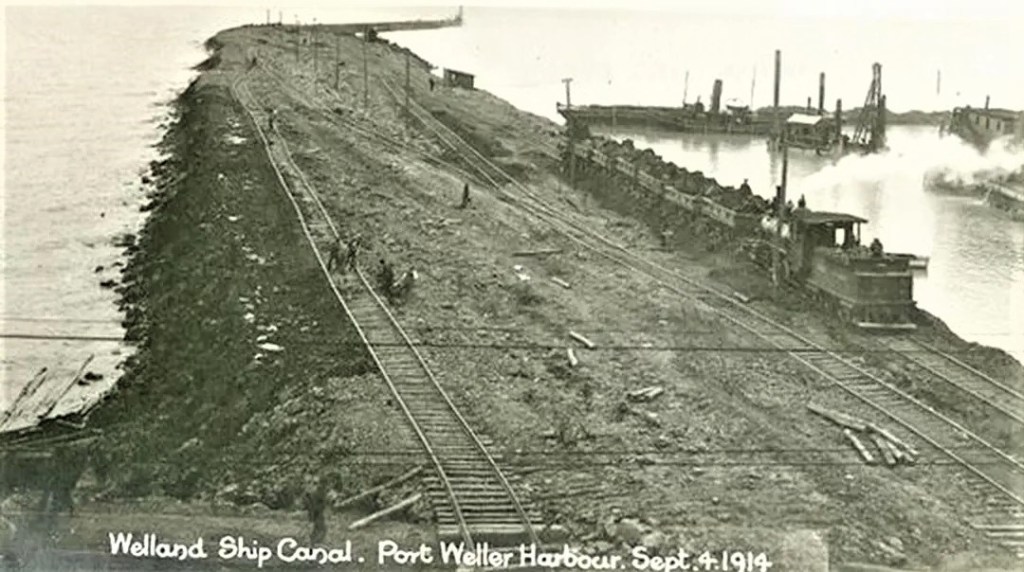
72. These massive breakwaters and the harbour between them were intended to protect ships from storms on Lake Ontario. Construction of the breakwaters, each about 2.3 km long, began in 1914, but was halted in March 1917 for the remainder of World War I. During this pause, silting and winter storms ruined much of what had been built. When construction was renewed, concrete cribs constructed in Port Dalhousie were towed here and sunk into Lake Ontario, then filled with gravel brought by dredges, tugs, and scows. Rock excavated from the slope of the Niagara Escarpment to create the flight locks was transported here by a specially constructed railroad to firm up the foundation of these breakwaters. The work was mostly complete by 1926.
(Top) View of the western breakwater under construction, 4 September 1914.
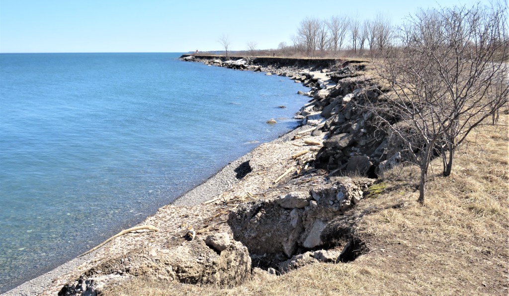
(Bottom) The rock and gravel foundation is visible here near the tip of the eastern breakwater.
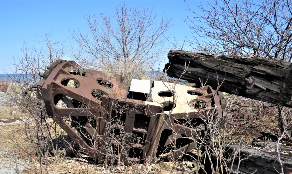
73. There are some intriguing metal ruins by the Trail here. They must surely be left over from the construction of the breakwater a century or more ago.

74. The view of Port Weller Harbour looking south. The Harbour is aligned due north-south and is about 350 metres wide for most of its length.
Port Weller is named for John Laing Weller, the engineer in charge of the construction of the Fourth Canal from 1912-17, and a consulting engineer on the project from 1919-26. Weller toured the almost-completed Panama Canal in March 1913 (it opened in 1914) and reported that he was “completely satisfied … that my designs, while differing radically from the Panama canal, are fully equal if not superior to them” (quoted in Styran and Taylor, This Colossal Project, p. 35).

75. Trees and shrubs were planted along both breakwaters to secure their surfaces, beautify them, and act as a windbreak for shipping. The George Nicholson Trail parallel to the shore is covered with gravel and well-drained, and now, in early spring, the sap is visibly rising.
76. Halfway along the western breakwater on the other side of the Harbour, this white Art Deco heritage building (1931) was once the lighthouse keeper’s dwelling, and is now a Canadian Coast Guard Search and Rescue office.
The last lighthouse keeper, Cyril Williamson, moved here in 1946 with his wife Ethel and their two sons. As a way of coping with her isolated life, Ethel became a notable ham radio operator as well as an author. Her book A Light on the Seaway (1972), published the year after the former lighthouse was demolished, gives a vivid picture of her life as what she ironically called a “Light-Housekeeper”: dead rats, no running water, rabbits devouring her vegetable garden, storms, fog, fires, Hurricane Hazel, a car lost to the Canal, and innumerable rescues of hapless boaters. Ethel died in 2010 at the age of 103.
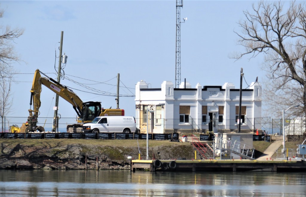
The hydraulic excavator seen here is being used to shore up the breakwater as a result of erosion caused by unprecedentedly high water levels on Lake Ontario in the recent past.
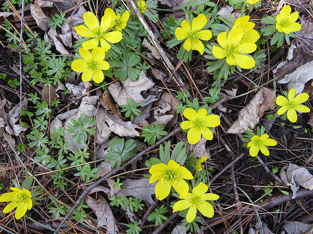
77. It’s 21 March, the vernal equinox. A little patch of winter aconite (Eranthys hyemalis) glows in the spring sunlight by the Trail. Beautiful as it is, every part of this early-flowering relative of the buttercup is poisonous.
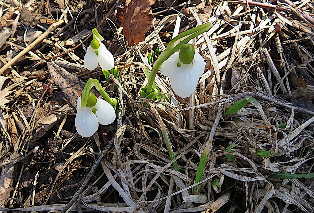
78. The aconites are not the only wildflowers blooming so early: three snowdrops (Galanthus nivalis) have just emerged from leaf litter by the Trail.
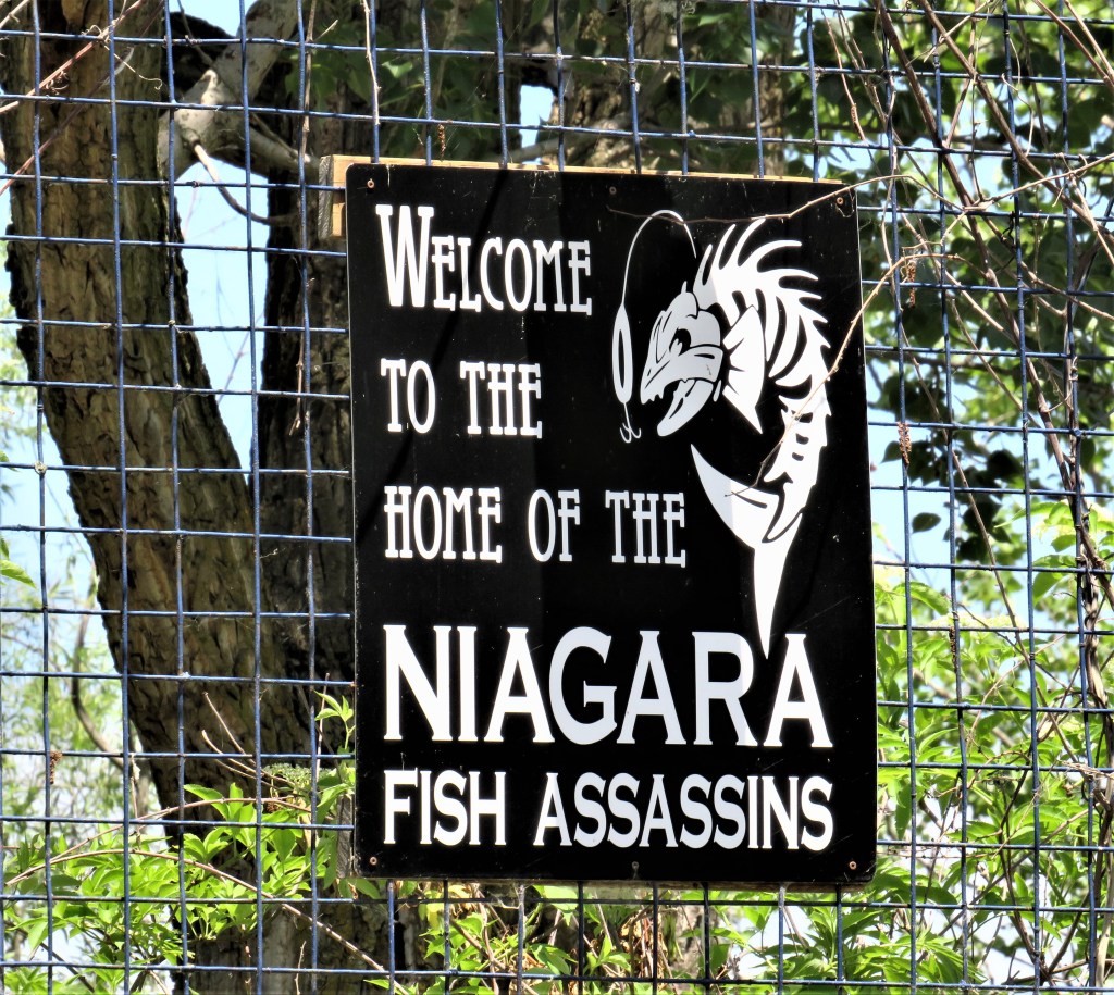
79. A sign advertising a fishing charter operation welcomes visitors to the St. Catharines Marina on the eastern side of the breakwater.
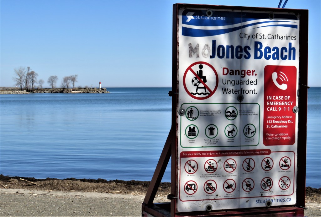
80. Jones Beach is a small public beach on McIntyre Bay, the stretch of Lake Ontario partially enclosed by the eastern side of the eastern breakwater. As a result of west-to-east currents on the Lake, this area is slowly silting up, and a spit of land requiring its own lighthouse projects to the east of the tip of the breakwater.
If you have parked at Jones Bay, this is where you get back in your car and drive to Sunset Beach on the other side of the Canal.
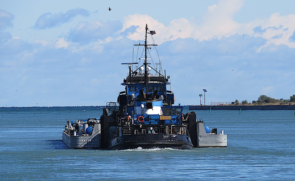
81. At last, some shipping!
We’re now on the left bank of the Canal. Tugs used to pull barges, but now they generally push them. In the ATB (articulated tug-barge) system, tugs insert themselves (excuse my language) into a tug-shaped space in the rear end of barges.
This 37-metre, 32,000 horsepower tugboat, built 1969, pushes a low-profile 124-metre barge north through Port Weller Harbour towards Lake Ontario. She is out of Ludington, MI, a small port on the eastern shore of Lake Michigan. Since 2010 she has pushed the barge Spartan II that carries calcium chloride, a specialty salt used mainly for de-icing at low temperatures, manufactured by the Occidental Chemical Co.’s facility at Ludington, to ports in the Great Lakes and St. Lawrence River.

82. At the Pilot House on the eastern shore of Port Weller Harbour is the Mrs. C., a 14.6-metre pilot boat built 2006. Her home port is Nanticoke, Ontario, a steel-making town on the north shore of Lake Erie.
All vessels more than 35 metres long not registered in Canada require piloting through the Canal: “licensed pilots have the exclusive legal responsibility for the conduct of the ship and for ensuring its safe navigation. In Canada, the pilot is not restricted to an advisory role, as it is in the case of other countries. The pilot is responsible for and controls the ship’s movement at all times, including during berthing and unberthing, while remaining responsible to the captain for the safe navigation of the ship” (Article 38.01 of the Pilotage Act, 1985).
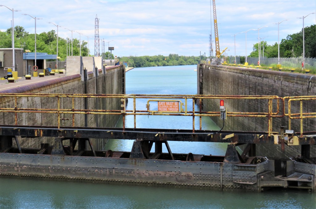
83. This is the interior of Lock 1, the last step down for vessels heading towards Lake Ontario. This lock raises, or lowers, vessels 14.02 metres. The view of the drained lock is from Bridge 1, the official name of the Lakeshore Road Bridge.
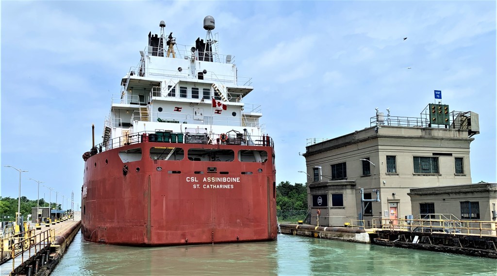
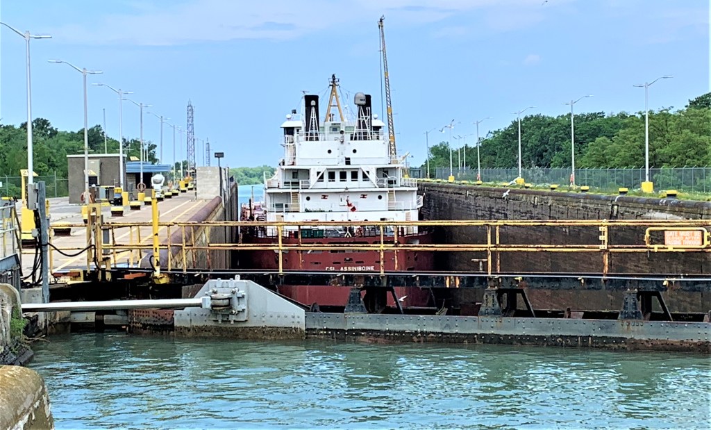
84. This is the same lock when filled, here containing CSL Assiniboine, heading for Lake Ontario. At right is the concrete valve house at Lock 1 in sleek early 1930s Art Moderne style.
CSL stands for Canada Steamship Lines. The quaint name recalls that the company, headquartered in Montreal, was founded in 1845. CSL now owns the world’s largest fleet of self-discharging (a.k.a. self-unloading) vessels.
Over the course of about ten minutes, the lock will slowly, but visibly, empty itself of 91 million litres of water using only the force of gravity …
85. … and Assiniboine, sinking down almost to Lake Ontario level, has now made the passage through all the Canal’s locks and can head through Port Weller Harbour to the Lake.
Assiniboine (built 1977) is a self-discharging bulk carrier flying the Canadian flag, with St. Catharines as her home port. Self-dischargers are the workhorses of the Canadian merchant fleet on the Great Lakes and St. Lawrence. They are so called because they carry conveyor belts that lift cargo from their holds and deposit it onto a boom at the dockside, so that they can be unloaded with minimal human intervention. Bulk carriers like this typically transport grain, salt, or ore.
Assiniboine, a laker (i,e., she never ventures into salt water), was built precisely to fit the locks on the Welland Ship Canal. She’s 222 metres long (about twice as long as a soccer field), and 23 metres wide. Locks 1-7 on the Canal are all 233.5 metres long and 24.4 metres wide. So the average clearance at either end of this lock is 5.75 metres, while there’s a mere 70 cm between the sides of the ship and the lock walls: a tight squeeze!
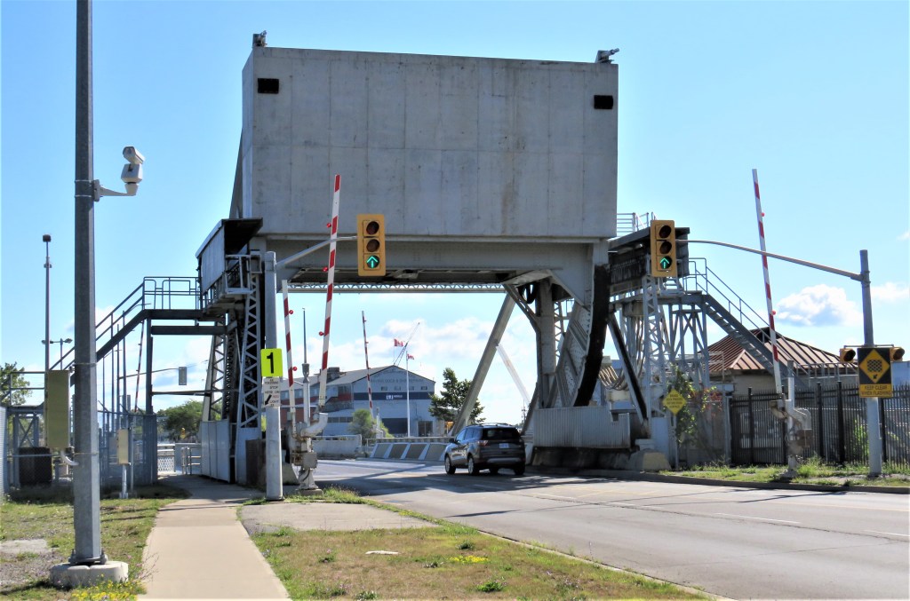
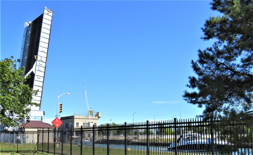
86. Two views of Bridge 1 immediately to the south of Lock 1. It’s a single-leaf plate-girder bascule bridge that carries Lakeshore Road over the Canal. It used to carry CN tracks too, but the line was abandoned, and there are now few signs of the former railway crossing.
(Top) The bridge’s huge counterweight looms above the roadway. On 22 July 2013, a pickup truck heading east ran the red light just before the barrier came down and the bridge was raised. The truck was too late to get across the bridge deck, but was unable to reverse out because of the barrier. The driver evacuated quickly before his new pickup was crushed flat by the counterweight.
(Bottom) What the bridge looks like when raised at a maximum angle of 82 degrees to allow vessels to pass under.
At this point we leave the Waterfront Trail. Next we’ll pick up the Welland Canal Trail on the south side of Lakeshore Road.
Go to Part 6: The Welland Ship Canal from Bridge 1 to Lock 3
