
87. This hike takes us from the free P at Charles A. Ansell Park, where we ended the previous hike, south along the Welland Canal Trail to the free P at St. Catharines Museum. Marked by the red dots on the map above, it’s about 7.1 km one way. If you park a car at each end, it’s a very pleasant stroll along a paved multiuse trail segregated from traffic. Be aware, though, that speeding cyclists don’t always alert pedestrians to their presence when passing from behind!
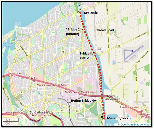
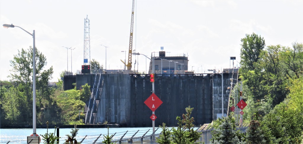
88. The Port Weller Dry Docks occupy a large area on the right bank of the Canal just south of Lakeshore Road. Their origin was a government-built facility for repairing lock gates established during the construction of the Fourth Canal. In 1946 the site was bought by Charles A. Ansell, who had worked at the Muir Brothers shipyard at Port Dalhousie (see #22 above). He founded the current dry docks, of which there are two: the “deep dock” has a depth of 7.9 metres, the same as the Canal, and is used to build or refit large ships; the “shelf,” 4.3 metres deep, is for smaller vessels. Since 1951 about 60 vessels have been built here, including bulk carriers, tankers, tugs, trawlers, barges, icebreakers, research vessels, car ferries, and self-dischargers. Since 2017, the dry docks have been leased by Heddle Marine, Canada’s largest shipyard operators, whose HQ is at Pier 14, Hamilton Harbour.
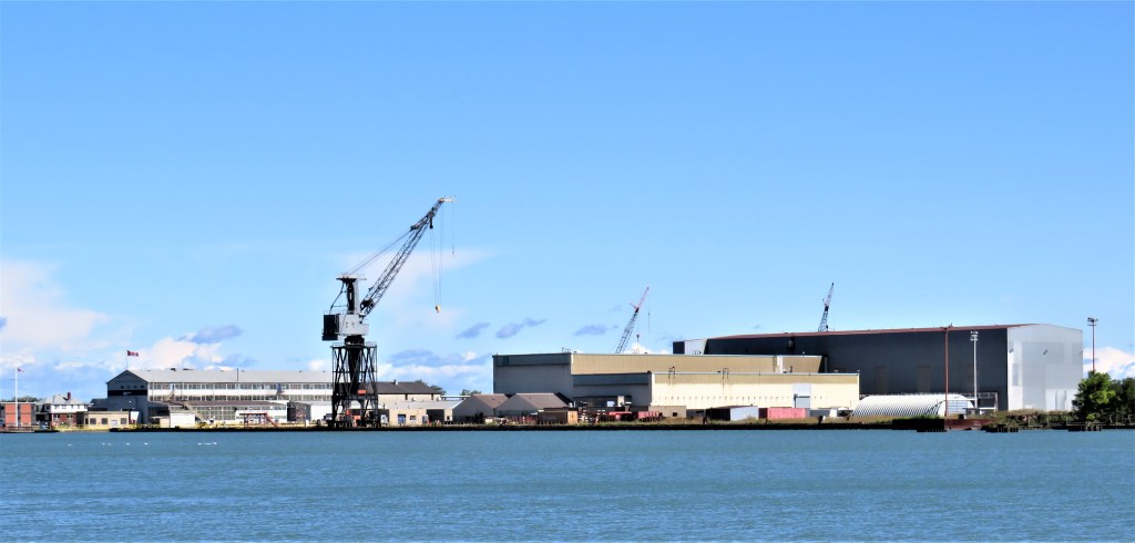
89. Let’s zoom in a little closer. There are four vessels visible here. From left to right: a tug and a workboat are moored at the dockside; for a better view, see #90 below. For the big ship in the deep dock on the right, see #92 below. The ship whose hull is under wraps in the “shelf” at centre is the Canada Coast Guard Icebreaker CCGS Amundsen, undergoing a $12M refit. Built in North Vancouver in 1979, Amundsen (98.3 metres long), currently dedicated to Arctic research, has led an eventful life. She responded to the 27 August 2010 grounding of the Arctic cruise ship MV Clipper Adventurer in the Coronation Gulf, Nunavut. She took off the 128 passengers and brought them to Kugluktuk. On 9 September 2013 a helicopter attached to Amundsen crashed in the McClure Strait, NWT, with a loss of three lives. On 24 August 2018, Amundsen assisted Akademik Ioffe, a Russian vessel with 102 passengers that had run aground in the Gulf of Boothia, Nunavut. Amundsen and her helicopter took off the passengers and transferred them to Akademik Ioffe’s sister ship.
You don’t get the best view of Amundsen from this distance, of course. If you’d like a better one, check out the current Canadian $50 bill. Amundsen is depicted on the obverse side.
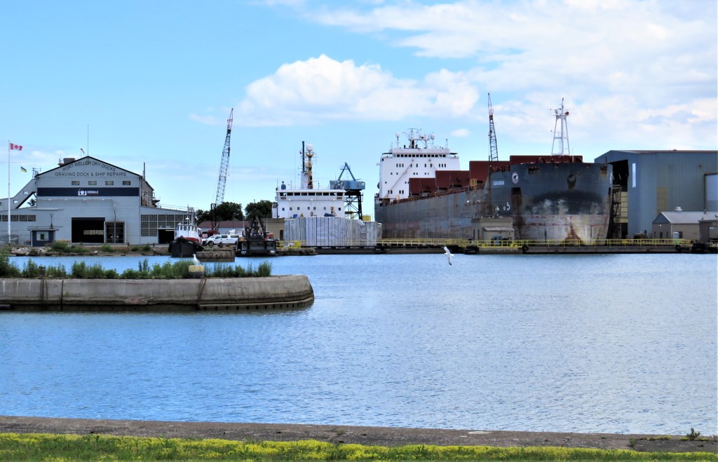
Zooming further in on those smaller vessels in the foreground …
90. … the one on the left is Burch Nash, a twin-screw tugboat built in 1944. Formerly known as Lac Manitoba, she sank on the St. Lawrence near Cornwall, Ontario in 2015. She was later raised by Heddle and is now used to help vessels in and out of the dry dock. Moored at her right is the John D., a workboat built in 1954, owned by McKeil Marine of Burlington, and used for various towing operations.
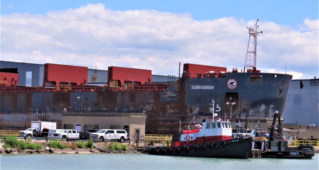
And zooming in further still …
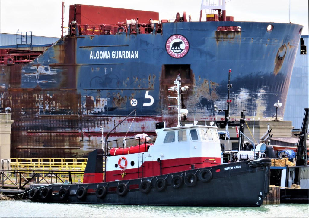
91. … looming over all, Algoma Guardian is being refitted in the deep dock. She’s a gearless bulk carrier, 222 metres long and 23 wide, built 1987 in Rijeka, Croatia, sailing under the Canadian flag with St. Catharines as her home port. Gearless bulk carriers do not have self-discharging apparatus, and are thus dependent on dockside equipment to unload their cargo. See #99 below for more about the Algoma fleet.
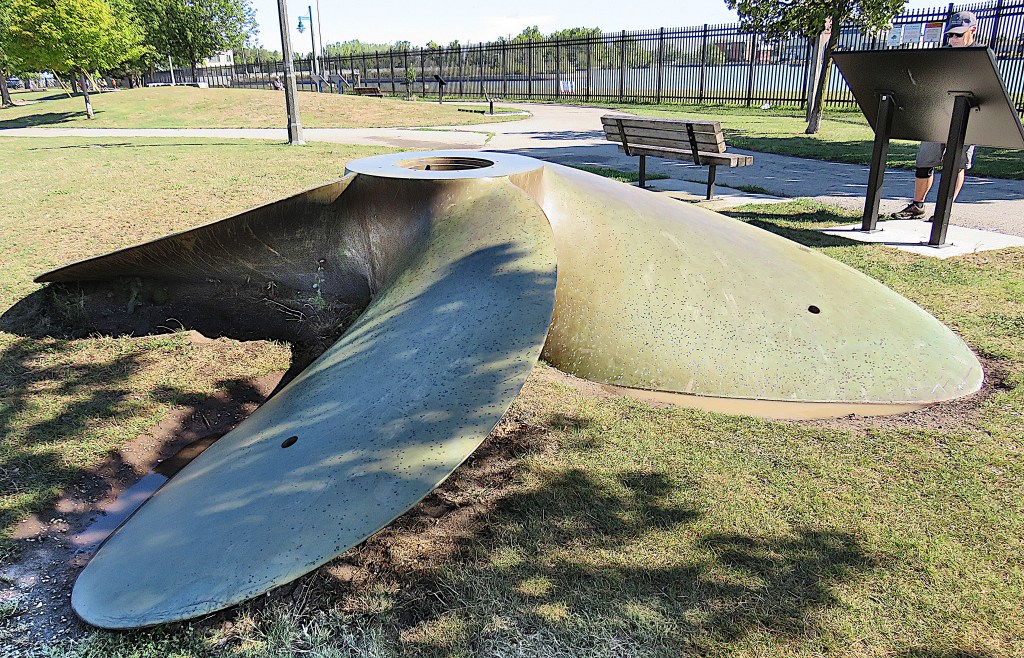
92. The John O. McKellar Propeller lies in Charles A. Ansell Park by the Trail. It comes from the ship of the same name built in the Port Weller dry docks in 1952. The name of that ship commemorates chief marine engineer John Oscar McKellar (1878-1951) of Scott Misener Steamships Co. Ltd., one of the largest shipping companies on the Seaway during much of the twentieth century.
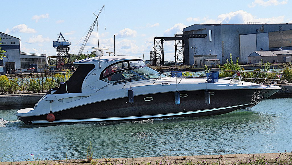
93. Pleasure boats like this may also transit the Welland Canal, though large commercial vessels are given precedence at locks. Operators must register with the Great Lakes/St. Lawrence Seaway System, book their passage online, and pay the toll in advance. The toll is a modest $30 per lock, or $240 total (plus taxes) in either Canadian or US funds for a one-way trip along the whole Canal.
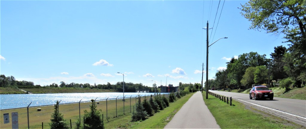
94. Looking south: at left, the Canal approaching Lock 2 at Carlton Street; centre, the Welland Canal Trail, very popular with walkers and cyclists; and right, the Welland Canals Parkway, offering motorists a pleasant drive along the Canal from the foot of the western breakwater at Port Weller to Lock 7 at Thorold.
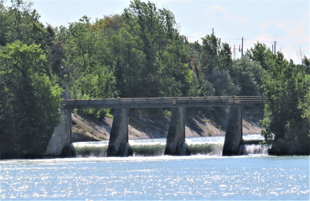
95. (Top) The north gates of Lock 2 at Carlton Street, St. Catharines; and (bottom), the weir next to Lock 2 that allows surplus water to bypass it.
96. Bridge 3A (built 1970), a rolling single-leaf bascule bridge that’s similar to Bridge 1 (see #86 above), takes Carlton Street across the Canal just south of Lock 2. So what happened to Bridge 2? And why “3A”?
Twenty-one bridges were planned in 1913, but only twenty were built by the time the Ship Canal opened in 1932. Bridge 2 was supposed to be a lift bridge carrying what is now Linwell Road over the Canal, and preliminary work on constructing it was carried out through 1915. But when work on the Canal recommenced after World War I, no further work was done, and Bridge 2 was formally cancelled in 1928. Yet several local farms were now divided by the Canal! The harsh fact was, it was too expensive to build Bridge 2 just for the convenience of a small rural population. As a belated sop to some very disgruntled local farmers, in 1932 Ottawa laid out and paved Read Road on the Canal’s right bank, connecting Lakeshore Road (and Bridge 1) to Bridge 3 at Carlton Street. Bridge 2, “the bridge that never was,” has only ever had a virtual existence.
The original Bridge 3 (built 1927) on this spot was destroyed after it was struck by a Japanese cargo ship Kanikawa Maru on 14 October 1968. So this Bridge gets an “A” after its number to indicate it was built after the opening of the Canal.
97. In the distance we get our first glimpse of the only non-movable bridge over the Fourth Canal …
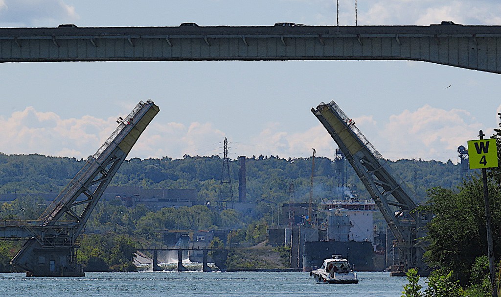
98. … but as we get closer, our attention is distracted by the raising of the twin-leaf bascule bridge (Bridge 4, a.k.a. Homer Bridge) that looks from this distance to be right underneath the giant fixed span but is actually about 200 metres south of it …

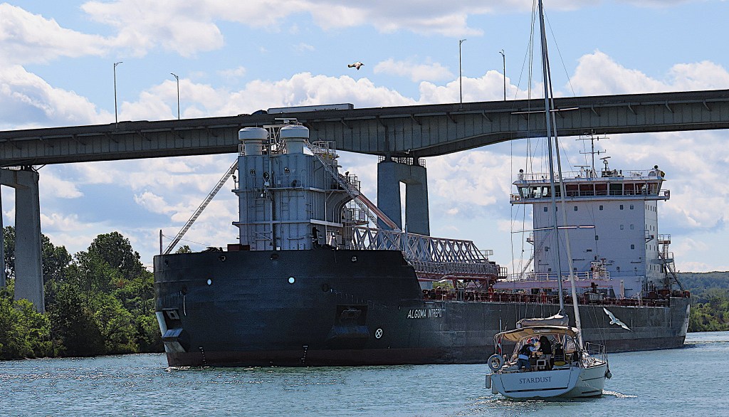
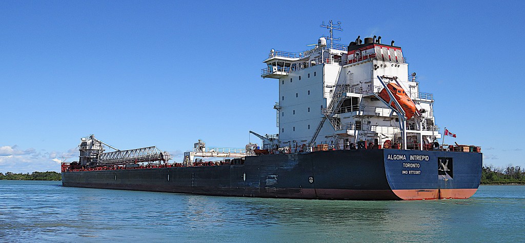
99. … and out of Lock 3 and into view sails Algoma Intrepid. She’s a spanking new self-discharging bulk carrier built in 2020, sailing under the Canadian flag with Toronto as her home port. She’s 198 metres long and 24 metres wide. Her draught – i.e., the vertical distance between waterline and keel, hence her maximum depth – is 6.9 metres, and she can carry just over 25,000 tonnes of cargo. Her forward-mounted boom allows cargo to be unloaded in narrow spaces. Her maximum unloading rate depends on what she’s carrying: 5,450 tonnes/hour for stone or 4,500 tonnes/hour for salt. As a self-discharger she is thus a half-sister to the gearless Algoma Guardian in dry dock at #91 above. Intrepid is the newest of the large fleet of cargo vessels operated by the marine subsidiary of Algoma Central Corporation of St. Catharines.
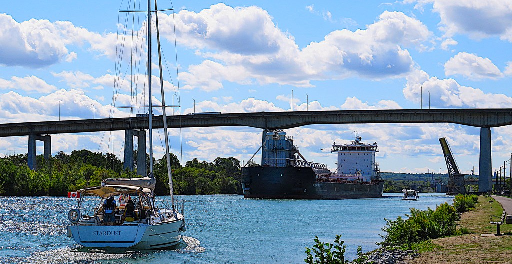
100. Not even the presence of the small pleasure craft allows you to gauge the sheer size of Intrepid …
101. … but as she heads north past us at the speed limit of 6 knots (a little faster than walking pace), we get a better sense of her awesome total length.
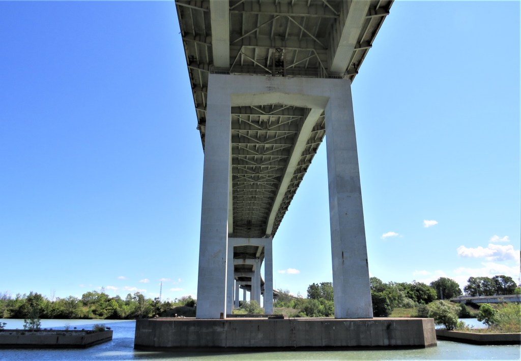
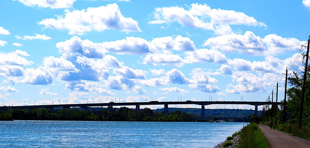
102. The Trail now passes under Bridge 4A, a.k.a. the Garden City Skyway, the fixed bridge carrying the Queen Elizabeth Way (QEW) over the Canal. The Skyway is 2.2 km long and 40 metres high at its apex, and it carries the six lanes of this major freeway between Toronto and the US border at Fort Erie/Buffalo. It was opened in 1963 (hence the “A”) and motorists were charged a toll to cross it until 1973. There are future plans to twin this bridge to allow eight lanes of traffic.
The Welland Canals: The Growth of Mr. Merritt’s Ditch (1988), p. 146.
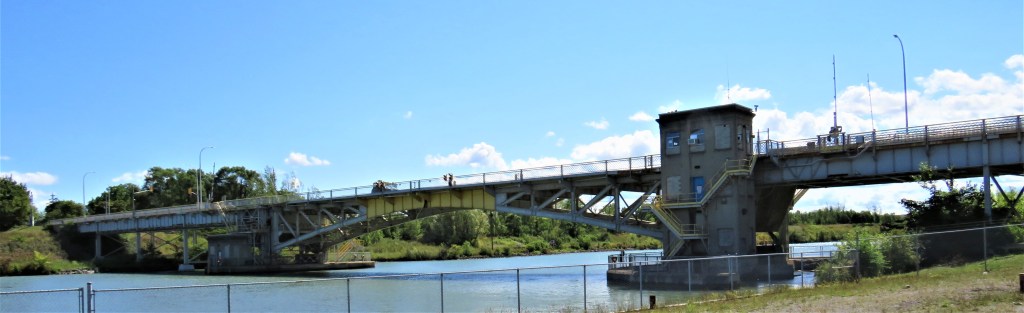
103. (Top) The leaves of Bridge 4, the only double-leaf rolling bascule bridge on the Canal, have now closed after the passage of Algoma Intrepid. This Bridge, a.k.a. the Homer Bridge after the former village of Homer that was mostly obliterated during Canal construction, carries Queenston Street over the Canal. Its counterweights are under the road surface, giving the Bridge a streamlined profile.
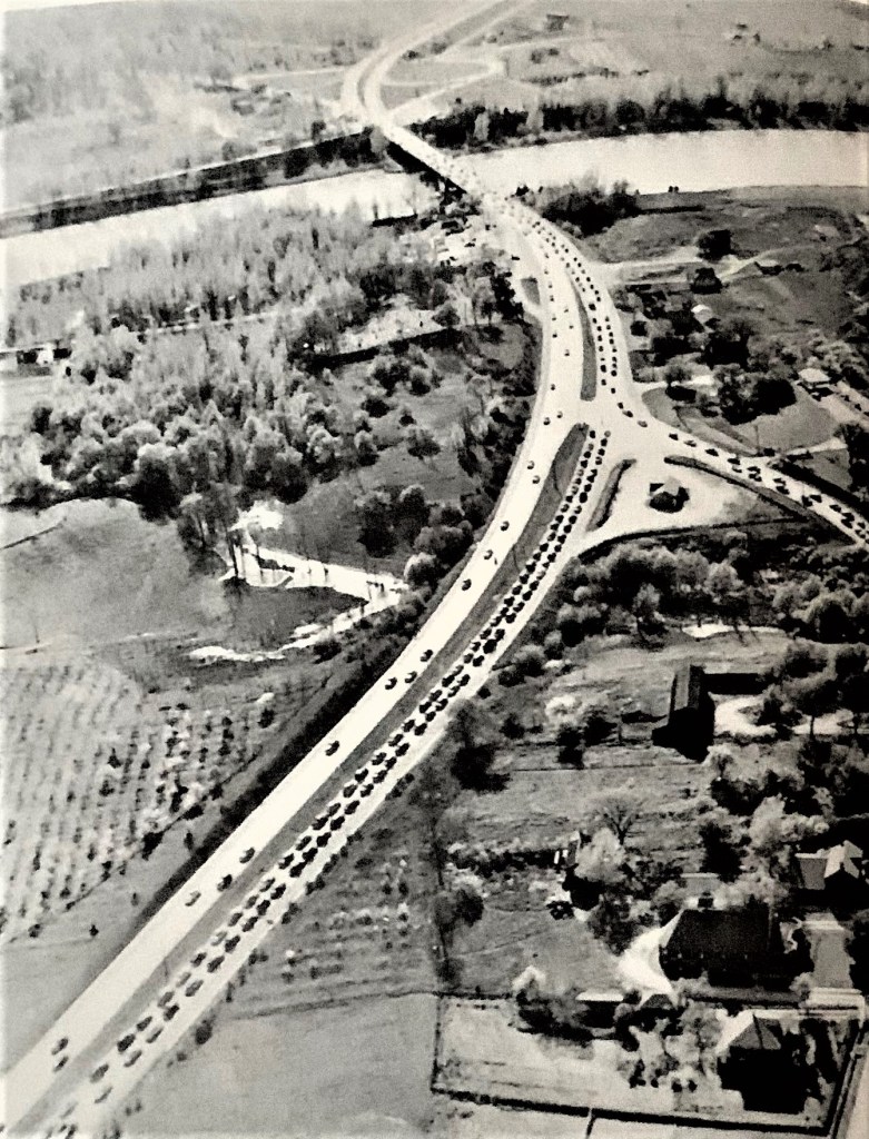
(Bottom) An aerial photo of Homer in 1950, before the construction of the Garden City Skyway, when the QEW used Bridge 4 to cross the Canal. Enormous queues of vehicles would form, waiting for a vessel to pass through.
104. We are now approaching Lock 3, the site of St. Catharines Museum and Welland Canals Centre, a must-visit for anyone interested in the Canal.
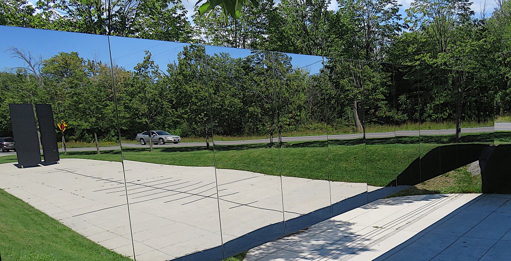
(Top) Just before we arrive at the Museum, we pass the Veil, an array of mirror-polished stainless steel panels between the Trail and the Canals Parkway. It’s part of the Fallen Workers Memorial, unveiled in 2017 to commemorate the 138 workers who died during the construction of the Fourth Canal. The names of those workers are inscribed on the two black Gates of Remembrance seen reflected in the image above. On the ground between the Gates and the Veil is a Timeline indicating the number of fatalities per each year of construction.
(Note: there is no similar memorial to the undoubtedly larger number of labourers who perished during the construction of the first three canals, as records of such things were poorly kept in those days.)
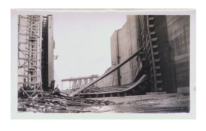
(Bottom) The collapse of a lock gate under construction at Lock 6 was the deadliest disaster to befall labourers on the Fourth Canal. On 1 August 1928, two cranes were erecting an 80 foot steel beam. The boom on one of the cranes swung out too far and the whole crane, unbalanced, fell into the lock, “tearing out the scaffolding on which the men were working and sending the gate leaf itself [weighing 500 tons] crashing down on other labourers” (R.M Styran and R.R. Taylor, This Colossal Project, p. 187). Ten men were crushed to death, eight dying on the day of the accident and two on 3 August as a result of their injuries, while 23 men were injured. The workers who lost their lives were aged between 24 and 62 and only two were Canadian born; the rest came from Ireland (3), Scotland (2), Italy, Ukraine, and Russia. The Canal’s construction was a truly cosmopolitan effort.
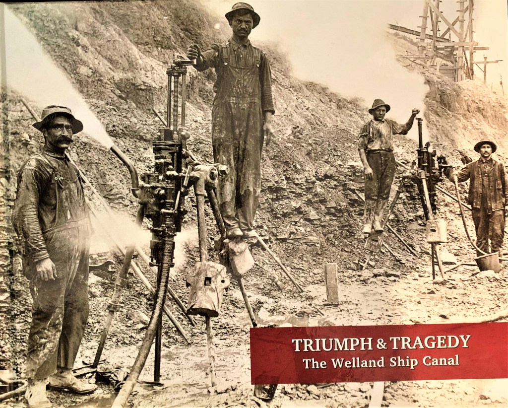
105. A new book does a splendid job of memorializing the 138 workers killed (and the many more injured) while constructing the Fourth Canal between 1914 and 1935. Much of the volume consists of short profiles of every man who died, and includes many historical photographs. It also contains much interesting detail about context and conditions, including the communities along the canal, the equipment workers used, the medical services available when injuries occurred, and so on. The full reference is: Arden Phair and Kathleen Powell, editors. Triumph and Tragedy: The Welland Ship Canal. Corrected Edition. St. Catharines, Ontario: St. Catharines Museum, May 2022. xii + 372 pages in hardcover.
In the next episode, we’ll begin by visiting the St. Catharines Museum and Welland Canals Centre.
